Paducah, KY
Weather Forecast Office
NOAA/NWS 1982 Marion, IL F4 Tornado Web Site
| Home | Storm Path | Weather | Photos | Heroes |
| Then / Now | Safety | Memorial | Credits | Contact Us |
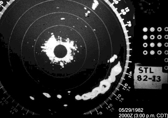
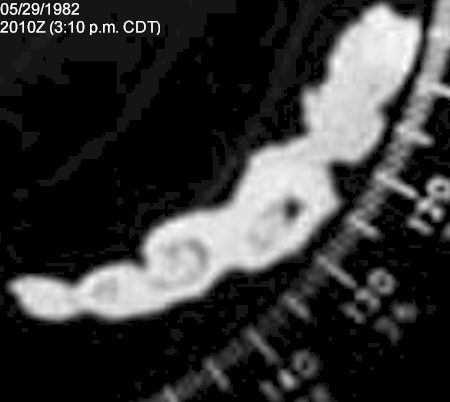
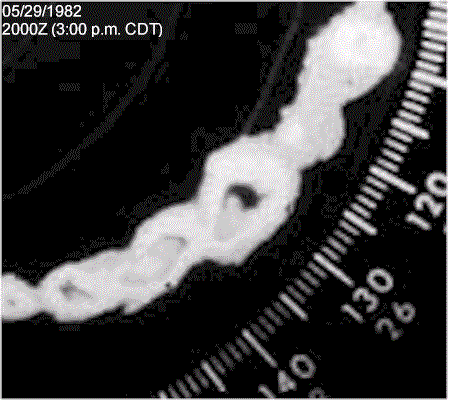
The first section contains radar and satellite imagery of the thunderstorm that produced the Marion tornado. The first two radar images were taken at 3:00 and 3:10 p.m. CDT respectively from the St. Louis WSR-57. The second two images are enlarged copies of the first two images for easier viewing. The final radar image is a loop of the third and fourth images. The strongest storm in the center of the image is the storm that produced the first reported tornado touchdown west-northwest of Carterville, Illinois at 3:05 p.m. CDT. Below the radar images are satellite pictures from 2:30 and 3:30 p.m. CDT respectively. All of these images are from the files of Dennis McCarthy, former Regional Director of NWS Central Region Headquarters.


This section contains impressive photographs of the actual tornado, shown as it moved east along Illinois Route 13 toward Marion. The left three pictures were shot from the southern portion of Herrin, Illinois, looking south-southeast toward Route 13. They were provided by Bill May, former resident of Herrin, and member of A.R.E.S. (Amateur Radio Emergency Services) when these pictures were taken. The picture on the right is a close-up shot of the tornado, looking southeast toward Marion from the Illinois Route 13 interchange of Interstate 57. While the identity of the person who took this picture is unknown, the ownership rights to this photograph belong to Don Fisher of Marion. We are using this picture with his permission.


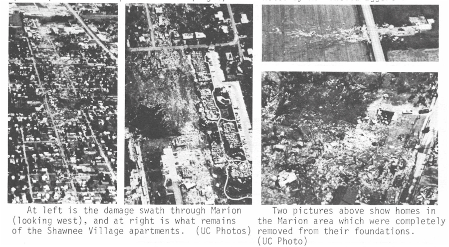
The final section contains excerpts from the official May 1982 Storm Data report related to the Williamson County tornado. This report was compiled by the NOAA National Weather Service Forecast Office in St. Louis, and published by the National Climatic Data Center in Asheville, North Carolina. Credits are contained in the captions underneath the photos.


FORECASTS
Forecast Discussion
User Defined Area Forecast
Hourly Forecasts
Fire Weather
Activity Planner
LOCAL INFORMATION
NWS Paducah KY Weekly Partner Briefing
Aviation Weather
Our Office
SKYWARN
Items of Interest
Hazardous Weather Support
WFO Paducah Navigator
Local Observations
Weather History
US Dept of Commerce
National Oceanic and Atmospheric Administration
National Weather Service
Paducah, KY
8250 Kentucky Highway 3520
West Paducah, KY 42086-9762
270-744-6440
Comments? Questions? Please Contact Us.

