Moderate to heavy mountain snow and strong winds are expected across the Northern Rockies. Lake effect snow will continue downwind of the Lower Great Lakes. Gusty winds and dry conditions will result in critical fire weather conditions in the Southwest and Southern Plains Wednesday through Friday. Extremely critical fire weather conditions are expected Thursday in portions of New Mexico. Read More >
|
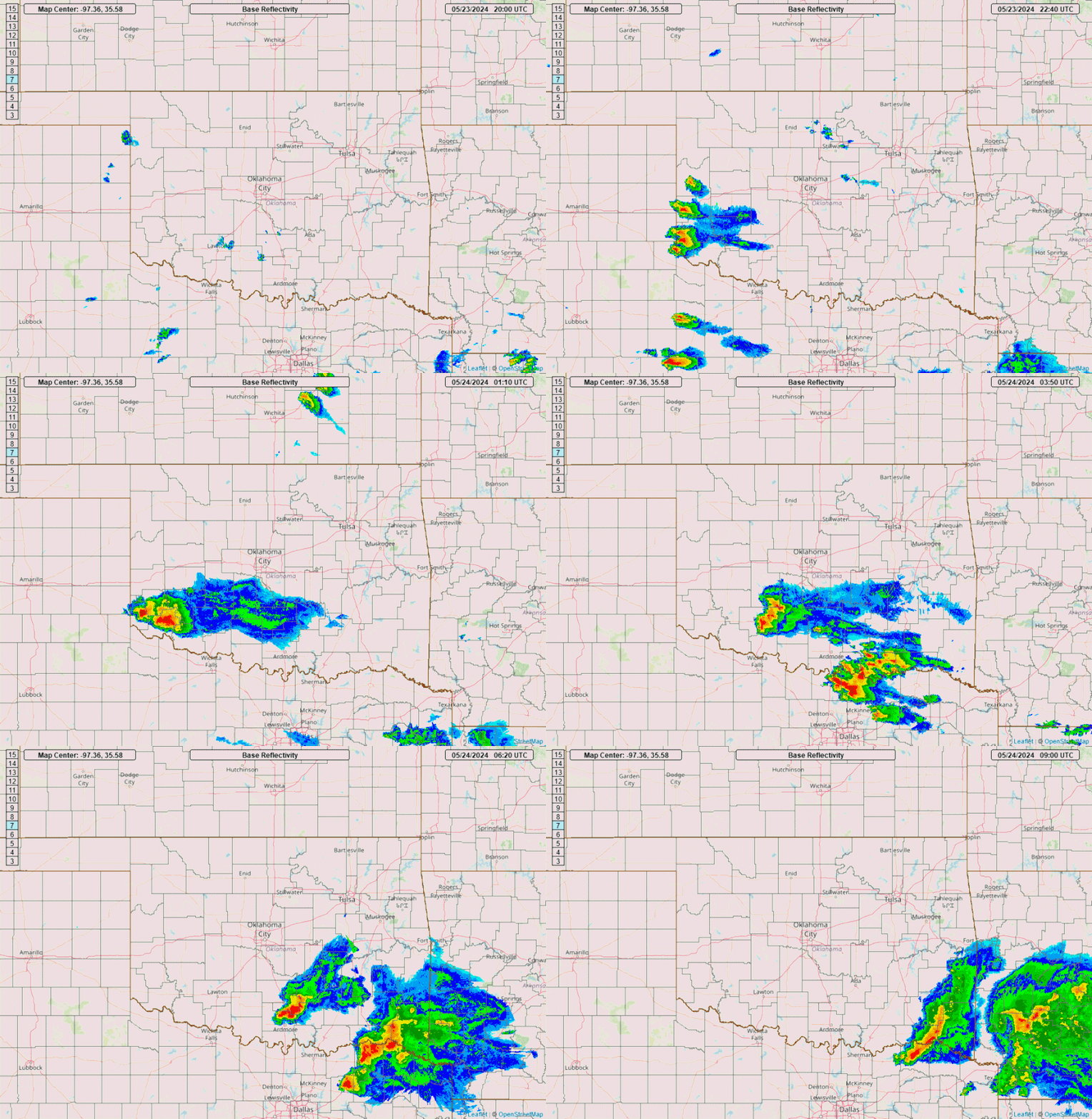
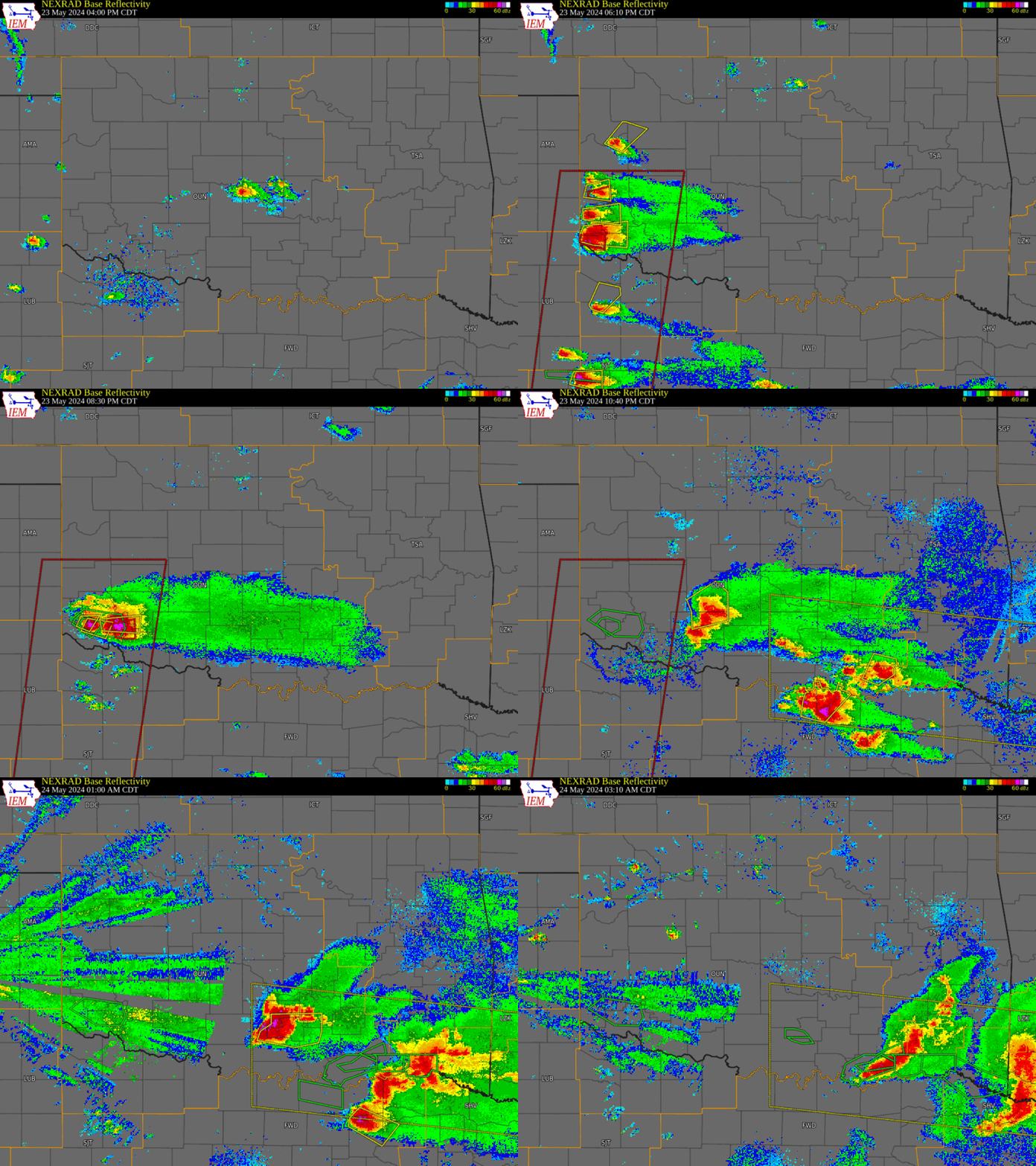
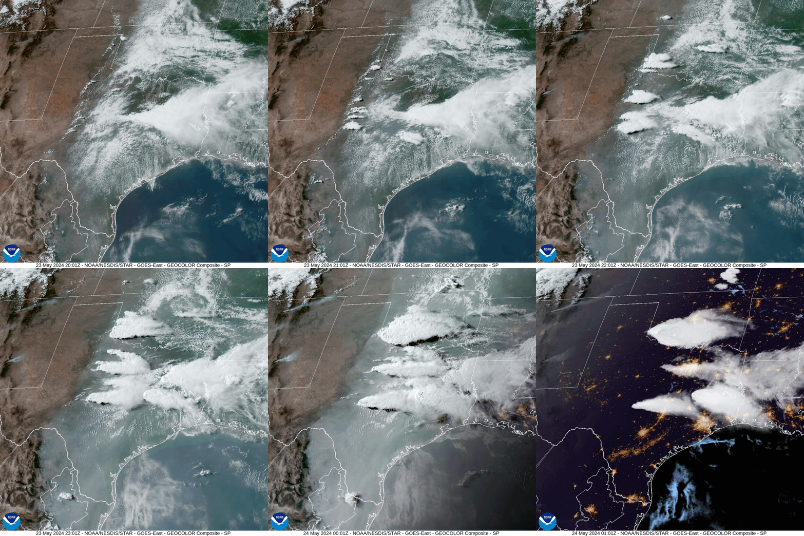
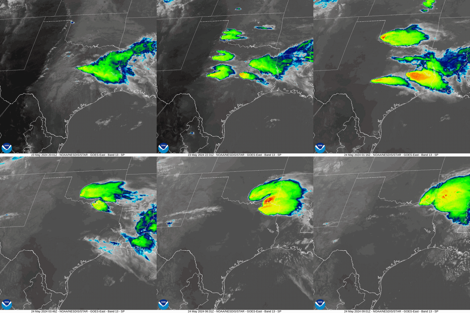
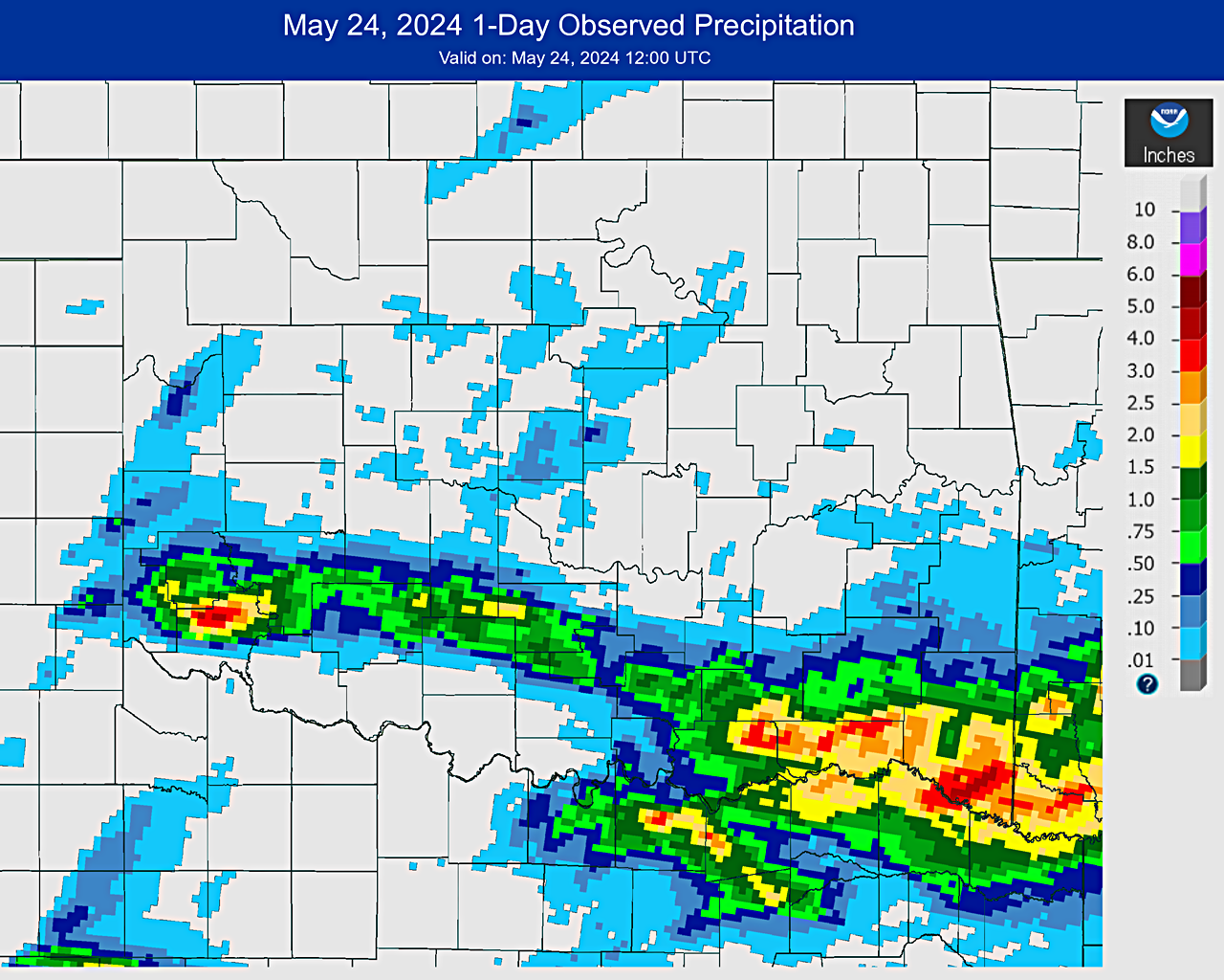
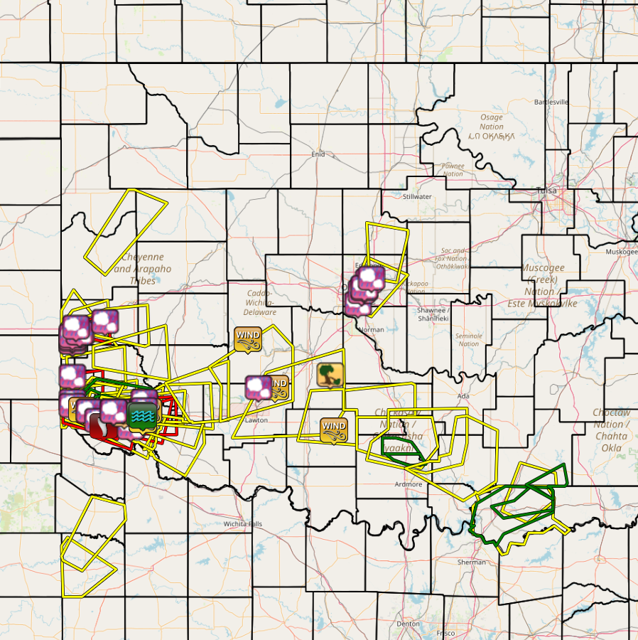
Just before 3:00 pm CDT on May 23, 2024, thunderstorms developed along a dry line in the eastern Texas panhandle and west Texas and began to move eastward. Eventually, a small group of storms moved into southwestern Oklahoma. One of these storms became a dominant supercell thunderstorm and produced large hail up to 3.0 inches in diameter, severe wind gusts of 60 to 70 mph, and wind damage. One very large tornado was accompanied by a satellite tornado in Jackson County, and both tornadoes produced damage. Another tornado occurred in Harmon County near Gould, OK On May 24, 2024, an NWS survey team determined that up to EF-2 damage was generated by a large tornado that occurred near Eldorado and Duke, OK. Three tornadoes were documented during the May 23, 2024 severe weather event. |
|
|
NOUS44 KOUN 241711
PNSOUN
OKZ004>048-050>052-TXZ083>090-250515-

Public Information Statement
National Weather Service Norman OK
1211 PM CDT Fri May 24 2024


...NWS Damage Survey for May 23 2024 Tornado Event...

*.Overview...This survey is continuing, as additional data from
aerial photography and additional data.

.Duke...

Rating:                 EF2
Estimated Peak Wind:    120 mph
Path Length /statute/:  14.9 miles
Path Width /maximum/:   1960 yards
Fatalities:             0
Injuries:               0

Start Date:             05/23/2024
Start Time:             07:04 PM CDT
Start Location:         6 SSE McQueen / Jackson County / OK
Start Lat/Lon:          34.5786 / -99.6567

End Date:               05/23/2024
End Time:               07:57 PM CDT
End Location:           5 ESE Duke / Jackson County / OK
End Lat/Lon:            34.6472 / -99.4758

Survey Summary:
A large, multiple vortex tornado began near the Harmon/Jackson
County line approximately 8 miles southwest of Duke. This tornado
moved slowly south and southeast, finally turning north-northeast
as it crossed SH34 approximately 7 miles south of Duke. The
tornado grew to a little over a mile wide circulation at the
widest point in the 15 mile path. Several structures were
damaged, with several barns destroyed, and several homes
suffering roof damage. The EF2 damage is mainly due to electric
powerline poles being snapped. Most of the known structure damage
was rated EF1 or lower.  This survey will continue, as additional
data continues to come in from aerial photos and other damage
assessments.

&&

EF Scale: The Enhanced Fujita Scale classifies tornadoes into the
following categories:

EF0.....65 to 85 mph
EF1.....86 to 110 mph
EF2.....111 to 135 mph
EF3.....136 to 165 mph
EF4.....166 to 200 mph
EF5.....>200 mph

NOTE:
The information in this statement is preliminary and subject to
change pending final review of the event and publication in
NWS Storm Data.


$$
Smith / Fox
|
Three tornadoes were documented during the May 23, 2024 severe weather event, including one EF-2 tornado that occurred near Eldorado and Duke, OK.
Tornadoes by Intensity |
|||||||
|---|---|---|---|---|---|---|---|
| EF?/EFU | EF0 | EF1 | EF2 | EF3 | EF4 | EF5 | Total |
| 0 | 2 | 0 | 1 | 0 | 0 | 0 | 3 |
| Tornado Number |
Date | Time (CST) |
Length of Path (miles) |
Width of Path (yards) |
F-Scale | Killed | Injured | County | Location |
|---|---|---|---|---|---|---|---|---|---|
| 1 | 05/23/2024 | 1717-1720 | 0.9 | 20 | EF0 | 0 | 0 | Harmon | 5 SW Gould |
| 2 | 05/23/2024 | 1804-1857 | 15 | 2000 | EF2 | 0 | 0 | Jackson | 7 N Eldorado - 5 ESE Duke |
| 3 | 05/23/2024 | 1825-1827 | 0.9 | 40 | EF0 | 0 | 0 | Jackson | 6 S Duke |
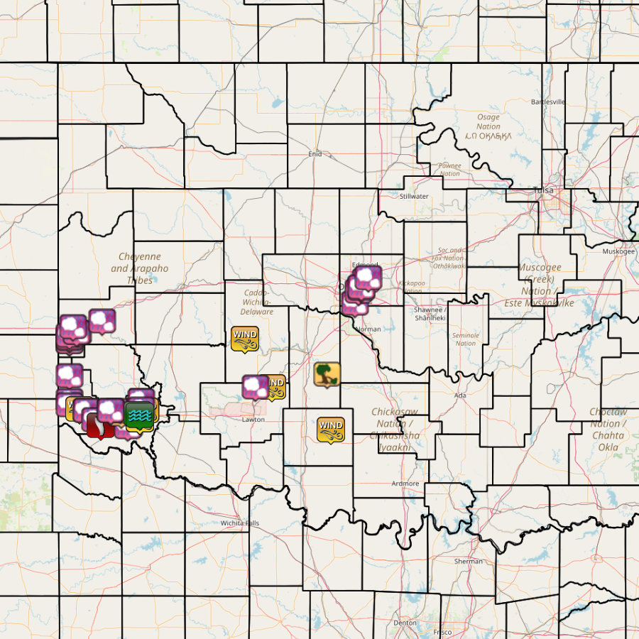
| Report Date |
Report Time (CST) |
Location | County | State | Event Type |
Mag. | Source | Lat. | Lon. | Remark |
|---|---|---|---|---|---|---|---|---|---|---|
| 05/23/2024 | 15:21 | 4 W Valley Brook | Oklahoma | OK | Hail | 1.00 in. | Public | 35.39 | -97.55 | Report from mPING: Quarter (1.00 in.). |
| 05/23/2024 | 15:36 | Oklahoma City | Oklahoma | OK | Hail | 1.00 in. | Public | 35.47 | -97.52 | Report from mPING: Quarter (1.00 in.). |
| 05/23/2024 | 15:40 | 2 NNE Oklahoma City | Oklahoma | OK | Hail | 1.00 in. | Emergency Mngr | 35.49 | -97.50 | |
| 05/23/2024 | 15:43 | 1 W Lake Aluma | Oklahoma | OK | Hail | 1.00 in. | Public | 35.54 | -97.46 | Report from mPING: Quarter (1.00 in.). |
| 05/23/2024 | 15:44 | 2 NE Oklahoma City | Oklahoma | OK | Hail | 1.75 in. | Public | 35.50 | -97.50 | Report from mPING: Golf Ball (1.75 in.). |
| 05/23/2024 | 15:47 | 6 SW Erick | Beckham | OK | Hail | 1.00 in. | Public | 35.13 | -99.91 | Report from mPING: Quarter (1.00 in.). |
| 05/23/2024 | 15:54 | 2 N Lake Aluma | Oklahoma | OK | Hail | 1.75 in. | Public | 35.56 | -97.44 | Report from mPING: Golf Ball (1.75 in.). |
| 05/23/2024 | 15:59 | 6 SW Erick | Beckham | OK | Hail | 1.00 in. | Public | 35.13 | -99.91 | Report from mPING: Quarter (1.00 in.). |
| 05/23/2024 | 16:03 | 5 SW Erick | Beckham | OK | Hail | 2.00 in. | Public | 35.15 | -99.91 | Report from mPING: Hen Egg (2.00 in.). |
| 05/23/2024 | 16:05 | 4 SW Erick | Beckham | OK | Hail | 1.00 in. | Public | 35.16 | -99.91 | Report from mPING: Quarter (1.00 in.). |
| 05/23/2024 | 16:17 | 4 SW Erick | Beckham | OK | Hail | 1.75 in. | Public | 35.17 | -99.91 | Report from mPING: Golf Ball (1.75 in.). |
| 05/23/2024 | 16:26 | 2 SE Erick | Beckham | OK | Hail | 1.00 in. | Public | 35.19 | -99.84 | Report from mPING: Quarter (1.00 in.). |
| 05/23/2024 | 16:28 | 2 E Madge | Harmon | OK | Hail | 1.00 in. | Public | 34.90 | -99.91 | Report from mPING: Quarter (1.00 in.). |
| 05/23/2024 | 16:32 | 2 SE Erick | Beckham | OK | Hail | 1.00 in. | Public | 35.19 | -99.85 | Report from mPING: Quarter (1.00 in.). |
| 05/23/2024 | 16:33 | 2 NW Erick | Beckham | OK | Hail | 1.75 in. | Public | 35.23 | -99.88 | Report from mPING: Golf Ball (1.75 in.). |
| 05/23/2024 | 16:37 | 3 N Hollis | Harmon | OK | Hail | 1.75 in. | Public | 34.73 | -99.91 | Report from mPING: Golf Ball (1.75 in.). |
| 05/23/2024 | 16:58 | 1 NNE Hollis | Harmon | OK | Hail | 2.50 in. | Broadcast Media | 34.70 | -99.91 | |
| 05/23/2024 | 17:15 | 3 W Gould | Harmon | OK | Tstm Wnd Gust | 66 mph | Mesonet | 34.67 | -99.83 | |
| 05/23/2024 | 17:18 | 1 SSE Gould | Harmon | OK | Hail | 1.50 in. | Other Federal | 34.66 | -99.77 | |
| 05/23/2024 | 17:20 | 1 S Gould | Harmon | OK | Hail | 1.75 in. | Public | 34.66 | -99.77 | Report from mPING: Golf Ball (1.75 in.). |
| 05/23/2024 | 17:22 | 5 S Mcqueen | Harmon | OK | Hail | 1.25 in. | Public | 34.60 | -99.70 | Report from mPING: Half Dollar (1.25 in.). |
| 05/23/2024 | 17:31 | 2 S Sayre | Beckham | OK | Hail | 1.00 in. | Public | 35.27 | -99.64 | Report from mPING: Quarter (1.00 in.). |
| 05/23/2024 | 17:59 | 1 N Olustee | Jackson | OK | Hail | 1.00 in. | Public | 34.56 | -99.42 | Report from mPING: Quarter (1.00 in.). |
| 05/23/2024 | 18:04 | 6 N Eldorado | Jackson | OK | Tornado | Broadcast Media | 34.56 | -99.65 | ||
| 05/23/2024 | 18:25 | 3 E Duke | Jackson | OK | Hail | 3.50 in. | Public | 34.66 | -99.52 | |
| 05/23/2024 | 18:43 | Olustee | Jackson | OK | Hail | 2.00 in. | Public | 34.55 | -99.43 | Report from mPING: Hen Egg (2.00 in.). |
| 05/23/2024 | 18:58 | 2 N Altus | Jackson | OK | Hail | 1.75 in. | Public | 34.67 | -99.33 | Report from mPING: Golf Ball (1.75 in.). |
| 05/23/2024 | 18:59 | 2 N Altus | Jackson | OK | Hail | 1.25 in. | Public | 34.67 | -99.32 | Report from mPING: Half Dollar (1.25 in.). |
| 05/23/2024 | 19:02 | 2 N Altus | Jackson | OK | Hail | 1.75 in. | Public | 34.67 | -99.33 | Report from mPING: Golf Ball (1.75 in.). |
| 05/23/2024 | 19:10 | 2 N Altus | Jackson | OK | Hail | 2,00 in. | Public | 34.67 | -99.32 | Report from mPING: Hen Egg (2.00 in.). |
| 05/23/2024 | 19:18 | 4 E Martha | Jackson | OK | Hail | 1.00 in. | Public | 34.73 | -99.32 | Report from mPING: Quarter (1.00 in.). |
| 05/23/2024 | 19:18 | 1 E Altus Air Force Base | Jackson | OK | Hail | 1.25 in. | Public | 34.66 | -99.28 | Report from mPING: Half Dollar (1.25 in.). |
| 05/23/2024 | 19:25 | 5 E Duke | Jackson | OK | Tstm Wnd Dmg | Public | 34.64 | -99.48 | Report from mPING: 3-inch tree limbs broken; Power poles broken. | |
| 05/23/2024 | 19:25 | 3 S Altus | Jackson | OK | Tstm Wnd Gust | 68 mph | Mesonet | 34.60 | -99.33 | |
| 05/23/2024 | 19:25 | Altus Air Force Base | Jackson | OK | Tstm Wnd Gust | 61 mph | ASOS | 34.66 | -99.29 | |
| 05/23/2024 | 19:30 | 3 S Altus | Jackson | OK | Tstm Wnd Gust | 60 mph | Mesonet | 34.60 | -99.33 | |
| 05/23/2024 | 19:30 | 3 S Altus | Jackson | OK | Tstm Wnd Dmg | Mesonet | 34.60 | -99.33 | ||
| 05/23/2024 | 19:35 | 3 S Altus | Jackson | OK | Tstm Wnd Gust | 67 mph | Mesonet | 34.60 | -99.33 | |
| 05/23/2024 | 19:37 | Duke | Jackson | OK | Hail | 1.75 in. | Broadcast Media | 34.66 | -99.57 | |
| 05/23/2024 | 19:37 | 2 N Altus | Jackson | OK | Hail | 1.00 in. | Public | 34.67 | -99.32 | Report from mPING: Quarter (1.00 in.). |
| 05/23/2024 | 19:40 | Duke | Jackson | OK | Hail | 2.75 in. | Public | 34.66 | -99.57 | |
| 05/23/2024 | 19:58 | 1 W Altus | Jackson | OK | Flash Flood | Public | 34.64 | -99.35 | High water over HWY 62 on west side of Altus. | |
| 05/23/2024 | 20:28 | 1 SE Altus | Jackson | OK | Flash Flood | Public | 34.63 | -99.33 | Report from mPING: Street/road flooding; Street/road closed; Vehicles stranded. | |
| 05/23/2024 | 21:00 | Fletcher | Comanche | OK | Non-Tstm Wnd Dmg | Emergency Mngr | 34.82 | -98.24 | Multiple power poles down. Possible heat burst. | |
| 05/23/2024 | 21:19 | 1 W Lake Ellsworth | Comanche | OK | Hail | 1.00 in. | Public | 34.82 | -98.37 | Report from mPING: Quarter (1.00 in.). |
| 05/23/2024 | 21:30 | 4 NNW Fort Cobb | Caddo | OK | Non-Tstm Wnd Gust | 62 mph | Mesonet | 35.15 | -98.46 | |
| 05/23/2024 | 21:35 | 4 NNW Fort Cobb | Caddo | OK | Non-Tstm Wnd Gust | 64 mph | Mesonet | 35.15 | -98.46 | Heat burst. |
| 05/23/2024 | 22:24 | Alex | Grady | OK | Tstm Wnd Dmg | Trained Spotter | 34.91 | -97.78 | Outbuilding near the town water tower lost its roof. | |
| 05/23/2024 | 23:05 | 7 NW Velma | Stephens | OK | Tstm Wnd Gust | 73 mph | Mesonet | 34.53 | -97.75 |
