A strong atmospheric river moving into northern California later Tuesday will bring a threat for moderate to heavy rainfall and flooding, gusty to high winds, and mountain snows for parts of the Northwest U.S. through at least Wednesday. Gusty winds and isolated rain and snow showers will continue in the Northeast U.S. Tuesday behind a cold front. Read More >
|
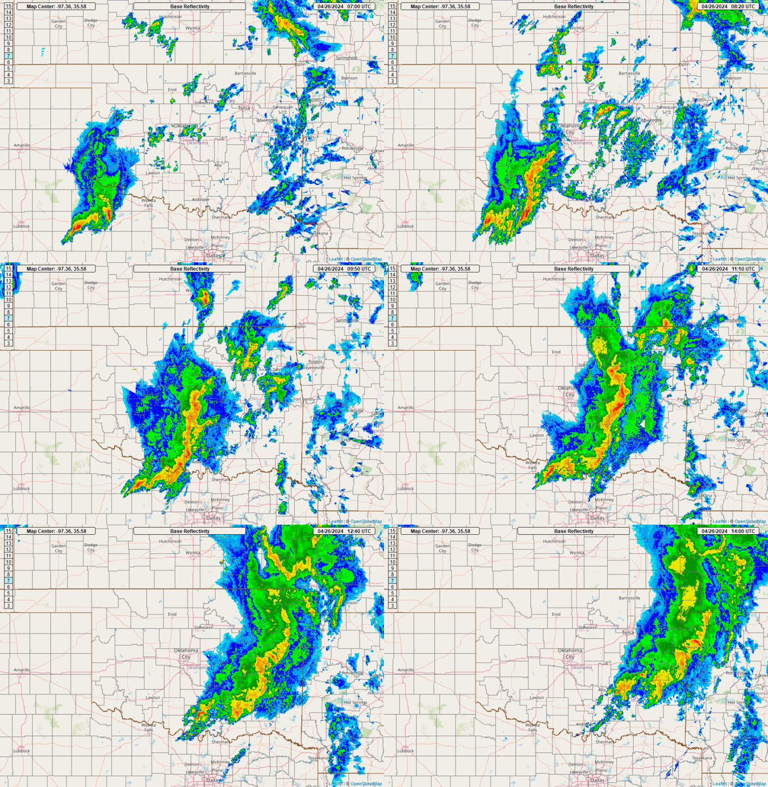
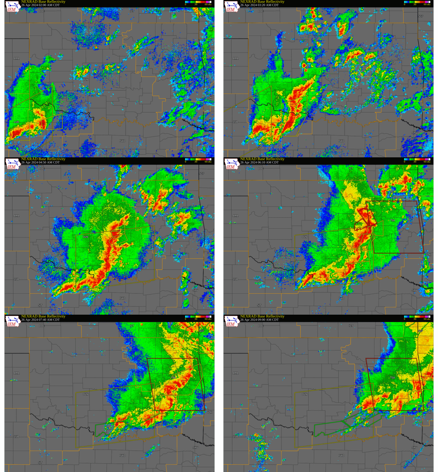
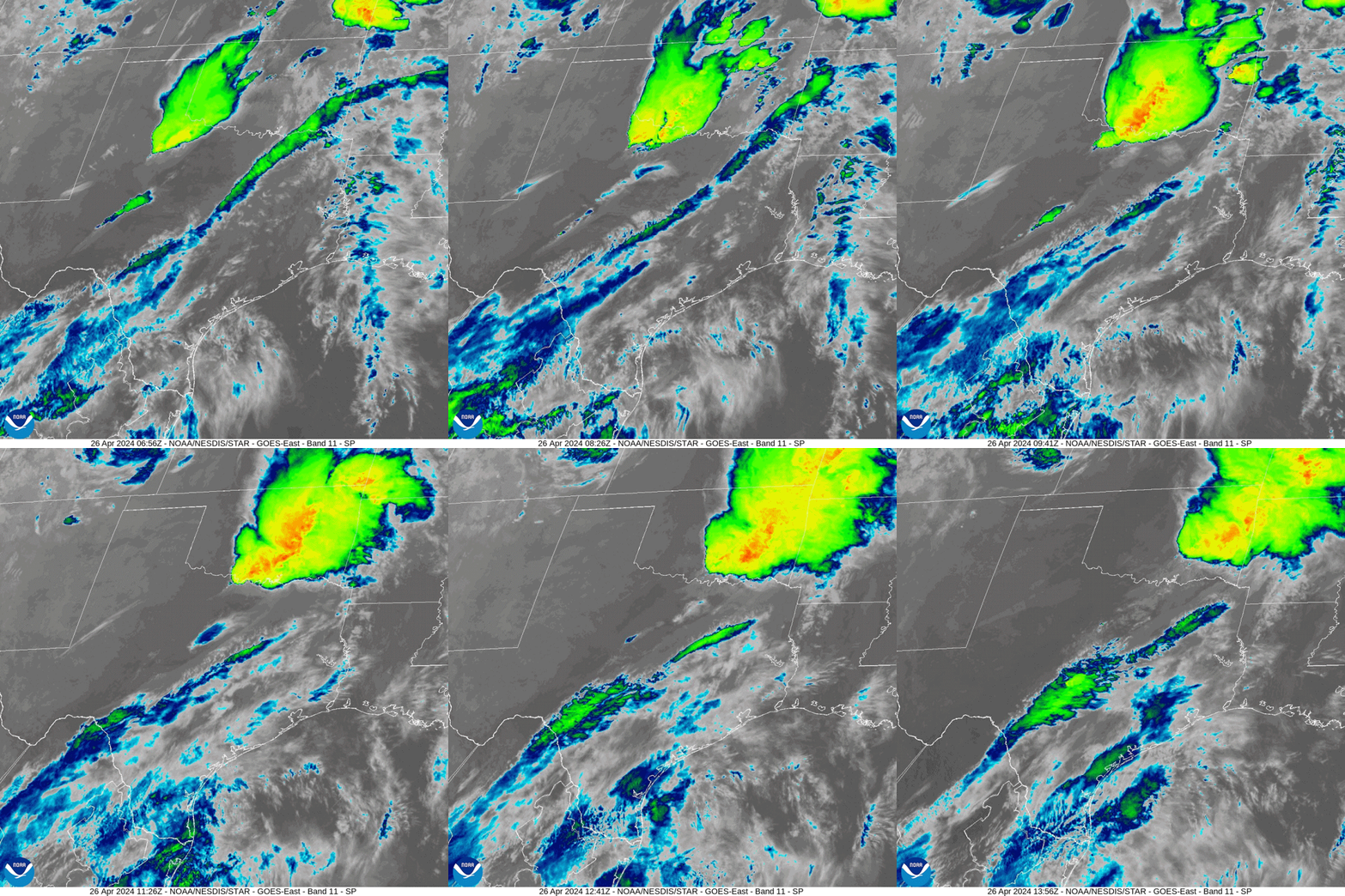
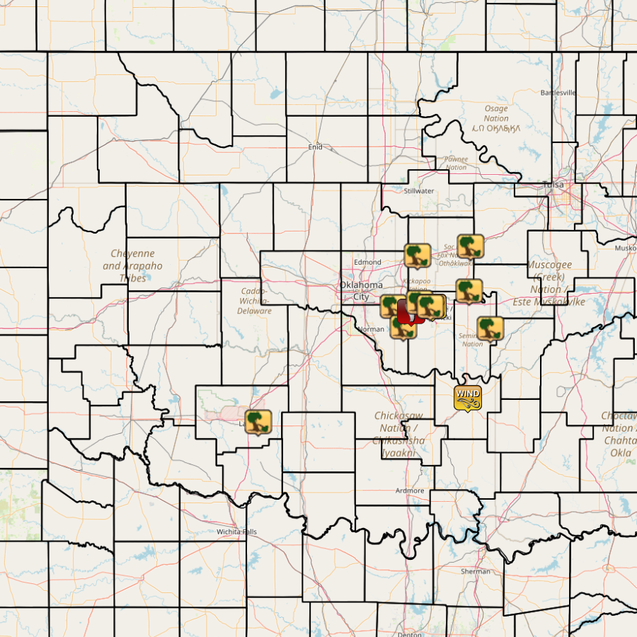
During the early morning hours of April 26, 2024, a line of strong to severe thunderstorms moved from west Texas and the southern Texas Panhandle into the NWS Norman forecast area in western north Texas and southwestern Oklahoma. As the complex moved eastward, the northern end of the thunderstorms intensified as it reached central Oklahoma. Eventually, several QLCS tornadoes were generated along the thunderstorm line in Cleveland, Pottawatomie, and Lincoln counties. Straight-line wind damage was also reported in these counties, as well as severe wind gusts of 61-63 mph. NWS teams conducted storm damage surveys in central Oklahoma during late April 2024 and documented 6 weak tornadoes that occurred on April 26, 2024 in the NWS Norman forecast area. Four were rated EF-0 and two more were rated EF-1. One of the EF-1 tornadoes moved through Pottawatomie and Lincoln counties before crossing into Okfuskee County in the NWS Tulsa forecast area. Two other tornadoes that occurred in the NWS Tulsa forecast area in Okmulgee and Pittsburg counties were rated EF-1. |
|
|
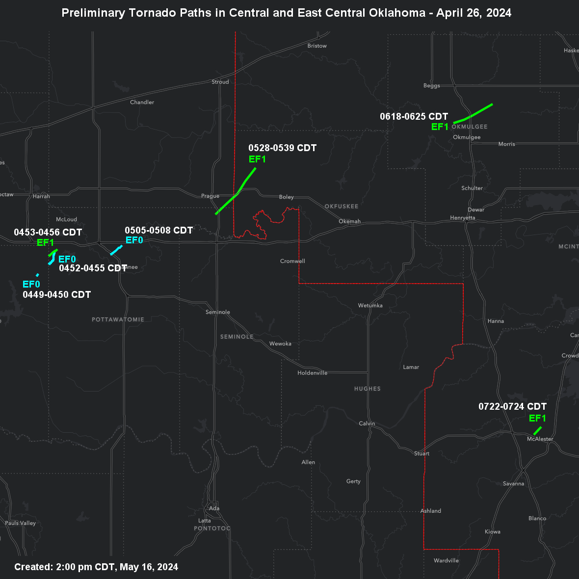
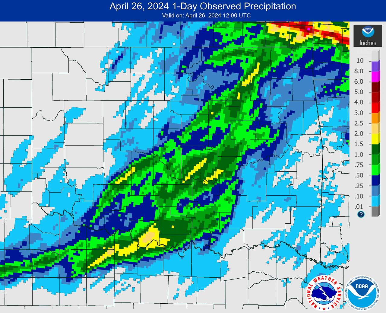
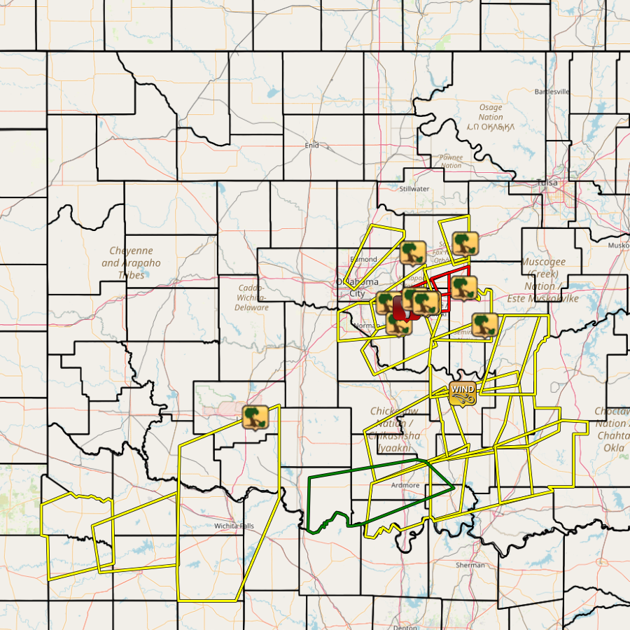
NWS teams conducted storm damage surveys in central Oklahoma during late April 2024 and documented 6 tornadoes that occurred on April 26, 2024 in the NWS Norman forecast area. Four were rated EF-0 and two more were rated EF-1. One of the EF-1 tornadoes crossed moved through Pottawatomie and Lincoln counties before crossing into Okfuskee County in the NWS Tulsa forecast area. Two other tornadoes that occurred in the NWS Tulsa forecast area in Okmulgee and Pittsburg counties were rated EF-1.
| Tornado Number |
Date | Time (CST) |
Length of Path (miles) |
Width of Path (yards) |
F-Scale | Killed | Injured | County | Location |
|---|---|---|---|---|---|---|---|---|---|
| 1 | 04/26/2024 | 0349-0350 | 0.5 | 30 | EF0 | 0 | 0 | Cleveland | 2 ESE Stella |
| 2 | 04/26/2024 | 0352-0355 | 2.4 | 40 | EF0 | 0 | 0 | Pottawatomie | 4 ENE Stella - 3 SE Newalla |
| 3 | 04/26/2024 | 0353-0356 | 1.9 | 75 | EF1 | 0 | 0 | Cleveland/ Pottawatomie | 4 SSE - 3 SE Newalla |
| 4 | 04/26/2024 | 0405-0408 | 2.4 | 50 | EF0 | 0 | 0 | Pottawatomie | 3 WNW - 3 N Shawnee |
| 5 | 04/26/2024 | 0428-0439 | 10 | 500 | EF1 | 0 | 0 | Pottawatomie/ Lincoln/ Okfuskee | 2.8 SSE Prague - 3.3 N Paden |
| 6 | 04/26/2024 | 0431-0431 | 0.2 | 30 | EF0 | 0 | 0 | Lincoln | 3 NNE Prague |
| 7 | 04/26/2024 | 0518-0525 | 6.9 | 650 | EF1 | 0 | 0 | Okmulgee | 3.1 NW - 6.5 NE Okmulgee |
| 8 | 04/26/2024 | 0622-0624 | 1.7 | 250 | EF1 | 0 | 0 | Pittsburg | 1 NW - 1.9 NNE McAlester |
| Report Date |
Report Time (CST) |
Location | County | State | Event Type |
Mag. | Source | Lat. | Lon. | Remark |
|---|---|---|---|---|---|---|---|---|---|---|
| 04/26/2024 | 02:30 | 4 E Lawton | Comanche | OK | Tstm Wnd Dmg | Broadcast Media | 34.61 | -98.33 | Power pole snapped in half. Radar estimated time. | |
| 04/26/2024 | 03:45 | 4 NW Stella | Cleveland | OK | Tstm Wnd Dmg | Public | 35.36 | -97.26 | Social media image showing multiple large tree limbs blown down. Radar estimated time. | |
| 04/26/2024 | 03:50 | 3 E Lake Thunderbird | Cleveland | OK | Tstm Wnd Dmg | NWS Employee | 35.23 | -97.18 | Powerline down. Time is radar estimated. | |
| 04/26/2024 | 03:52 | 4 WNW Bethel Acres | Pottawatomie | OK | Tornado | Emergency Mngr | 35.33 | -97.12 | Trees and powerlines down. Likely tornado. Additional details forthcoming. Radar estimated time. | |
| 04/26/2024 | 04:03 | Dale | Pottawatomie | OK | Tstm Wnd Dmg | Emergency Mngr | 35.39 | -97.05 | Relayed image showing the roof removed from a mobile home. Radar estimated time. | |
| 04/26/2024 | 04:10 | 3 NNW Shawnee | Pottawatomie | OK | Tstm Wnd Gust | 63 mph | Mesonet | 35.36 | -96.95 | Shawnee (SHAW) Mesonet. |
| 04/26/2024 | 04:10 | 3 NW Shawnee | Pottawatomie | OK | Tstm Wnd Dmg | Emergency Mngr | 35.36 | -96.95 | Relayed image showing light roof damage (panels removed) to a home. Radar estimated time. | |
| 04/26/2024 | 04:10 | Wellston | Lincoln | OK | Tstm Wnd Dmg | Emergency Mngr | 35.69 | -97.07 | Powerlines down. Radar estimated time. | |
| 04/26/2024 | 04:15 | 3 NW Shawnee | Pottawatomie | OK | Tstm Wnd Dmg | Emergency Mngr | 35.36 | -96.97 | Report of box truck overturned. | |
| 04/26/2024 | 04:30 | 2 NNE Centerview | Pottawatomie | OK | Tstm Wnd Dmg | Emergency Mngr | 35.46 | -96.66 | Trees and powerlines down along with minor damage to a home. Radar estimated time. | |
| 04/26/2024 | 04:40 | 1 E Stroud | Lincoln | OK | Tstm Wnd Dmg | Emergency Mngr | 35.75 | -96.65 | Roof damage to an apartment building. Radar estimated time. | |
| 04/26/2024 | 04:50 | 5 N Wewoka | Seminole | OK | Tstm Wnd Dmg | Emergency Mngr | 35.22 | -96.49 | Trees down. Radar estimated time. | |
| 04/26/2024 | 04:59 | 1 WSW Ada | Pontotoc | OK | Tstm Wnd Gust | 61 mph | Trained Spotter | 34.77 | -96.67 | Measured via handheld anemometer. |
