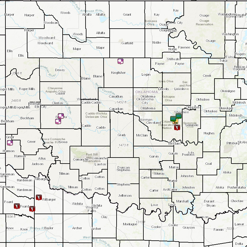
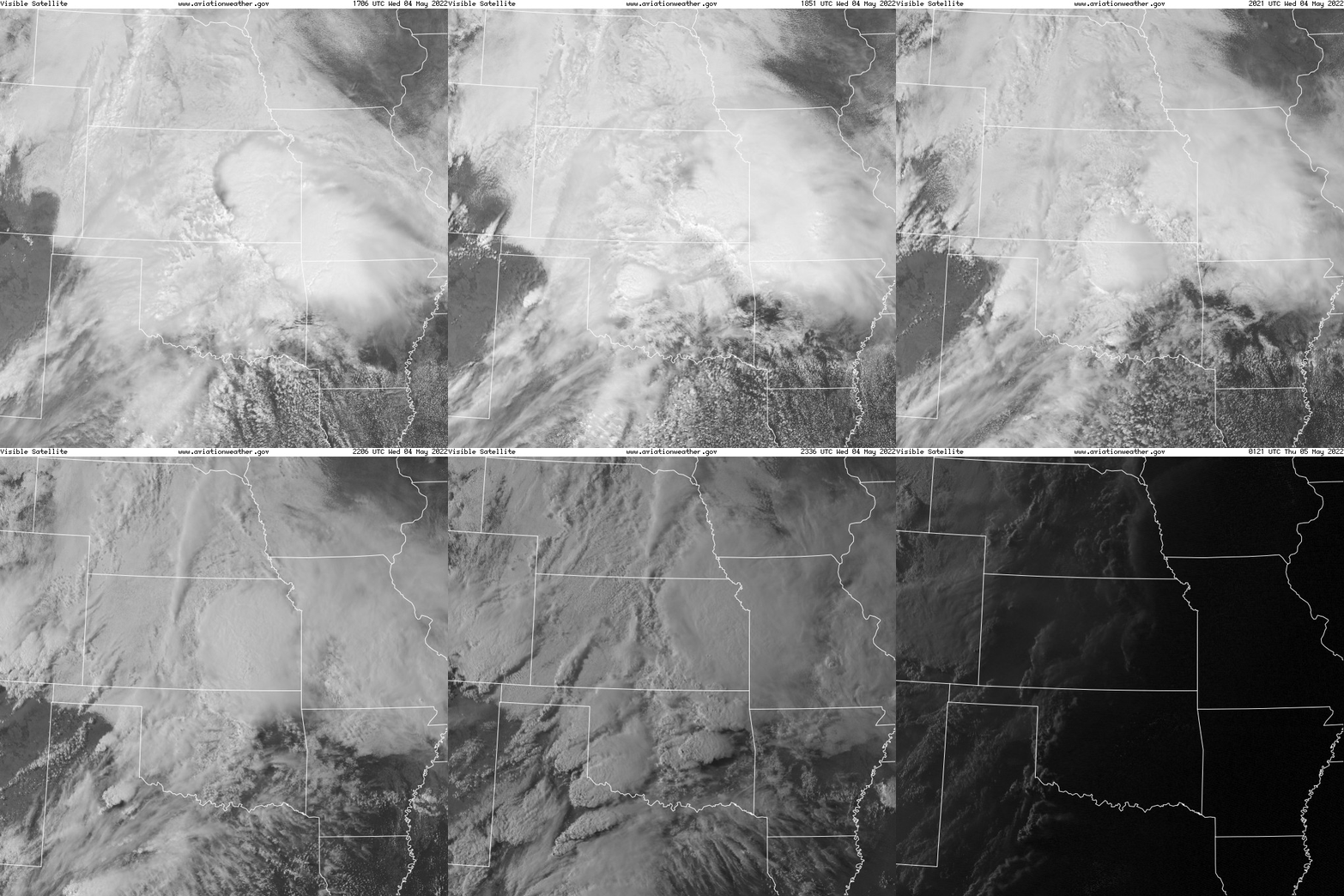
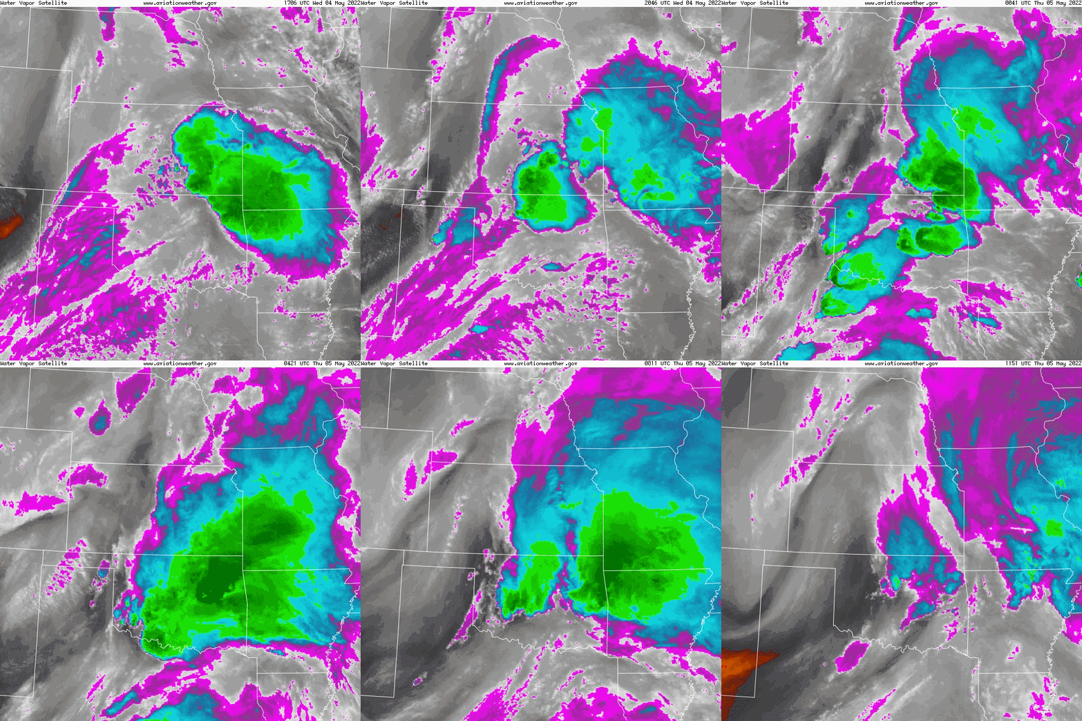
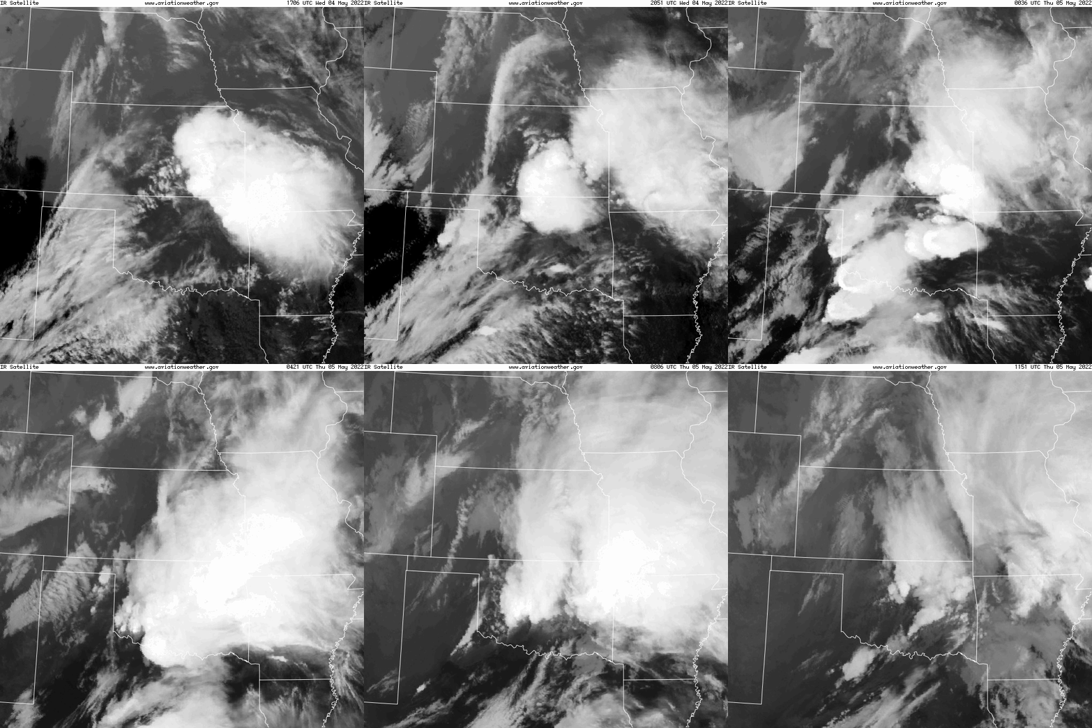
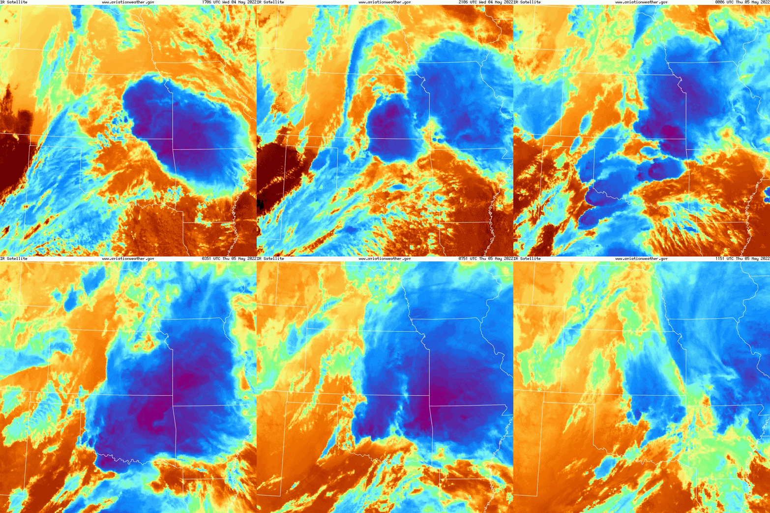
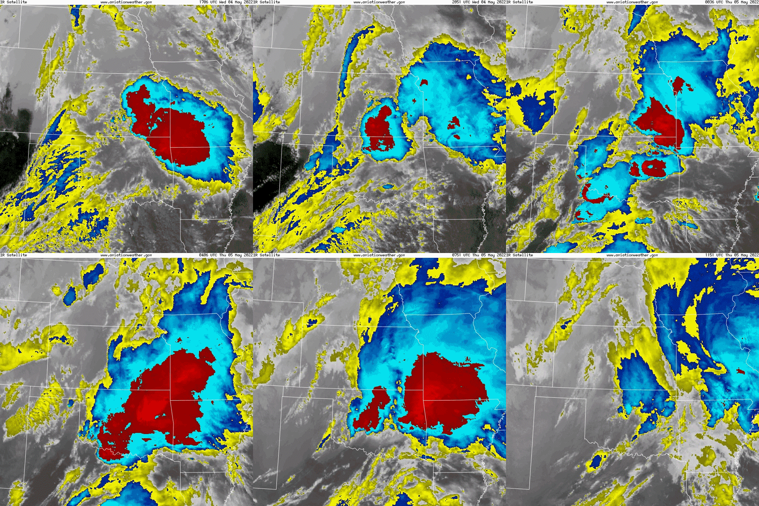
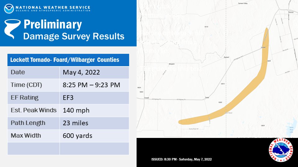
An active week of severe weather continued during the afternoon and evening of May 4, 2022. Ahead of a west Texas dryline, a few supercell thunderstorms developed across western Oklahoma and north Texas. Additional supercell thunderstorms developed in the vicinity of a warm front across east-central Oklahoma. Multiple tornadoes along with scattered large hail and wind damage events occurred within the WFO Norman warning area. The most significant storm of the event developed in Dickens County, Texas (NWS Lubbock warning area) and traveled across portions of west north Texas (King, Foard and Wilbarger counties). Storm survey teams confirmed that this storm produced two long-track tornadoes in the NWS Norman area, including a long-track EF-3 tornado that struck the town of Lockett, TX just after sunset.
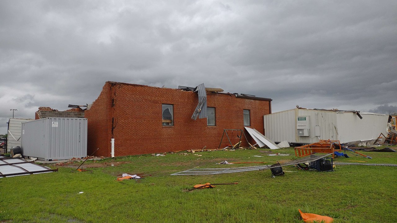
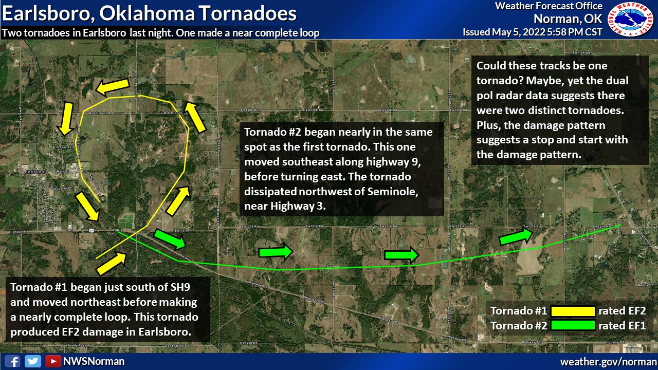
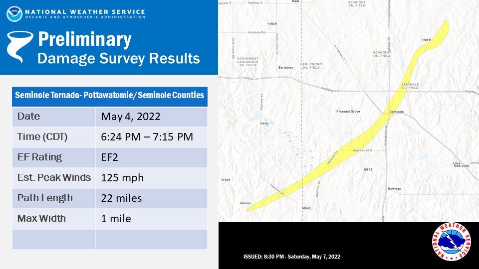
Another significant supercell occurred further east across central Oklahoma, itself producing a long-track significant (EF-2) tornado. This tornado impacted downtown Seminole, OK at a width around one half mile. Widespread areas of light to moderate damage occurred throughout town. This storm went on to produce an additional long-track tornado from near Cromwell to Okemah, OK (NWS Tulsa warning area). Another supercell storm, immediately trailing the "Seminole" tornadic storm, produced additional tornadoes across Pottawatomie and Seminole counties. One tornado produced from this storm completed a near full loop near the town of Earlsboro, OK.
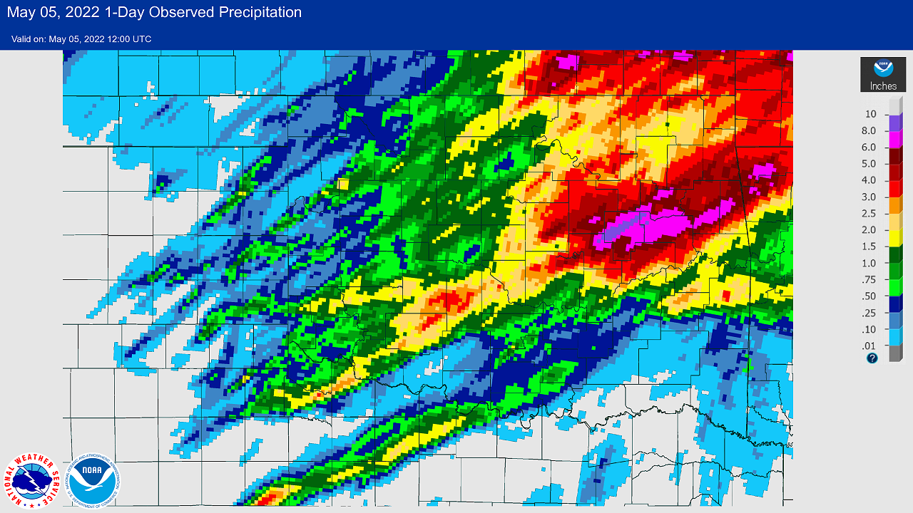
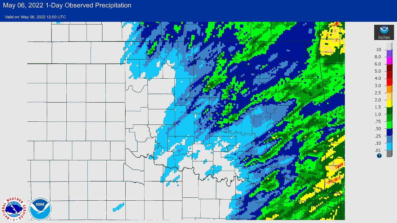
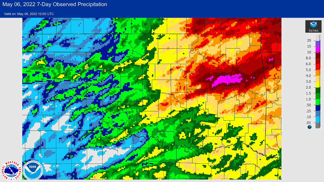
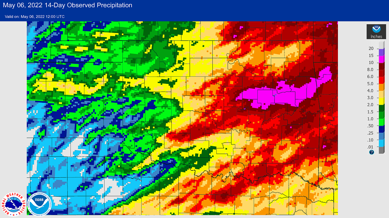
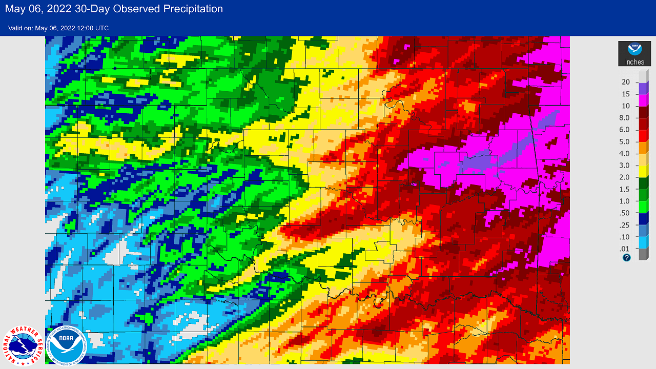
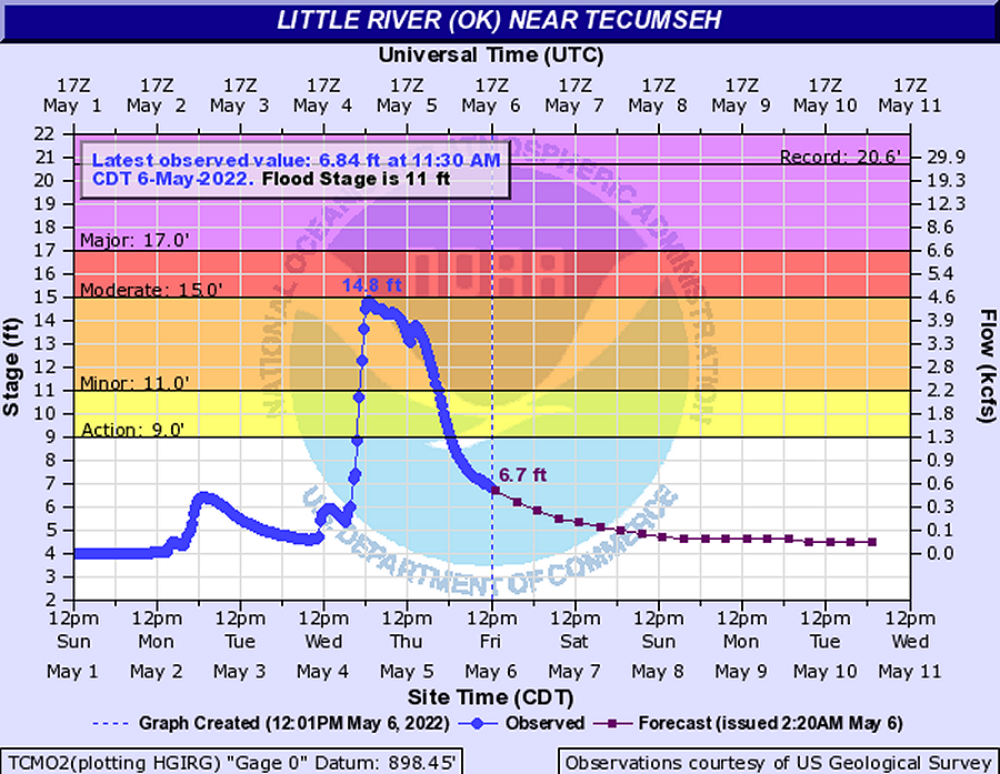
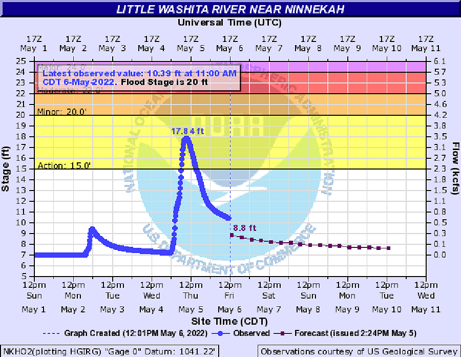
In addition, areas of very heavy rainfall fell across portions of central Oklahoma, generally along and east of the I-35 corridor. Heaviest amounts (around 2-4 inches) occurred across portions of northern Pottawatomie and Seminole counties, where multiple thunderstorms trained across similar areas into the early morning of May 5th.
NOUS44 KOUN 062149
PNSOUN
OKZ004>048-050>052-TXZ083>090-070715-

Public Information Statement...Corrected...
National Weather Service Norman OK
205 PM CDT Fri May 6 2022

...NWS DAMAGE SURVEY FOR MAY 2 AND MAY 4 TORNADO EVENTS...

.Update...Corrected Brooksville Tornado rating and estimated peak
wind speed, clarified data that is yet to be determined.

Previous update: Updated information to include the tornadoes from
May 2 2022 and to update information on the May 4 tornadoes.
Additional information has changed some details in the Seminole track,
but the rating did not change.  Sixteen tornadoes have now been
confirmed for both days.

.Overview...Two survey crews from WFO Norman went out on May 3rd
and again on May 5th. Additional information was given to our
office from WFO Lubbock, WFO Tulsa, and NWS employees from SPC and
from WDTD.

.Loyal 1...

Rating:                 EF0
Estimated Peak Wind:    60 mph
Path Length /statute/:  0.6 miles
Path Width /maximum/:   80 yards
Fatalities:             0
Injuries:               0

Start Date:             05/02/2022
Start Time:             04:13 PM CDT
Start Location:         2 W Loyal / Kingfisher County / OK
Start Lat/Lon:          35.97 / -98.16

End Date:               05/02/2022
End Time:               04:14 PM CDT
End Location:           2 W Loyal / Kingfisher County / OK
End Lat/Lon:            35.98 / -98.16

Survey Summary:
Photographic evidence of a brief tornado west of Loyal. Open
farmland and minimal damage to vegetation and trees.

.Loyal 2...

Rating:                 EF0
Estimated Peak Wind:    75 mph
Path Length /statute/:  0.9 miles
Path Width /maximum/:   To be determined
Fatalities:             0
Injuries:               0

Start Date:             05/02/2022
Start Time:             04:22 PM CDT
Start Location:         2 WSW Loyal / Kingfisher County / OK
Start Lat/Lon:          35.96 / -98.15

End Date:               05/02/2022
End Time:               04:26 PM CDT
End Location:           2 W Loyal / Kingfisher County / OK
End Lat/Lon:            35.98 / -98.15

Survey Summary:
Photographic evidence from NWS employee. Damage to trees and open
farmland.

.Cyril ...

Rating:                 EF1
Estimated Peak Wind:    90 mph
Path Length /statute/:  0.5 miles
Path Width /maximum/:   240 yards
Fatalities:             0
Injuries:               0

Start Date:             05/02/2022
Start Time:             05:13 PM CDT
Start Location:         1 N Cyril / Caddo County / OK
Start Lat/Lon:          34.92 / -98.20

End Date:               05/03/2022
End Time:               05:13 PM CDT
End Location:           1 NNE Cyril / Caddo County / OK
End Lat/Lon:            34.91 / -98.19

Survey Summary:
NWS survey crew found evidence of a brief tornado which caused EF-
1 damage to homes and trees. The damage was just north of
SH19 along County Road 1450 on the north side of Cyril.

.Red Rock...

Rating:                 EF0
Estimated Peak Wind:    75 mph
Path Length /statute/:  5.6 miles
Path Width /maximum/:   150 yards
Fatalities:             0
Injuries:               0

Start Date:             05/02/2022
Start Time:             05:57 PM CDT
Start Location:         4 SSE Red Rock / Noble County / OK
Start Lat/Lon:          36.41 / -97.14

End Date:               05/02/2022
End Time:               06:00 PM CDT
End Location:           3 S Sooner Lake / Noble County / OK
End Lat/Lon:            36.39 / -97.04

Survey Summary:
This tornado occurred near the intersection of US177 and 412. The
tornado did damage to trees before moving across Sooner Lake
and dissipating.

.Ripley...

Rating:                 EF1
Estimated Peak Wind:    90 mph
Path Length /statute/:  6.6 miles
Path Width /maximum/:   500 yards
Fatalities:             0
Injuries:               0

Start Date:             05/02/2022
Start Time:             06:26 PM CDT
Start Location:         3 WSW Ripley / Payne County / OK
Start Lat/Lon:          36.00 / -96.97

End Date:               05/02/2022
End Time:               06:33 PM CDT
End Location:           3 E Ripley / Payne County / OK
End Lat/Lon:            36.01 / -96.85

Survey Summary:
The Ripley tornado began to the west of the Cimarron River,
beginning around South Union Road near 104th Street. The tornado
moved east northeast, causing damage to trees, farm buildings,
and a few mobile homes.

..Monday Seminole...

Rating:                 EF1
Estimated Peak Wind:    110 mph
Path Length /statute/:  6.3 miles
Path Width /maximum/:   700 yards
Fatalities:             0
Injuries:               0

Start Date:             05/02/2022
Start Time:             07:52 PM CDT
Start Location:         3 ESE Harjo / Seminole County / OK
Start Lat/Lon:          35.20 / -96.76

End Date:               05/02/2022
End Time:               08:10 PM CDT
End Location:           2 SE Seminole / Seminole County / OK
End Lat/Lon:            35.21 / -96.65

Survey Summary:
A tornado formed from a supercell thunderstorm that traveled from
near Apache, OK.  The first damage took the form of broken
branches about 5.5 miles west southwest of Seminole.  The most
intense damage occurred along Ew1250 road east of Ns3510 Rd where
numerous Oak trees were snapped and uprooted with large limbs
blown downwind.  A house in the vicinity lost several courses of
shingles.  We applied a higher than expected wind speed to the
house given  higher than typical quality of the shingles.  An
outhouse near the residence was leveled and debris blown
downwind.  Farther east on Ns3550 Rd, a small stretch of trees
exhibited the most intense damage with roughly 50% of them
uprooted or snapped.  Finally, the last tree damage occurred one
mile southeast of downtown Seminole.

.Maud to Seminole...

Rating:                 EF2
Estimated Peak Wind:    125 mph
Path Length /statute/:  21.6 miles
Path Width /maximum/:   1760 yards
Fatalities:             0
Injuries:               0

Start Date:             05/04/2022
Start Time:             06:24 PM CDT
Start Location:         4 W Maud / Pottawatomie County / OK
Start Lat/Lon:          35.13 / -96.85

End Date:               05/04/2022
End Time:               07:14 PM CDT
End Location:           4 E Little / Seminole County / OK
End Lat/Lon:            35.32 / -96.60

Survey Summary:
A long track tornado began near Maud, before making a north to
northeast path of damage across Seminole County. The most
extensive damage was to buildings just east of downtown Seminole,
as well as near the Seminole Academy. Buildings had the roofs
removed by the tornado, and some buildings had exterior walls
damaged. As the tornado moved to the northeast, it produced
sporadic damage to mainly rural areas before dissipating.

.Seminole Satellite...

Rating:                 EF0
Estimated Peak Wind:    80 mph
Path Length /statute/:  2 miles
Path Width /maximum/:   175 yards
Fatalities:             0
Injuries:               0

Start Date:             05/04/2022
Start Time:             07:01 PM CDT
Start Location:         5 NE Seminole / Seminole County / OK
Start Lat/Lon:          35.28 / -96.61

End Date:               05/04/2022
End Time:               07:04 PM CDT
End Location:           5 ESE Little / Seminole County / OK
End Lat/Lon:            35.31 / -96.59

Survey Summary:
A satellite tornado occurred just east of the main Seminole
tornado. This tornado caused damage to trees and mobile homes.

.Southern Foard County...

Rating:                 EF1
Estimated Peak Wind:    To be determined
Path Length /statute/:  20 miles
Path Width /maximum/:   100 yards
Fatalities:             0
Injuries:               0

Start Date:             05/04/2022
Start Time:             07:15 PM CDT
Start Location:         9 SE Hackberry / Foard County / TX
Start Lat/Lon:          33.84 / -100.02

End Date:               05/04/2022
End Time:               08:12 PM CDT
End Location:           3 SSE Crowell / Foard County / TX
End Lat/Lon:            33.94 / -99.69

Survey Summary:
This tornado crossed into Foard County from King County. This
long track tornado moved northeast towards Crowell, crossing SH6
about 5 miles to the south of Crowell. Shortly after crossing
SH6, the tornado began to occlude and dissipated. Tree damage was
noted in south central Foard County. The times and path length
only apply to that portion of the tornado in Foard County. Refer
to information from the NWS office in Lubbock Texas for the
portion of this tornado in King County.

..Cromwell 1...

Rating:                 EF1
Estimated Peak Wind:    90 mph
Path Length /statute/:  13.6 miles
Path Width /maximum/:   To be determined
Fatalities:             0
Injuries:               0

Start Date:             05/04/2022
Start Time:             07:21 PM CDT
Start Location:         4 SW Cromwell / Seminole County / OK
Start Lat/Lon:          35.30 / -96.50

End Date:               05/04/2022
End Time:               07:49 PM CDT
End Location:           5 NNE Cromwell / Seminole County / OK
End Lat/Lon:            35.35 / -96.44

Survey Summary:
The Cromwell tornado began to the southwest of Cromwell, before moving
north and northeast towards Okemah. This is not the true end point
of the tornado, as it went on into Okfuskee County in NWS Tulsa`s County
Warning Area.

.Brooksville...

Rating:                 EF1
Estimated Peak Wind:    100 mph
Path Length /statute/:  2.3 miles
Path Width /maximum/:   100 yards
Fatalities:             0
Injuries:               0

Start Date:             05/04/2022
Start Time:             08:07 PM CDT
Start Location:         1 ENE Brooksville / Pottawatomie County / OK
Start Lat/Lon:          35.20 / -96.94

End Date:               05/04/2022
End Time:               08:22 PM CDT
End Location:           4 SSE Tecumseh / Pottawatomie County / OK
End Lat/Lon:            35.21 / -96.90

Survey Summary:
Damage was found along US177 to the south of Tecumseh as the
tornado moved to the north and northeast. Additional tree damage
was found by the survey crew along Harrison Road before the
tornado dissipated just west of Skagg City Road.

.Lockett...

Rating:                 EF3
Estimated Peak Wind:    140 mph
Path Length /statute/:  23 miles
Path Width /maximum/:   600 yards
Fatalities:             0
Injuries:               0

Start Date:             05/04/2022
Start Time:             08:25 PM CDT
Start Location:         5 WSW Thalia / Foard County / TX
Start Lat/Lon:          33.94 / -99.62

End Date:               05/04/2022
End Time:               09:23 PM CDT
End Location:           3 NNE Lockett / Wilbarger County / TX
End Lat/Lon:            34.13 / -99.35

Survey Summary:
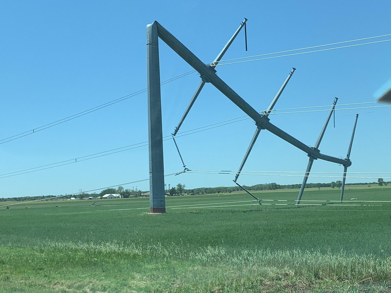
The Lockett tornado was the second long track tornado, beginning
southeast of Crowell before moving into Wilbarger County
approximately 5 miles south of SH70. The tornado took a sharp
turn to the left, before impacting the Lockett area. Seven metal
electrical transmission poles were bent nearly to the ground just
south of Lockett.  The tornado then dissipated near SH70 and
County Road 126W to the southwest of Vernon.

.Earlsboro 1...

Rating:                 EF2
Estimated Peak Wind:    135 mph
Path Length /statute/:  3.4 miles
Path Width /maximum/:   To be determined
Fatalities:             0
Injuries:               0

Start Date:             05/04/2022
Start Time:             08:28 PM CDT
Start Location:         1 SSE Earlsboro / Pottawatomie County /
OK
Start Lat/Lon:          35.26 / -96.80

End Date:               05/04/2022
End Time:               08:35 PM CDT
End Location:           Earlsboro / Pottawatomie County / OK
End Lat/Lon:            35.26 / -96.80

Survey Summary:
The first Earlsboro tornado began on the southeast side of the city,
near SH9. This tornado moved in nearly a complete circle, affecting
the northeast side of the city. Damage to houses, power lines, and
buildings were found by the damage survey crew.

.Earlsboro 2...

Rating:                 EF1
Estimated Peak Wind:    90 mph
Path Length /statute/:  4.5 miles
Path Width /maximum/:   175 yards
Fatalities:             0
Injuries:               0

Start Date:             05/04/2022
Start Time:             08:35 PM CDT
Start Location:         1 SE Earlsboro / Pottawatomie County / OK
Start Lat/Lon:          35.26 / -96.79

End Date:               05/04/2022
End Time:               08:50 PM CDT
End Location:           3 NW Seminole / Seminole County / OK
End Lat/Lon:            35.26 / -96.72

Survey Summary:
The second Earlsboro tornado began nearly in the same spot that
the first one did. The first damage to trees and buildings was
noted just east of the Union Pacific tracks along SH9/US270. The
tornado then moved to briefly to the southeast before turning to
the east. The tornado then dissipated near SH 3E just northwest
of Seminole.

.Cromwell 2...

Rating:                 EF1
Estimated Peak Wind:    100 mph
Path Length /statute/:  1.8 miles
Path Width /maximum/:   150 yards
Fatalities:             0
Injuries:               0

Start Date:             05/04/2022
Start Time:             08:58 PM CDT
Start Location:         3 WSW Cromwell / Seminole County / OK
Start Lat/Lon:          35.33 / -96.51

End Date:               05/04/2022
End Time:               09:02 PM CDT
End Location:           2 W Cromwell / Seminole County / OK
End Lat/Lon:            35.34 / -96.49

Survey Summary:
A satellite tornado occurred just west of Cromwell. This tornado
caused tree and roof damage along NS 3660 Road approximately
2 miles west of Cromwell.

.Grandfield...

Rating:                 EF-U
Estimated Peak Wind:    N/A
Path Length /statute/:  1 mile
Path Width /maximum/:   50 yards
Fatalities:             0
Injuries:               0

Start Date:             05/04/2022
Start Time:             10:22 PM CDT
Start Location:         5 SW Loveland / Tillman County / OK
Start Lat/Lon:          34.24 / -98.83

End Date:               05/04/2022
End Time:               10:25 PM CDT
End Location:           4 SW Loveland / Tillman County / OK
End Lat/Lon:            34.25 / -98.82

Survey Summary:
This tornado was observed by storm spotters. No damage indicators
were hit to give it a full rating. Path length and width determined
by a combination of eyewitnesses and radar data.

EF Scale: The Enhanced Fujita Scale classifies tornadoes into the
following categories:

EFU...Unknown...No indicators hit to determine wind
EF0...Weak......65 to 85 mph
EF1...Weak......86 to 110 mph
EF2...Strong....111 to 135 mph
EF3...Strong....136 to 165 mph
EF4...Violent...166 to 200 mph
EF5...Violent...>200 mph

NOTE:
The information in this statement is preliminary and subject to
change pending final review of the events and publication in NWS
Storm Data.

$$

WFO Norman
|
| Tornadoes by Intensity | |||||||
|---|---|---|---|---|---|---|---|
| EFU | EF0 | EF1 | EF2 | EF3 | EF4 | EF5 | Total |
| 5 | 3 | 6 | 2 | 1 | 0 | 0 | 17 |
| Tornado Number |
Date | Time (CST) |
Length of Path (miles) |
Width of Path (yards) |
F-Scale | Killed | Injured | County | Location |
|---|---|---|---|---|---|---|---|---|---|
| 1 | 05/04/2022 | 1723-1733 | 4.6 | 100 | EF0 | 0 | 0 | Pottawatomie | 3 WNW - 1.5 NNW Maud |
| 2 | 05/04/2022 | 1737-1740 | 1 | 100 | EF? | 0 | 0 | Pottawatomie | 2 NNW - 3 N Maud |
| 3 | 05/04/2022 | 1744-1814 | 12 | 1760 | EF2 | 0 | 0 | Seminole | 4.5 SW Seminole - Seminole - 4 E Little |
| 4 | 05/04/2022 | 1800-1819 | 8 | 100 | EF? | 0 | 0 | King/ Foard | 7 SE Chalk - 19 WSW Crowell |
| 5 | 05/04/2022 | 1801-1804 | 2 | 175 | EF0 | 0 | 0 | Seminole | 5 NE Seminole - 5 ESE Little |
| 6 | 05/04/2022 | 1821-1849 | 14 | 1350 | EF1 | 0 | 0 | Seminole/ Okfuskee | 4 SW Cromwell - 2 WNW Okemah |
| 7 | 05/04/2022 | 1840-1856 | 9 | 100 | EF0 | 0 | 0 | Foard | 13 SW - 6 SSW Crowell |
| 8 | 05/04/2022 | 1844-1845 | 0.4 | 150 | EF1 | 0 | 0 | Okfuskee | 3.5 SW - 3.1 SW Okemah |
| 9 | 05/04/2022 | 1907-1922 | 2.3 | 100 | EF1 | 0 | 0 | Pottawatomie | 1 ENE Brooksville - 4 SSE Tecumseh |
| 10 | 05/04/2022 | 1911-1913 | 1 | 50 | EF? | 0 | 0 | Foard | 3 SSE - 4 SSE Crowell |
| 11 | 05/04/2022 | 1925-2023 | 23 | 600 | EF3 | 0 | 0 | Foard/ Wilbarger | 5 SW Thalia - Lockett - 3 N Lockett |
| 12 | 05/04/2022 | 1928-1935 | 3.4 | 150 | EF2 | 0 | 0 | Pottawatomie | 1 SSE Earlsboro - Earlsboro |
| 13 | 05/04/2022 | 1935-1950 | 5 | 175 | EF1 | 0 | 0 | Pottawatomie/ Seminole | 1 SE Earlsboro - 3 NW Seminole |
| 14 | 05/04/2022 | 1958-2002 | 1.8 | 150 | EF1 | 0 | 0 | Seminole | 3 WSW - 2 W Cromwell |
| 15 | 05/04/2022 | 2052-2052 | 0.2 | 20 | EF? | 0 | 0 | Kiowa | 4 NNE Roosevelt |
| 16 | 05/04/2022 | 2122-2125 | 1 | 50 | EF? | 0 | 0 | Tillman | 5 SW - 4 SW Loveland |
| 17 | 05/05/2022 | 0109-0113 | 2.4 | 450 | EF1 | 0 | 0 | Pittsburg | .3 NE - 2.7 ENE Blocker |
