Scattered strong to severe thunderstorms are possible Tuesday and Wednesday afternoon and evening from east Texas into western Alabama. Damaging winds, large hail, and a couple of tornadoes will be possible. Excessive rainfall in this area may lead to flooding as well. Late-season snow is expected over parts of the central Rockies including the Denver Metro tonight into Wednesday. Read More >
The winter event of Thursday, December 5 to Friday, December 6, 2013 essentially impacted the region in two separate waves of wintry precipitation. A strong upper level trough set up over the western half of the United States Wednesday night through Thursday morning. Embedded within the larger wave, a short wave trough dug eastward into the southern Rockies. In response, a surface trough/front developed which then lifted across the southern plains beginning Thursday evening. Prior to this...a strong arctic cold front surged southward across the plains states into Texas, bringing unseasonably cold weather Tuesday and Wednesday (12/3-4/2013).
Precipitation started midday Thursday, in the form of freezing rain across the western north Texas and southern Oklahoma. While to the north, snow developed, primarily north of the I-40 corridor and across Oklahoma City through the afternoon. There was a fine transition line between freezing rain/sleet and snow across the southern half of the OKC metro, as freezing rain quickly transitioned to sleet from Moore and Norman and locations south and east of the I-44 corridor. This first wave, of wintry precipitation slowly diminished through the early to mid evening hours across central Oklahoma, while freezing rain and sleet continued to fall through the evening and overnight across southern Oklahoma and southward into the Dallas/Fort Worth metro area.
The second wave of primarily snow, with a little sleet mixed in, started across western Texas and slowly lifted north-northeast across southwestern Oklahoma shortly before midnight. This band of snow increased through the overnight hours and continued through Friday (12/6/2013) morning, with the primary band of precipitation extending from west Texas through central Oklahoma and into the Arkansas and Missouri Ozarks. The remaining winter precipitation slowly tapered off through the late morning, moving into western Arkansas by early afternoon.
This system laid down a decent swath of snow/sleet accumulations and a glazing of ice across far southern Oklahoma. The most impressive snow totals were associated with the main heavy snow band that formed over western north Texas, dropping 4 to 6 inches of snow from there up through Oklahoma City. Other less heavy snow bands developed farther east, with appreciable snow accumulations of 2 to 3 inches over a large portion of central Oklahoma.

NWUS54 KOUN 061652
LSROUN

PRELIMINARY LOCAL STORM REPORT
NATIONAL WEATHER SERVICE NORMAN OK
1051 AM CST FRI DEC 06 2013

..TIME...   ...EVENT...      ...CITY LOCATION...     ...LAT.LON...
..DATE...   ....MAG....      ..COUNTY LOCATION..ST.. ...SOURCE....
            ..REMARKS..

0600 AM     SNOW             6 W PURCELL             35.01N 97.48W
12/06/2013  E3.0 INCH        MCCLAIN            OK   PUBLIC

0630 AM     SNOW             ALTUS                   34.64N 99.33W
12/06/2013  E4.5 INCH        JACKSON            OK   EMERGENCY MNGR

0700 AM     SNOW             MARSHALL                36.16N 97.62W
12/06/2013  E1.0 INCH        LOGAN              OK   CO-OP OBSERVER

0700 AM     SNOW             OKARCHE                 35.73N 97.98W
12/06/2013  E3.0 INCH        CANADIAN           OK   CO-OP OBSERVER

0700 AM     SNOW             CRESCENT                35.95N 97.59W
12/06/2013  E2.0 INCH        LOGAN              OK   CO-OP OBSERVER

0700 AM     SNOW             MULHALL                 36.06N 97.40W
12/06/2013  E3.0 INCH        LOGAN              OK   CO-OP OBSERVER

0700 AM     SNOW             HOBART                  35.03N 99.09W
12/06/2013  E4.0 INCH        KIOWA              OK   CO-OP OBSERVER

0700 AM     SNOW             NOBLE                   35.14N 97.39W
12/06/2013  E2.0 INCH        CLEVELAND          OK   CO-OP OBSERVER

0700 AM     SNOW             PERRY                   36.29N 97.29W
12/06/2013  E1.0 INCH        NOBLE              OK   CO-OP OBSERVER

0700 AM     SNOW             6 SSW FREDERICK         34.31N 99.05W
12/06/2013  E2.5 INCH        TILLMAN            OK   PUBLIC

0700 AM     SNOW             YALE                    36.11N 96.70W
12/06/2013  E2.5 INCH        PAYNE              OK   PUBLIC

0700 AM     SNOW             2 N GLENCOE             36.26N 96.93W
12/06/2013  E2.5 INCH        NOBLE              OK   PUBLIC

0700 AM     SNOW             CHICKASHA               35.04N 97.95W
12/06/2013  E3.0 INCH        GRADY              OK   CO-OP OBSERVER

0700 AM     SNOW             3 NNW SHAWNEE           35.38N 96.94W
12/06/2013  E3.0 INCH        POTTAWATOMIE       OK   PUBLIC

0700 AM     SNOW             5 SSW CLINTON           35.44N 99.01W
12/06/2013  E1.5 INCH        WASHITA            OK   PUBLIC

0700 AM     SNOW             LAWTON                  34.60N 98.42W
12/06/2013  E2.0 INCH        COMANCHE           OK   CO-OP OBSERVER

0700 AM     SNOW             CENTRAHOMA              34.61N 96.34W
12/06/2013  E1.0 INCH        COAL               OK   CO-OP OBSERVER

0700 AM     SNOW             MEEKER                  35.50N 96.89W
12/06/2013  E2.0 INCH        LINCOLN            OK   CO-OP OBSERVER

0725 AM     SNOW             QUANAH                  34.30N 99.74W
12/06/2013  E6.0 INCH        HARDEMAN           TX   AMATEUR RADIO

0730 AM     SNOW             2 E HEALDTON            34.23N 97.45W
12/06/2013  E1.5 INCH        CARTER             OK   CO-OP OBSERVER

0730 AM     SNOW             MUSTANG                 35.39N 97.72W
12/06/2013  E3.0 INCH        CANADIAN           OK   PUBLIC

0735 AM     SNOW             SW NORMAN               35.22N 97.44W
12/06/2013  E3.1 INCH        CLEVELAND          OK   PUBLIC

0738 AM     SNOW             SULPHUR                 34.51N 96.98W
12/06/2013  E2.0 INCH        MURRAY             OK   PUBLIC

            SNOW AND SLEET.

0745 AM     SNOW             PINK                    35.26N 97.12W
12/06/2013  E2.0 INCH        POTTAWATOMIE       OK   PUBLIC

0745 AM     SNOW             SEMINOLE                35.23N 96.68W
12/06/2013  E2.5 INCH        SEMINOLE           OK   PUBLIC

0748 AM     SLEET            ATOKA                   34.38N 96.13W
12/06/2013  E1.50 INCH       ATOKA              OK   PUBLIC

0754 AM     SNOW             FORT COBB               35.10N 98.44W
12/06/2013  E6.0 INCH        CADDO              OK   EMERGENCY MNGR

0800 AM     SNOW             1 NE MIDWEST CITY       35.47N 97.38W
12/06/2013  E2.4 INCH        OKLAHOMA           OK   PUBLIC

0800 AM     SNOW             CHICKASHA               35.04N 97.95W
12/06/2013  E3.0 INCH        GRADY              OK   CO-OP OBSERVER

0800 AM     SNOW             2 S GUTHRIE             35.85N 97.42W
12/06/2013  E4.5 INCH        LOGAN              OK   PUBLIC

0800 AM     SNOW             EL RENO                 35.53N 97.96W
12/06/2013  E3.5 INCH        CANADIAN           OK   PUBLIC

0804 AM     SLEET            ELMORE CITY             34.62N 97.40W
12/06/2013  E2.80 INCH       GARVIN             OK   PUBLIC

            SLEET AND SNOW

0806 AM     SLEET            STRATFORD               34.80N 96.96W
12/06/2013  E2.00 INCH       GARVIN             OK   PUBLIC

0810 AM     SNOW             EDMOND                  35.65N 97.48W
12/06/2013  E4.0 INCH        OKLAHOMA           OK   PUBLIC

0814 AM     SNOW             WARR ACRES              35.53N 97.62W
12/06/2013  E4.5 INCH        OKLAHOMA           OK   PUBLIC

            4-5 INCHES REPORTED NEAR NW 63RD.

0815 AM     SNOW             PRAGUE                  35.49N 96.69W
12/06/2013  E5.0 INCH        LINCOLN            OK   EMERGENCY MNGR

0816 AM     SNOW             NE EDMOND               35.65N 97.48W
12/06/2013  E4.5 INCH        OKLAHOMA           OK   PUBLIC

0830 AM     SNOW             3 E ANADARKO            35.07N 98.19W
12/06/2013  E3.4 INCH        CADDO              OK   PUBLIC

0831 AM     SNOW             PIEDMONT                35.64N 97.75W
12/06/2013  E4.0 INCH        CANADIAN           OK   PUBLIC

0841 AM     SNOW             SE NORMAN               35.22N 97.44W
12/06/2013  E2.9 INCH        CLEVELAND          OK   PUBLIC

0845 AM     SLEET            WAYNE                   34.92N 97.32W
12/06/2013  E2.50 INCH       MCCLAIN            OK   PUBLIC

            2-3 INCHES OF SLEET AND SNOW

0906 AM     SNOW             NW SHAWNEE              35.34N 96.92W
12/06/2013  E5.0 INCH        POTTAWATOMIE       OK   EMERGENCY MNGR

0910 AM     SNOW             VERNON                  34.15N 99.29W
12/06/2013  E2.5 INCH        WILBARGER          TX   PUBLIC

            2-3 INCHES REPORTED.

0915 AM     SLEET            SEYMOUR                 33.60N 99.26W
12/06/2013  E1.00 INCH       BAYLOR             TX   DEPT OF HIGHWAYS

0915 AM     SNOW             CROWELL                 33.98N 99.72W
12/06/2013  E2.0 INCH        FOARD              TX   CO-OP OBSERVER

0925 AM     SLEET            HENRIETTA               33.82N 98.19W
12/06/2013  E1.50 INCH       CLAY               TX   PUBLIC

0930 AM     SLEET            ATOKA                   34.38N 96.13W
12/06/2013  E2.00 INCH       ATOKA              OK   PUBLIC

0930 AM     SNOW             TUTTLE                  35.29N 97.81W
12/06/2013  E3.5 INCH        GRADY              OK   EMERGENCY MNGR

0930 AM     SNOW             RUSH SPRINGS            34.78N 97.96W
12/06/2013  E2.0 INCH        GRADY              OK   EMERGENCY MNGR

0930 AM     SNOW             DUNCAN                  34.50N 97.96W
12/06/2013  E3.0 INCH        STEPHENS           OK   AMATEUR RADIO

            SNOW AND SLEET.

0933 AM     SLEET            STRINGTOWN              34.47N 96.05W
12/06/2013  E3.00 INCH       ATOKA              OK   PUBLIC

            2 INCHES OF SLEET AND 1 INCH SNOW.

0935 AM     SNOW             MANGUM                  34.88N 99.50W
12/06/2013  E2.0 INCH        GREER              OK   PUBLIC

0935 AM     SNOW             HOLLIS                  34.69N 99.92W
12/06/2013  E3.0 INCH        HARMON             OK   PUBLIC

0940 AM     SNOW             FREDERICK               34.39N 99.01W
12/06/2013  E3.0 INCH        TILLMAN            OK   PUBLIC

0940 AM     SLEET            ARCHER CITY             33.59N 98.63W
12/06/2013  E1.00 INCH       ARCHER             TX   PUBLIC

0945 AM     SNOW             5 N HENNEPIN            34.58N 97.35W
12/06/2013  E4.0 INCH        GARVIN             OK   CO-OP OBSERVER

0945 AM     SNOW             ELECTRA                 34.03N 98.92W
12/06/2013  E1.5 INCH        WICHITA            TX   PUBLIC

            SNOW AND SLEET.

0945 AM     SNOW             ENID                    36.40N 97.88W
12/06/2013  E0.5 INCH        GARFIELD           OK   EMERGENCY MNGR

0945 AM     SNOW             HYDRO                   35.55N 98.58W
12/06/2013  E2.0 INCH        CADDO              OK   PUBLIC

0945 AM     SNOW             14 E WETUMKA            35.24N 95.99W
12/06/2013  E5.0 INCH        HUGHES             OK   EMERGENCY MNGR

0945 AM     SNOW             WATONGA                 35.85N 98.41W
12/06/2013  E1.0 INCH        BLAINE             OK   PUBLIC

0950 AM     SNOW             WALTERS                 34.36N 98.31W
12/06/2013  E0.0 INCH        COTTON             OK   PUBLIC

1000 AM     SNOW             CENTRAHOMA              34.61N 96.34W
12/06/2013  E3.0 INCH        COAL               OK   CO-OP OBSERVER

            1 INCH OF SLEET AND 2 INCHES OF SNOW.

1013 AM     SLEET            MARIETTA                33.93N 97.12W
12/06/2013  E1.00 INCH       LOVE               OK   PUBLIC

1015 AM     SNOW             WAURIKA                 34.17N 98.00W
12/06/2013  E2.0 INCH        JEFFERSON          OK   PUBLIC

            SNOW AND SLEET.

1020 AM     SNOW             OAKWOOD                 35.93N 98.70W
12/06/2013  E1.0 INCH        DEWEY              OK   PUBLIC

1022 AM     SNOW             THOMAS                  35.75N 98.75W
12/06/2013  E1.0 INCH        CUSTER             OK   PUBLIC

1027 AM     SNOW             HOLDENVILLE             35.08N 96.40W
12/06/2013  E4.0 INCH        HUGHES             OK   EMERGENCY MNGR

1030 AM     SLEET            TISHOMINGO              34.24N 96.68W
12/06/2013  E2.00 INCH       JOHNSTON           OK   PUBLIC

            SLEET AND SNOW.

1030 AM     SLEET            MADILL                  34.09N 96.77W
12/06/2013  E1.00 INCH       MARSHALL           OK   PUBLIC

1036 AM     SLEET            ARDMORE                 34.17N 97.14W
12/06/2013  E1.00 INCH       CARTER             OK   PUBLIC

1040 AM     SNOW             DURANT                  34.00N 96.39W
12/06/2013  E2.0 INCH        BRYAN              OK   CO-OP OBSERVER

            1 INCH OF SLEET AND 1 INCH OF SNOW.

1048 AM     SLEET            BOKCHITO                34.02N 96.14W
12/06/2013  E2.00 INCH       BRYAN              OK   PUBLIC


&&

$$

EM

The snow field from the December 5-6, 2013 winter storm covered a large area within the NWS Norman forecast area. The satellite photos at 10:31 AM CST on December 10, 2013 show this snow field. Please note that the small swath of snow in north central Oklahoma was from a small winter system that dropped light now in the region on December 9, 2013. More satellite images and information regarding this event can be found on the CIMSS Satellite Blog.
 Local Visible Satellite Image of the Snow Band in Oklahoma and North Texas at 10:31 AM CST on December 10, 2013 |
 Regional Visible Satellite Image of the Snow Band in Oklahoma and North Texas at 10:31 AM CST on December 10, 2013 |

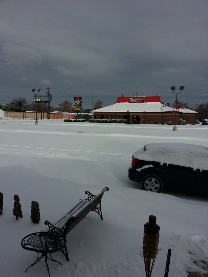
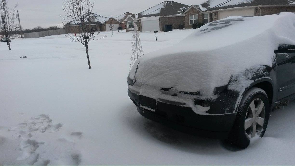
Quanah, TX - Photo courtesy of Bryan Rupp |

Quanah, TX - Photo courtesy of Bryan Rupp |

Norman, OK - Photo courtesy of Paul Kamis |

Ada, OK - Photo courtesy of Chrissie Ballard Christian |

Anadarko, OK - Photo courtesy of Danny Bryan |

Anadarko, OK - Photo courtesy of Danny Bryan |

Noble, OK - Photo courtesy of Deborah Hulse-Gann Shelton |

Ardmore, OK - Photo courtesy of Dewey Johnston |

Oklahoma City, OK - Photo courtesy of Jessica Crain |

Roff, OK - Photo courtesy of Jennifer Hunt |
Winter Weather Briefing - 11:00 AM CST, December 5, 2013
Behind the Scenes at NWS Norman: Forecasting a Winter Storm Presentation - December 4, 2013
Winter Weather Briefing - 11:00 AM CST, December 4, 2013
Winter Weather Briefing - 2:30 PM CST, December 3, 2013