
A dangerous, record heat wave continues across portions of the West through Tuesday. High rip current risk and dangerous surf continue through the weekend. There are flash flooding concerns through the weekend for portions of the Southeast and Southwest. Read More >
For the third consecutive week, after winter weather events on February 12, 2013 and February 20-21. 2013, a major winter storm affected the southern Plains with widespread snowfall on February 24-26, 2013. An upper level storm system dove southeast through the Great Basin into New Mexico, then intensified rapidly as it lifted east-northeast through West Texas and the Red River Valley.
Before any wintry precipitation fell, a few severe thunderstorms developed over southwest Oklahoma along a strong cold front. However, behind this front, very cold air allowed liquid precipitation to change over to snow and sleet by Sunday evening. The strength of this storm allowed it to produce significantly more wind than the ones which struck earlier in the month, leading to blizzard conditions in parts of northern and western Oklahoma.
A strong cold front pushed through the Texas and Oklahoma Panhandles on the afternoon and evening of February 24, reaching into far western Oklahoma by midnight. Heavy snowfall developed behind the front, then gradually spread eastward overnight as temperatures fell to near or below freezing across western and northern Oklahoma. By early afternoon on February 25, moderate to heavy snow was occurring over most areas northwest of a line from Hollis to Kingfisher. Very heavy snow bands and occasional thundersnow led to significant snow accumulations over a large part of northwest Oklahoma.
Several areas saw snowfall in excess of 15 inches, and when combined with the snow that was already present from the winter storm a few days before, snow depths of up to 25 inches were reported in localized areas. Strong and gusty winds led to snow drifts up to 5 to 8 feet in depth, shutting down many highways and secondary roads in western Oklahoma. The heavy wet nature of the snow caused some structural damage at Alva, Cherokee, and Woodward.
Widespread power outages were reported due to snow-covered power lines and downed trees and tree limbs. The rain-snow line hovered near the I-44 corridor and Oklahoma City metro area for much of the afternoon, with many areas to the east only changing to snow after sunset as the event was winding down. The snow gradually tapered off from west to east during the late afternoon and evening, with most of the accumulating snow in central Oklahoma ending by midnight.


PRELIMINARY LOCAL STORM REPORT...SUMMARY
NATIONAL WEATHER SERVICE NORMAN OK
347 PM CST TUE FEB 26 2013

..TIME...   ...EVENT...      ...CITY LOCATION...     ...LAT.LON...
..DATE...   ....MAG....      ..COUNTY LOCATION..ST.. ...SOURCE....
            ..REMARKS..

0730 AM     HEAVY SNOW       SHATTUCK                36.28N 99.88W
02/25/2013  E5.0 INCH        ELLIS              OK   EMERGENCY MNGR

0930 AM     HEAVY SNOW       LAVERNE                 36.71N 99.90W
02/25/2013  E8.0 INCH        HARPER             OK   COUNTY OFFICIAL

0942 AM     HEAVY SNOW       FREEDOM                 36.77N 99.11W
02/25/2013  M4.0 INCH        WOODS              OK   COUNTY OFFICIAL

0945 AM     HEAVY SNOW       ALVA                    36.80N 98.67W
02/25/2013  E9.0 INCH        WOODS              OK   LAW ENFORCEMENT

0951 AM     HEAVY SNOW       MOORELAND               36.44N 99.21W
02/25/2013  M10.0 INCH       WOODWARD           OK   LAW ENFORCEMENT

0958 AM     SNOW             HELENA                  36.55N 98.27W
02/25/2013  E2.0 INCH        ALFALFA            OK   COUNTY OFFICIAL

1005 AM     HEAVY SNOW       SHATTUCK                36.28N 99.88W
02/25/2013  E6.0 INCH        ELLIS              OK   COUNTY OFFICIAL

1010 AM     HEAVY SNOW       ARNETT                  36.14N 99.77W
02/25/2013  E8.0 INCH        ELLIS              OK   COUNTY OFFICIAL

1021 AM     HEAVY SNOW       8 S HARMON              36.03N 99.56W
02/25/2013  E6.0 INCH        ELLIS              OK   PUBLIC

1025 AM     HEAVY SNOW       SHARON                  36.28N 99.34W
02/25/2013  E6.0 INCH        WOODWARD           OK   COUNTY OFFICIAL

1056 AM     HEAVY SNOW       CHEYENNE                35.61N 99.68W
02/25/2013  E4.0 INCH        ROGER MILLS        OK   EMERGENCY MNGR

1112 AM     HEAVY SNOW       WOODWARD                36.43N 99.39W
02/25/2013  M8.0 INCH        WOODWARD           OK   EMERGENCY MNGR

1125 AM     HEAVY SNOW       SWEETWATER              35.42N 99.92W
02/25/2013  E6.0 INCH        BECKHAM            OK   PUBLIC

1127 AM     SNOW             HAMMON                  35.63N 99.38W
02/25/2013  E2.0 INCH        ROGER MILLS        OK   PUBLIC

1132 AM     SNOW             MAYFIELD                35.33N 99.88W
02/25/2013  E5.0 INCH        BECKHAM            OK   CO-OP OBSERVER

1232 PM     SNOW             ALVA                    36.80N 98.67W
02/25/2013  E6.0 INCH        WOODS              OK   EMERGENCY MNGR

            NEW SNOW ON TOP OF PREVIOUS ACCUMULATION

0200 PM     HEAVY SNOW       ALVA                    36.80N 98.67W
02/25/2013  M17.0 INCH       WOODS              OK   BROADCAST MEDIA

            TOTAL SNOW DEPTH 24 INCHES OVER 2 EVENTS. AWNING
            COLLAPSED AT SONIC.

0224 PM     SNOW             12 S WATONGA            35.68N 98.41W
02/25/2013  E6.0 INCH        BLAINE             OK   PUBLIC

0230 PM     SNOW             WOODWARD                36.43N 99.39W
02/25/2013  M10.0 INCH       WOODWARD           OK   CO-OP OBSERVER

0250 PM     HEAVY SNOW       10 NW WOODWARD          36.54N 99.52W
02/25/2013  M15.0 INCH       WOODWARD           OK   TRAINED SPOTTER

            NEAR FORT SUPPLY

0330 PM     HEAVY SNOW       WOODWARD                36.43N 99.39W
02/25/2013  M15.0 INCH       WOODWARD           OK   EMERGENCY MNGR

0530 PM     BLIZZARD         WOODWARD                36.43N 99.39W
02/25/2013                   WOODWARD           OK   PUBLIC

            *** 1 FATAL *** CORRECTION. ROOF COLLAPSED AT A PRIVATE
            RESIDENCE, WITH 1 FATALITY. THE WALMART ROOF HAD A
            PARTIAL ROOF COLLAPSE IN THE GARDEN CENTER.

0530 PM     SNOW             OMEGA                   35.87N 98.20W
02/25/2013  E6.0 INCH        KINGFISHER         OK   STORM CHASER

0555 PM     HEAVY SNOW       VANCE AIR FORCE BASE    36.34N 97.90W
02/25/2013  M4.0 INCH        GARFIELD           OK   PUBLIC

            1 INCH IN LAST HOUR. OTHER REPORTS OF 5 INCHES.

0700 PM     SNOW             WOODWARD                36.43N 99.39W
02/25/2013  M13.2 INCH       WOODWARD           OK   EMERGENCY MNGR

0930 PM     SNOW             STILLWATER              36.12N 97.06W
02/25/2013  M2.0 INCH        PAYNE              OK   PUBLIC

1130 PM     SNOW             5 SSE PIEDMONT          35.58N 97.71W
02/25/2013  M1.0 INCH        CANADIAN           OK   PUBLIC

0700 AM     HEAVY SNOW       HINTON                  35.47N 98.36W
02/26/2013  M5.0 INCH        CADDO              OK   COUNTY OFFICIAL

0700 AM     HEAVY SNOW       ARAPAHO                 35.58N 98.96W
02/26/2013  E9.0 INCH        CUSTER             OK   EMERGENCY MNGR

0700 AM     HEAVY SNOW       REYDON                  35.65N 99.92W
02/26/2013  E10.0 INCH       ROGER MILLS        OK   PUBLIC

0700 AM     SNOW             3 SE FORT SUPPLY        36.54N 99.54W
02/26/2013  M16.0 INCH       WOODWARD           OK   TRAINED SPOTTER

            DRIFTS TO SIX FEET.

0700 AM     SNOW             WATONGA                 35.85N 98.41W
02/26/2013  M7.0 INCH        BLAINE             OK   CO-OP OBSERVER

0700 AM     SNOW             4 W CHEROKEE            36.75N 98.43W
02/26/2013  M9.3 INCH        ALFALFA            OK   CO-OP OBSERVER

            SNOW DRIFTS UP TO 4 1/2 FEET.

0700 AM     SNOW             PONCA CITY              36.71N 97.09W
02/26/2013  M6.7 INCH        KAY                OK   CO-OP OBSERVER

0700 AM     SNOW             5 S CARTER              35.14N 99.50W
02/26/2013  M3.5 INCH        BECKHAM            OK   CO-OP OBSERVER

0700 AM     SNOW             TALOGA                  36.04N 98.96W
02/26/2013  M14.0 INCH       DEWEY              OK   CO-OP OBSERVER

0700 AM     SNOW             7 E WAYNOKA             36.58N 98.75W
02/26/2013  M12.0 INCH       WOODS              OK   CO-OP OBSERVER

            8 FOOT DRIFTS.

0700 AM     SNOW             QUANAH                  34.30N 99.74W
02/26/2013  E4.0 INCH        HARDEMAN           TX   FIRE DEPT/RESCUE

0700 AM     SNOW             1 S MEDFORD             36.79N 97.73W
02/26/2013  M3.2 INCH        GRANT              OK   CO-OP OBSERVER

The above radar animation shows the progression of the winter storm across the area beginning at 3 pm CST Sunday, February 24th, and running through 8 apm CST, February 26th. An area of thunderstorms initially developed over southwest Oklahoma on the evening of the 24th. These storms produced a few severe wind gusts up to 80 mph and small hail. This was quite unique in that some areas over southwest Oklahoma were within severe thunderstorm warnings and blizzard warnings at the same time. These storms were fueled by a strong cold front that surged southward during the overnight hours. Rain and storms quickly changed over to snow, sleet, and freezing rain over portions of northern and western Oklahoma, and even western north Texas. As frozen precipitation began this early in the event, it';s no wonder that these areas saw the greatest amount of snow. (Images courtesy of the Storm Prediction Center)
 |
 |
| Visible satellite images from 9:45 AM CST and 11:31 AM CST on 2/26/2013 showing the snow pack over northwest Oklahoma. | |

The above infrared satellite animation shows the progression of the winter storm across the area beginning at 6 pm CST Sunday, Feb 24, and running through 7 pm CST, Feb 26. IR satellite depicts cloud top temperatures. In this animation, blues indicate cold cloud tops, which are normally in the high levels of the atmosphere, and are often convective in nature. The reds, yellows, and greens indicated low to mid-level cloud tops. The cold cloud tops with this system were initially associated with thunderstorms over southwest Oklahoma and north Texas. these storms produced very heavy rainfall, hail, and even damaging winds. However, much of this transitioned to snow by the morning of February 25th. Note the cold cloud tops over northwest Oklahoma and the Texas panhandle halfway through the animation. These were associated with convective snow bands, which produced very heavy snowfall and, at times, thunder and lightning. Toward the end of the animation, cloud tops begin to warm, indicating most of the heavier snow had come to an end - one of the reasons much of central Oklahoma didn't see the heavy snows that were forecast.
As seen in the map below from the Oklahoma Mesonet, the strongest winds with this system occurred west of I-35, where gusts over 50 mph were recorded. Sustained winds ranged from 25 to 35 mph.

This video, provided by Jeromy Carter, shows dangerous blizzard and winter storm conditions near Watonga, Calumet, and Binger in Blaine, Canadian, and Caddo counties.
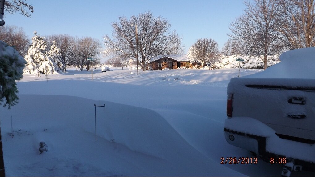
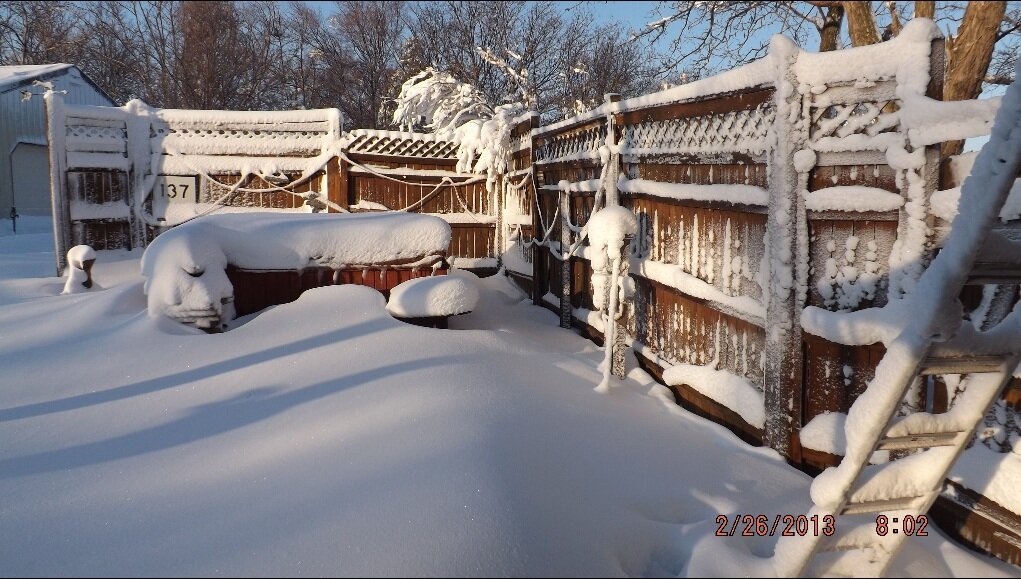
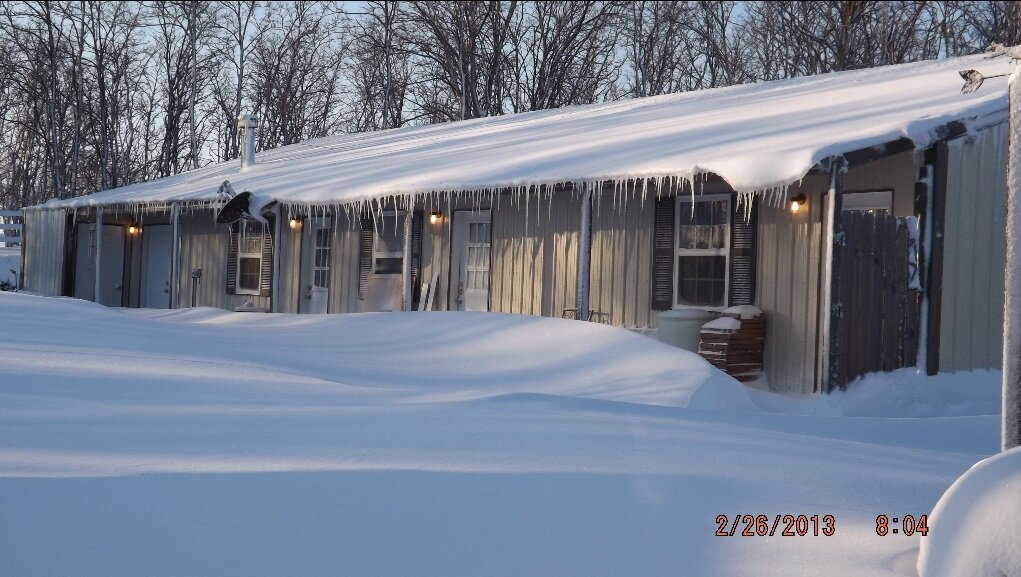
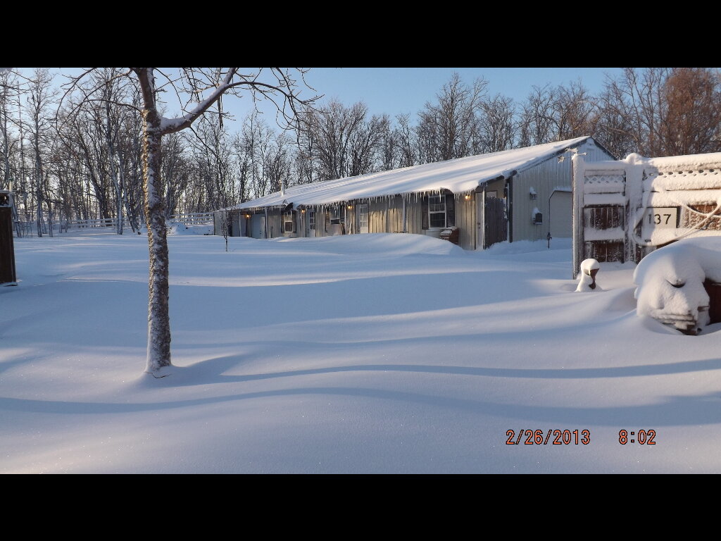
These photos were provided courtesy of Roy Anderson.
 |
 |
 |
 |
 |
 |
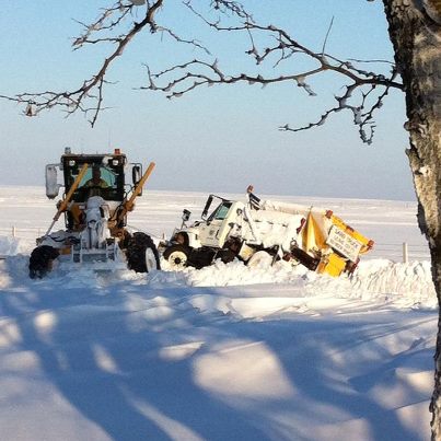
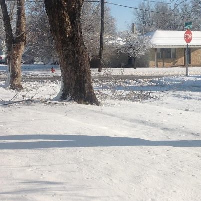
These photos were taken in the Clinton, OK area courtesy Robin Rodriquez. Even heavy machinery had difficulty maneuvering the snow-packed roads.
 |
 |
 |
These photos, taken by Marc Crow of Elk City, show a bird feeder becoming encased in snow throughout the day on Monday, February 25.
 |
 |
These photos were provided courtesy of Daniel and LaRae Brown.
 |
 |
 |
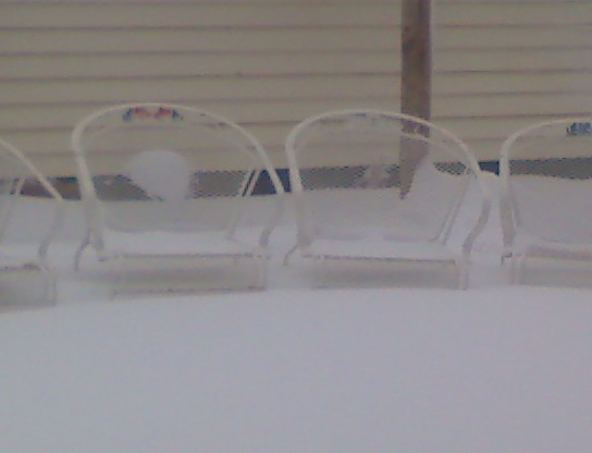
This photos shows a blizzard in progress in Cheyenne, OK and was taken by Cy Howenstine.

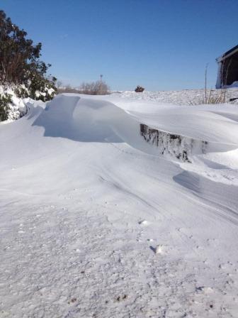
These photos show large snow drifts in Cheyenne, OK and were taken by Dusti Kirk.
 |
 |
 |
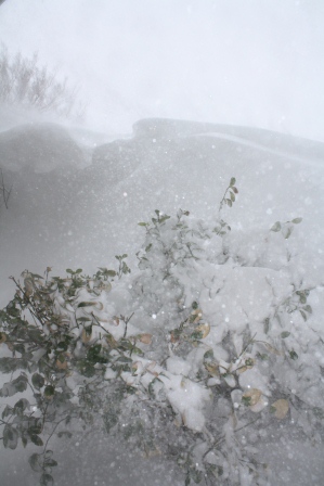
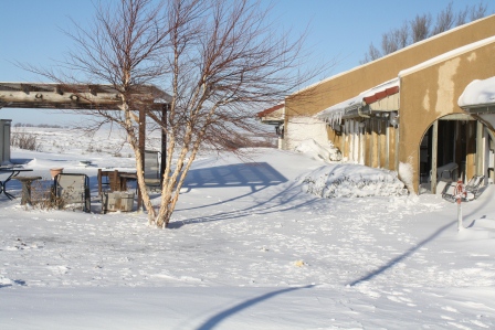
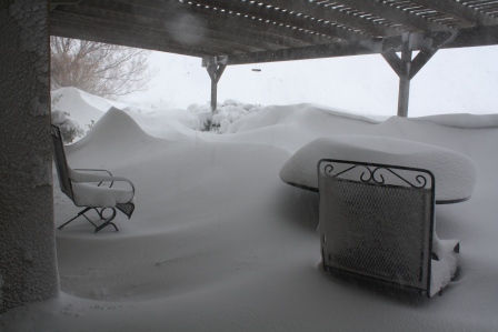
These photos were taken by Clyde Wheeler southwest of Laverne, Oklahoma. Numerous snowdrifts are apparent in these photos.
 |
 |
 |
 |
 |
 |
 |
 |
 |
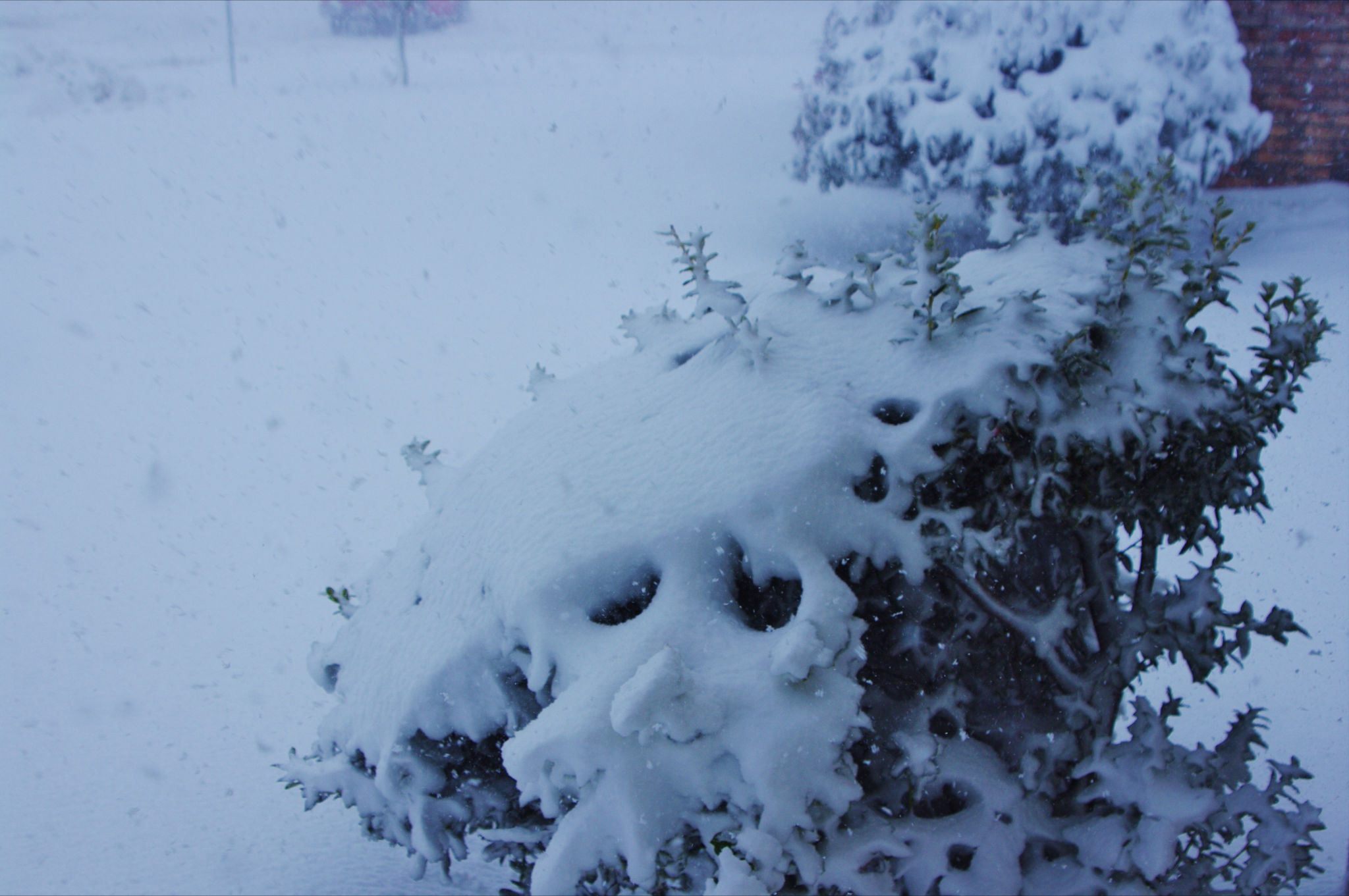
These photos were provided courtesy of Mary Van Winkle.
 |
 |
 |
 |
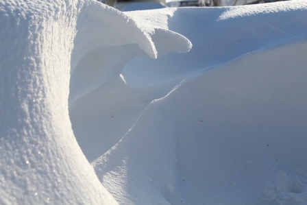
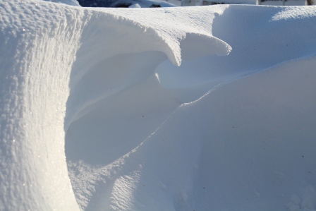
These photos show a crescent shaped snow drift in Mooreland and were provided by Tania.
 |
 |
 |


A winter wonderland - Photos provided courtesy of Tara Hall.
 |
 |
 |
A special thanks to everyone who took time to send their photos our way!