National Weather Service United States Department of Commerce

Severe Thunderstorms in the Southern U.S.; Heavy Snow in the North-Central U.S.

Isolated severe thunderstorms are likely across parts of the Southeast/Deep South Tuesday morning into early evening. A couple tornadoes are possible in parts of eastern Mississippi and Alabama. In the north-central U.S., a storm will bring heavy snow and gusty to high winds over parts of the northern Plains and Upper Midwest Tuesday before impacting the Great Lakes Wednesday into Thanksgiving. Read More >

Click a location below for detailed forecast.

Last Map Update: Mon, Nov 24, 2025 at 8:46:40 pm CST

Patchy fog will be possible along and east of I-35 tonight into tomorrow morning. Some fog may become dense at times with potential sudden changes to visibility, especially in low-lying areas.
Patchy fog can surprise you: Be ready for sudden changes in visibility. Turn on your low-beam headlights when approaching fog. Drive slowly, and keep your distance from other vehicles. Use extra caution on bridges and in valleys.
Rain chances will diminish from west to east through the afternoon and early evening with highest chances in north central OK for the rest of the day. Patchy drizzle is also possible in some areas.
The skies will be mostly sunny on Thanksgiving day with a south to southeast wind at 5-10 mph and seasonably average temperatures with highs in the low 50s to around 60 across our area.
An upper level system will bring a pattern change this weekend and into the first week of December. Below normal temperatures are favored with increasing preicpitation chances. There is still some uncertainty in timing of the cold air mass, which will play a key role in the precipitation types this weekend and into early next week and could potentially impact holiday travel plans.
Temperatures are trending colder into the first week of December with a strong cold front later this weekend. There remains some uncertainty in the temperatures Sunday, as seen in the temperature upper/lower ranges, with model inconsistencies in the exact timing of the cold air mass. Overall, the trend is looking to be colder with below normal temperatures for this time of year.
Patchy fog may develop along and east of I-35 Tuesday morning. Turning cooler mid-week and continuing through the week. Increasing precipitation chances chances into Thanksgiving weekend and early next week.

Local Weather History For November 24th...
On November 24th, 2013, snow and sleet affected western and central
Oklahoma. A band of accumulations over four inches stretched from
near Hollis to just north of Lawton, with a maximum of thirteen
inches near Vinson. A mixture of snow and sleet resulted in
accumulations of almost two inches as far east as Oklahoma City.

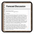
Text Product Selector (Selected product opens in current window)
Weather Observations Area Forecast Discussion Air Quality Forecasts Hydrology Information Frequently Asked Questions Social Media
Observations Discussion Air Quality Hydrology FAQ Social Media
 
Submit a Storm Report Graphical Weather Forecasts Aviation Weather Forecasts Climate Data Storm Data Weather Radio Information
Storm Reports Gridded Forecast Aviation Climate Storm Data Weather Radio  
 
Satellite Information Hourly Weather Forecast Fire Weather Information Past Weather Events StormReady Skywarn/Storm Spotters
Satellite Hourly Forecast Fire Weather Past Events StormReady Storm Spotters