
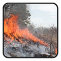
High winds and very dry conditions will continue to produce elevated to critical fire weather conditions over portions of New Mexico and far western Texas through Saturday. Heavy snow will continue in the Central Rockies Heavy rain, flooding, and severe thunderstorm risks increase from the Southern Plains into the Lower Missouri Valley this weekend. Read More >
Last Map Update: Thu, Apr 17, 2025 at 11:26:29 pm CDT


|
Local Weather History For April 17th...
|
|
Severe weather and flash flooding affected a small part of western
north Texas, into southwest and central Oklahoma on this date in 2013. At least five weak, short-lived tornadoes occurred from around Odell and Harrold, Texas, up toward Grandfield and Lawton, Oklahoma. Minor damage was reported with the tornadoes, but thankfully, no one was hurt. Numerous reports of damaging wind and hail, along with very heavy rain were also received across southwest and central Oklahoma. The largest hail and strongest wind was seen from Snyder and Cache, to Rush Springs and Chickasha. Significant flash flooding was also seen around Medicine Park, Meers, Chickasha, and Newcastle, where four to seven inches of rain fell in a short period of time. |
|
Text Product Selector (Selected product opens in current window)
|
|
 |
 |
 |
 |
 |
 |
| Observations | Discussion | Air Quality | Hydrology | FAQ | Social Media |
 |
 |
 |
 |
 |
 |
| Storm Reports | Gridded Forecast | Aviation | Climate | Storm Data | Weather Radio |
 |
 |
 |
 |
 |
 |
| Satellite | Hourly Forecast | Fire Weather | Past Events | StormReady | Storm Spotters |


 Local Radar
 Weather Map
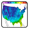
 Drought Conditions