
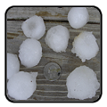
Multiple corridors of severe thunderstorms are expected across the Upper Midwest on Monday into Monday night, with a regional severe weather outbreak possible. The most dangerous period is likely during the late afternoon and evening when strong tornado potential should be maximized. Scattered large to very large hail and damaging winds are likely as well. Read More >
Last Map Update: Mon, Apr 28, 2025 at 3:46:28 am CDT


|
Local Weather History For April 28th...
|
|
April 2015 was a wet month for much of the region. While in the
midths of a long-term and exceptional drought across western Oklahoma, locations from around Taloga, to Cheyenne and Sayre received between 10 and 15 inches of rain during the month! This made April 2015 the second wettest month for west-central Oklahoma since records began in 1895. |
|
Text Product Selector (Selected product opens in current window)
|
|
 |
 |
 |
 |
 |
 |
| Observations | Discussion | Air Quality | Hydrology | FAQ | Social Media |
 |
 |
 |
 |
 |
 |
| Storm Reports | Gridded Forecast | Aviation | Climate | Storm Data | Weather Radio |
 |
 |
 |
 |
 |
 |
| Satellite | Hourly Forecast | Fire Weather | Past Events | StormReady | Storm Spotters |


 Local Radar
 Weather Map
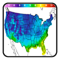
 Drought Conditions