Last Map Update: Mon, Jan 27, 2025 at 5:56:26 am CST
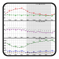
Current Weather Observations... | |||||||||||||||||||||||||||||||||||||||||||||||||||||||||||||||||||||||||||||||||||||||||||||||||||||||||||||||||||||||||||||||||||||||||||||||||||||||||||||||||||||||||||||||||||||
|
|
Local Weather History For January 27th...
|
|
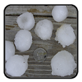
On January 27th and 28th back in 2009, a significant sleet storm
tracked over western north Texas, up through southern and central Oklahoma. Most of this sleet affected areas near and southeast of Interstate-44, from near Wichita Falls, Texas, up through Duncan, Chickasha, Purcell, Shawnee, Seminole, and Holdenville. Up to 4 inches of sleet accumulated on top of a quarter-inch of ice. |
|
Text Product Selector (Selected product opens in current window)
|
|
 |
 |
 |
 |
 |
 |
| Observations | Discussion | Air Quality | Hydrology | FAQ | Social Media |
 |
 |
 |
 |
 |
 |
| Storm Reports | Gridded Forecast | Aviation | Climate | Storm Data | Weather Radio |
 |
 |
 |
 |
 |
 |
| Satellite | Hourly Forecast | Fire Weather | Past Events | StormReady | Storm Spotters |


 Local Radar
 Weather Map
 Drought Conditions