| Click anywhere on the map for the forecast. Turn "on and off" the various weather parameters using the display options. Hover over a highlighted area to see the hazard. | Map Display Options | |||||||
|
Hazardous Weather Outlook Forecast Discussion |
|
• Submit Report • |
CURRENT CONDITIONS
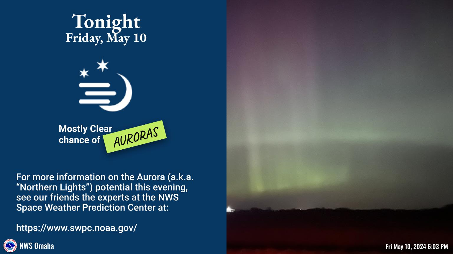
| Observations | Local WX Story | Geo-Color Satellite |
 |
 |
 |
| Local, Regional, & National Radar | ||||||||
Omaha  |
Regional Radar  |
National Radar |
||||||
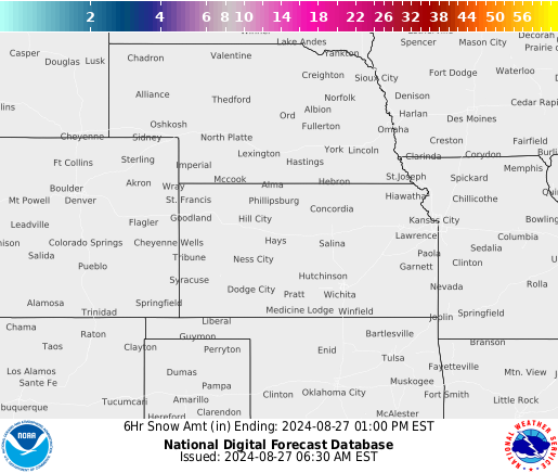
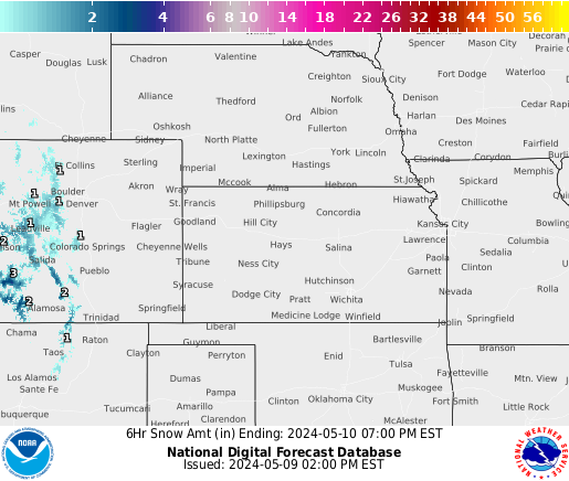
FORECAST SNOW / ICE
| 6 Hour Snow Forecasts | Snow/Ice Accumulation Potential - More Details | |||||||
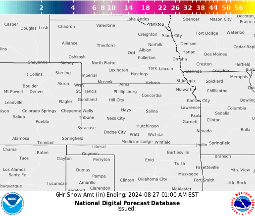 Most Current |
 |
 |
 |
 |
 36 Hours |
 Snowfall |
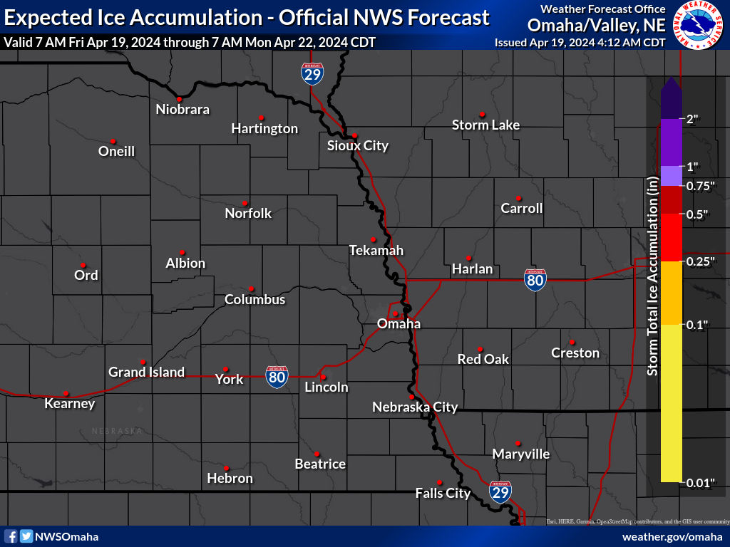 Ice |
|
| Probabilistic Snowfall Forecasts - More Details | By City | |||||||
 measurable |
 1" or more |
 2" or more |
 4"or more |
 6" or more |
 8" or more |
 12" or more |
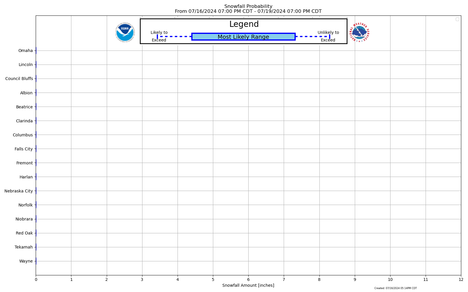 Most Likely |
 Exceedance |
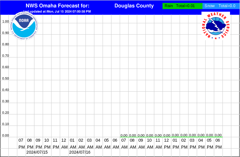
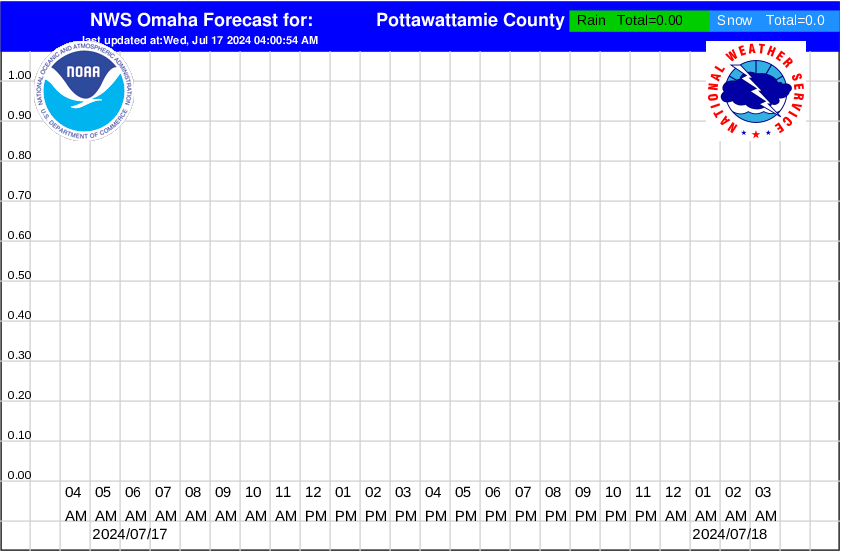
| Hourly Precipitation Graphs - by county | ||
| Graphics only updated when precipitation in the forecast | ||
|
|
|
|
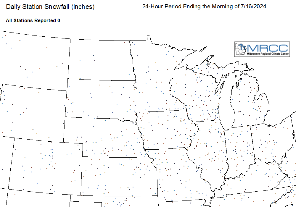
PAST ACCUMULATIONS
| Last 7 days - from MRCC | ||
In-depth snow analysis from the National Operational Hydrologic Remote Sensing Center (NOHRSC) |
 Snowfall |
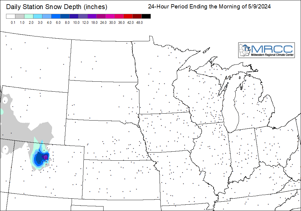 Snow Depth |
|
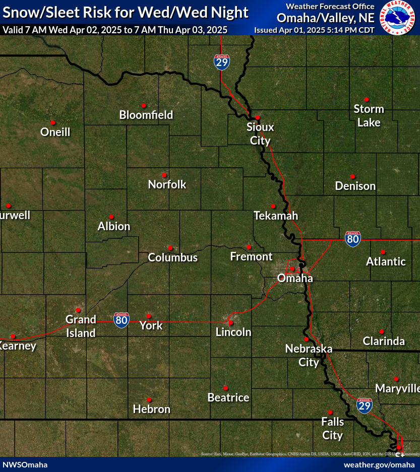
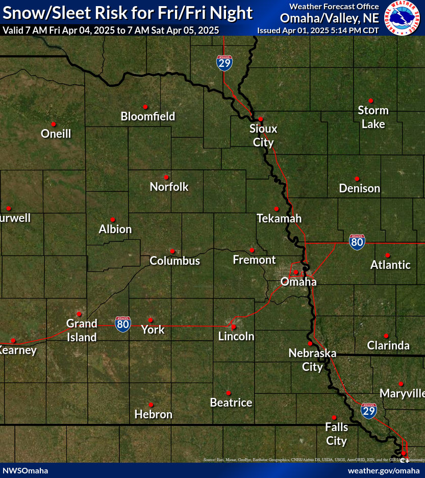
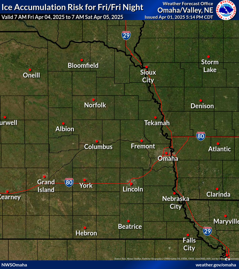
HAZARDS |
More information available on the HAZARDS DASHBOARD |
The Experimental Enhanced Hazardous Weather Outlook is a decision support service that supports preparedness and response efforts prior to and during hazardous weather. This service provides decision makers with convenient access to potential weather hazard information by graphically depicting the risk of weather hazards out through seven days.
|
Snow / Sleet - Legend
|
Ice - Legend
|
Extreme Cold - Legend
|
|||||
 |
 |
 |
 |
 |
 |
||
 |
 |
 |
 |
 |
 |
||
Snow and Sleet Legend
|
Risk Level
|
Hazard
|
Impacts/Actions
|
|
None
|
None
|
< 1" of snow or sleet
|
|
Limited
|
1 to 3 inches
|
Locally hazardous travel conditions on bridges, overpasses, and untreated or secondary roads
|
|
Elevated
|
3 to 6 inches
|
Be prepared to reduce travel speed for hazardous travel conditions - especially on bridges, overpasses, untreated and secondary roads
|
|
Significant
|
6 to 12 inches
|
Plan for hazardous travel conditions. Avoid travel if possible
|
|
Extreme
|
12 or more inches
|
Travel will be dangerous and may be impossible. Avoid travel unless it is an emergency
|
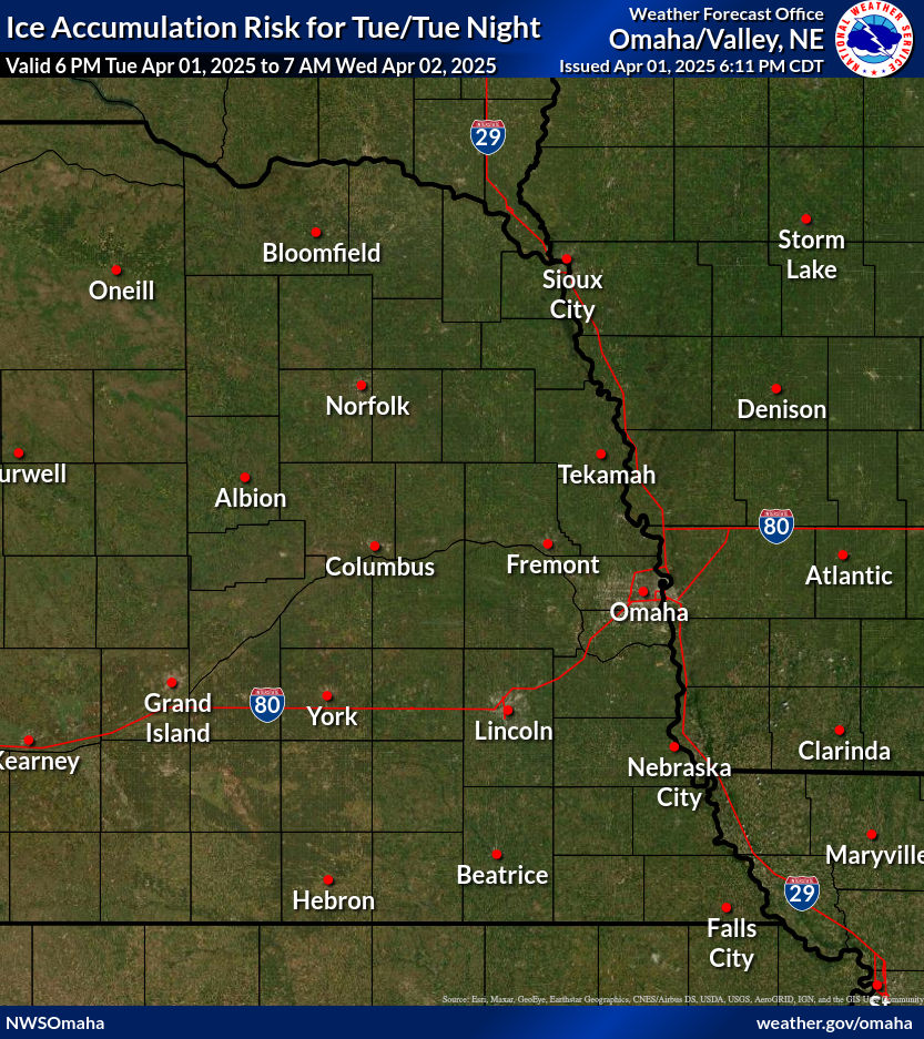
Ice Accumulation Legend
|
Risk Level
|
Hazard
|
Impacts/Actions
|
|
None
|
None
|
No freezing rain or drizzle
|
|
Limited
|
Very light freezing rain or drizzle with up to a thin glaze, or freezing fog
|
Locally hazardous travel conditions on bridges, overpasses, and untreated or secondary roads
|
|
Elevated
|
Freezing rain or drizzle with accumulation less than 1/4 inch
|
Be prepared to reduce travel speed for hazardous travel conditions - especially on bridges, overpasses, untreated and secondary roads
|
|
Significant
|
Freezing rain with accumulation of 1/4 to less than 1 inch
|
Plan for hazardous travel conditions. Power lines and trees may be damaged resulting in localized to scattered power outages. Avoid travel if possible and prepare for possible power outages
|
|
Extreme
|
Freezing rain with accumulation of greater than or equal to 1 inch
|
Travel will be dangerous and may be impossible. Power lines and trees likely damaged resulting in widespread power outages. Avoid travel unless it is an emergency and prepare for extended power outages
|
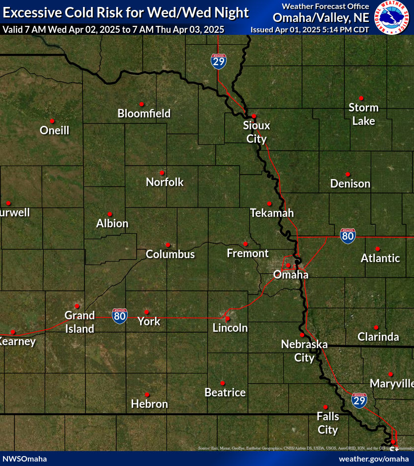
Excessive Cold Legend
|
Risk Level
|
Hazard
|
Impacts/Actions
|
|
None
|
Wind chills 10 F or warmer
|
Its cold, stay warm.
|
|
Limited
|
Wind chills < -4 F
|
Frostbite and hypothermia may occur with prolonged exposure without proper clothing. Have proper clothing for exposure and limit or eliminate exposure if possible.
|
|
Elevated
|
Wind chills < -19 F
|
Frostbite and hypothermia could occur within 30 minutes without proper clothing. Have proper clothing for exposure and limit or eliminate exposure if possible.
|
|
Significant
|
Wind chills < -29 F
|
Frostbite and hypothermia will likely occur within minutes without proper clothing. Have proper clothing for exposure and limit or eliminate exposure.
|
|
Extreme
|
Wind chills < -39 F
|
Frostbite and hypothermia will occur within minutes without proper clothing. Have proper clothing for exposure and limit or eliminate exposure.
|
OUTLOOKS
| Outlooks from the Weather Prediction Center |
|
|
|
|
Days 4-7
|
||||
 |
 |
 |
 |
 |
|||
 |
 |
 |
 |
 |
|||
|
|||||||
WINDCHILL
|
Calculate the wind chill, or reference the wind chill chart: |
WEBCAMS
Note: Webcams are provided through third parties and may not always be up to date. Please check the time stamp on each image to ensure the image is current.
 Brunswick Hwy 14 & Hwy 20 |
 Randolph Hwy 81 & Hwy 20 |
 Winnebago Hwy 77 & Hwy 75 |
 Battle Creek Hy275 & Hwy 121 |
 Oakland Hwy 77 & Hwy 32 |
 Wahoo Hwy 77 & Hwy 92 |
 Columbus Hwy81 & Hwy 22 |
 Cortland Hwy 77 |
 Dawson Hwy75 & Hwy 8 |
 Nebraska City Hwy2 NE-IA |
 Manley Hwy 50 & Hwy 1 |
 Greenwood I80 exit |
 Lincoln I80 & Hwy 77 |
 Lincoln I80 & Hwy77-S |
 Milford I80 ExitRathbun Lake |
 Roca Hwy 77 City |
 Tekamah Hwy 75 |
 I80 & Hwy 370 |
 I80 & I680 |
 I480 & Hwy 75 |
 E-I880 at MM 15, IA |
 Red Oak, IA US34 |
 Iowa I80 / I880 |
 Onawa I29 |
ROADS
|
||||||
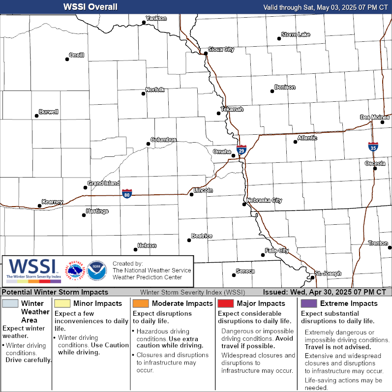
WINTER STORM SEVERITY INDEX
The Winter Storm Severity Index (WSSI) is a utility to provide information on the severity of winter weather and potential societal impacts (travel conditions, etc). The WSSI does not depict official watches, warnings or advisories, and should always be used in context with official forecasts. The WSSI uses NWS forecasts and typically updates every two hours. Always check the creation and valid times. Need more regional information? user guide?
| Overall Impact | By Weather Element | |||
 |
Snow Amount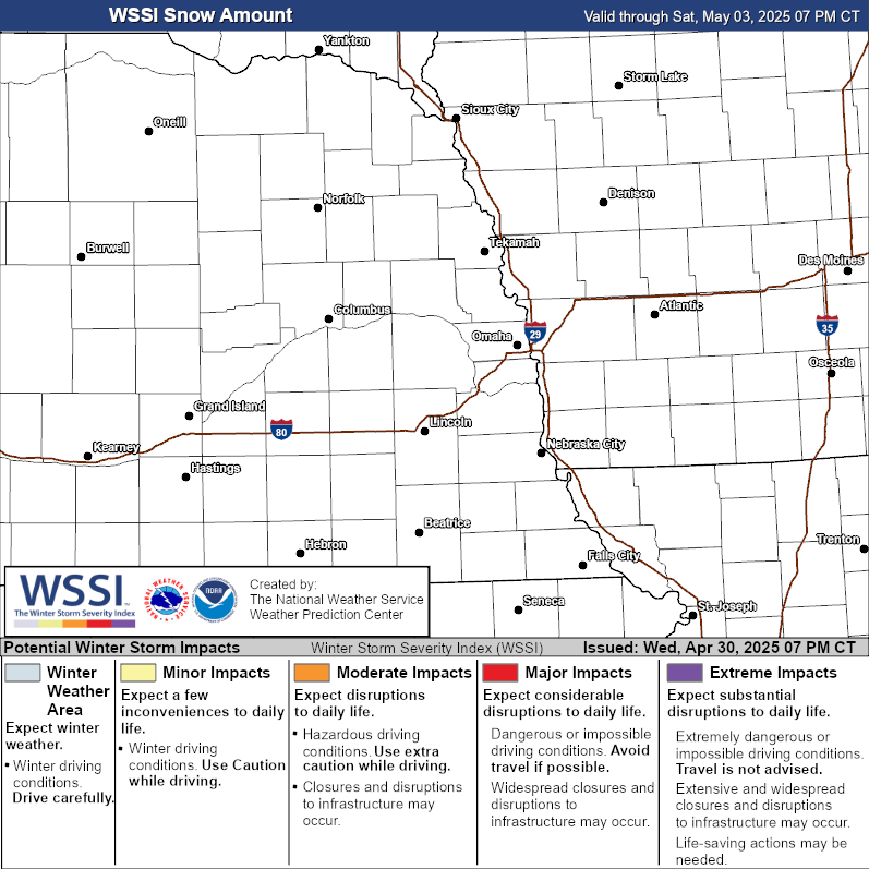 |
Ice Accumualation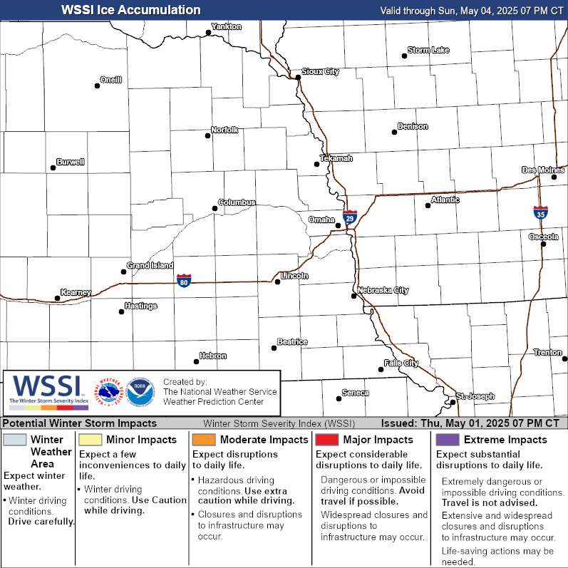 |
Blowing Snow |
|
Flash Freeze |
Ground Blizzard |
Snow Load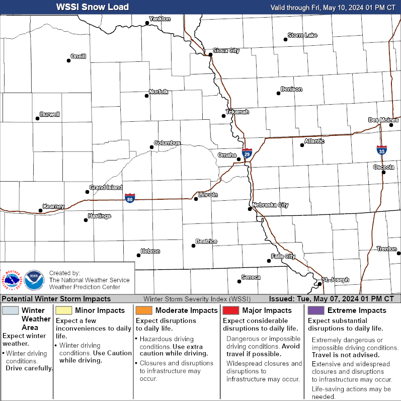 |
||