A couple of frontal boundaries will move east and south from the Plains to the Gulf and Atlantic coastlines. These boundaries will focus showers and thunderstorms through the weekend, with scattered severe thunderstorms from the Southern Plains and across the Gulf Coast states. Locally heavy rainfall may also occur, which may be welcome news across drought areas. Meanwhile, heat spreads westward. Read More >
Overview
|
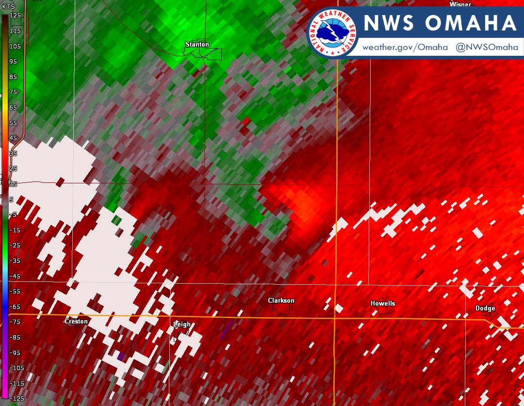
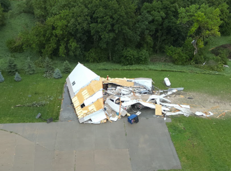
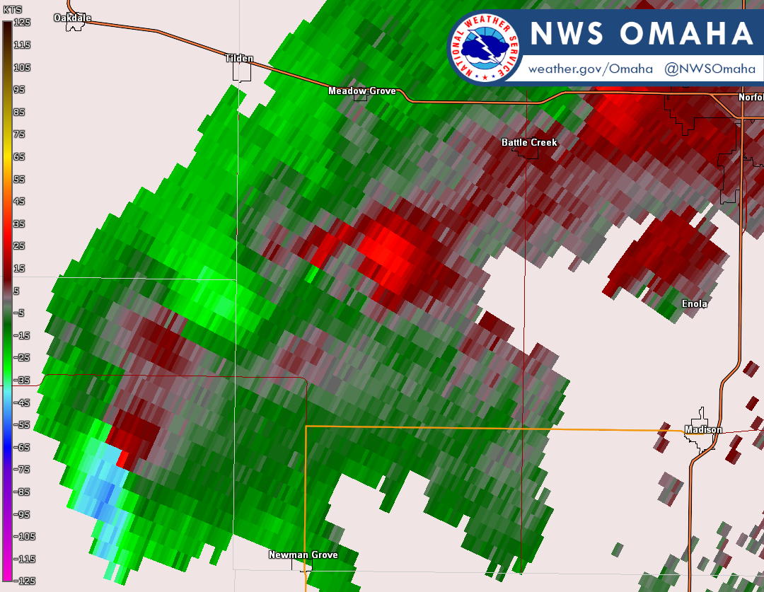
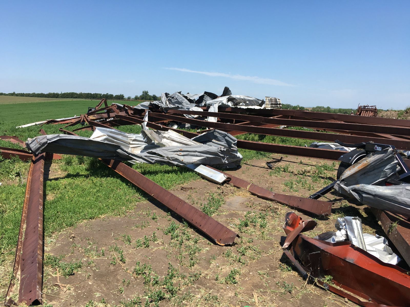
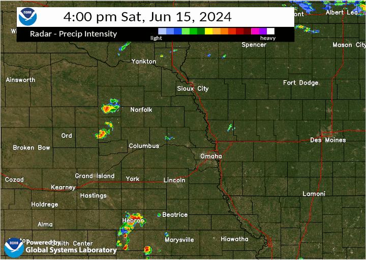
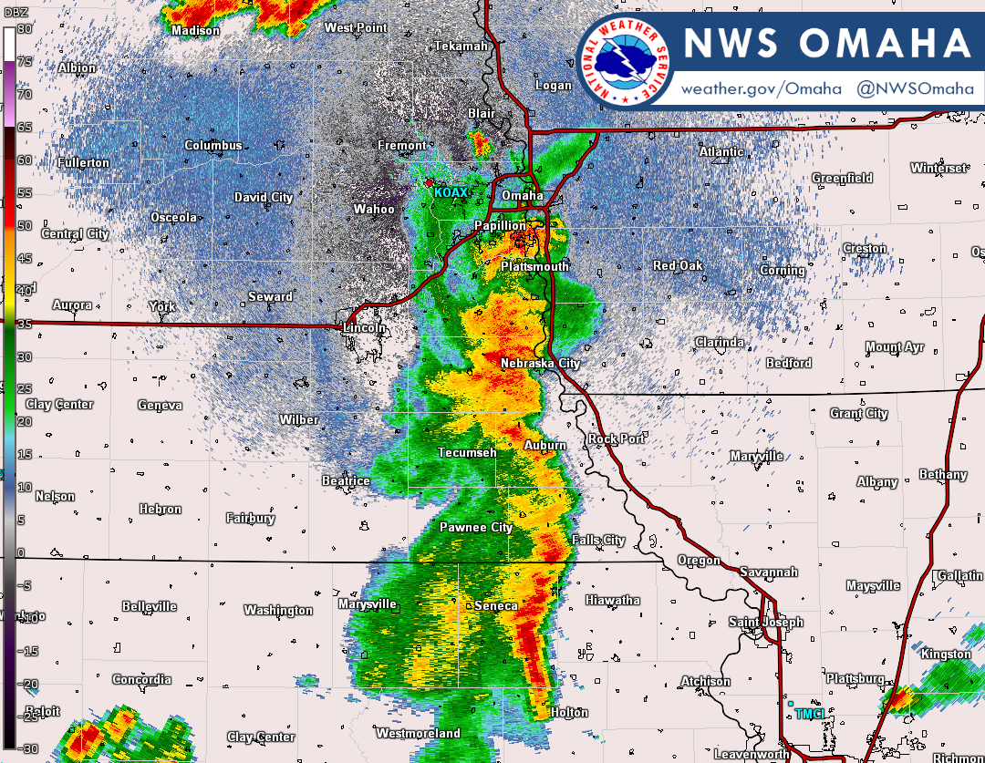
Two different systems led to the development of two complexes of storms across our area on the afternoon of June 15th. A lingering small surface low leftover for overnight storms the previous night across western Nebraska moved into northeast Nebraska creating the complex of storms that produced five tornadoes across Madison, Stanton, and Cuming counties that evening, all rated between EF0 and EF1. To the south, an advancing warm front lifting northward out of Kansas led to the development of storms starting in south-central Nebraska that quickly developed into a line. This line moved eastward south of I-80 producing strong, damaging winds at times, with reports up to 69 mph. |
 Radar Loop |
Tornadoes
|
Tornado - Clarkson, NE
Track Map 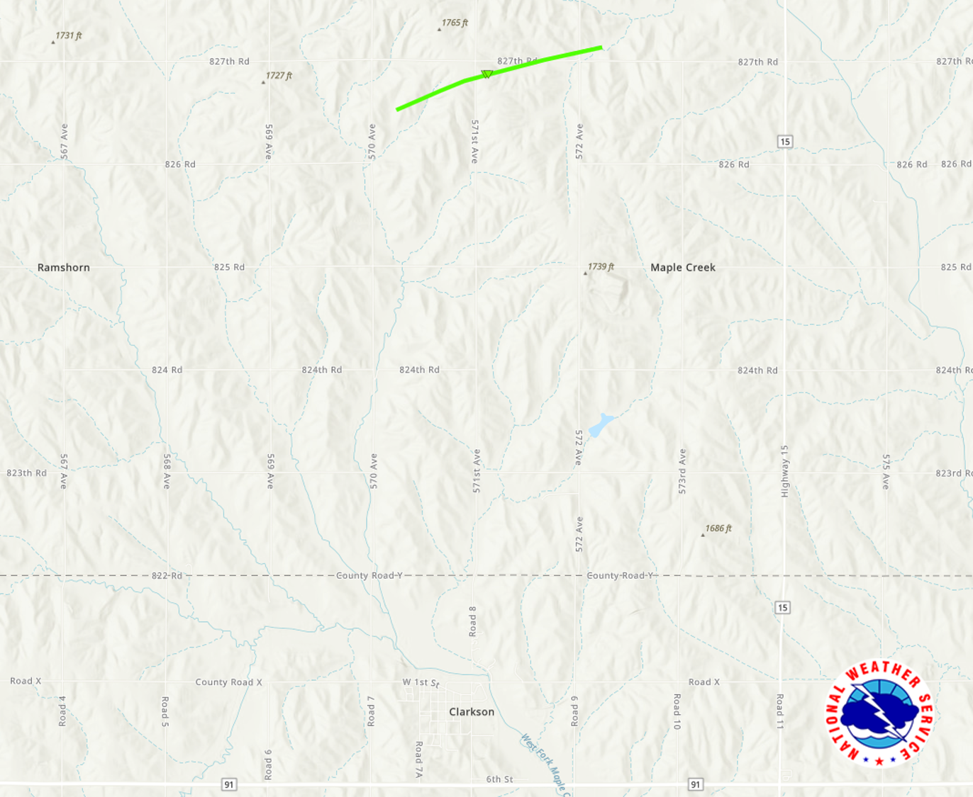 
|
||||||||||||||||
|
||||||||||||||||
|
Tornado - Meadow Grove
Track Map 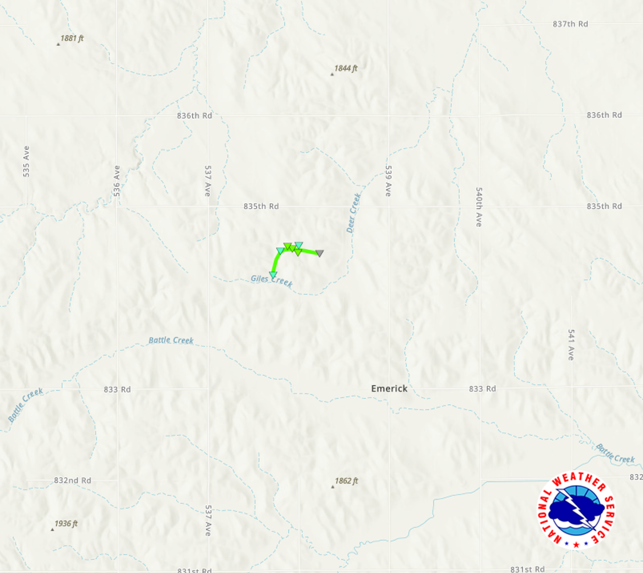
|
||||||||||||||||
|
||||||||||||||||
|
Tornado - North of Pilger
Track Map 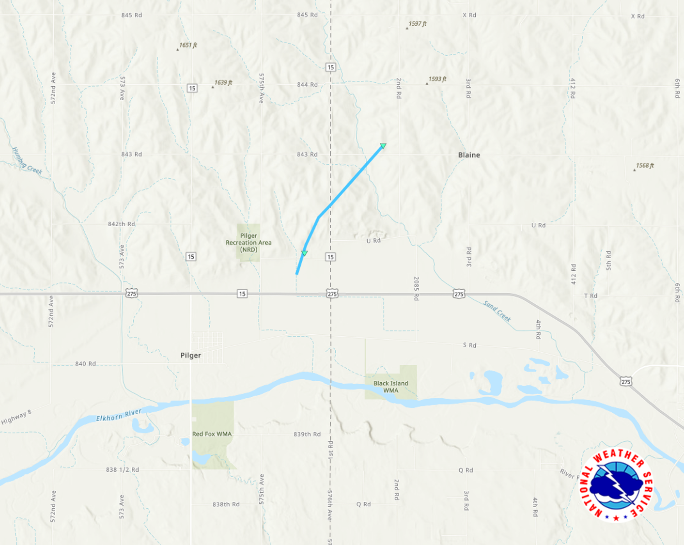
|
||||||||||||||||
|
Tornado - Winside
Track Map 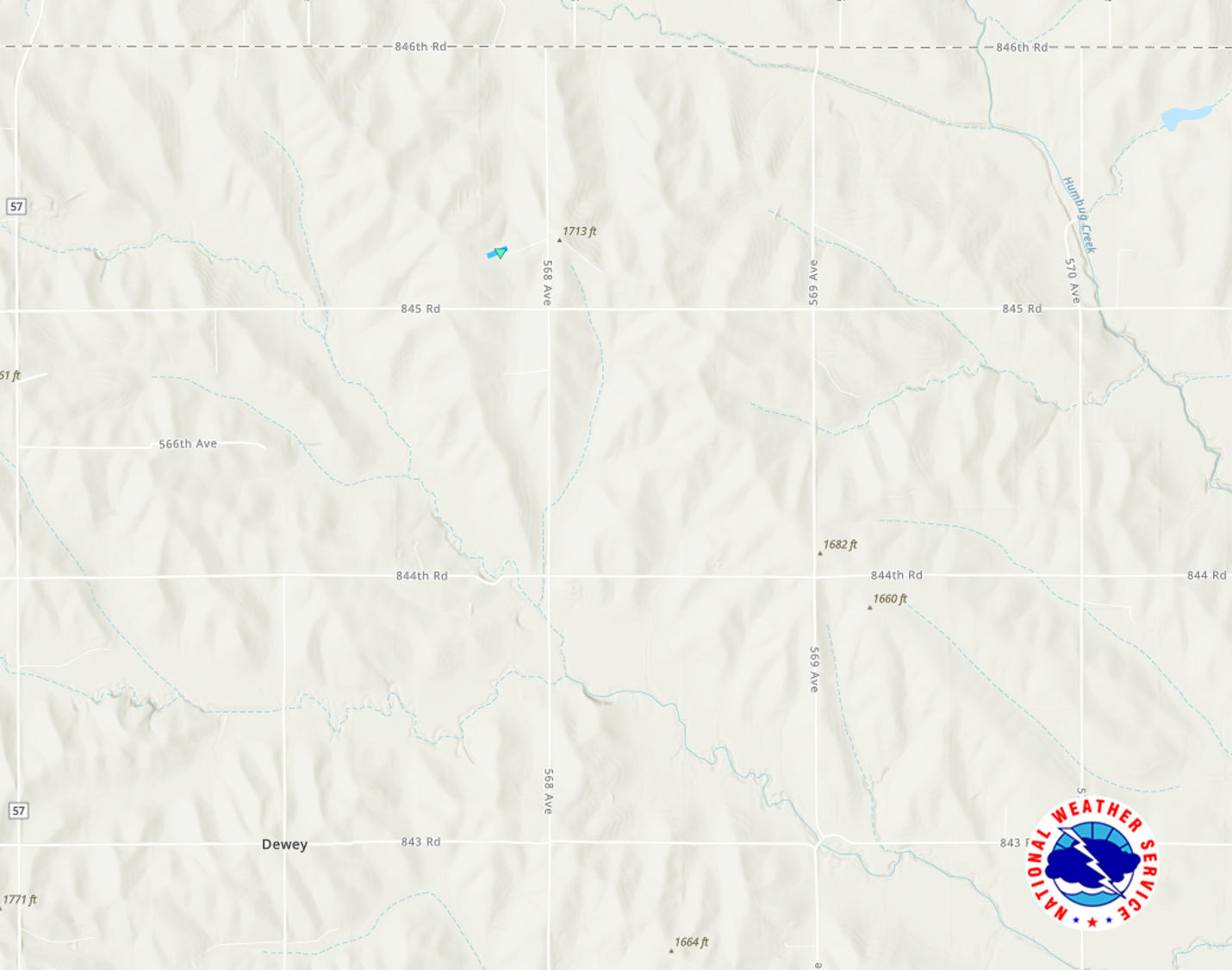
|
||||||||||||||||
|
Tornado - Newman Grove
Track Map 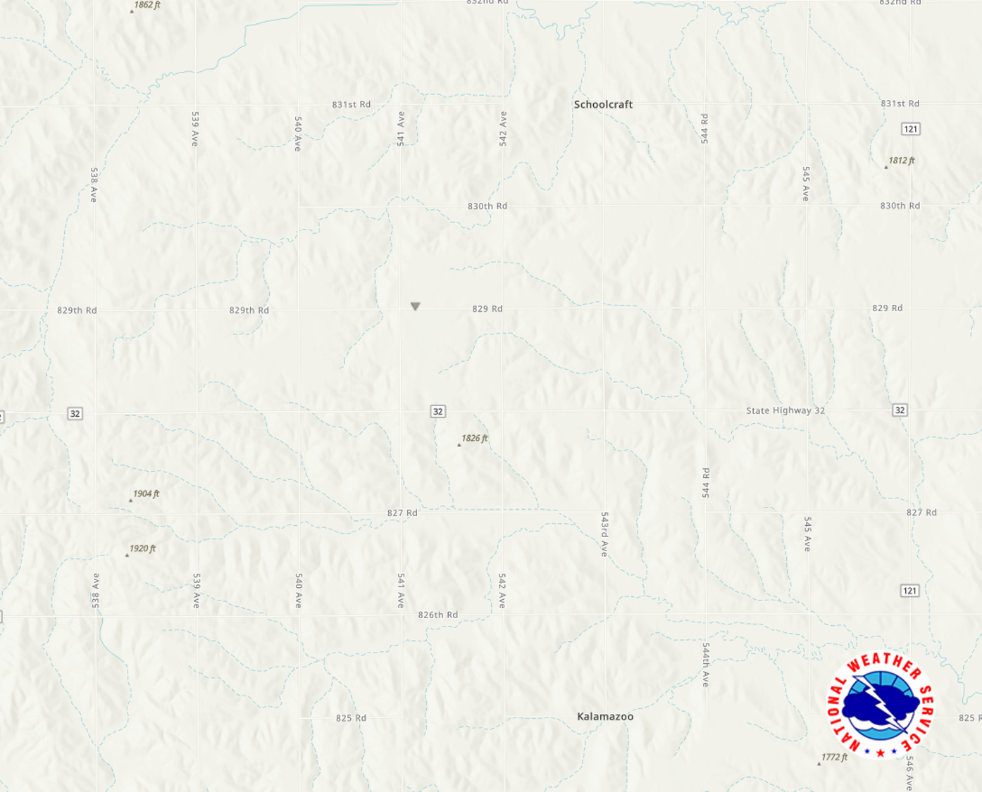
|
||||||||||||||||
|
Tornado - Tecumseh
Track Map 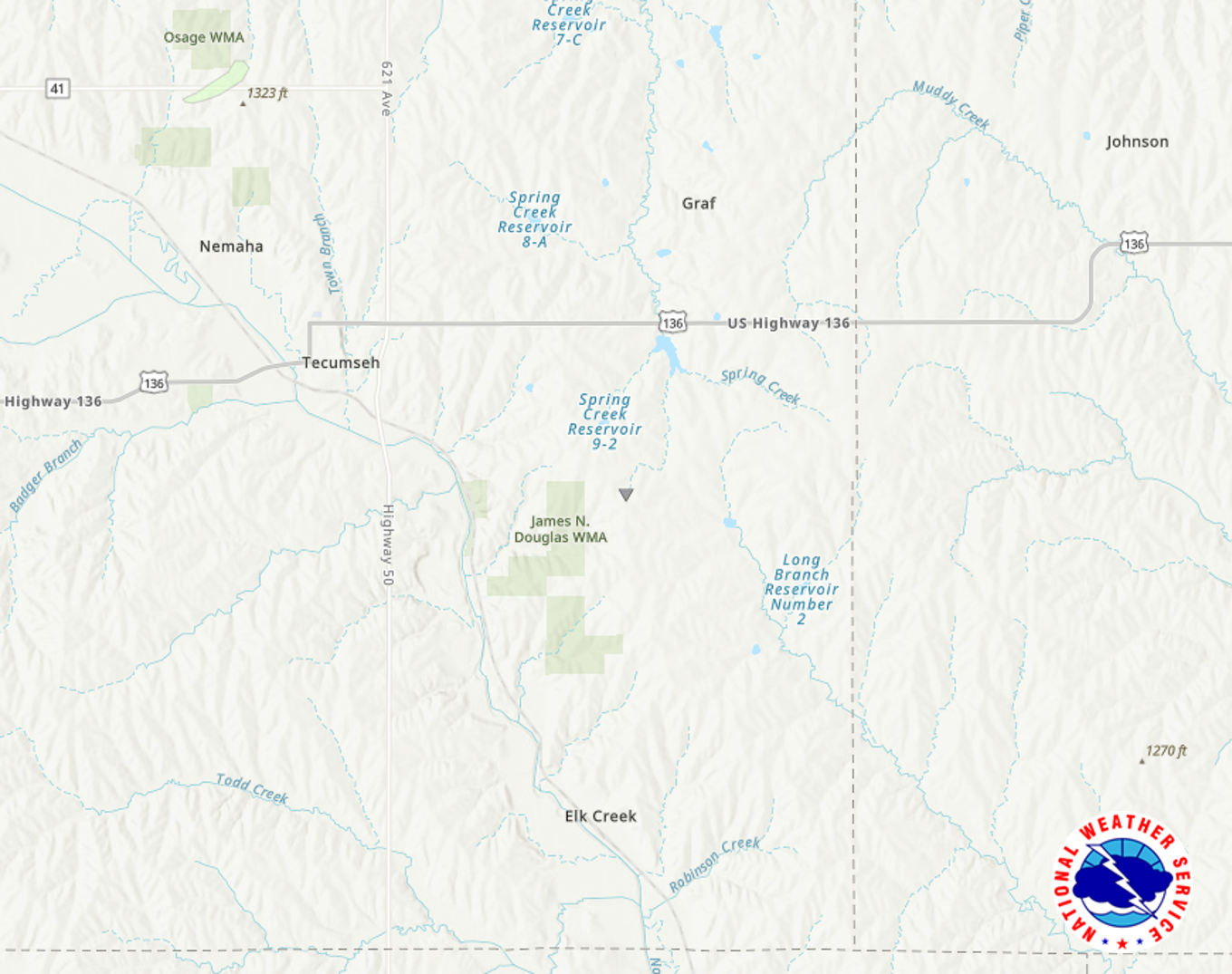
|
||||||||||||||||
The Enhanced Fujita (EF) Scale classifies tornadoes into the following categories:
| EF0 Weak 65-85 mph |
EF1 Moderate 86-110 mph |
EF2 Significant 111-135 mph |
EF3 Severe 136-165 mph |
EF4 Extreme 166-200 mph |
EF5 Catastrophic 200+ mph |
 |
|||||
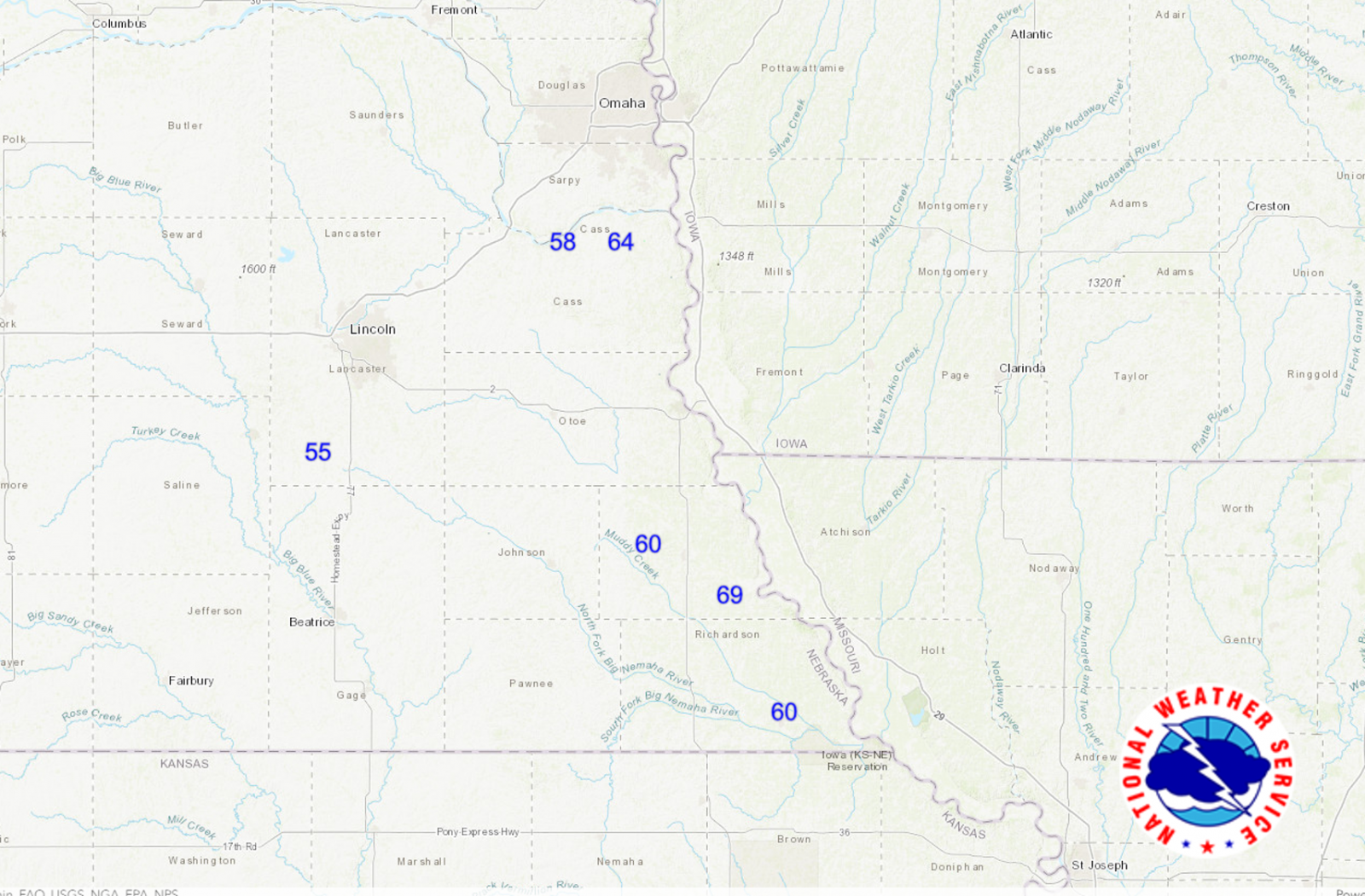
Damaging Wind:
A line of storms moved across southeast Nebraska producing damaging winds up to 69 miles per hour.
Wind
Insert summary here.
 |
 |
||
| Radar image of the line of storms moving across southeast Nebraska. | Wind reports of 55 to 69 mph across southeast Nebraska. |
|
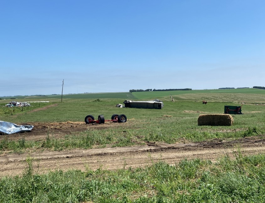
Microburst- St Mary Area
|
||||||||
 |
Media use of NWS Web News Stories is encouraged! Please acknowledge the NWS as the source of any news information accessed from this site. |
|