Overview
|
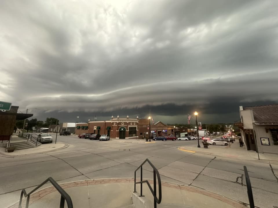
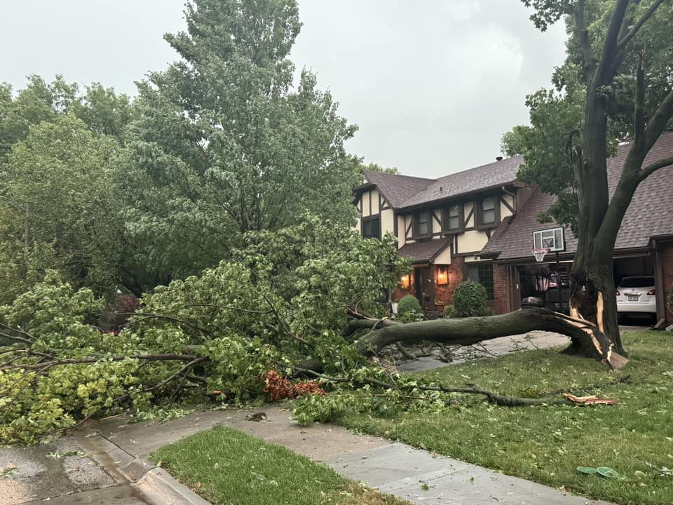
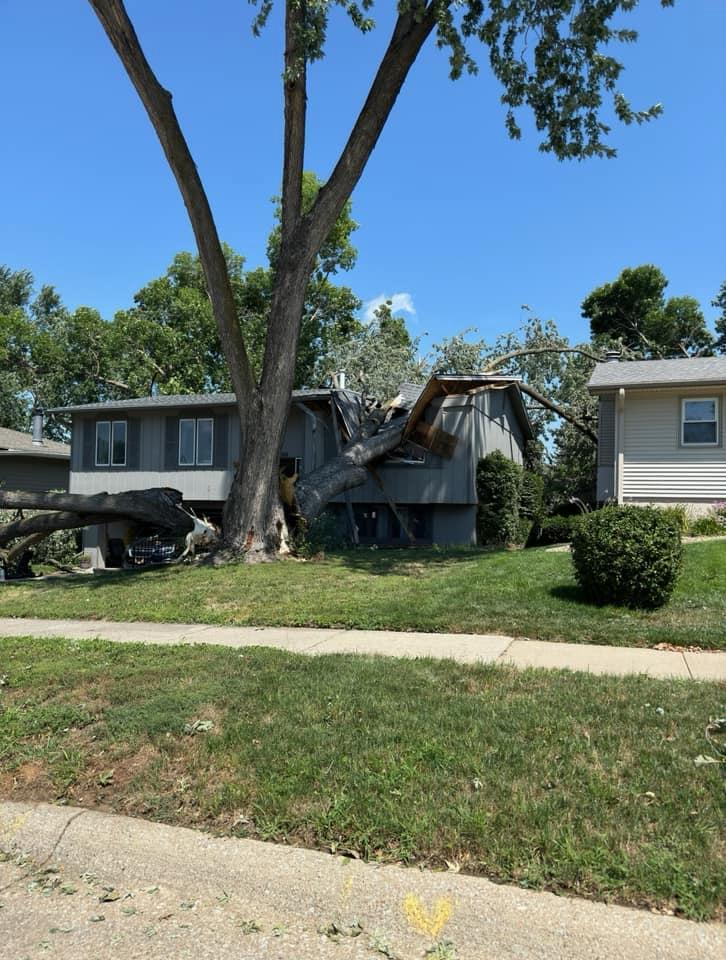
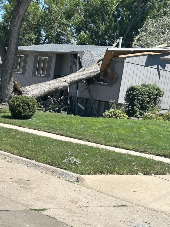
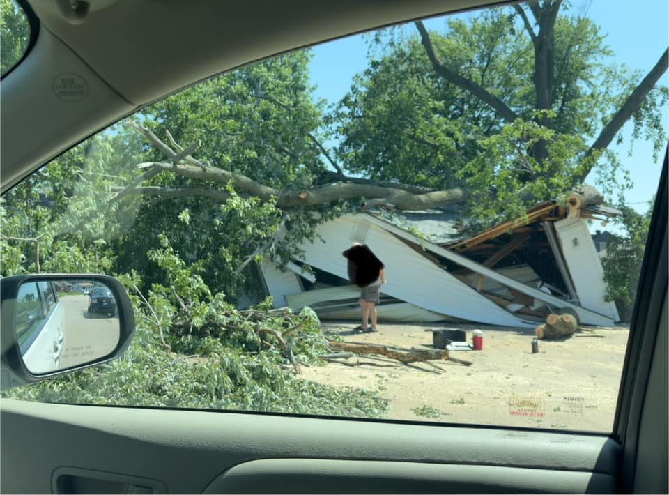
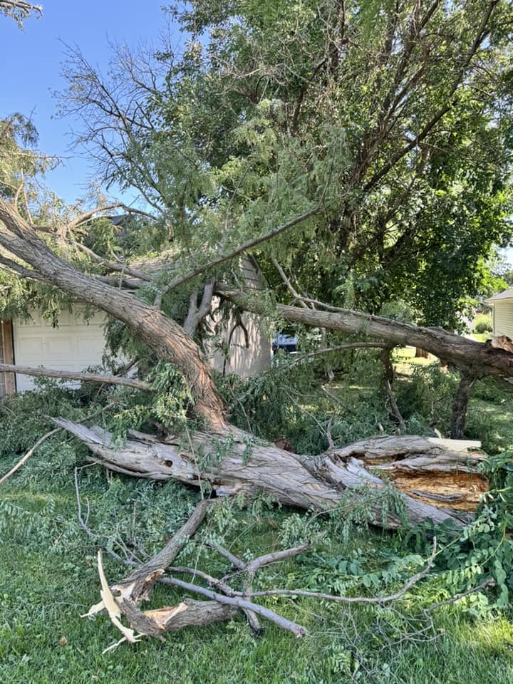
A line of intense thunderstorms brought 70-90+ mph winds and widespread damage to portions of southeast Nebraska and southwest Iowa including the Omaha and Lincoln areas. Despite the widespread wind damage, this line of storms did not meet the criteria to be classified as a derecho. A derecho wind damage swath must extend either continuously or intermittently more than 400 miles (about 650 km) with a width of at least 60 miles (about 100 km). This criterion is used to eliminate more common, shorter-lived, and generally less-organized wind-producing convective systems. This particular line of storms produced damage for about 230 miles. |
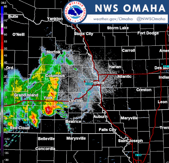 Radar Loop |
Wind:
Measured Wind GustsLocation Speed Time/Date Lat/Lon ...Iowa... ...Harrison County... 1 SSE Missouri Valley 69 MPH 0623 PM 07/31 41.54N/95.89W Missouri Valley 66 MPH 0614 PM 07/31 41.55N/95.90W 4 SW Logan 58 MPH 0652 PM 07/31 41.60N/95.84W ...Mills County... 2 NW Silver City 76 MPH 0604 PM 07/31 41.14N/95.67W 4 N Hastings 73 MPH 0614 PM 07/31 41.08N/95.48W 3 WNW Silver City 64 MPH 0605 PM 07/31 41.12N/95.70W ...Montgomery County... 7 ESE Henderson 59 MPH 0629 PM 07/31 41.10N/95.31W ...Pottawattamie County... 4 SW Mcclelland 70 MPH 0606 PM 07/31 41.29N/95.73W 3 WSW Underwood 58 MPH 0614 PM 07/31 41.38N/95.73W ...Nebraska... ...Cass County... Louisville 89 MPH 0548 PM 07/31 41.00N/96.16W 3 WSW Murdock 66 MPH 0519 PM 07/31 40.91N/96.34W 1 E Louisville 59 MPH 0536 PM 07/31 41.00N/96.15W 3 SSE Plattsmouth 59 MPH 0559 PM 07/31 40.97N/95.88W 1 NE Murray 58 MPH 0643 PM 07/31 40.93N/95.91W ...Douglas County... 1 S Washington 90 MPH 0554 PM 07/31 41.38N/96.21W 7 ENE Omaha 90 MPH 0608 PM 07/31 41.30N/95.89W 2 E Elkhorn 77 MPH 0544 PM 07/31 41.28N/96.19W 1 WNW Valley 76 MPH 0537 PM 07/31 41.32N/96.37W 3 W Millard 75 MPH 0532 PM 07/31 41.20N/96.22W 1 W Omaha 68 MPH 0550 PM 07/31 41.27N/96.03W ...Lancaster County... 1 SW Denton 92 MPH 0443 PM 07/31 40.73N/96.86W 4 NW Martell 88 MPH 0456 PM 07/31 40.69N/96.80W 4 WNW Lincoln 83 MPH 0504 PM 07/31 40.85N/96.76W 1 SSE Davey 76 MPH 0503 PM 07/31 40.97N/96.66W 4 SE Malcolm 75 MPH 0448 PM 07/31 40.87N/96.80W 2 WNW Lincoln 74 MPH 0447 PM 07/31 40.83N/96.72W 4 ESE Raymond 70 MPH 0448 PM 07/31 40.94N/96.71W 1 W Lincoln 67 MPH 0457 PM 07/31 40.81N/96.71W 2 SSW Greenwood 67 MPH 0507 PM 07/31 40.93N/96.46W 3 SSW Davey 67 MPH 0508 PM 07/31 40.95N/96.69W 1 ENE Hickman 65 MPH 0455 PM 07/31 40.63N/96.61W 1 NE Hickman 60 MPH 0457 PM 07/31 40.63N/96.62W 6 NNW Bennet 59 MPH 0503 PM 07/31 40.76N/96.56W ...Saline County... 6 SSW Friend 63 MPH 0420 PM 07/31 40.57N/97.31W 3 E Friend 59 MPH 0429 PM 07/31 40.65N/97.23W Friend 55 MPH 0420 PM 07/31 40.65N/97.29W ...Sarpy County... 2 SW Papillion 80 MPH 0543 PM 07/31 41.14N/96.06W ...Saunders County... 4 W Ceresco 59 MPH 0457 PM 07/31 41.05N/96.73W ...Seward County... Cordova 60 MPH 0420 PM 07/31 40.72N/97.35WAll Storm Reports:
..TIME... ...EVENT... ...CITY LOCATION... ...LAT.LON...
..DATE... ....MAG.... ..COUNTY LOCATION..ST.. ...SOURCE....
..REMARKS..
0420 PM Tstm Wnd Gst 6 SSW Friend 40.57N 97.31W
07/31/2024 M63 MPH Saline NE Public
Measured on a personal weather station.
0420 PM Tstm Wnd Gst Cordova 40.72N 97.35W
07/31/2024 E60 MPH Seward NE Public
Estimated 50-60 mph winds.
0420 PM Tstm Wnd Gst Friend 40.65N 97.29W
07/31/2024 E55 MPH Saline NE Law Enforcement
Estimated 50-55 mph with pea size hail. A
trailer was slightly displaced by the wind.
0429 PM Tstm Wnd Gst 3 E Friend 40.65N 97.23W
07/31/2024 M59 MPH Saline NE CO-OP Observer
Personal weather station measurement.
0442 PM Tstm Wnd Dmg Crete 40.63N 96.95W
07/31/2024 Saline NE Law Enforcement
Power line down and a large tree down on the
road.
0443 PM Tstm Wnd Gst 1 SW Denton 40.73N 96.86W
07/31/2024 M92 MPH Lancaster NE Mesonet
0447 PM Tstm Wnd Gst 2 WNW Lincoln 40.83N 96.72W
07/31/2024 M74 MPH Lancaster NE Mesonet
0448 PM Tstm Wnd Gst 4 SE Malcolm 40.87N 96.80W
07/31/2024 M75 MPH Lancaster NE Mesonet
0448 PM Tstm Wnd Gst 4 ESE Raymond 40.94N 96.71W
07/31/2024 M70 MPH Lancaster NE Mesonet
0454 PM Tstm Wnd Dmg 1 WSW Lincoln 40.81N 96.71W
07/31/2024 Lancaster NE Public
estimated 70 mph. Numerous trees down.
0455 PM Tstm Wnd Gst 1 ENE Hickman 40.63N 96.61W
07/31/2024 M65 MPH Lancaster NE Mesonet
0456 PM Tstm Wnd Gst 4 NW Martell 40.69N 96.80W
07/31/2024 M88 MPH Lancaster NE Mesonet
0457 PM Tstm Wnd Gst 1 W Lincoln 40.81N 96.71W
07/31/2024 M67 MPH Lancaster NE Mesonet
0457 PM Tstm Wnd Gst 1 NE Hickman 40.63N 96.62W
07/31/2024 M60 MPH Lancaster NE Mesonet
0457 PM Tstm Wnd Gst 4 W Ceresco 41.05N 96.73W
07/31/2024 M59 MPH Saunders NE Mesonet
0503 PM Tstm Wnd Gst 1 SSE Davey 40.97N 96.66W
07/31/2024 M76 MPH Lancaster NE Trained Spotter
0503 PM Tstm Wnd Gst 6 NNW Bennet 40.76N 96.56W
07/31/2024 M59 MPH Lancaster NE Mesonet
0504 PM Tstm Wnd Gst 4 WNW Lincoln 40.85N 96.76W
07/31/2024 M83 MPH Lancaster NE ASOS
Max observed wind at the Lincoln Airport.
0505 PM Tstm Wnd Dmg 3 NW Lincoln 40.84N 96.74W
07/31/2024 Lancaster NE Public
Roof damage to a hotel near the airport.
0507 PM Tstm Wnd Gst 2 SSW Greenwood 40.93N 96.46W
07/31/2024 M67 MPH Lancaster NE Mesonet
0508 PM Tstm Wnd Gst 3 SSW Davey 40.95N 96.69W
07/31/2024 M67 MPH Lancaster NE Mesonet
0519 PM Tstm Wnd Gst 3 WSW Murdock 40.91N 96.34W
07/31/2024 M66 MPH Cass NE Mesonet
0532 PM Tstm Wnd Dmg 2 WSW Chalco 41.17N 96.17W
07/31/2024 Sarpy NE Other Federal
Report of part of roof off of house and
multiple broken windows. Time estimated
based off radar.
0532 PM Tstm Wnd Gst 3 W Millard 41.20N 96.22W
07/31/2024 M75 MPH Douglas NE Mesonet
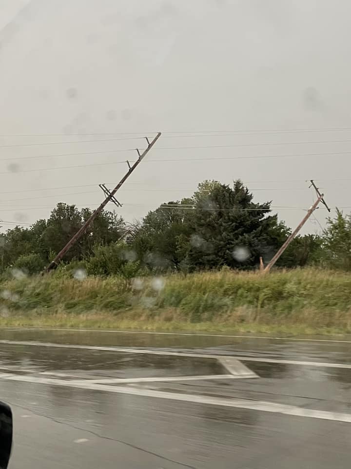
0534 PM Tstm Wnd Dmg 2 N Springfield 41.12N 96.14W
07/31/2024 Sarpy NE Public
Picture on Twitter shows power poles snapped
on Highway 50 north of Springfield. Time
estimated from radar.
0536 PM Tstm Wnd Gst 1 E Louisville 41.00N 96.15W
07/31/2024 E59 MPH Cass NE Mesonet
0537 PM Tstm Wnd Gst 1 WNW Valley 41.32N 96.37W
07/31/2024 M76 MPH Douglas NE Official NWS Obs
Highest gust at NWS Omaha office.
0542 PM Tstm Wnd Dmg Waterloo 41.29N 96.29W
07/31/2024 Douglas NE Amateur Radio
Roof blown off of commercial building.
0543 PM Tstm Wnd Gst 2 SW Papillion 41.14N 96.06W
07/31/2024 M80 MPH Sarpy NE Mesonet
0544 PM Tstm Wnd Gst 2 E Elkhorn 41.28N 96.19W
07/31/2024 M77 MPH Douglas NE Mesonet
0548 PM Tstm Wnd Gst Louisville 41.00N 96.16W
07/31/2024 M89 MPH Cass NE Mesonet
0550 PM Tstm Wnd Gst 1 W Omaha 41.27N 96.03W
07/31/2024 M68 MPH Douglas NE Public
0554 PM Tstm Wnd Gst 1 S Washington 41.38N 96.21W
07/31/2024 M90 MPH Douglas NE Mesonet
0559 PM Tstm Wnd Gst 3 SSE Plattsmouth 40.97N 95.88W
07/31/2024 M59 MPH Cass NE Mesonet
0602 PM Tstm Wnd Dmg 2 NNW Omaha 41.28N 96.02W
07/31/2024 Douglas NE Amateur Radio
Downed power line in road at Maple and 70th
Circle.
0603 PM Tstm Wnd Dmg 2 SW Crescent 41.35N 95.90W
07/31/2024 Pottawattamie IA Dept of Highways
Semi trailer flipped over on I-29.
0604 PM Tstm Wnd Gst 2 NW Silver City 41.14N 95.67W
07/31/2024 M76 MPH Mills IA Mesonet
0605 PM Tstm Wnd Gst 3 WNW Silver City 41.12N 95.70W
07/31/2024 M64 MPH Mills IA Mesonet
0606 PM Tstm Wnd Gst 4 SW Mcclelland 41.29N 95.73W
07/31/2024 M70 MPH Pottawattamie IA Mesonet
0608 PM Tstm Wnd Gst 7 ENE Omaha 41.30N 95.89W
07/31/2024 M90 MPH Douglas NE ASOS
0614 PM Tstm Wnd Gst 4 N Hastings 41.08N 95.48W
07/31/2024 M73 MPH Mills IA Mesonet
0614 PM Tstm Wnd Gst Missouri Valley 41.55N 95.90W
07/31/2024 M66 MPH Harrison IA Mesonet
0614 PM Tstm Wnd Gst 3 WSW Underwood 41.38N 95.73W
07/31/2024 M58 MPH Pottawattamie IA Mesonet
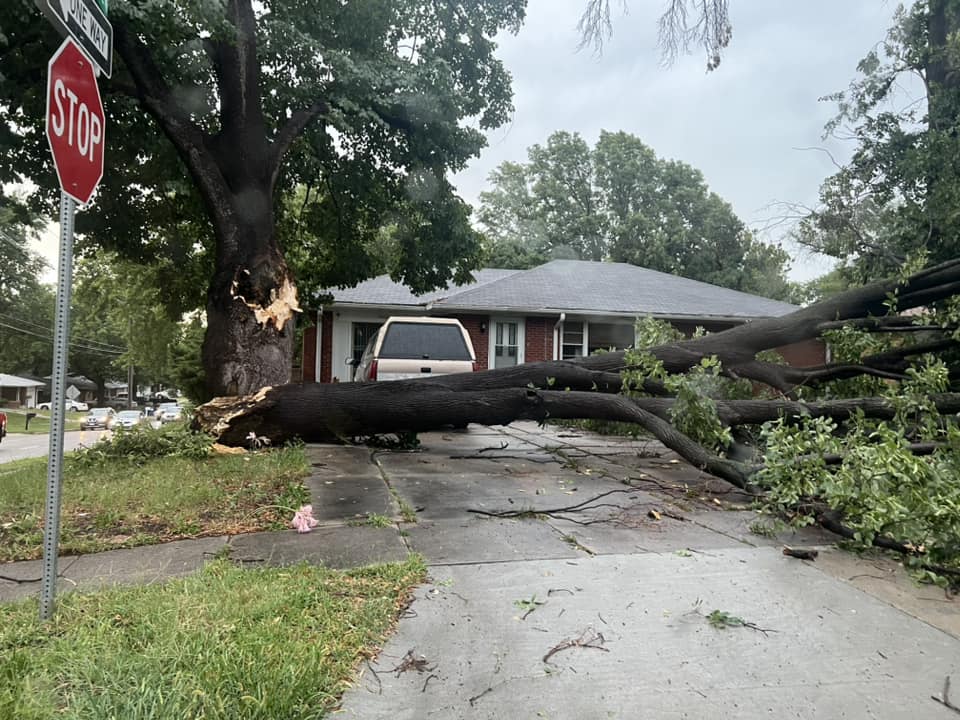
0615 PM Tstm Wnd Dmg Neola 41.45N 95.62W
07/31/2024 Pottawattamie IA Emergency Mngr
One large downed tree blocked Main St and
power lines down. Time estimated from radar.
0623 PM Tstm Wnd Gst 1 SSE Missouri Valley 41.54N 95.89W
07/31/2024 E69 MPH Harrison IA Mesonet
0627 PM Tstm Wnd Dmg Oakland 41.31N 95.40W
07/31/2024 Pottawattamie IA Emergency Mngr
Tree down on house and power lines down.
Time estimated from radar.
0629 PM Tstm Wnd Gst 7 ESE Henderson 41.10N 95.31W
07/31/2024 M59 MPH Montgomery IA Public
Measured on personal weather station.
0643 PM Tstm Wnd Gst 1 NE Murray 40.93N 95.91W
07/31/2024 M58 MPH Cass NE Mesonet
0652 PM Tstm Wnd Gst 4 SW Logan 41.60N 95.84W
07/31/2024 M58 MPH Harrison IA Mesonet
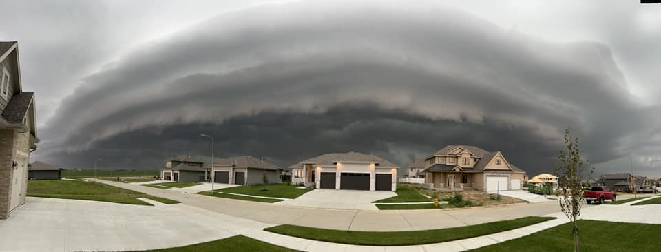
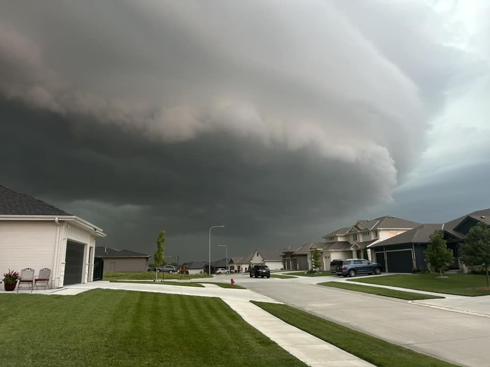
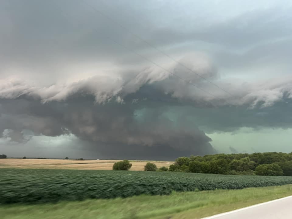
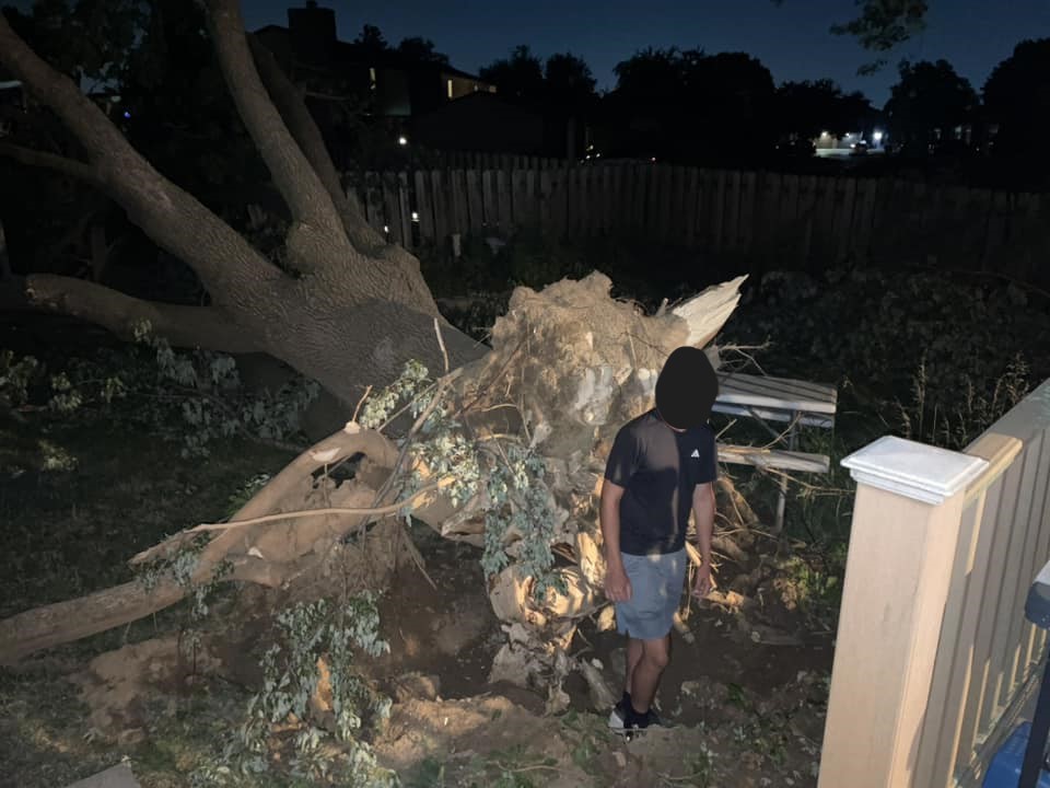
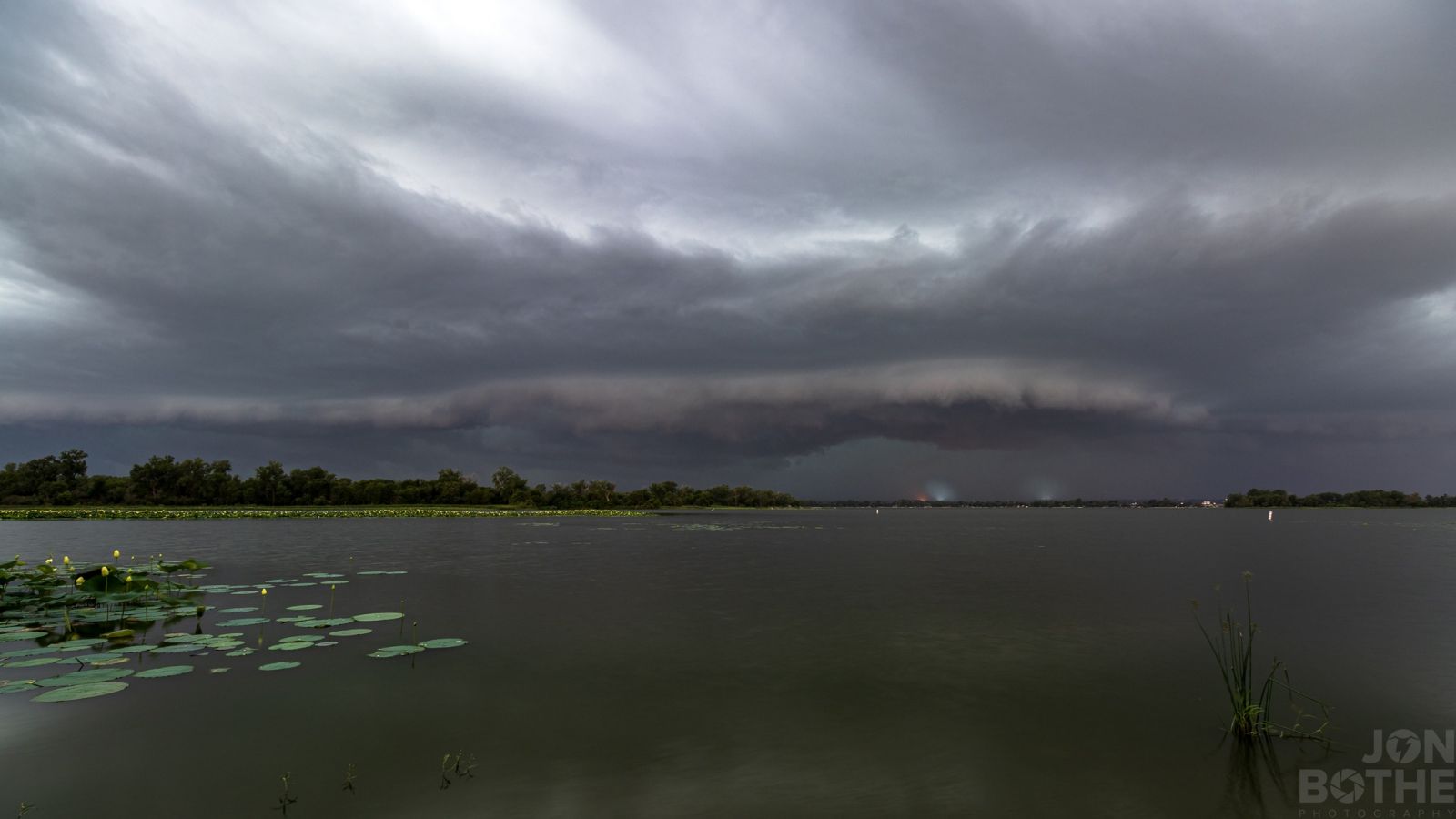
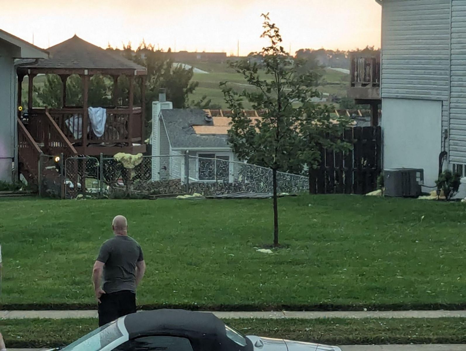
Photos & Video
 |
 |
 |
 |
| Papillion (Krystle DuBois) |
Gretna (Tanner Lawrence) |
Near Ashland (Carey Hofmeister) |
Springfield (Megan Anderson) |
 |
 |
 |
 |
| 56th and L - Lincoln (Jaxon Trotter) |
Near Highway 50 and Capehart Road - Springfield Area (Michelle Folts Kalin) |
Omaha (Kelly Hillabrand) |
168th and Center - Omaha (Erika DeBoer) |
 |
 |
 |
 |
| 130th and Westwood Lane - Omaha (Caitlin Adams) |
130th and Westwood Lane - Omaha (Jessica Roccaforte-Russell) |
120th and Center - Omaha (Caitlin Adams) |
60th and Blondo - Omaha (Lorri Balentine) |
 |
 |
 |
| Lake Manawa (Jon Bothe) |
96th and Buckboard Boulevard - Papillion (Evan Kuchera) |
South Omaha (Del Phillips) |
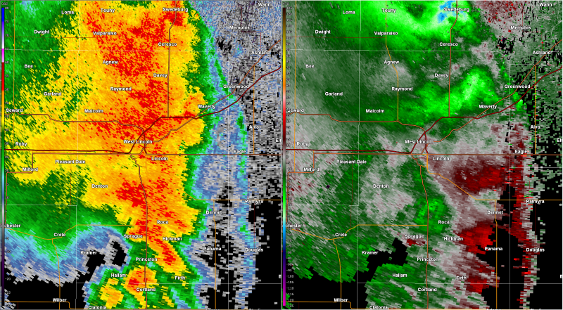
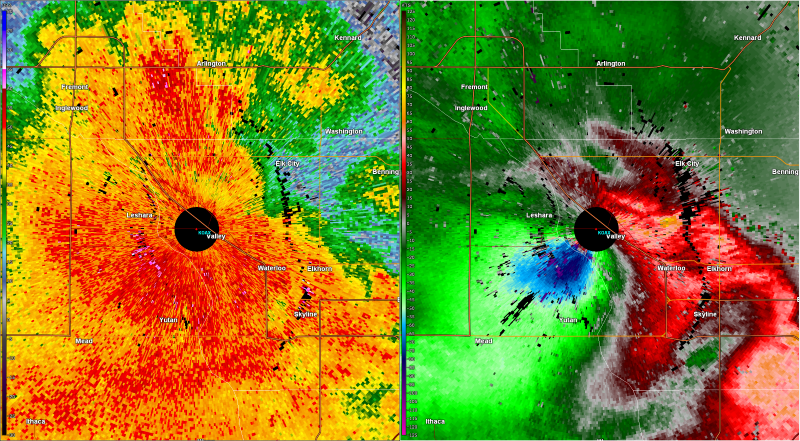
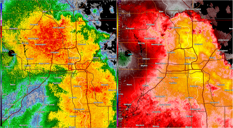
Radar
 |
 |
 |
|
| Reflectivity and base velocity near the time of an 83 mph wind gust at the Lincoln Airport | Reflectivity and base velocity near the time of a 76 mph wind gust at the NWS Omaha/Valley office | Reflectivity and base velocity near the time of a 90 mph wind gust at the Omaha Airport | Caption |
Rain Reports
Location                     Amount    Time/Date       Lat/Lon

...Iowa...

...Fremont County...
Sidney 5.1 NNE               0.83 in   0800 AM 08/01   40.81N/95.61W

...Harrison County...
Portsmouth 4.8 W             0.75 in   0800 AM 08/01   41.66N/95.61W

...Mills County...
Pacific Junction 3.9 N       0.72 in   0700 AM 08/01   41.07N/95.80W
Glenwood 1.7 WSW             0.67 in   0900 AM 08/01   41.04N/95.77W

...Montgomery County...
6 NE Emerson                 0.80 in   0500 PM 08/01   41.09N/95.31W
2 NNW Coburg                 0.71 in   0500 PM 08/01   40.96N/95.28W
Red Oak                      0.65 in   0700 AM 08/01   41.00N/95.23W
0.9 W Red Oak                0.55 in   0400 PM 08/01   41.01N/95.24W

...Page County...
3.0 E Clarinda               1.15 in   0445 PM 08/01   40.73N/94.98W
1.9 NE Shenandoah            1.00 in   0800 AM 08/01   40.78N/95.35W

...Pottawattamie County...
Council Bluffs 3.3 E         0.96 in   0900 AM 08/01   41.25N/95.80W
Loess Hills Hitchcock        0.76 in   0411 PM 08/01   41.42N/95.85W
Oakland                      0.74 in   0700 AM 08/01   41.31N/95.39W
Council Bluffs 2.1 SSE       0.64 in   0800 AM 08/01   41.21N/95.85W
Underwood                    0.59 in   0355 PM 08/01   41.42N/95.77W
Council Bluffs 1.5 E         0.58 in   0800 AM 08/01   41.24N/95.83W

...Shelby County...
Elk Horn 0.2 SSE             0.55 in   0539 AM 08/01   41.59N/95.06W

...Nebraska...

...Cass County...
Plattsmouth                  0.97 in   0456 PM 08/01   40.97N/95.88W
Plattsmouth 0.2 NNW          0.87 in   0700 AM 08/01   41.01N/95.89W
Plattsmouth 2.9 SSE          0.86 in   0700 AM 08/01   40.97N/95.88W
Plattsmouth 1.4 SW           0.63 in   0700 AM 08/01   40.99N/95.90W
Murdock                      0.57 in   0445 PM 08/01   40.93N/96.33W

...Douglas County...
2.9 SSW Bennington           2.53 in   0700 AM 08/01   41.33N/96.17W
3.7 NW Omaha                 2.28 in   0450 PM 08/01   41.31N/96.05W
3 SSE Bennington             2.13 in   0700 AM 08/01   41.32N/96.14W
Elkhorn 0.7 ENE              2.08 in   0700 AM 08/01   41.29N/96.22W
0.8 SE Boys Town             1.64 in   0445 PM 08/01   41.25N/96.12W
Omaha 5.3 W                  1.62 in   0800 AM 08/01   41.28N/96.11W
Elkhorn 0.8 NNW              1.55 in   0700 AM 08/01   41.29N/96.24W
Omaha 11.1 W                 1.28 in   0700 AM 08/01   41.28N/96.15W
Omaha 7.0 W                  1.28 in   0700 AM 08/01   41.27N/96.15W
2.1 W Boys Town              1.24 in   0450 PM 08/01   41.25N/96.17W
Omaha 2.9 W                  1.23 in   0700 AM 08/01   41.27N/95.99W
Bennington 0.1 E             1.21 in   0858 AM 08/01   41.37N/96.15W
Elkhorn 2.1 SSW              1.17 in   0700 AM 08/01   41.25N/96.25W
Bennington                   1.08 in   0445 PM 08/01   41.33N/96.18W
1.6 NW Bennington            1.08 in   0445 PM 08/01   41.38N/96.18W
2.8 E Boys Town              1.04 in   0435 PM 08/01   41.25N/96.08W
5.6 NW Omaha                 1.01 in   0415 PM 08/01   41.34N/96.05W
1.4 SW Omaha                 0.84 in   0445 PM 08/01   41.24N/96.02W
Omaha 9.4 WSW                0.77 in   0700 AM 08/01   41.21N/96.18W
Omaha Eppley Airfield        0.76 in   0452 PM 08/01   41.32N/95.90W
Omaha 7.5 WNW                0.75 in   0700 AM 08/01   41.29N/96.15W
Chalco 2.4 NNW               0.74 in   0700 AM 08/01   41.22N/96.15W
Chalco 3.5 NNW               0.65 in   0700 AM 08/01   41.23N/96.17W
Omaha                        0.64 in   0500 PM 08/01   41.23N/96.15W

...Lancaster County...
5.5 NW Lincoln               1.55 in   0440 PM 08/01   40.86N/96.78W
Raymond 7.3 WNW              1.48 in   0715 AM 08/01   41.00N/96.91W
2.1 N Lincoln                1.45 in   0425 PM 08/01   40.85N/96.68W
Lincoln 5.26 NNE             1.35 in   0700 AM 08/01   40.88N/96.65W
Davey 1.2 NNW                1.33 in   0700 AM 08/01   41.00N/96.68W
Lincoln Airport              1.15 in   0454 PM 08/01   40.85N/96.77W
Lincoln 1.72 NW              1.09 in   0700 AM 08/01   40.83N/96.70W
Malcolm 0.3 SSE              1.06 in   0800 AM 08/01   40.90N/96.86W
5.9 NE Lincoln               0.89 in   0415 PM 08/01   40.89N/96.62W
Roca                         0.88 in   0425 PM 08/01   40.66N/96.67W
Lincoln                      0.85 in   0458 PM 08/01   40.82N/96.66W
Lincoln 7.7 SSE              0.84 in   0700 AM 08/01   40.72N/96.62W
Denton 1.4 NNE               0.80 in   0830 AM 08/01   40.76N/96.83W
Lincoln 4.5 SE               0.78 in   0700 AM 08/01   40.77N/96.63W
Lincoln 3.9 ENE              0.75 in   0700 AM 08/01   40.84N/96.62W
Lincoln 3.28 ESE             0.73 in   0700 AM 08/01   40.80N/96.62W
Lincoln 1.2 ENE              0.70 in   0700 AM 08/01   40.82N/96.67W
SPRING CREEK PRAIRIE LINCOLN 0.70 in   0400 PM 08/01   40.70N/96.85W
Lincoln 5.8 SSE              0.68 in   0700 AM 08/01   40.72N/96.62W
Lincoln 0.9 SE               0.67 in   0700 AM 08/01   40.81N/96.68W
Lincoln 6.6 S                0.65 in   0700 AM 08/01   40.72N/96.68W
Lincoln 1.3 NE               0.62 in   0649 AM 08/01   40.83N/96.67W
Lincoln 5.7 S                0.62 in   0745 AM 08/01   40.73N/96.67W
Lincoln 6.8 SE               0.61 in   0700 AM 08/01   40.75N/96.59W
Lincoln 4.51 ESE             0.60 in   0700 AM 08/01   40.77N/96.61W
3.6 SE Lincoln               0.60 in   0415 PM 08/01   40.78N/96.64W
Lincoln 8.1 SSE              0.58 in   0800 AM 08/01   40.71N/96.62W
Lincoln 6.5 SSE              0.57 in   0700 AM 08/01   40.73N/96.64W
Lincoln 5.3 SE               0.57 in   0800 AM 08/01   40.77N/96.61W
Lincoln 2.7 SSW              0.56 in   0700 AM 08/01   40.78N/96.71W
Lincoln 6.1 SSE              0.53 in   0700 AM 08/01   40.74N/96.64W
LINCOLN                      0.53 in   0458 PM 08/01   40.75N/96.68W
LINCOLN                      0.52 in   0455 PM 08/01   40.82N/96.63W

...Otoe County...
4 NNW Unadilla               0.51 in   0505 PM 08/01   40.75N/96.29W

...Richardson County...
Falls City 0.6 W             0.50 in   0700 AM 08/01   40.07N/95.61W

...Saline County...
Milford 5.9 SSE              1.64 in   0700 AM 08/01   40.69N/97.03W
Friend 3.4 E                 1.22 in   0700 AM 08/01   40.66N/97.22W
Friend                       1.22 in   0700 AM 08/01   40.65N/97.28W

...Sarpy County...
Offutt Afb                   0.82 in   1255 PM 08/01   41.12N/95.92W

...Saunders County...
Mead 6 SE                    1.78 in   0600 AM 08/01   41.17N/96.42W
3 SSE Mead                   1.70 in   0500 PM 08/01   41.18N/96.47W
Wahoo 1.7 S                  1.01 in   0700 AM 08/01   41.19N/96.62W
Mead 5.4 N                   0.89 in   0800 AM 08/01   41.31N/96.47W
Wahoo                        0.87 in   0455 PM 08/01   41.23N/96.60W
Ceresco 4.7 E                0.75 in   0735 AM 08/01   41.05N/96.56W

...Seward County...
Garland 4.56 S               1.48 in   0700 AM 08/01   40.88N/96.99W
Milford 0.2 N                1.30 in   0700 AM 08/01   40.78N/97.05W
Milford                      1.12 in   0445 PM 08/01   40.77N/97.05W
Milford 1.1 SSW              0.96 in   0700 AM 08/01   40.76N/97.06W
Milford                      0.96 in   0445 PM 08/01   40.83N/97.06W
Beaver Crossing 4.1 E        0.84 in   0700 AM 08/01   40.79N/97.20W
Seward 1.0 ESE               0.81 in   0700 AM 08/01   40.90N/97.08W
Garland                      0.66 in   0445 PM 08/01   40.90N/96.97W
2.4 N Pleasant Dale          0.59 in   0415 PM 08/01   40.83N/96.94W

...Washington County...
Blair 7.8 SSE                1.08 in   0700 AM 08/01   41.43N/96.10W
4 W Ft Calhoun               0.93 in   0700 AM 08/01   41.45N/96.09W
Blair Muni                   0.76 in   0455 PM 08/01   41.42N/96.12W
Fort Calhoun 2.5 WNW         0.63 in   0700 AM 08/01   41.47N/96.07W
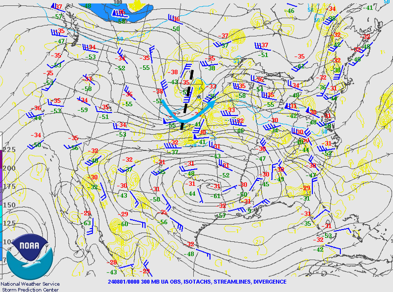
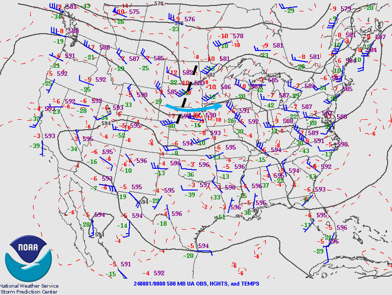
Environment
A hot, humid air mass in place across the mid-Missouri Valley in conjunction with a surface cold front and an upper-air disturbance approaching the region from the west provided the necessary ingredients for a widespread damaging wind event during the afternoon and evening hours of July 31st.
 |
 |
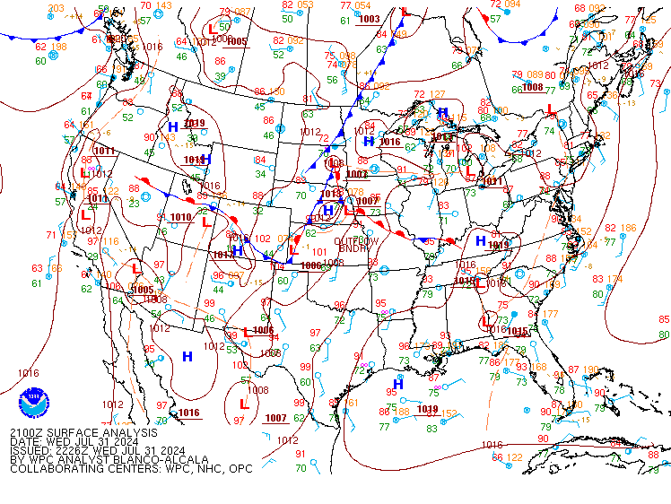 |
| Figure 1: 300 mb analysis, valid 7 pm July 31st. A shortwave trough axis (black dashed) and jet streak (blue arrow) are annotated on the map. | Figure 2: 500 mb analysis, valid 7 pm July 31st. A shortwave trough axis (black dashed) and jet streak (blue arrow) are annotated on the map. | Figure 3: Surface analysis, valid 4 pm July 31st. |
 |
 |
|
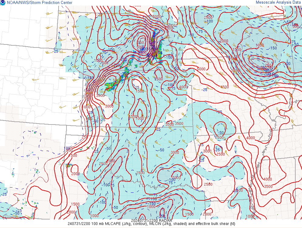
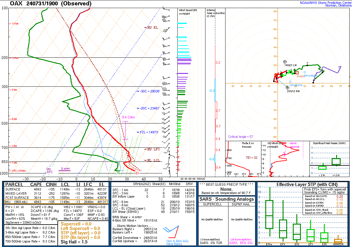
| Figure 1: Objective analysis of mixed-layer CAPE and effective bulk shear, valid 5 pm July 31st. | Figure 2: Skew-T/log P diagram for Valley, NE, valid 2 pm July 31st |
Additional Information
The Forecast
 |
 |
| SPC Day 7 Probabilistic Outlook | SPC Day 6 Probabilistic Outlook |
 |
 |
| SPC Day 5 Probabilistic Outlook | SPC Day 4 Probabilistic Outlook |
 |
 |
| SPC Day 3 Categorical Outlook | SPC Day 3 Probabilistic Outlook |
 |
 |
 |
 |
| SPC Day 2 Categorical Outlook | SPC Day 2 Tornado Outlook | SPC Day 2 Hail Outlook | SPC Day 2 Wind Outlook |
 |
 |
 |
 |
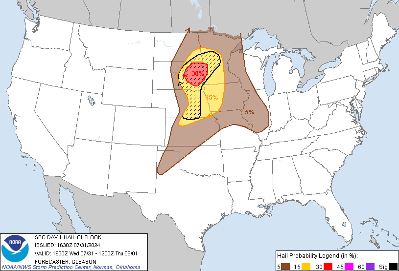
| SPC Day 1 Categorical Outlook | SPC Day 1 Tornado Outlook | SPC Day 1 Hail Outlook | SPC Day 1 Wind Outlook |
 |
Media use of NWS Web News Stories is encouraged! Please acknowledge the NWS as the source of any news information accessed from this site. |
|

