Overview
|
Significant heavy rainfall occurred on the days of June 17th and 18th. Areas hardest hit were Dodge, far western Douglas, far western Sarpy and northern Saunders counties. The highest rainfall report received was 7.12 inches from the Fremont, Nebraska NWS cooperative observer. The hardest hit communities were Scribner and Fremont. In Scribner local officials had to put in the levee closure gates on the north side of town to keep the town from flooding. These gates effectively closed Highway 275 since that road goes through the local levee. Widespread urban flooding was observed in Fremont. Many roads and properties were flooded, areas hardest hit were in the east part of town where the water took several days to subside. In addition to the heavy rain, there were several reports of strong winds which resulted in minor tree damage in northeast Nebraska. The most substantial damage was a barn that was destroyed near Petersburg, Nebrsaka. |
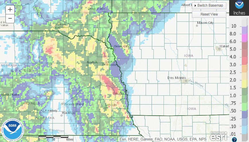 Rainfall Map for the event. |
 |
 |
 |
| Fremont, Nebraska (Courtesy: Chase Moffitt/WOWT) | Highway 36 and 276th (Courtesy: Chase Moffitt/WOWT) | Near Highway 275 near West Point, Nebraska (Courtesy: Chase Moffitt/WOWT) |
River Flooding
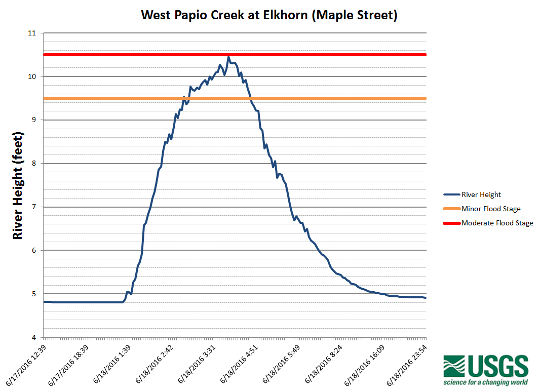
Several creeks and rivers rose out of their banks as a result of intense rain. The West Papillion Creek in Elkhorn left its banks during the early morning hours of June 18th. The water rose high enough to partially flood Maple Street, causing the road to be closed to traffic for a short time. Significant flooding was also recorded along Maple Creek which rose above moderate flood stage. The most severe flooding occurred along Pebble Creek where the river exceeded major flood stage. Pebble Creek reached a peak of 23.94 feet which, unofficially, is the third highest river stage recorded at that site.
Hydrographs
 |
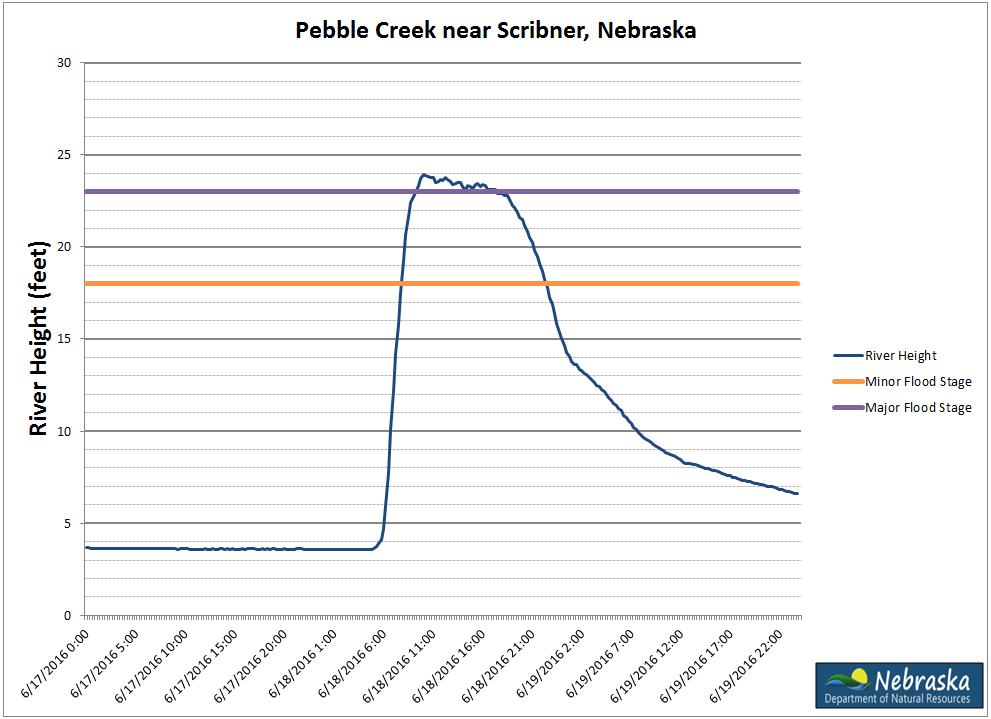 |
| USGS River Gage in Elkhorn, NE | Nebraska DNR Gage near Scribner, NE |
| All river data is provisional and subject to change by the gage owner. | |
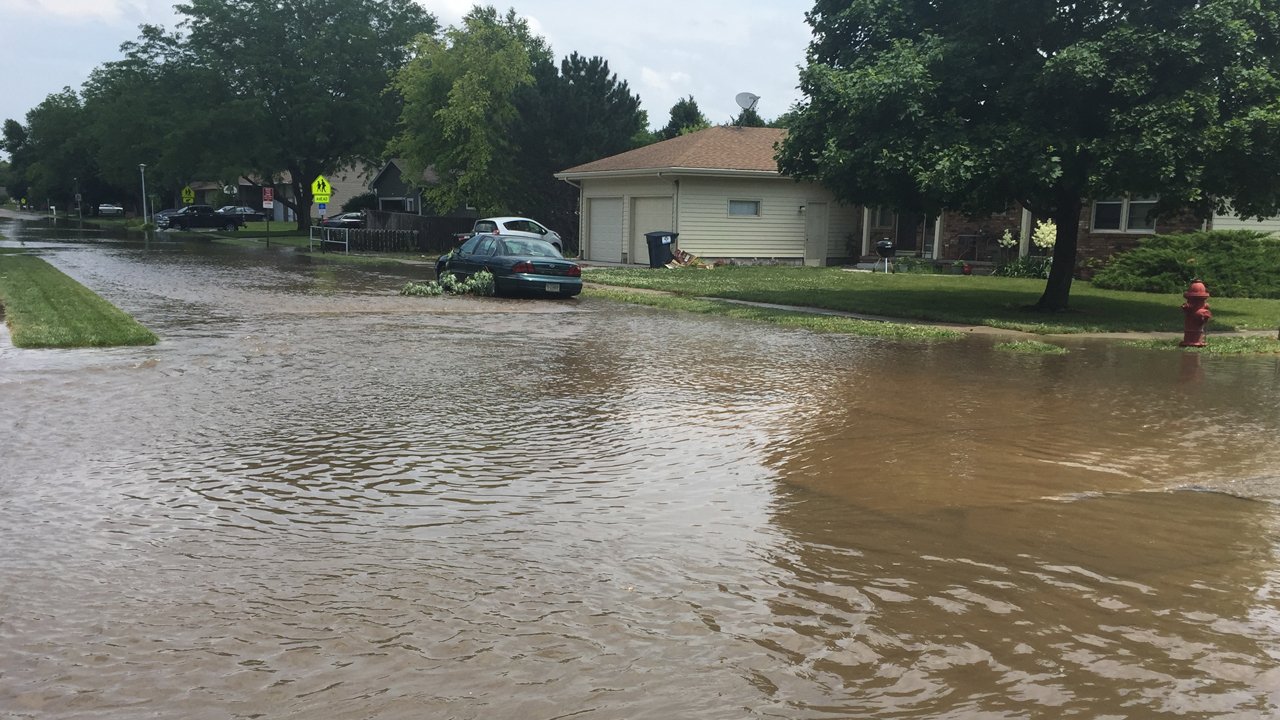
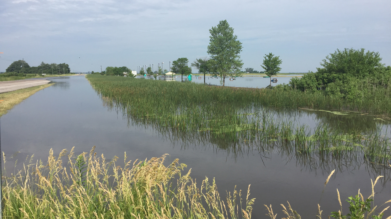
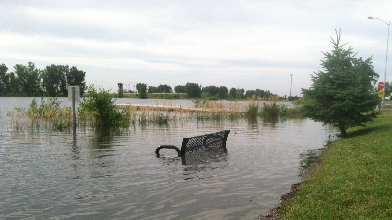
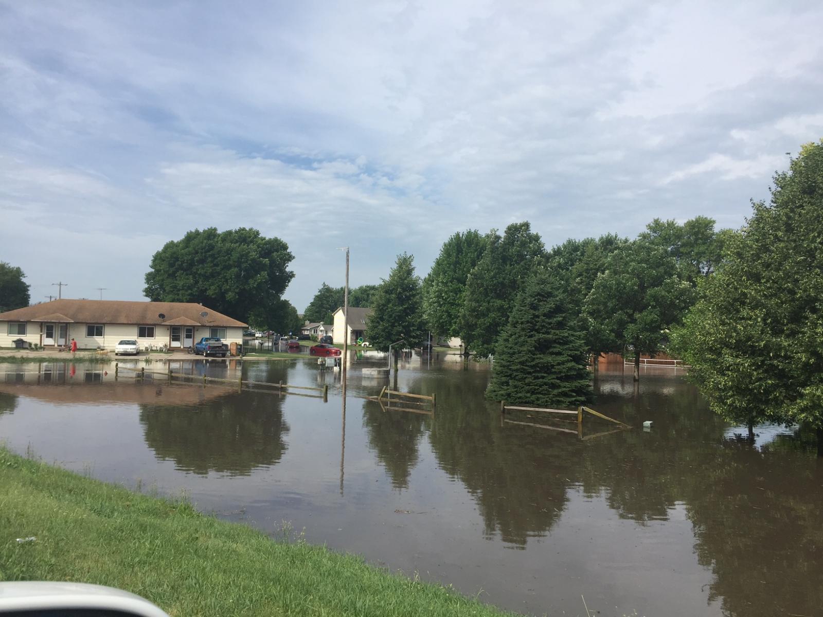
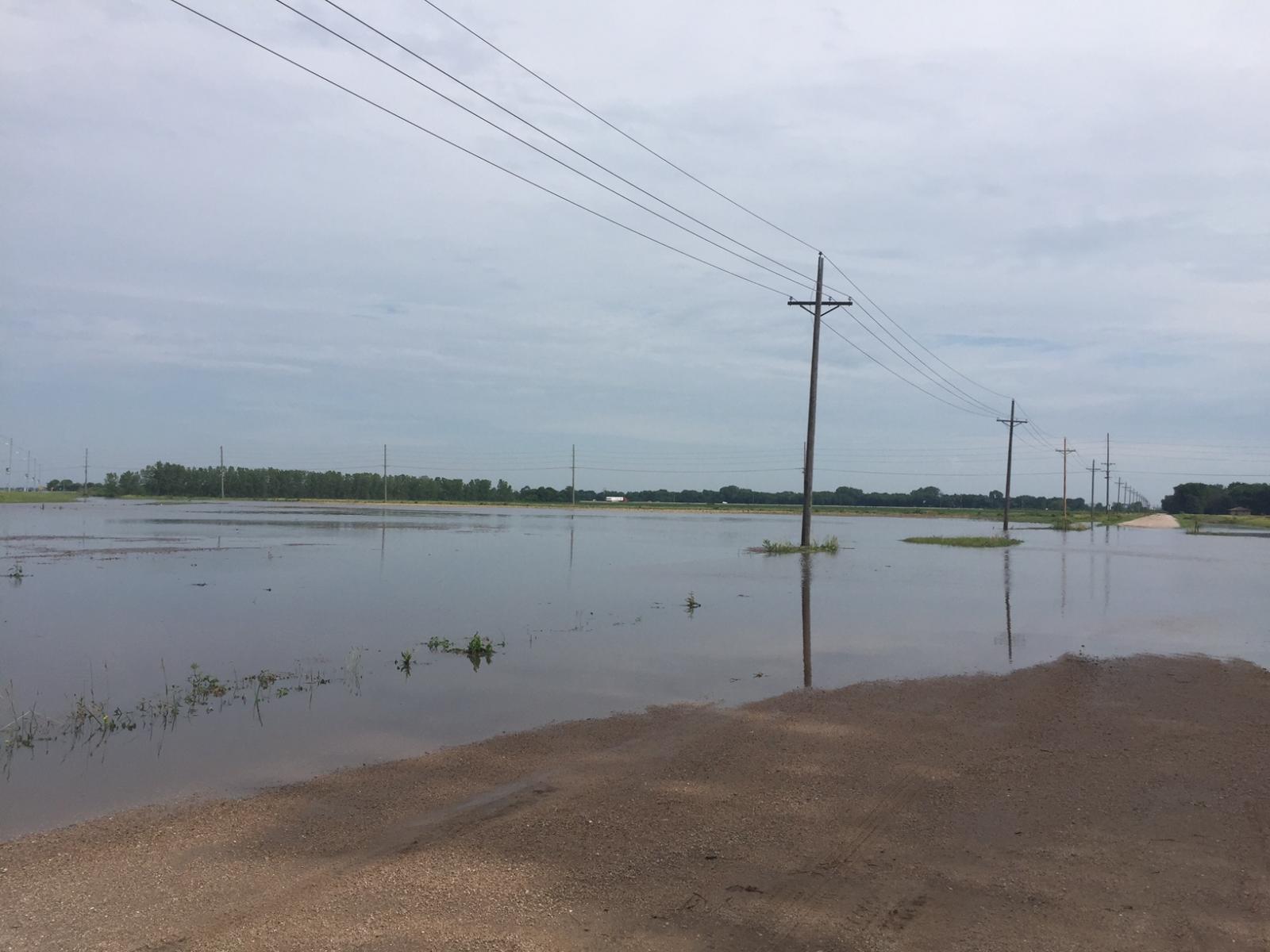
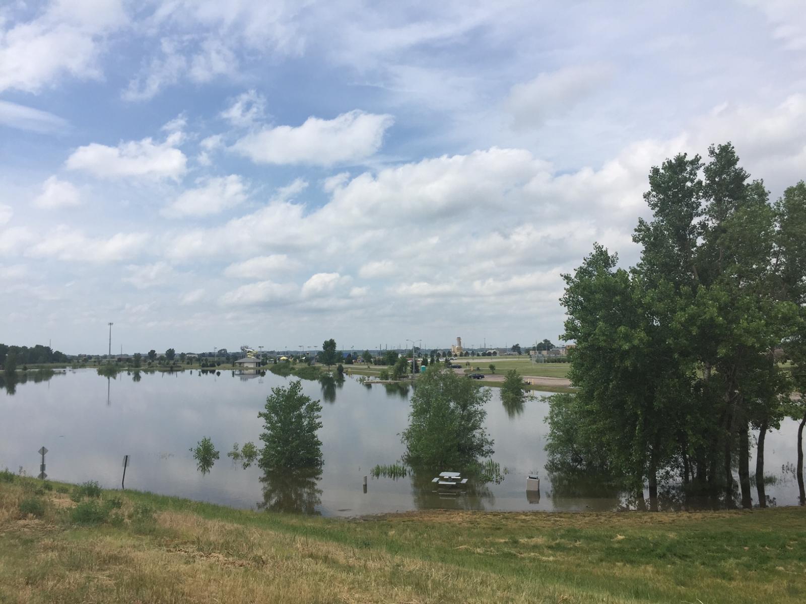
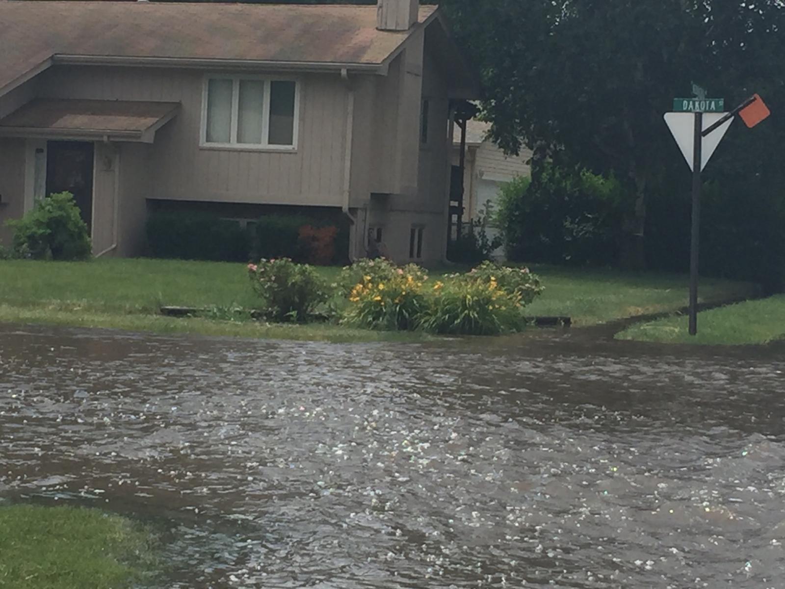
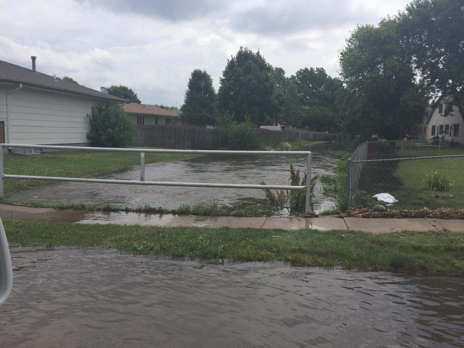
Photos:
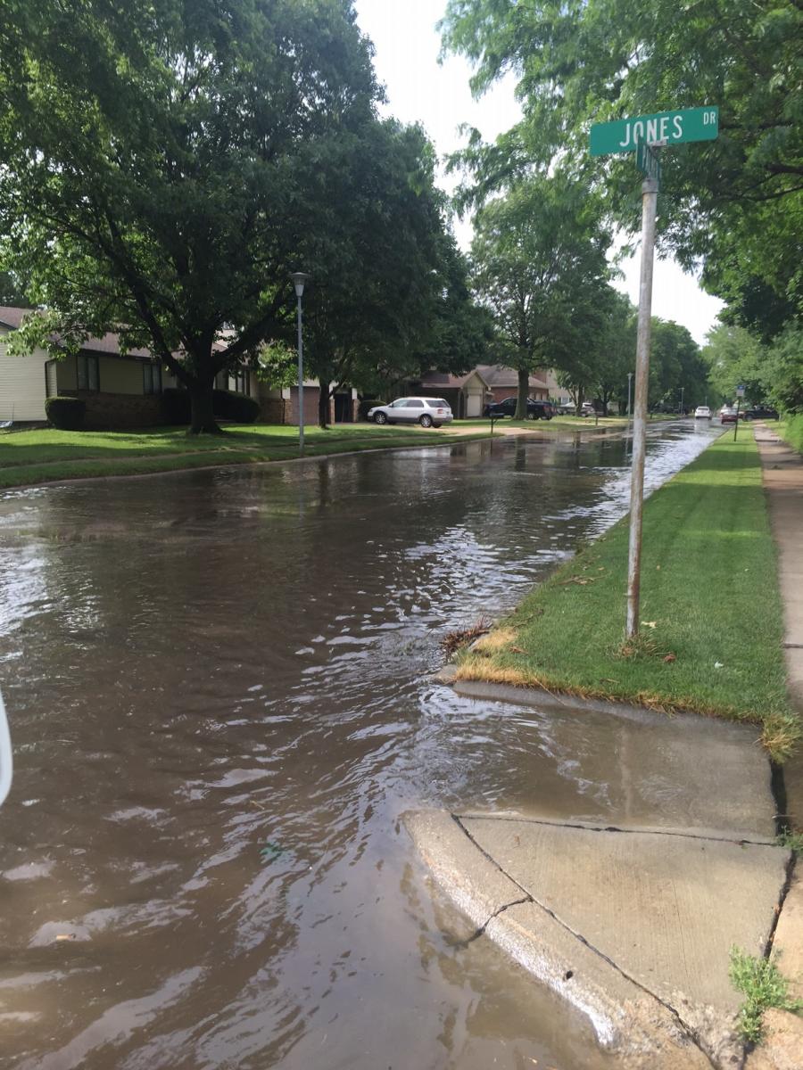
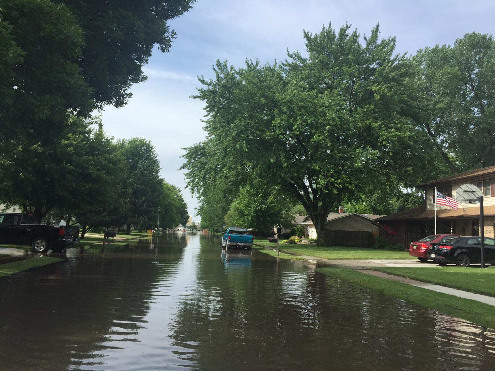
The pictures below were taken around Fremont on June 18th, 2016.
 |
 |
 |
 |
 |
 |
 |
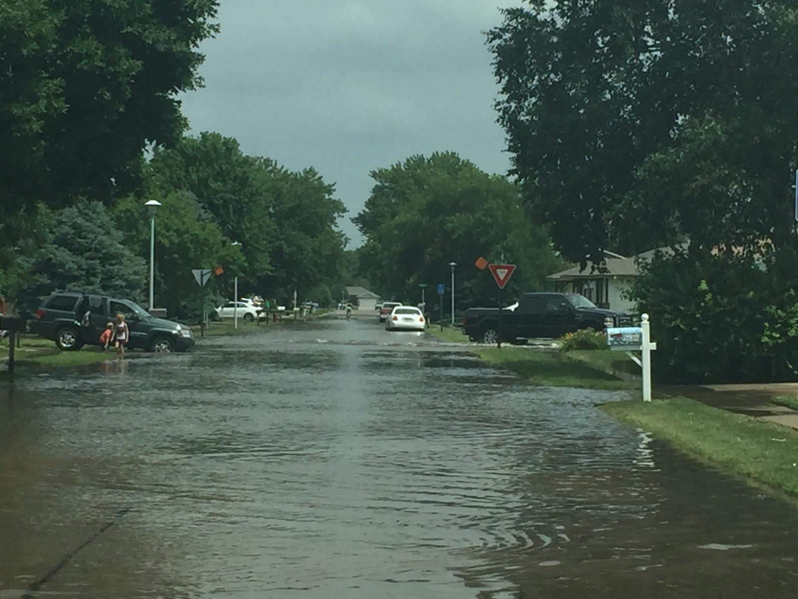 |
| Photos courtesy of Rebecca Kern (NWS Forecaster) | |||
Rain Reports (click for Interactive map)
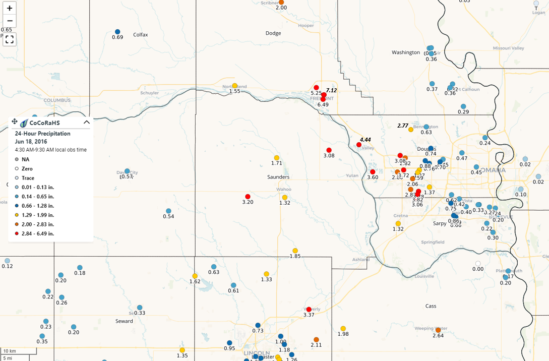
The map above shows the CoCoRaHS reports from this event. NWS reports have been added and are shown in italics.
 |
Media use of NWS Web News Stories is encouraged! Please acknowledge the NWS as the source of any news information accessed from this site. |
|

