Overview
|
A large upper-level storm system moved across eastern Nebraska and southwest Iowa during the afternoon of April 27th. As this occurred, a cold front slowly moved through the region, as a warm front lifted into southeast Nebraska and southwest Iowa. Although surface temperatures only warmed into the upper 50s and mid 60s, very cold temperatures above the surface created instability across the region. Thunderstorms developed by mid-afternoon along the two fronts and isolated to scattered reports of severe weather were received, mainly in the form of large hail and damaging winds. Tornadic thunderstorms occurred both in the Omaha metro and in southwest Iowa (near Stanton). Though weak, the tornadoes in Omaha garnered a lot of attention since they moved through a major populated area during a busy time of day. Of the four tornadoes reported to the National Weather Service, the most significant damage was EF-1 which occurred in both Omaha and near Stanton. |
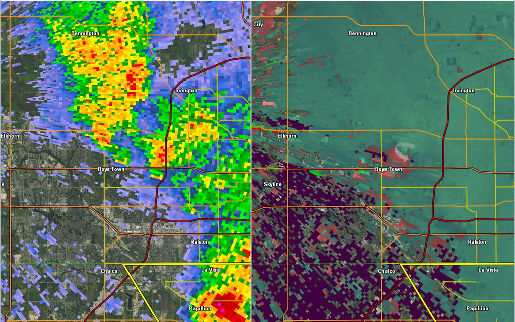
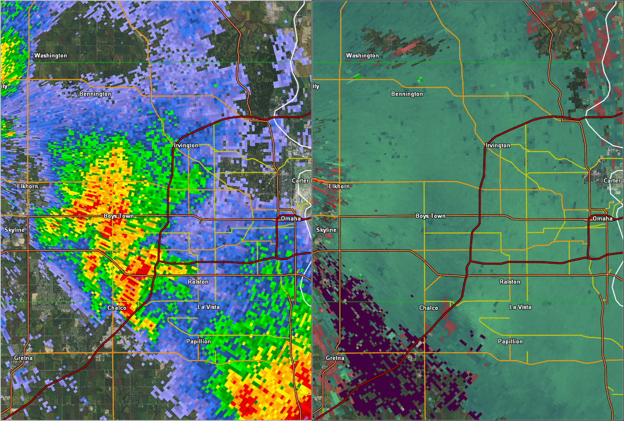
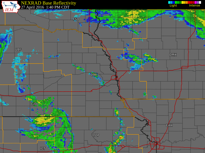 Radar animation from April 27th, 2016 |
 |
 |
 |
|
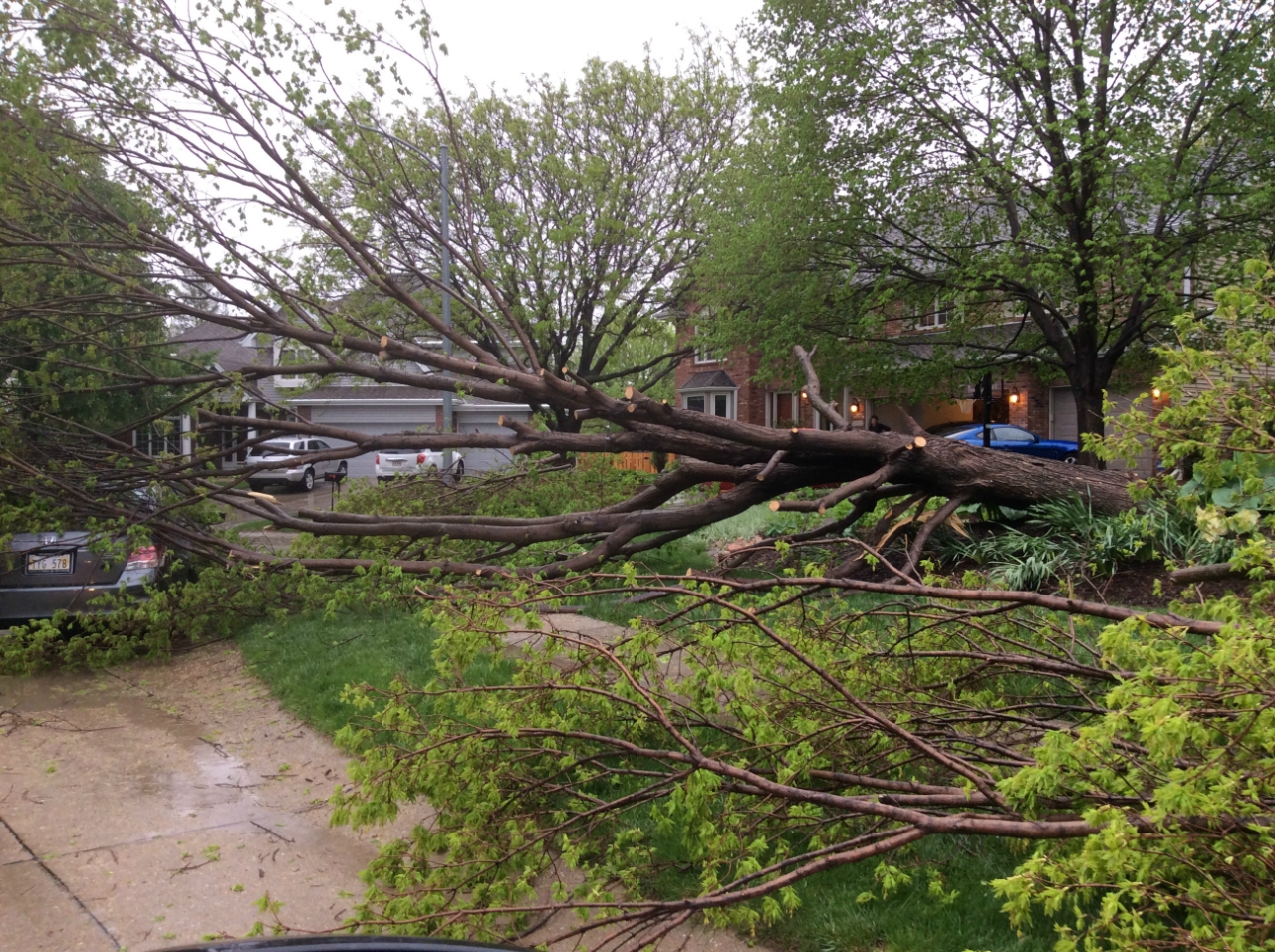
EF-1 Damage in Omaha |
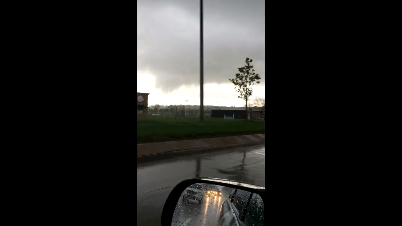
Screenshot from Spring Weather Productions |
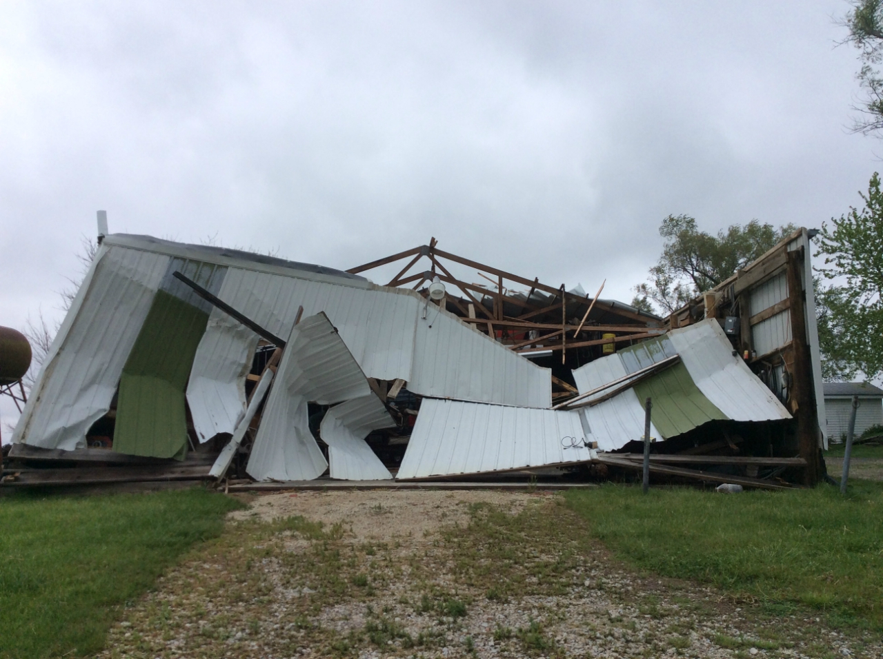
EF-1 Damage near Stanton,IA (source: NWS Storm Survey) |
Tornadoes:
|
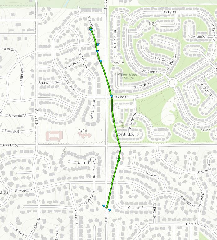
Tornado #1 - Omaha (near Boys Town)
|
||||||||||||||||
|
||||||||||||||||
|
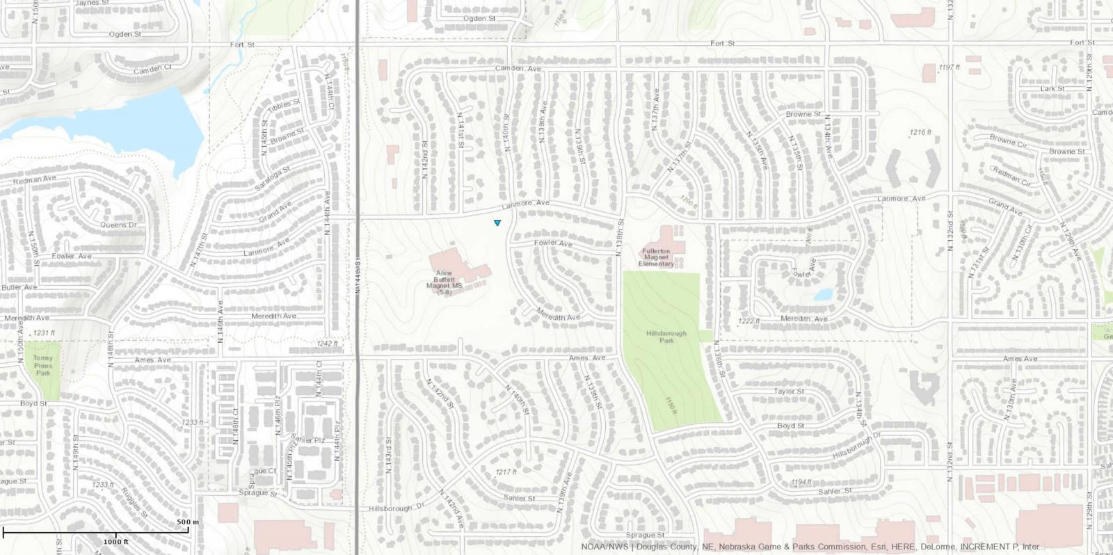
Tornado #2 - (near 144th and Fort St.)
|
||||||||||||||||
|
Tornado #3- Omaha (Waterford Estates)
|
||||||||||||||||
|
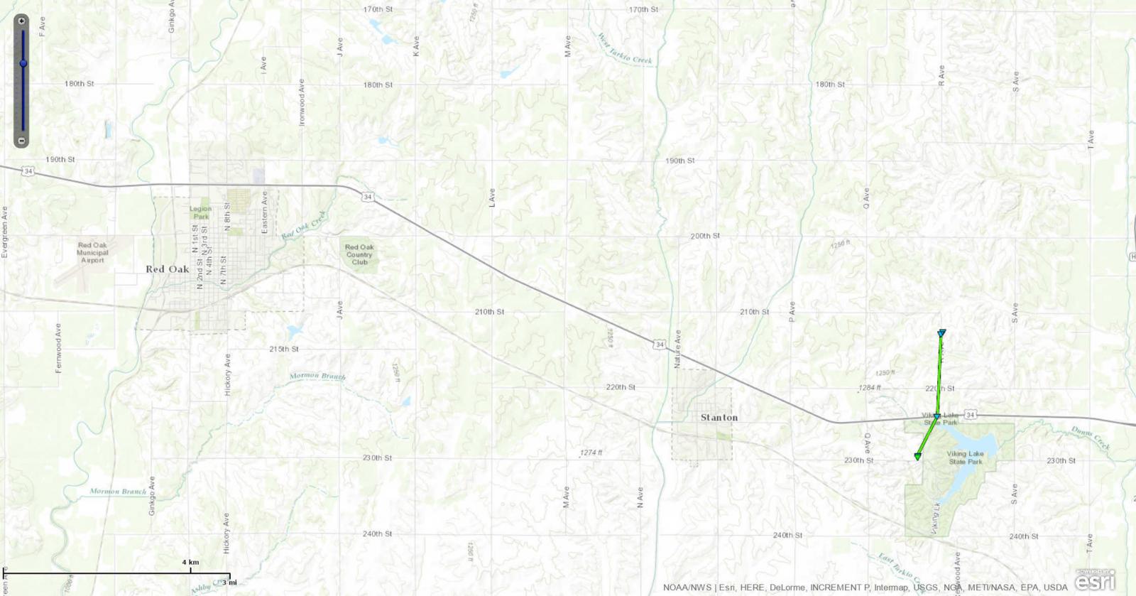
Tornado #4 - Stanton, Iowa
|
||||||||||||||||
|
 |
 |
| EF-1 Damage near Stanton,IA (source: NWS Storm Survey) |
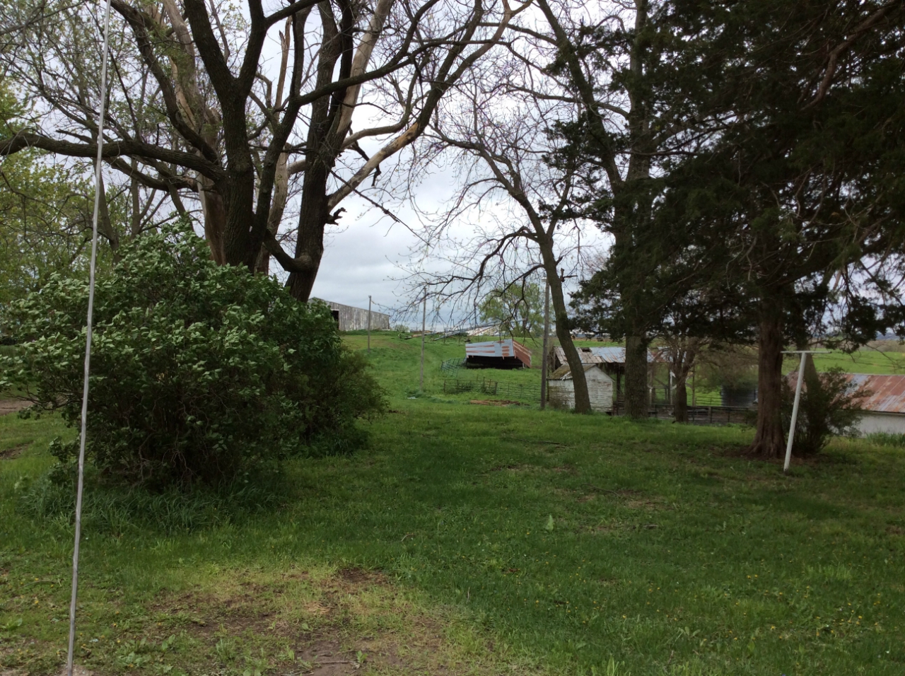
EF-0 Damage near Stanton,IA (source: NWS Storm Survey) |
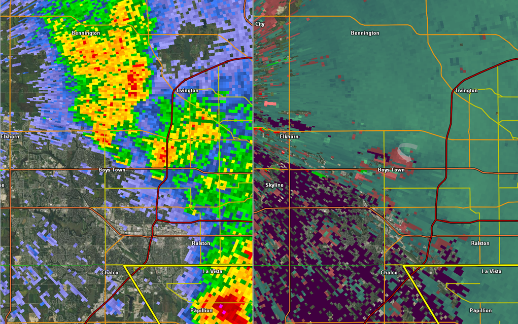
Radar image of the tornado near Stanton, Iowa |
The Enhanced Fujita (EF) Scale classifies tornadoes into the following categories:
| EF0 Weak 65-85 mph |
EF1 Moderate 86-110 mph |
EF2 Significant 111-135 mph |
EF3 Severe 136-165 mph |
EF4 Extreme 166-200 mph |
EF5 Catastrophic 200+ mph |
 |
|||||
Storm Reports
| Date/Time (CDT) | County | State | City | Type | Magnitude | Remark |
|---|---|---|---|---|---|---|
| 4/27/2016 2:39 PM | Douglas | Nebraska | 1 NW Valley | Hail | 1.25 inches | |
| 4/27/2016 2:39 PM | Page | Iowa | 2 NE Hepburn | Tornado | N/A | Brief touchdown. No damage. |
| 4/27/2016 2:44 PM | Douglas | Nebraska | Valley | Hail | 1.25 inches | |
| 4/27/2016 2:47 PM | Douglas | Nebraska | 2 NW Valley | Hail | 1 inch | |
| 4/27/2016 2:48 PM | Douglas | Nebraska | 3 NNW Valley | Hail | 1.75 inches | Delayed report. |
| 4/27/2016 3:06 PM | Cass | Nebraska | Plattsmouth | Wind | 60 mph | |
| 4/27/2016 3:11 PM | Cass | Nebraska | Plattsmouth | Hail | 1 inch | |
| 4/27/2016 3:14 PM | Montgomery | Iowa | 4 E Stanton | Tornado | N/A | Fire chief observed tornado. Damage reported. |
| 4/27/2016 3:15 PM | Douglas | Nebraska | 3 N Valley | Hail | 1.5 inches | |
| 4/27/2016 3:17 PM | Montgomery | Iowa | 3 ENE Stanton | Tornado | N/A | Tornado on the ground with debris. |
| 4/27/2016 3:25 PM | Montgomery | Iowa | 5 N Stanton | Hail | 1 inch | Hail up to quarter size. |
| 4/27/2016 3:35 PM | Washington | Nebraska | 1 S Arlington | Hail | 1.5 inch | |
| 4/27/2016 3:43 PM | Douglas | Nebraska | 1 NE Boys Town | Tornado | N/A | Tornado near 132nd street between Dodge and Blondo. |
| 4/27/2016 3:45 PM | Sarpy | Nebraska | Bellevue | Wind | 60 mph | |
| 4/27/2016 3:50 PM | Page | Iowa | Essex | Hail | 1 inch | |
| 4/27/2016 3:59 PM | Sarpy | Nebraska | 2 W Offutt AFB | Wind | 60 mph | Small tree limbs down less than 2 in diameter. |
 |
Media use of NWS Web News Stories is encouraged! Please acknowledge the NWS as the source of any news information accessed from this site. |
|