
Severe Weather Awareness Week
March 25-29, 2019
Severe Weather Awareness Week Packet 2019 is available at this Link
Become a Weather-Ready Nation Ambassador
|
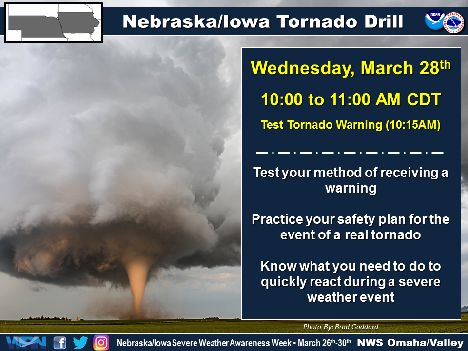
The National Weather Service along with Nebraska Emergency Management and the Iowa Homeland Security and Emergency Division have declared March 25 through March 29 as Severe Weather Awareness Week. Knowing when severe weather is possible will give you time to prepare! You can always find the latest forecasts and hazardous weather conditions at weather.gov. If you’re not on your computer, you can access the same information via your mobile device at https://mobile.weather.gov. Wireless Emergency Alerts are life saving messages that will pop up on your mobile phone when you are in a geographic area that is under a Warning. Visit www.weather.gov/wirelessalerts for more information! Each day during Severe Weather Awareness Week…the National Weather Service in Omaha will cover severe weather topics and have this information available on our webpage as well as on NOAA Weather Radio All Hazards. Topics which will be covered include… Monday...Severe Weather Terminology Tuesday...Thunderstorms Wednesday...Tornadoes Thursday...Lightning Friday...Flooding Saturday...How to Report Severe Weather The National Weather Service will conduct a Tornado Drill on WEDNESDAY, March 27th, at 10 a.m. with the TEST Tornado Warning drill at 1015 a.m. CDT. Please note the data change! The purpose of this drill is to ensure that Nebraskans and Iowans can adequately receive a Tornado Warning and can practice any actions that would be taken in the event of a real tornado. The test warning will be sent through all communication channels normally used for severe weather dissemination. Severe Weather Drill - What To Expect
|
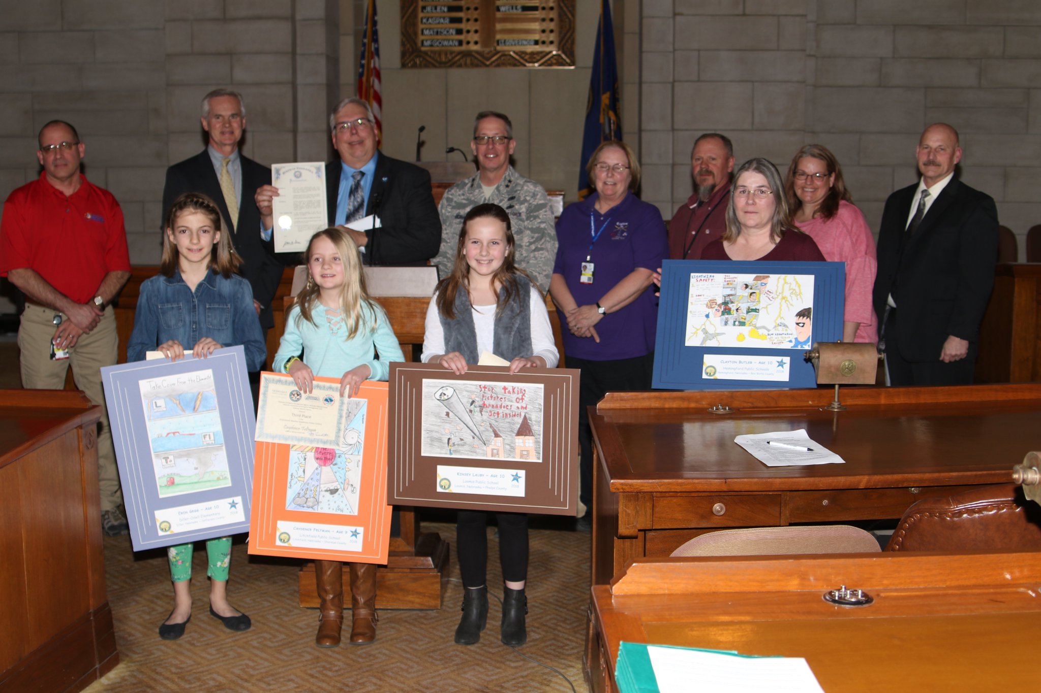
Proclamation Signing and Poster Contest (1st Place)
|
|
Poster Contest Here are all the winners:
Severe Weather Poster Contest 1st Place: Jack Baarson, Age 10, Bell Elementary School, Papillion, Sarpy County 2nd Place: Ansley Throener, Adams Elementary School, Lincoln, Lancaster County 3rd Place: Julia Schuler, Cornerstone Christian School, Bellevue, Sarpy County. 4th Place: Keri Wagoner, Aurora Elementary School, Aurora, Hamilton County Honorable Mention Jonah Fisher, 10, Loomis School, Loomis, Phelps County Luke Gompert, 10, North Street Academy, Center, Knox County Kaden Haverkamp, 10, Bloomfield School, Bloomfield, Knox County Alexis Lucas, 10, Litchfield Public School, Litchfield, Sherman County Karina Morales, 10, Perkins County School, Grant, Perkins County Zachary Moseley, 10, Cornerstone Christian, Bellevue, Sarpy County Jasmine Northey, 9, Cody Elementary School, North Platte, Lincoln County Becca Pobanz, 8, Meadowlark Elementary, Kearney, Buffalo County Stella Smith, 9, Meadowlark Elementary, Kearney, Buffalo County
|
|||||||||||||||||||||||||||||||||||||||||||||
|
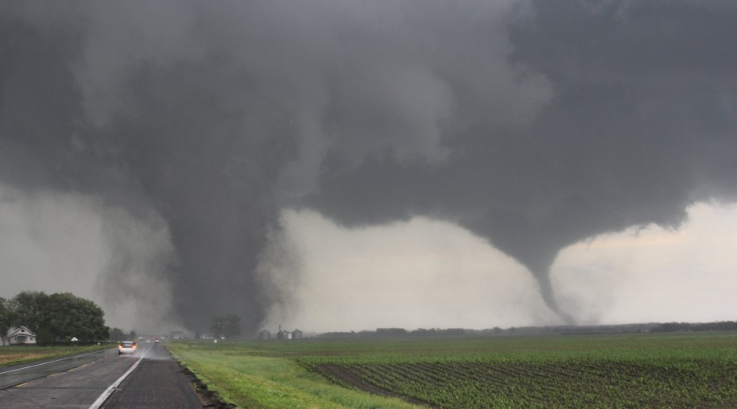
Tornadoes There were 33 tornadoes in Nebraska last year, that is 9 less than the 1950-2018 average of 42 and 21 less than the 30 year (1989-2018) average of 54. Iowa reported 69 tornadoes, which is 23 above of the longer term average of 46. Of the tornadoes that occurred in Nebraska and Iowa in 2018, there were no injuries in Nebraska and 36 injuries in Iowa. Typically, most tornadoes in Nebraska and Iowa occur in June, though the incidence increases beginning late April. The most tornadoes in Nebraska occurred in June with 24. In Iowa, the most occurred in July with 21.
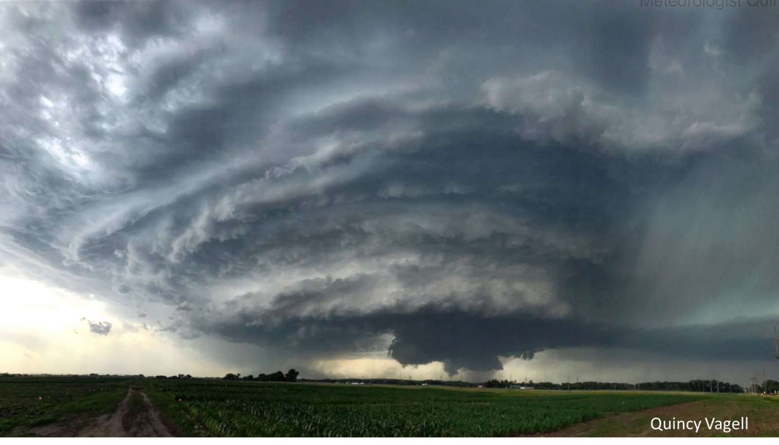
Near Battle Creek, NE - June 16, 2017 Photo courtesy of Quincy Vagell Know what to do before, during and after a tornado. Knowing what to do before, during and after a tornado could save your life. Here’s what you need to know. Before:
During:
After:
For more information visit... Tornadoes |
|||||||||||||||||||||||||||||||||||||||||||||
|
Severe Thunderstorms A thunderstorm is considered severe when it produces hail that is one inch in diameter or larger, damaging winds equal to or greater than 58 miles per hour, or a tornado. There are numerous aspects of severe thunderstorms that pose a threat to life and property. Along with the threat of large hail, damaging winds, and tornadoes, everyone must also be aware of the possibility of dangerous lightning and flooding. Now is the time to review Severe Weather Safety Information.
|
|||||||||||||||||||||||||||||||||||||||||||||
|
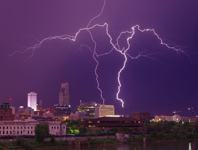
Lightning When Thunder Roars, Go Indoors! For anyone outside, whether you're involved in sports or some other activity, keep an eye on the sky. If you hear thunder, you're already in danger and should head inside a substantial building or hardtopped vehicle immediately. Don’t wait for rain. Outdoor activities (fishing, boating, golf, soccer, walking, running, yardwork) contributes to dozens of lightning deaths in the United States. Officials in charge of organized sports should have a lightning safety plan, and those involved in the sport (and their parents) should understand the plan and know what to do. The plan should identify: -How long it will take to get everyone to safety -Where the participants and spectators should take shelter -When officials should stop and resume the event -Who is responsible for making weather-related safety decisions -Who is responsible for monitoring conditions and notifying officials of weather-related threats. Whether you're out for a run, watching your child's game, or attending a major sports event, remember that there's no safe place outside in a thunderstorm. When thunder roars, go indoors! For more information go to: Lightning Safety
|
|||||||||||||||||||||||||||||||||||||||||||||
|
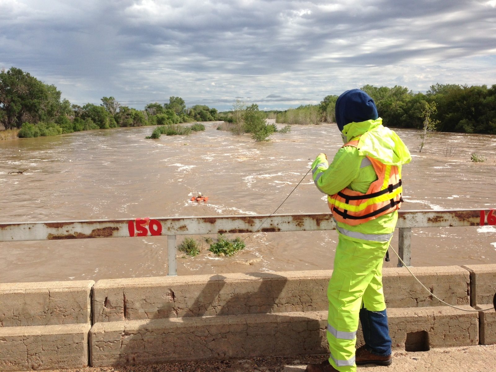
Flooding Never Drive or Walk into Flood Waters -Turn Around Don’t Drown! Flooding is one of the leading causes of weather related fatalities in the U.S. On average, flooding claims nearly 82 lives each year. More than half of these deaths occur in motor vehicles when people attempt to drive through flooded roadways. This happens because people underestimate the force and power of water, especially when it is moving.
For more information and flood safety tips, visit the Flood Safety page.
|
|||||||||||||||||||||||||||||||||||||||||||||
|
Statistics - 2018 Nebraska Tornadoes: 33 (21 less than the 30 year average of 54) Deaths: 0 Injuries: 0 Hail Size: 4.25” on August 6th (North of Grant - Perkins County) Wind Gust: Estimated: 100 MPH on July 18th - Near O'Neill (Holt County) July 26th - Near Danbury/Lebanon (Red Willow County)
Iowa Tornadoes: 69 (23 above the longer term average of 46) Deaths: 0 Injuries: 36 Hail Size: 3.00” on August 8th ( Near Garner - Hancock County)
August 28th - Elvira (Clinton County) 2014
|
|||||||||||||||||||||||||||||||||||||||||||||
|
Severe Weather Products and Services Visit our Severe Weather Decision Support Page
|
|||||||||||||||||||||||||||||||||||||||||||||
 |
Media use of NWS Web News Stories is encouraged! Please acknowledge the NWS as the source of any news information accessed from this site. |
|


.png)
 Platte River near Roscoe Courtesy USGS
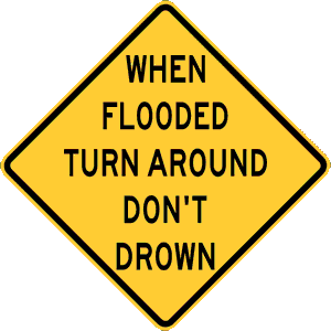 Just six inches of fast-moving water can knock over and carry off an adult. Twelve inches of water can float a small car. If that water is moving, it can carry that car away. Eighteen to twenty-four inches of flowing water can carry away most vehicles, including large SUVs. It is impossible to tell the exact depth of water covering a roadway or the condition of the road below the water. This is especially true at night when your vision is more limited. It is never safe to drive or walk through flood waters. Any time you come to a flooded road, walkway, or path, follow this simple rule: Turn Around Don’t Drown.