Blizzard conditions were widespread over northeat Nebraska into west central Iowa much of Groundhog Day, Tuesday. The snow began in earnest before sunrise, and was falling at a rate of an inch or two per hour along Interstate 80 and north, helped by atmospheric instability that produced areas of Thundersnow that made the morning drive-time very dangerous.
By mid morning, much of the snow had pushed north of the Interstate, but moderate to heavy snow continued much of the day in northeast Nebraska into west central Iowa. Thus the highest snowfall totals wound up being there, with many locations reporting 10 to 18 inches of total snowfall.
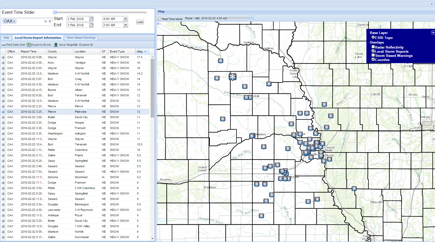
Here's a map of the Storm Total Snowfall across the local area, created with data from our volunteer COOP and COCORAHS weather observers.

| Snow | Lat | Lon | Location |
| 18 | 42.2 | -97.5167 | Piecre, NE |
| 15.8 | 42.0413 | -97.1747 | Stanton, NE |
| 15.7 | 42.5938 | -97.6436 | Bloomfield, NE |
| 14.5 | 40.27 | -98.67 | Wakefiled, NE |
| 14.4 | 42.202 | -96.8227 | NE-TN-1 |
| 14.4 | 41.7613 | -98.2138 | Loretto, NE |
| 14.2 | 41.986 | -97.435 | Norfolk, NE Airport |
| 14 | 42.2333 | -97.0092 | Wayne, NE |
| 13.6 | 41.53 | -98.51 | Greely, NE |
| 13 | 41.46 | -97.35 | Columbus, NE |
| 13 | 42.1297 | -98.0267 | Neligh, NE |
| 12.5 | 42.41 | -96.39 | Sioux City, IA |
| 12.4 | 40.9 | -97.62 | York, NE |
| 12 | 42.93 | -97.38 | Yankton, SD |
| 12 | 41.45 | -96.53 | Fremont, NE |
| 11 | 41.8422 | -96.7164 | West Point, NE |
| 10.5 | 41.43 | -96.4669 | Fremont, NE |
| 10 | 41.4314 | -96.4921 | NE-DD-3 |
| 10 | 40.9 | -97.0833 | Seward, NE |
| 10 | 41.8263 | -96.0505 | Little Sioux, IA |
| 10 | 41.3894 | -95.6811 | Underwood, IA |
| 9.7 | 40.6558 | -97.2208 | Friend, NE |
| 9.5 | 41.3536 | -96.2094 | Bennington, NE |
| 9 | 42.48 | -98.67 | Oneill, NE |
| 9 | 41.7 | -94.92 | Audubon, IA |
| 8.5 | 41.2491 | -97.1327 | David City, NE |
| 8.4 | 41.2853 | -95.8336 | IA-PT-2 |
| 8.4 | 41.4466 | -96.0919 | Fort Calhoun, NE |
| 8 | 41.32 | -96.3669 | Valley, NE NWS |
| 8 | 41.98 | -95.38 | Denison, IA |
| 7.8 | 40.8486 | -96.6601 | NE-LA-26 |
| 7.7 | 41.1586 | -96.1922 | Gretna, NE |
| 7.4 | 41.6783 | -95.3222 | Harlan, IA |
| 7.1 | 41.1271 | -96.2474 | NE-SY-9 |
| 7 | 41.11 | -95.92 | Offut AFB |
| 7 | 41.4 | -95.05 | Atlantic, IA |
| 7 | 41.5495 | -95.5722 | IA-HR-4 |
| 7 | 41.0408 | -96.3775 | Ashland, NE |
| 7 | 41.15 | -96.05 | Papillion, NE |
| 6.9 | 41.2108 | -96.2067 | NE-DG-6 |
| 6.4 | 40.851 | -96.759 | Lincoln, NE Airport |
| 6.3 | 40.8337 | -96.7967 | NE-LA-21 |
| 6.2 | 40.7494 | -96.5928 | NE-LA-19 |
| 6.1 | 41.2745 | -96.1463 | NE-DG-8 |
| 6.1 | 42.0747 | -95.9944 | Kennebeck, IA |
| 6 | 41.1364 | -96.0596 | NE-SY-1 |
| 5.8 | 40.85 | -96.63 | NE-LA-32 |
| 5.5 | 41.0639 | -96.0069 | Springfield, NE |
| 5.2 | 42.718 | -98.209 | Verdel, NE |
| 5 | 41.0516 | -95.7491 | Glenwood, IA |
| 5 | 41.6333 | -95.7833 | Logan, IA |
| 4.9 | 41.303 | -95.894 | Omaha Eppley |
| 4.7 | 40.15 | -97.59 | Hebron, NE |
| 4.7 | 39.55 | -97.65 | Concordia, KS |
| 4.5 | 41.0105 | -95.889 | NE-CA-3 |
| 4.5 | 41.2116 | -95.848 | IA-PT-13 |
| 4.2 | 43.59 | -96.74 | Sioux Falls, SD |
| 4.1 | 40.0891 | -97.1959 | NE-JF-1 |
| 4 | 40.7708 | -96.6279 | NE-LA-1 |
| 4 | 40.1836 | -96.4813 | Virginia, NE |
| 3.5 | 40.1355 | -97.1713 | Fairbury, NE |
| 2.7 | 40.8756 | -95.5664 | Randolph, IA |
| 2.5 | 40.2994 | -96.75 | Beatrice, NE |
| 2 | 40.7647 | -95.3803 | Shenandoah, IA |
| 1 | 40.2353 | -96.0861 | Table Rock, NE |
| 1 | 40.7244 | -95.0191 | Clarinda, IA |
| 0.1 | 40.24 | -95.68 | Shubert, NE |
Here is a link to some of the reports we have received through midnight from around eastern Nebraska and southwest Iowa.
https://nwschat.weather.gov/lsr/#OAX/201602021000/201602030800/0101
Strong winds were also noted with this storm, causing blizzard conditions across a good part of the area as the snow was falling. Here is a list of some of the higher wind reports we received during the storm:
LOCATION SPEED TIME/DATE LAT/LON
...IOWA...
...FREMONT COUNTY...
4 E NEBRASKA CITY 57 MPH 0542 AM 02/02 40.69N/95.78W
SHENANDOAH AIRPORT 48 MPH 0535 AM 02/02 40.77N/95.41W
...HARRISON COUNTY...
5 SSW BLENCOE 43 MPH 0741 PM 02/02 41.87N/96.10W
...MONTGOMERY COUNTY...
RED OAK AIRPORT 51 MPH 0735 AM 02/02 41.01N/95.26W
...PAGE COUNTY...
CLARINDA AIRPORT 44 MPH 0135 AM 02/03 40.72N/95.03W
...POTTAWATTAMIE COUNTY...
COUNCIL BLUFFS AIRPORT 54 MPH 0735 AM 02/02 41.26N/95.76W
3 ENE AVOCA 48 MPH 0900 AM 02/02 41.50N/95.29W
4 N CRESCENT 39 MPH 0911 AM 02/02 41.42N/95.85W
...SHELBY COUNTY...
HARLAN AIRPORT 51 MPH 0915 AM 02/02 41.59N/95.34W
...NEBRASKA...
...BOONE COUNTY...
ALBION AIRPORT 44 MPH 1115 AM 02/02 41.73N/98.06W
1 WSW CEDAR RAPIDS 40 MPH 1122 AM 02/02 41.55N/98.17W
...BURT COUNTY...
TEKAMAH AIRPORT 49 MPH 1012 PM 02/02 41.76N/96.18W
...BUTLER COUNTY...
3 NE GARRISON 36 MPH 0612 PM 02/02 41.21N/97.13W
...CASS COUNTY...
1 WSW MANLEY 41 MPH 0537 AM 02/02 40.91N/96.18W
PLATTSMOUTH AIRPORT 41 MPH 0435 AM 02/02 40.95N/95.92W
...COLFAX COUNTY...
2 W SCHUYLER 42 MPH 1100 AM 02/02 41.45N/97.11W
...DODGE COUNTY...
2 E ROGERS 38 MPH 1100 PM 02/02 41.46N/96.87W
...DOUGLAS COUNTY...
OMAHA EPPLEY AIRFIELD 51 MPH 1012 AM 02/02 41.30N/95.89W
MILLARD AIRPORT 35 MPH 1140 PM 02/02 41.20N/96.12W
...GAGE COUNTY...
BEATRICE AIRPORT 43 MPH 0855 PM 02/02 40.30N/96.75W
4 W BARNESTON 35 MPH 0342 AM 02/03 40.04N/96.65W
...JEFFERSON COUNTY...
1 W HARBINE 36 MPH 1032 PM 02/02 40.19N/96.98W
...LANCASTER COUNTY...
LINCOLN AIRPORT 49 MPH 0749 PM 02/02 40.85N/96.76W
...MADISON COUNTY...
NORFOLK AIRPORT 51 MPH 0241 PM 02/02 41.99N/97.43W
MADISON 37 MPH 1140 AM 02/02 41.83N/97.44W
...NEMAHA COUNTY...
1 SE JULIAN 41 MPH 0512 AM 02/02 40.51N/95.86W
...OTOE COUNTY...
NEBRASKA CITY AIRPORT 44 MPH 0535 AM 02/02 40.61N/95.87W
...PLATTE COUNTY...
COLUMBUS AIRPORT 48 MPH 0915 AM 02/02 41.45N/97.34W
...RICHARDSON COUNTY...
FALLS CITY AIRPORT 44 MPH 0403 AM 02/02 40.08N/95.59W
5 S DAWSON 39 MPH 0227 AM 02/03 40.06N/95.82W
...SARPY COUNTY...
OFFUTT AFB 40 MPH 0902 AM 02/02 41.12N/95.92W
...SAUNDERS COUNTY...
WAHOO AIRPORT 44 MPH 0715 PM 02/02 41.23N/96.60W
...SEWARD COUNTY...
4 NNW MILFORD 35 MPH 1152 PM 02/02 40.82N/97.07W
...WASHINGTON COUNTY...
BLAIR AIRPORT 46 MPH 1135 PM 02/02 41.41N/96.11W
...WAYNE COUNTY...
WAYNE MUNICIPAL AIRPORT 46 MPH 1155 AM 02/02 42.24N/96.98W
OBSERVATIONS ARE COLLECTED FROM A VARIETY OF SOURCES WITH VARYING
EQUIPMENT AND EXPOSURE. NOT ALL DATA LISTED ARE CONSIDERED OFFICIAL.
$$
NWS OMAHA/VALLEY NE
IRIS SYSTEM

