Marquette, MI
Weather Forecast Office
 |
 |
||||||
Gridded Forecast DatasetsIn the last 10 years, additional gridded forecast products have been developed by the National Weather Service. These gridded products allow forecasters at the NWS to provide specific forecast information every 1.5 miles for a variety of weather elements, such as waves, winds, temperatures, and weather. In turn, graphics such as those below can be generated, allowing customers and partners to get a complete picture of the weather across the Great Lakes. For further gridded forecast information for the Great Lakes, please go to https://weather.gov/greatlakes. 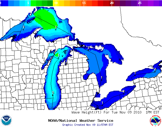 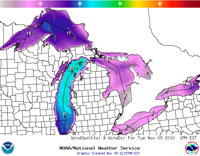
|
|||||||
| Credits | Disclaimer | |
|||||||
US Dept of Commerce
National Oceanic and Atmospheric Administration
National Weather Service
Marquette, MI
112 Airpark Drive South
Negaunee, MI 49866
906-475-5212
Comments? Questions? Please Contact Us.

