...FEBRUARY 2013 MONTHLY CLIMATE SUMMARY...
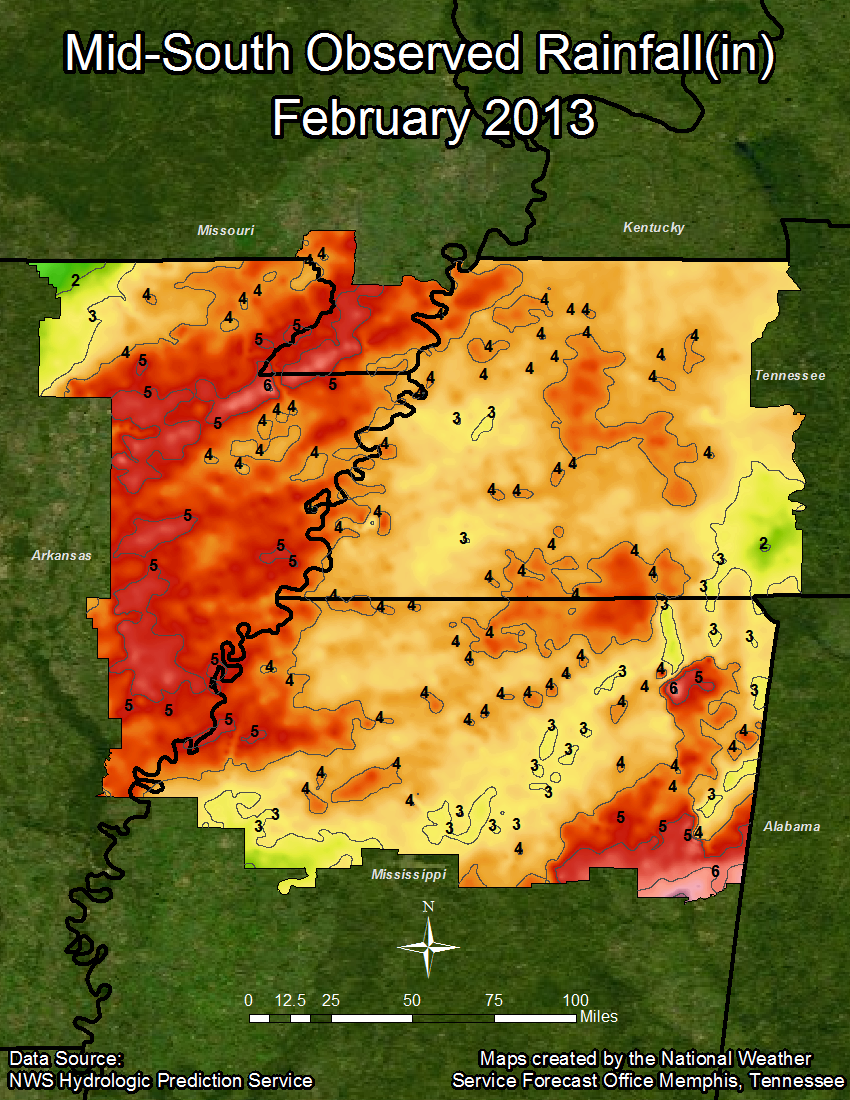
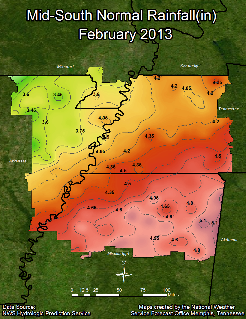
February 2013 yielded slightly below normal temperatures for all official climate sites with Jonesboro being the only exception checking in at 0.6 degrees above normal. However, due to January being abnormally warm, yearly temperatures are still around 2.0 degrees above normal on average. Jonesboro also stood out in the precipitation category as it was the only official climate site to finish the month above normal with a departure of 0.70 inches. Memphis measured 0.54 inches below normal for the month while Jackson and Tupelo measured at 0.52 and 1.24 inches below normal, respectively. Thus Tupelo was the driest climate sight versus the average during the month of February. With that said, just like with temperatures, above normal precipitation values from January keep the yearly totals around 3.6 inches above normal on average. Some light snow was recorded at all official climate sites during the month of February. Below is the climate data that tells the story:
Temperature Data:
Memphis Jackson Jonesboro Tupelo
Average Temperature (FEB) : 45.2 42.1 42.1 45.1
Normal Avg. Temp (FEB) : 45.5 42.3 41.5 45.9
Departure from Normal (FEB) : -0.3 -0.2 0.6 -0.8
Average Temperature (YEAR) : 45.1 42.1 41.7 45.6
Normal Avg. Temp (YEAR) : 43.4 40.3 39.5 43.8
Departure from Normal (YEAR): 1.7 1.8 2.2 1.8
Precipitation Data:
Memphis Jackson Jonesboro Tupelo
Total Snowfall (FEB) : T 0.1 T T
Total Precipitation (FEB) : 3.85 3.65 4.42 3.72
Normal Precipitation (FEB) : 4.39 4.17 3.72 4.96
Departure from Normal (FEB) : -0.54 -0.52 0.70 -1.24
Total Precipitation (YEAR) : 13.57 11.94 9.79 12.43
Normal Precipitation (YEAR) : 8.37 8.24 7.15 9.44
Departure from Normal (YEAR) : 5.20 3.70 2.64 2.99
Significant Weather Events:
For FEBRUARY 2013: Winter weather was the main storyline from the month as multiple waves of freezing rain, sleet, and snow affected portions of the Mid-South region. The first of which started on the early morning hours of Saturday February 2nd, as a weak upper level wave and an associated surface low passed through the region. Surface temperatures were already at or below freezing across the entire area. Temperatures aloft were increasing as warm southerly flow overran the subfreezing surface layer. This produced an ample setup for freezing rain and sleet. Luckily, total atmospheric moisture was limited with this system, so accumulations across the region were minimal. Most areas generally saw a tenth of an inch or less of ice accumulation along with some light sleet.
The next wave of winter weather came on the late afternoon hours of Thursday, February 21st. On the 20th, a strong surface low had developed across the Texas/Oklahoma panhandle and was pushing its way eastward. Ice Storm warnings had been issued across portions of eastern Oklahoma, southern Missouri, and much of northern Arkansas. As the system progressed, moisture began to overspread the Mid-South region out ahead of the surface low as warm moist air aloft once again overran the cooler surface air mass. Warmer surface temperatures were expected to move in across most of the Mid-South region that afternoon. Thus, the Ice Storm warning was issued for portions of northeast Arkansas were the subfreezing surface temperatures would remain. In the end, most of the icing impacts were felt in this region. Reports from Randolph and Lawrence counties of around a quarter inch of ice accumulation on trees were reported. Elsewhere, little to know ice accumulation was observed. However, some areas further east across west Tennessee and northeast Mississippi did experience brief periods of moderate sleet and snowfall into the evening hours of the 21st, with minor accumulations of less than an inch being observed.
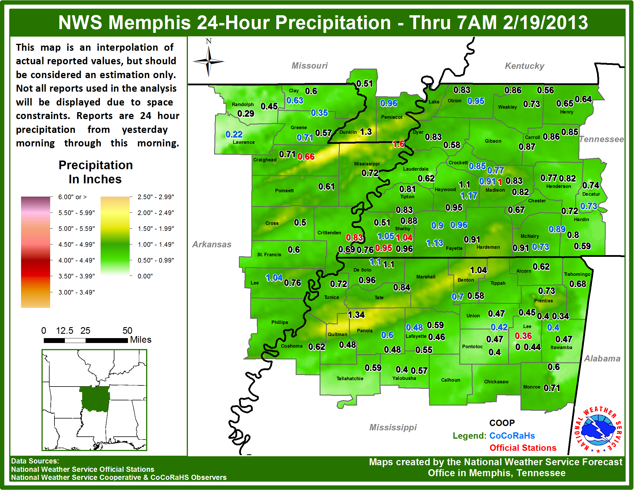
The month of February produced one severe weather event across the Mid-South region which occurred on Monday, February 18th. A deepening surface low and its associated cold front moved by the region during the evening hours of the 18th producing damaging winds across portions of northeast Arkansas. Reports of minor roof damage to a structure, and many trees down across Lawrence County were received.
February 2013 Precipitation Graphics:

February 18th - 19th Rainfall:
CDG

