

Public Information Statement
National Weather Service Memphis TN
422 PM CDT Tue May 28 2024

...NWS Damage Survey for 05/26/24 Tornado Event Update #1...

An additional damage survey was conducted in southern Madison
County, Tennessee on Tuesday, May 28.

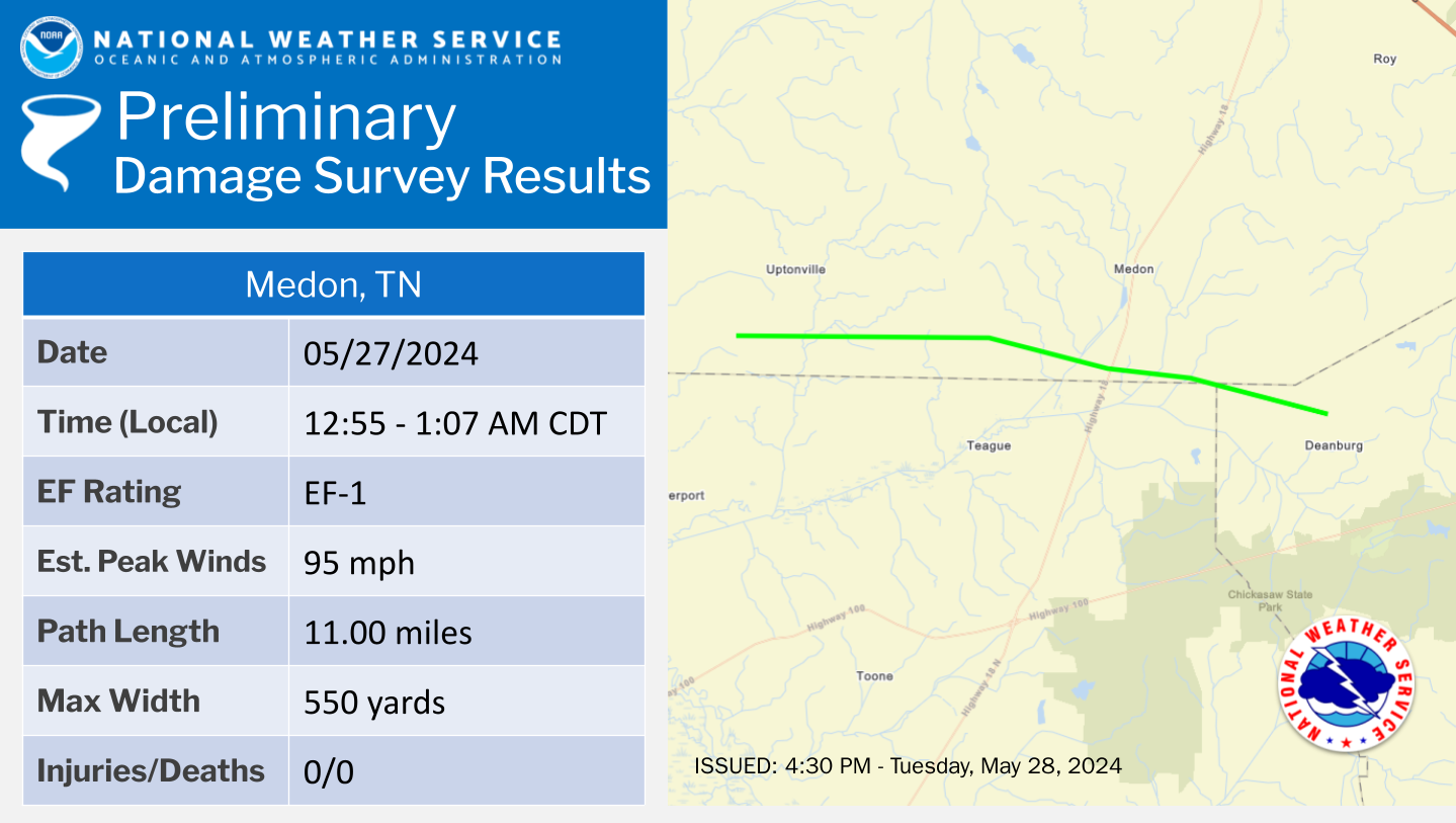
.Medon Tornado...

Rating:                 EF1
Estimated Peak Wind:    95 mph
Path Length /statute/:  11.00 miles
Path Width /maximum/:   550 yards
Fatalities:             0
Injuries:               0

Start Date:             05/27/2024
Start Time:             12:55 AM CDT
Start Location:         3 NNE Cloverport / Madison County / TN
Start Lat/Lon:          35.4404 / -88.9974

End Date:               05/27/2024
End Time:               01:07 AM CDT
End Location:           4 ESE Medon / Chester County / TN
End Lat/Lon:            35.4197 / -88.8055

Survey Summary:
This tornado began in far southern Madison County along Sanderson
Road where several trees were uprooted. The tornado continued
eastward along Hailey Road where numerous trees were uprooted or
snapped. The first sign of structural damage occurred to the
carport of a home on Bowman Road just west of Kelly Road with
more widespread and significant tree damage in the field just
behind the house. Several trees were uprooted along Swink Road
but almost none of the adjacent structures had any damage. Fairly
widespread tree damage continued in a rural area on Lowery and
Cain Roads as it moved into Chester County.

The most significant damage occurred to two houses just off
Highway 18, close to the Hardeman County Line. One house had
partial uplift of roof and notable loss of paneling from the
second story. A second house had a tree collapse onto a garage,
major uplift of a patio roof, and its chimney collapsed on the
side of the house. In many places, the tree damage was sporadic
and consistent with a broad circulation. The tornado dissipated as
it moved into Chester County and eventually lifted in a heavily
forested area.

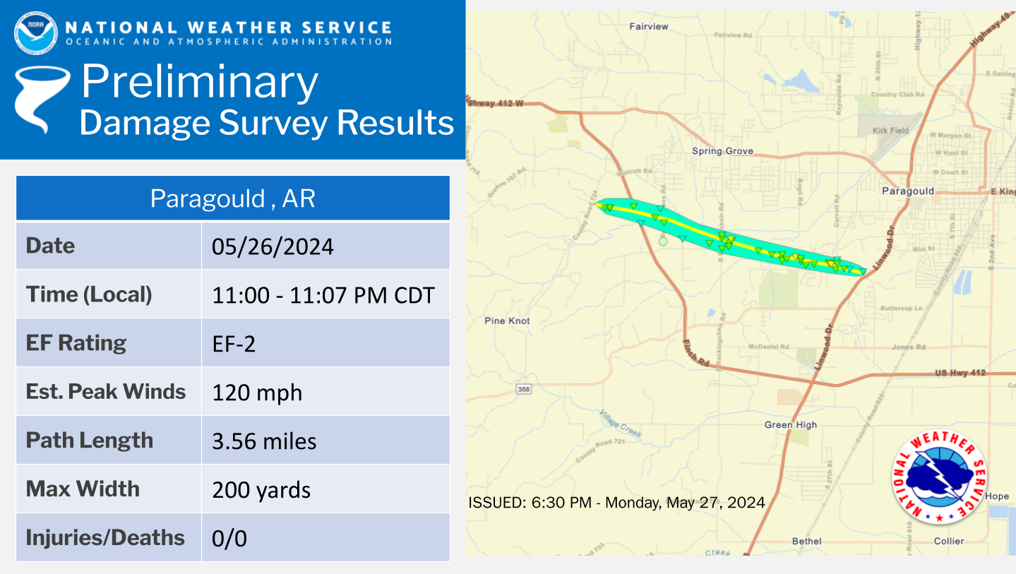
.Paragould Tornado...

Rating:                 EF2
Estimated Peak Wind:    120 mph
Path Length /statute/:  3.56 miles
Path Width /maximum/:   200 yards
Fatalities:             0
Injuries:               0

Start Date:             05/26/2024
Start Time:             11:00 PM CDT
Start Location:         3 W Paragould / Greene County / AR
Start Lat/Lon:          36.0505 / -90.5774

End Date:               05/26/2024
End Time:               11:07 PM CDT
End Location:           1 S Paragould / Greene County / AR
End Lat/Lon:            36.0376 / -90.5159

Survey Summary:
The tornado began along County Road 735 in Paragould, AR,
resulting in a few trees uprooted and snapped. Damage was also
noted to a carport which had fallen on a vehicle with only minor
roof damage to the home. The tornado continued to move east,
crossing Highway 412 and producing additional tree damage. Wind
speeds within the tornado intensified as it approached Spring
Grove Road where the first signs of significant structural damage
were noted to a home. A couple of homes suffered minor roof
damage along Pruetts Chapel Road with further intensification
noted on Rockingchair Road and Sandy Lane where significant roof
damage occurred to a residence and a couple of outbuildings were
completely destroyed.

Damage became more sporadic as the tornado moved east along Pruetts
Chapel Road, but additional significant damage to homes and trees
was noted on South 34th Street and Sandwedge Drive, along Enclave
Circle, and on Carroll Road. The maximum intensity of the tornado
was likely in this area. One home lost its entire roof and
widespread tree damage with a clear path was noted nearby. The
tornado quickly weakened as it moved to the east with the last
damage noted just to the west of Highway 49 north of Mockingbird
Lane.

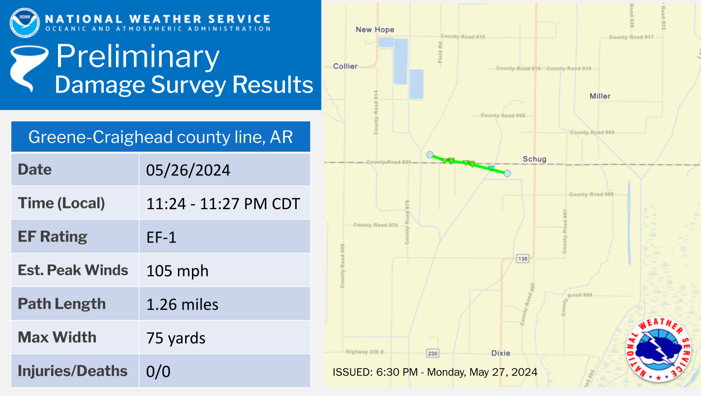
.County Line Tornado...

Rating:                 EF1
Estimated Peak Wind:    105 mph
Path Length /statute/:  1.26 miles
Path Width /maximum/:   75 yards
Fatalities:             0
Injuries:               0

Start Date:             05/26/2024
Start Time:             11:24 PM CDT
Start Location:         6 SSE Paragould / Greene County / AR
Start Lat/Lon:          35.967 / -90.4717

End Date:               05/26/2024
End Time:               11:27 PM CDT
End Location:           7 SSE Paragould / Craighead County / AR
End Lat/Lon:            35.9628 / -90.4498

Survey Summary:
This tornado developed in far southern Greene County, AR, just
east of the intersection of County Road 931 and Craighead County
Road 989 on the Greene-Craighead County line. The first sign of
damage was some farm equipment blown into an open field. Two
homes were damaged just north of County Road 931, one
significantly. The first home along suffered minor exterior
damage and a tree was snapped in its front yard.

More significant damage occurred to the house just to the east
near the intersection of 931 and Craighead County Road 991, where
much of the roof was removed and a nearby outbuilding was
completely destroyed. In addition, exterior walls from an add-on
room partially collapsed. Several power lines were also down along
County Road 931 as the tornado crossed into extreme northern
Craighead County. Mostly tree damage was noted in Craighead County
just south of Route 931 with the tornado lifting in an open field
to the west of Highway 135.

&&

EF Scale: The Enhanced Fujita Scale classifies tornadoes into the
following categories:

EF0.....65 to 85 mph
EF1.....86 to 110 mph
EF2.....111 to 135 mph
EF3.....136 to 165 mph
EF4.....166 to 200 mph
EF5.....>200 mph

NOTE:
The information in this statement is preliminary and subject to
change pending final review of the event and publication in
NWS Storm Data.