The cold winter of 2013-2014 has led to current significant snow cover for parts of the Upper Midwest, including into North Central Illinois which has actually seen snow cover since early December. Now in mid-February, the snow cover has also been sustained in the Chicago area and some locations south for over a month.
Snow cover is an important consideration for forecasters, as it can:
In addition to tracking and forecasting weather conditions over land, the NWS Chicago office also is responsible for forecasts of winds, wave heights, and weather on much of Lake Michigan. Part of the task of predicting wave heights involves knowing which parts of the lake are covered in ice. This information, which can change greatly even over the course of a day, is provided by the National Ice Center (NIC) in Suitland, Maryland. They use primarily satellite information for determining amount and type of ice coverage. The below imagery is from the NIC and is a daily loop depicting ice coverage across the lake from January 1st to the present, and one can see how quickly the ice expands in the first half of February. One reason for this is due to episodes of lighter wind speeds collocated with the bitter cold. Note some days were unavailable in this loop due to no satellite data because of extensive cloud cover over the lake.
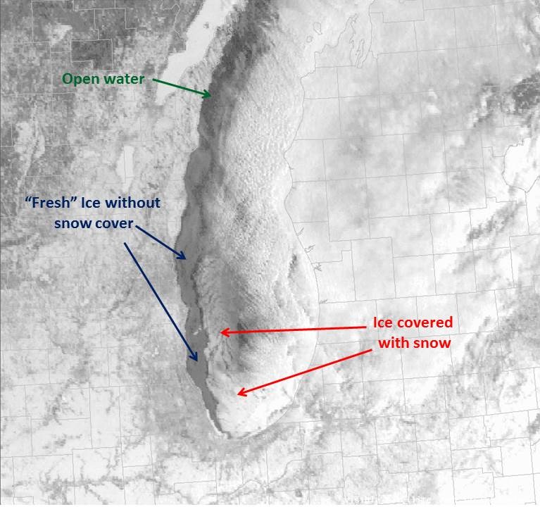
And at times one can notice both snow and ice coverage in the same location! Below is a labeled visible satellite image of Lake Michigan from February 10th depicting snow covered ice vs. "fresh" ice that had recently formed since the prior snow events on February 4th-5th and 8th.
Related Stories:

