Overview
A brief EF0 tornado occurred early Monday evening at around 6:30 pm CDT near the town of Manhattan, IL in central Will County. The only evident impacts of the tornado were some minor corn damage in a field.Tornado:
|
Tornado - Near Manhattan, IL
Track Map  
Downloadable KMZ File |
||||||||||||||||
The Enhanced Fujita (EF) Scale classifies tornadoes into the following categories:
| EF0 Weak 65-85 mph |
EF1 Moderate 86-110 mph |
EF2 Significant 111-135 mph |
EF3 Severe 136-165 mph |
EF4 Extreme 166-200 mph |
EF5 Catastrophic 200+ mph |
 |
|||||
Radar and Photos:
 |
 |
|
Annotated 4 Panel Radar Image from KLOT WSR-88D at time of weak tornado, 6:32 PM CDT 8/20/18. |
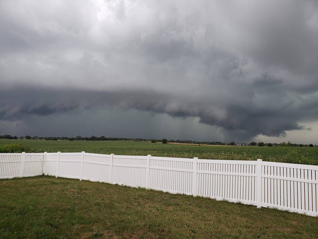
Photo from a couple miles north of where the tornado ended. |
Storm Reports: Public Information Statement
PUBLIC INFORMATION STATEMENT
NATIONAL WEATHER SERVICE CHICAGO IL
425 PM CDT WED AUG 22 2018 /525 PM EDT WED AUG 22 2018/

...NWS DAMAGE SURVEY FOR 08/20/2018 TORNADO...

.BRIEF TORNADO NEAR MANHATTAN ILLINOIS ON MONDAY EVENING...

RATING:                 EF-0
ESTIMATED PEAK WIND:    65 MPH
PATH LENGTH /STATUTE/:  0.25 MILES
PATH WIDTH /MAXIMUM/:   100 YARDS
FATALITIES:             0
INJURIES:               0

START DATE:             AUG 20 2018
START TIME:             6:31 PM CDT
START LOCATION:         1 MILE WEST OF MANHATTAN, IL
START LAT/LON:          41.4267/-88.0027

END DATE:               AUG 20 2018
END TIME:               6:34 PM CDT
END LOCATION:           1 MILE WEST OF MANHATTAN, IL
END_LAT/LON:            41.4306/-88.0021

ON WEDNESDAY MORNING, AUGUST 22, A SPOTTER REPORTED HAVING SEEN A
FUNNEL BRIEFLY TOUCH DOWN MONDAY EVENING IN AN AREA THAT THE NWS
HAD BEEN MONITORING CLOSELY ON RADAR AT THE TIME. A GROUND SURVEY
WEDNESDAY AFTERNOON REVEALED MULTIPLE PATCHES OF FLATTENED CORN
IN A FIELD ALONG GOUGAR ROAD NEAR MANHATTAN, IL. THE STALKS WERE
ALL LAYING TOWARD THE NORTHEAST. THEY WERE ALSO QUITE DRY AND
COULD BE SNAPPED OVER WITH LITTLE PRESSURE, BUT ENOUGH RADAR AND
EYEWITNESS EVIDENCE EXISTS TO SUGGEST THERE WAS BRIEFLY A BROAD
AND WEAK CIRCULATION ON THE GROUND.

EF SCALE: THE ENHANCED FUJITA SCALE CLASSIFIES
TORNADOES INTO THE FOLLOWING CATEGORIES.

EF0...WEAK......65 TO 85 MPH
EF1...WEAK......86 TO 110 MPH
EF2...STRONG....111 TO 135 MPH
EF3...STRONG....136 TO 165 MPH
EF4...VIOLENT...166 TO 200 MPH
EF5...VIOLENT...>200 MPH

NOTE:
THE INFORMATION IN THIS STATEMENT IS PRELIMINARY AND SUBJECT TO
CHANGE PENDING FINAL REVIEW OF THE EVENT AND PUBLICATION IN
NWS STORM DATA.

$$

LENNING
 |
Media use of NWS Web News Stories is encouraged! Please acknowledge the NWS as the source of any news information accessed from this site. NWS Chicago Science & Past Events Page |
|

