|
|
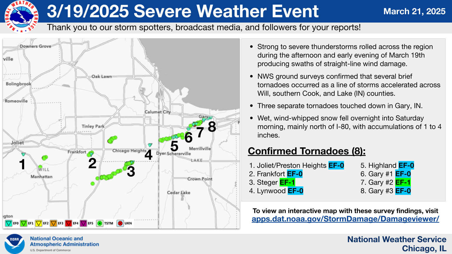
Overview
Page last updated: 6:00 PM CDT Friday March 28, 2025
Tornadoes
|
Downloadable KMZ File with All Tornado Tracks Downloadable Shapefile with All Tornado Tracks
Below is a summary of all of the NWS damage survey findings in the NWS Chicago forecast area from this severe weather event. An interactive map with all of this information can be found on our Damage Assessment Toolkit Viewer website (to see the data from this event, make sure that the date range in the top right corner includes this event's date). Instructions for how to download KMZ files and shapefiles with our survey data are available here. |
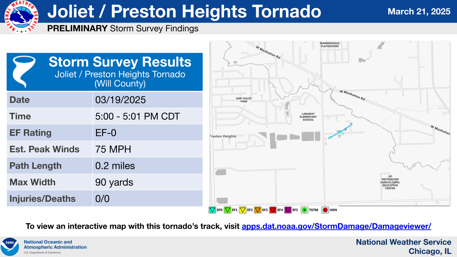
1.) Joliet/Preston Heights Tornado
|
(click on image to enlarge) |
|
Summary: A tornado touched down just southeast of the intersection of Rowell Avenue and Eunice Avenue. This brief tornado moved east northeast across Eunice Avenue, causing shingle damage to one house and uprooting a few trees. Metal panels and pieces of a car port were blown to the northeast at least 200 yards, and one vehicle was blown over. Peak winds were estimated at 75 mph. This tornado dissipated near Howliston Court. |
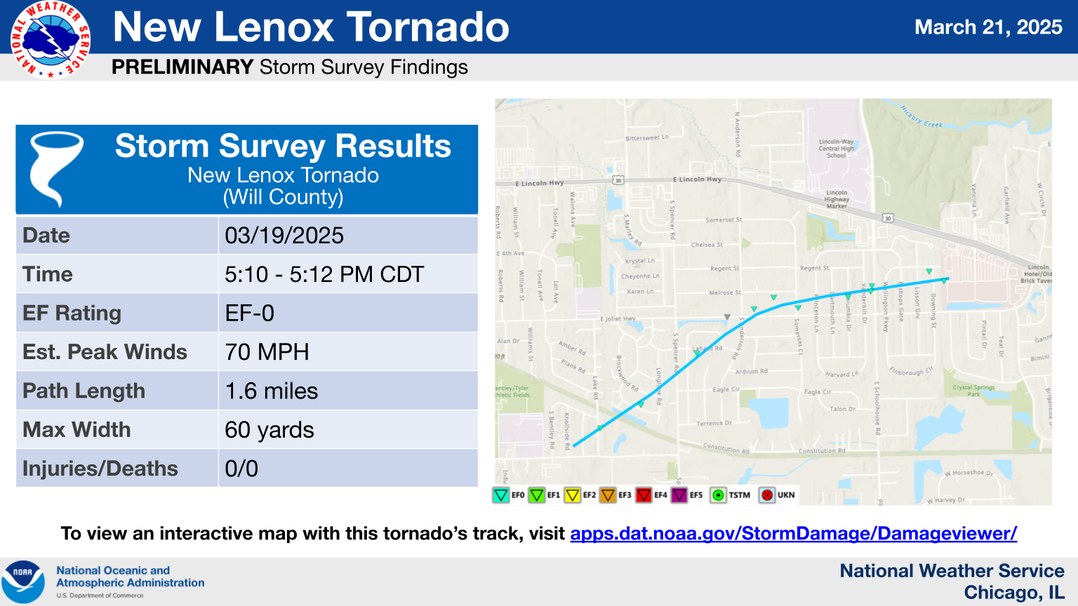
2.) New Lenox Tornado
|
(click on image to enlarge) |
|
Summary: This brief tornado began in a subdivision just east of the Arnold J. Tyler Elementary school. It continued to the northeast and crossed Joliet Highway near Anderson Road and then turned eastward, causing shingle, tree, and fencing damage to houses on either side of Schoolhouse Road. Damage became sporadic as the tornado lifted and dissipated the Bluestone Commons Retail Center. Damage along the track was consistent with an EF-0 tornado with peak winds near 70 mph. |
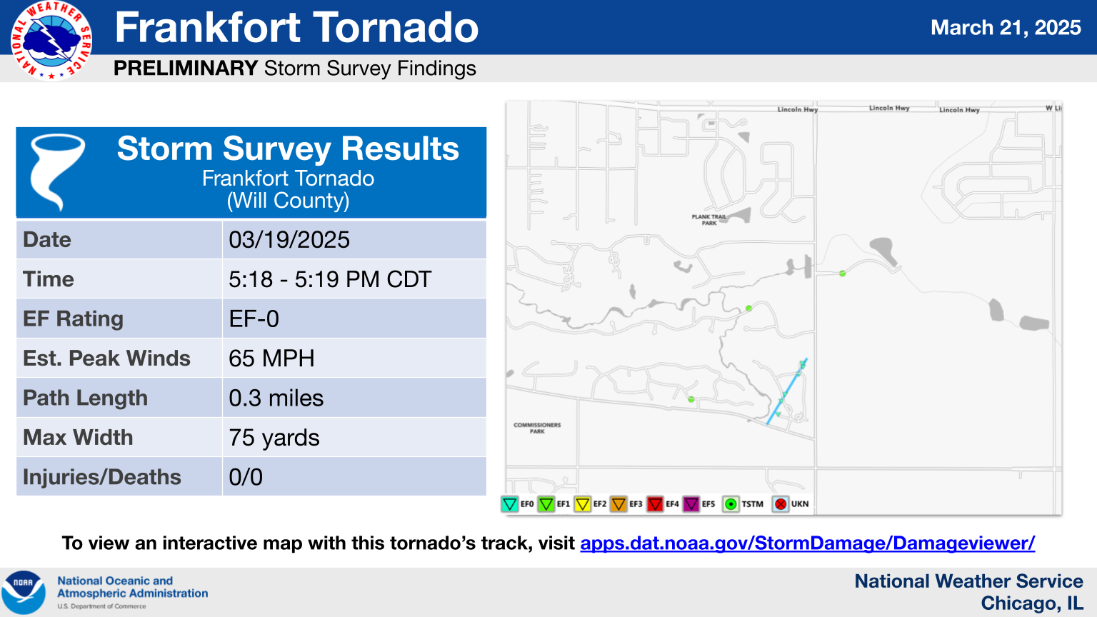
3.) Frankfort Tornado
|
(click on image to enlarge) |
|
Summary: A tornado briefly touched down near Sauk Trail near the Sauk Trail Forest Preserve in Frankfort. This tornado moved to the north northeast into a residential area along Shetland Drive and Troon Circle. Damage was mostly confined to broken branches and a few small uprooted trees. Peak winds were estimated at 65 mph. The tornado dissipated just past this neighborhood near Harlem Avenue. |
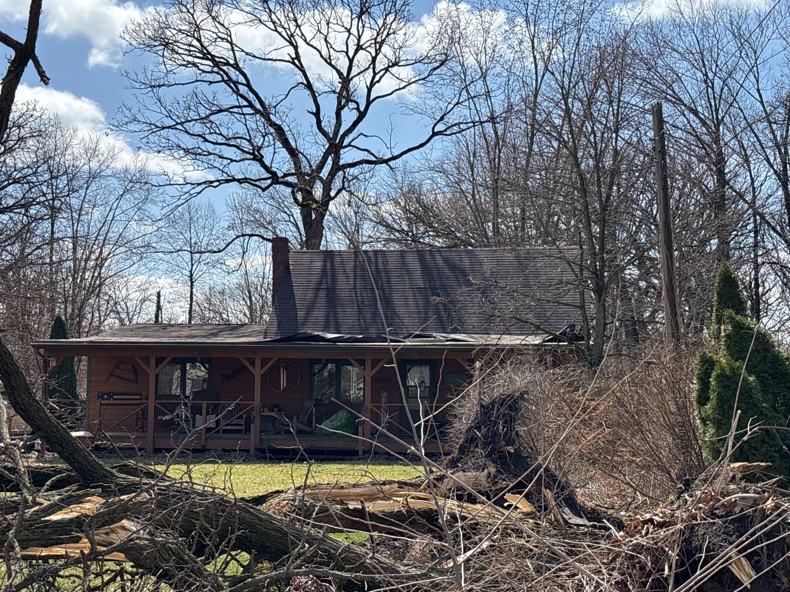
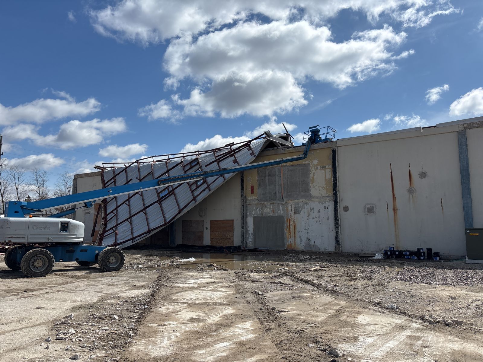
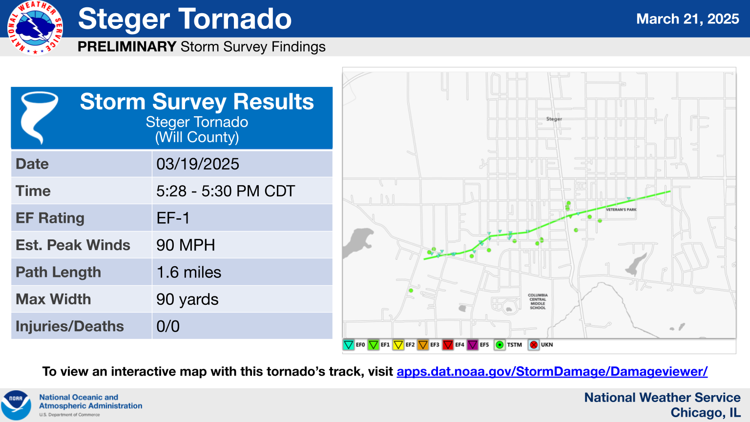
4.) Steger Tornado
|
(click on image to enlarge) |
|
Summary: A tornado touched down near Kings Road south of Richton Road in Steger. This tornado moved east northeast toward Richton Road, intensified briefly, causing damage to shingles at multiple houses. Wind speed was estimated up to 80 mph in this area. The tornado continued east northeast through residential areas, weakening slightly, with damage mostly confined to broken branches. The tornado again intensified briefly as it neared IL-1 where a large section of metal roof panels was removed from a metal warehouse building. Wind speeds were estimated at 90 mph in this area. Debris from the warehouse was blown across nearby railroad tracks. The tornado weakened as it moved into another residential area, with damage confined to broken branches. The tornado dissipated near Hereford Avenue and Durham Drive. |
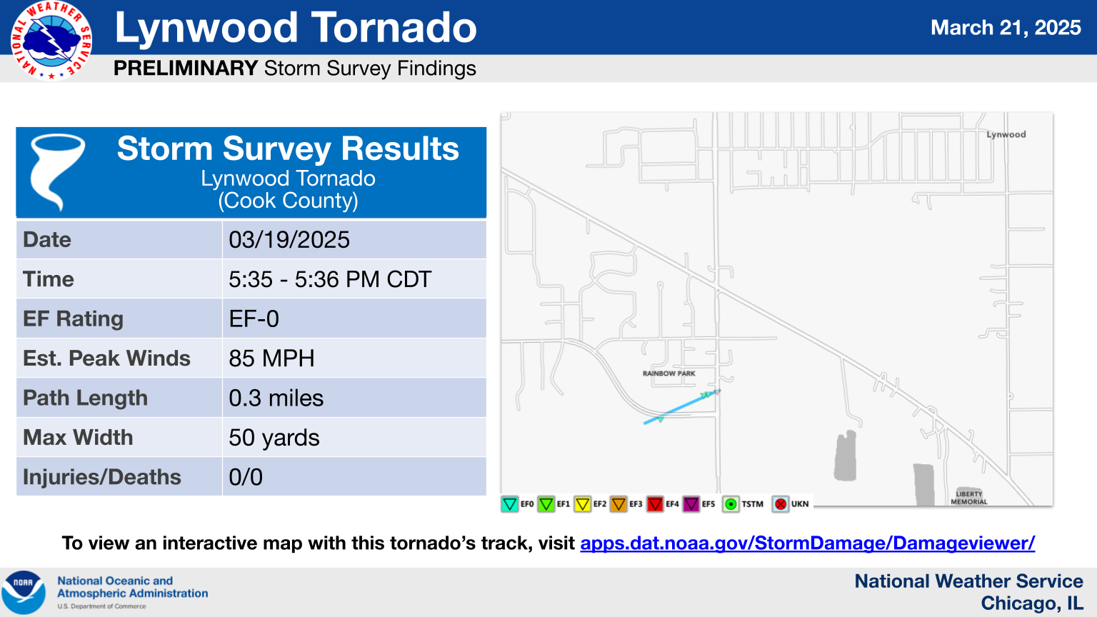
5.) Lynwood Tornado
|
(click on image to enlarge) |
|
Summary: A tornado touched down near Joe Orr Road west of Torrence Avenue in Lynwood. This brief tornado caused damage to the roof of two industrial buildings with winds estimated at 85 mph. Pieces of debris were blown onto Torrence Avenue. The tornado dissipated shortly after it crossed Torrence Avenue. |
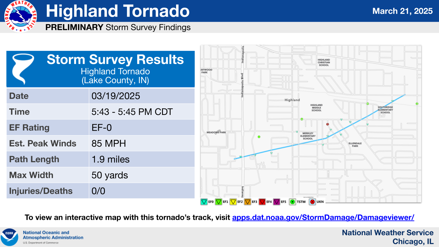
6.) Highland Tornado
|
(click on image to enlarge) |
|
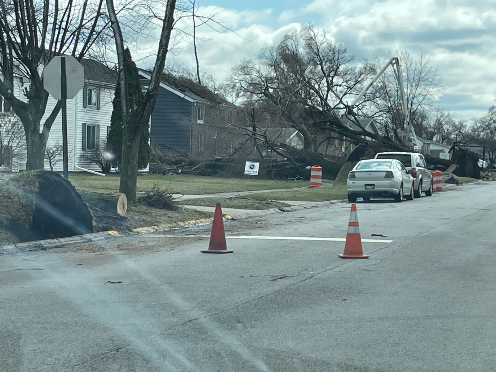
Summary: A tornado touched down just northwest of the intersection of US-41 and 45th Street in Highland. This tornado first caused damage to the roof of a commercial building on US-41, then continued east northeast into a residential area near Merkley Elementary School where damage was mostly small branches broken and a few instances of shingle damage. The tornado briefly intensified as it neared Forrest Drive and Sac Drive, with a few trees uprooted and multiple large branches broken. One large tree was uprooted onto a house, causing roof damage. Winds were estimated at 85 mph in this neighborhood. Fences were also damaged in the vicinity. The tornado continued northeast toward the residential area near Southridge Elementary School, where damage was mostly confined to small branches. The tornado dissipated near Wirth Road just west of Kleinman Road. |
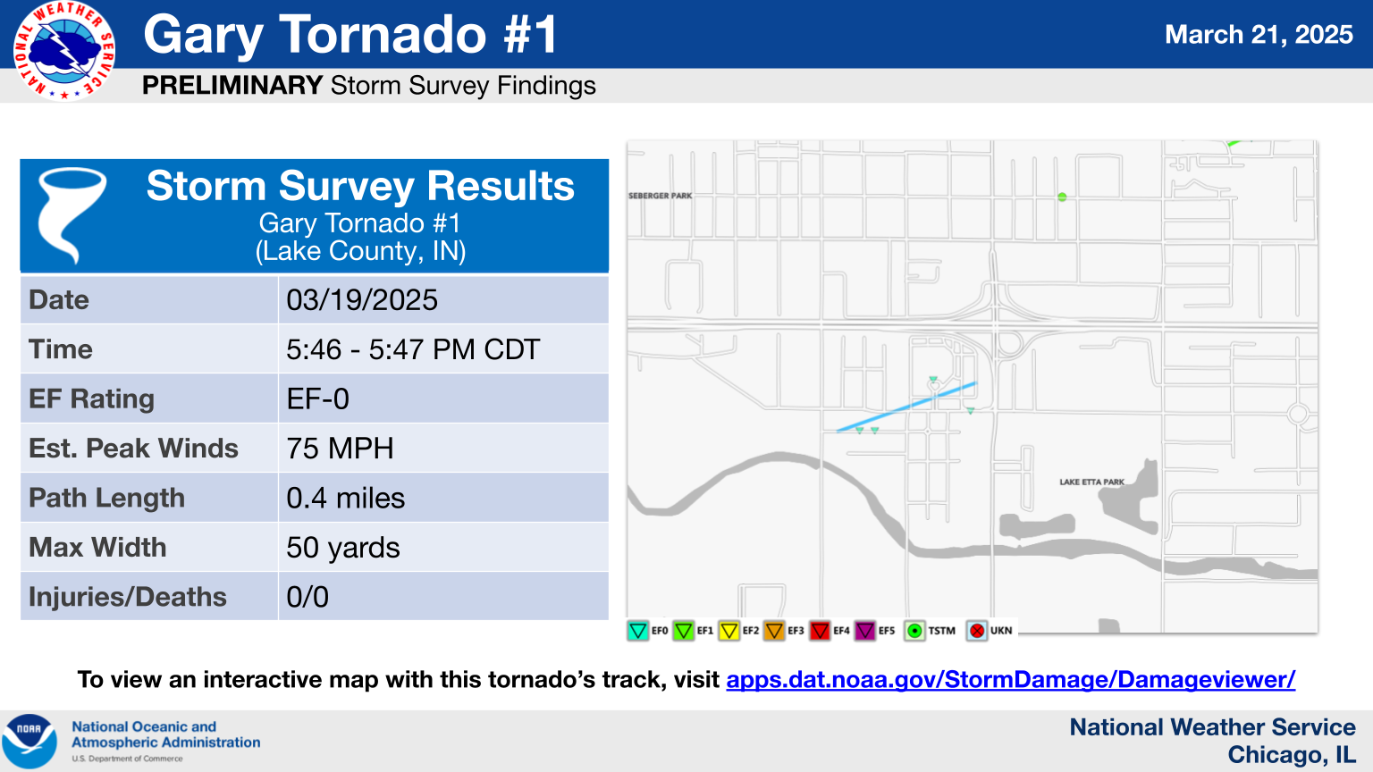
7.) Gary Tornado #1
|
(click on image to enlarge) |
|
Summary: A tornado touched down near West 29th Place, just east of Colfax Street in Gary. This brief tornado uprooted two large trees with estimated winds of 75 mph, as well as blowing out the glass doors at the entrance of the Hard Rock Casino. The tornado dissipated shortly after passing the casino before Burr Street. |
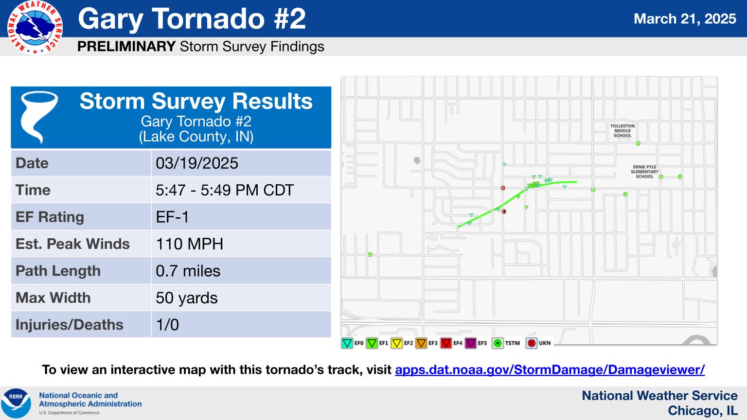
8.) Gary Tornado #2
|
(click on image to enlarge) |
|
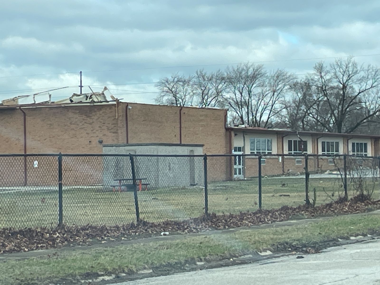
Summary: A tornado touched down near Morton Street between West 23rd Avenue and West 22nd Plaza in Gary. This brief tornado ripped the roof off Frankie Woods McCullough Academy gymnasium, blew out the garage and ripped off the roofs of several homes on west 21st Avenue, as well as bent several power poles and light fixtures. Officials reported an adult female was injured due to part of the roof collapsing onto them. They were taken to the hospital and were reported to be in stable condition. The tornado dissipated just before the New Revelation Baptist Church on West 21st Avenue, just before Chase Street. |
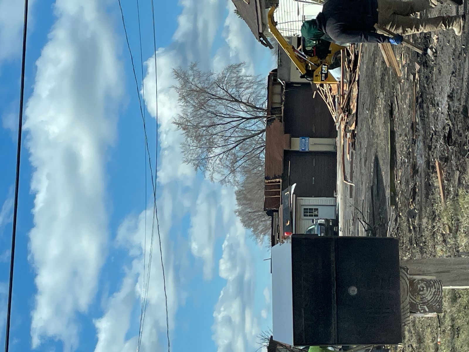
9.) Gary Tornado #3
|
(click on image to enlarge) |
|
Summary: A tornado touched down near Norton Park, just south of West 13th Avenue in Gary. This brief tornado blew tree debris across roadways and uprooted several small trees east of the Gary Business District with estimated winds of 70 mph. The tornado dissipated around MLK Drive, just north of East 7th Avenue before reaching the Dunes Highway. |
The Enhanced Fujita (EF) Scale classifies tornadoes into the following categories:
| EF0 Weak 65-85 mph |
EF1 Moderate 86-110 mph |
EF2 Significant 111-135 mph |
EF3 Severe 136-165 mph |
EF4 Extreme 166-200 mph |
EF5 Catastrophic 200+ mph |
 |
|||||
When a tornado is known to have occurred but does not cause damage to any qualified damage indicators, or if the only damage is located in an area that is inaccessible to NWS storm survey personnel, then a tornado may be assigned the EF-Unknown (EF-U) rating.
Photos
 |
 |
 |
| Tree and roof damage in Steger, IL (NWS Storm Survey) | Peeled-back roof on the north end of a warehouse on Route 1 (Chicago Rd) in Steger, IL (NWS Storm Survey) | Lynwood, IL (NWS Storm Survey) |
 |
 |
 |
| Highland, IN (NWS Storm Survey) | Damage from the Gary #2 Tornado (NWS Storm Survey) | Damage from the Gary #2 Tornado (NWS Storm Survey) |
Radar
|
(Click to enlarge loop) Radar loop (roughly 4-6 PM) showing the evolution of a line of strong to severe thunderstorms. |
Environment
 |
 |
 |
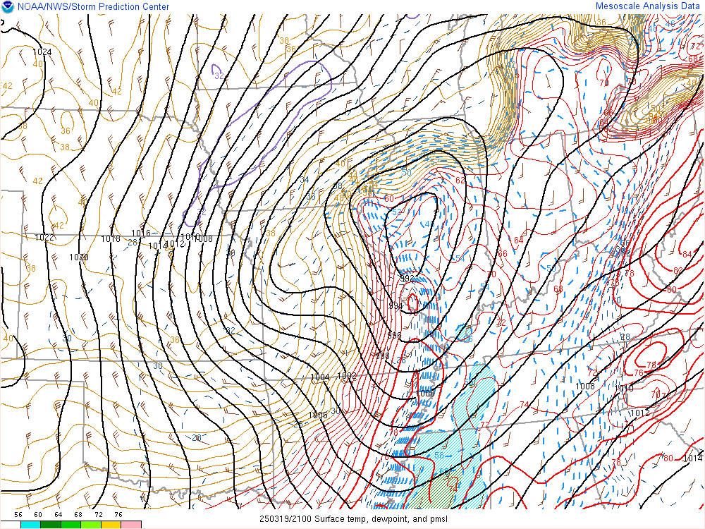
| Surface analysis at 4 PM showing a strong area of low pressure across central Illinois and a stationary front near I-80. | Mixed-layer CAPE analysis at 5 PM showing sufficient instability for severe weather. | Deep layer shear analysis showing values in excess of 40 knots, sufficient for organized severe thunderstorms. |
Subsequent Snow
 |
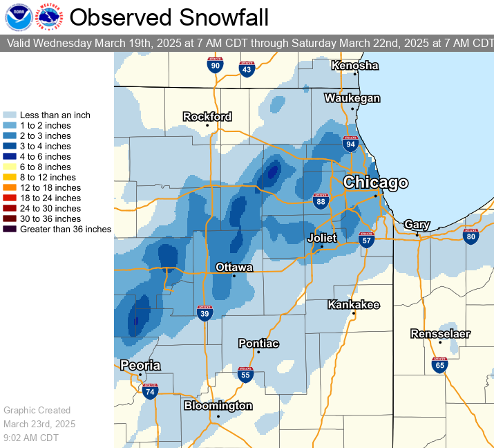 |
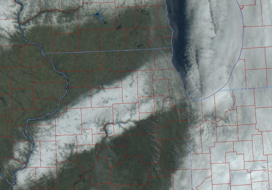
| "True color" satellite image from early Thursday morning showing a swath of snow stretching from near Galesburg into Chicago and the north and west suburbs. Nearly all of this snow had melted by late afternoon. Image courtesy of the College of DuPage (see https://weather.cod.edu/satrad) | Snowfall analysis. A very wet and heavy 1 to 3 inches of snow fell across the region Wednesday night/early Thursday morning. |
 |
Media use of NWS Web News Stories is encouraged! Please acknowledge the NWS as the source of any news information accessed from this site. Additional event recaps can be found on the NWS Chicago Past Events Page |
|


