Overview
|
Fast Facts:
|
 |
Tornado:
|
Tornado - NORTH SIDE OF WAUKEGAN
Track Map
|
||||||||||||||||
The Enhanced Fujita (EF) Scale classifies tornadoes into the following categories:
| EF0 Weak 65-85 mph |
EF1 Moderate 86-110 mph |
EF2 Significant 111-135 mph |
EF3 Severe 136-165 mph |
EF4 Extreme 166-200 mph |
EF5 Catastrophic 200+ mph |
 |
|||||
Photos:
 |
 |
 |
 |
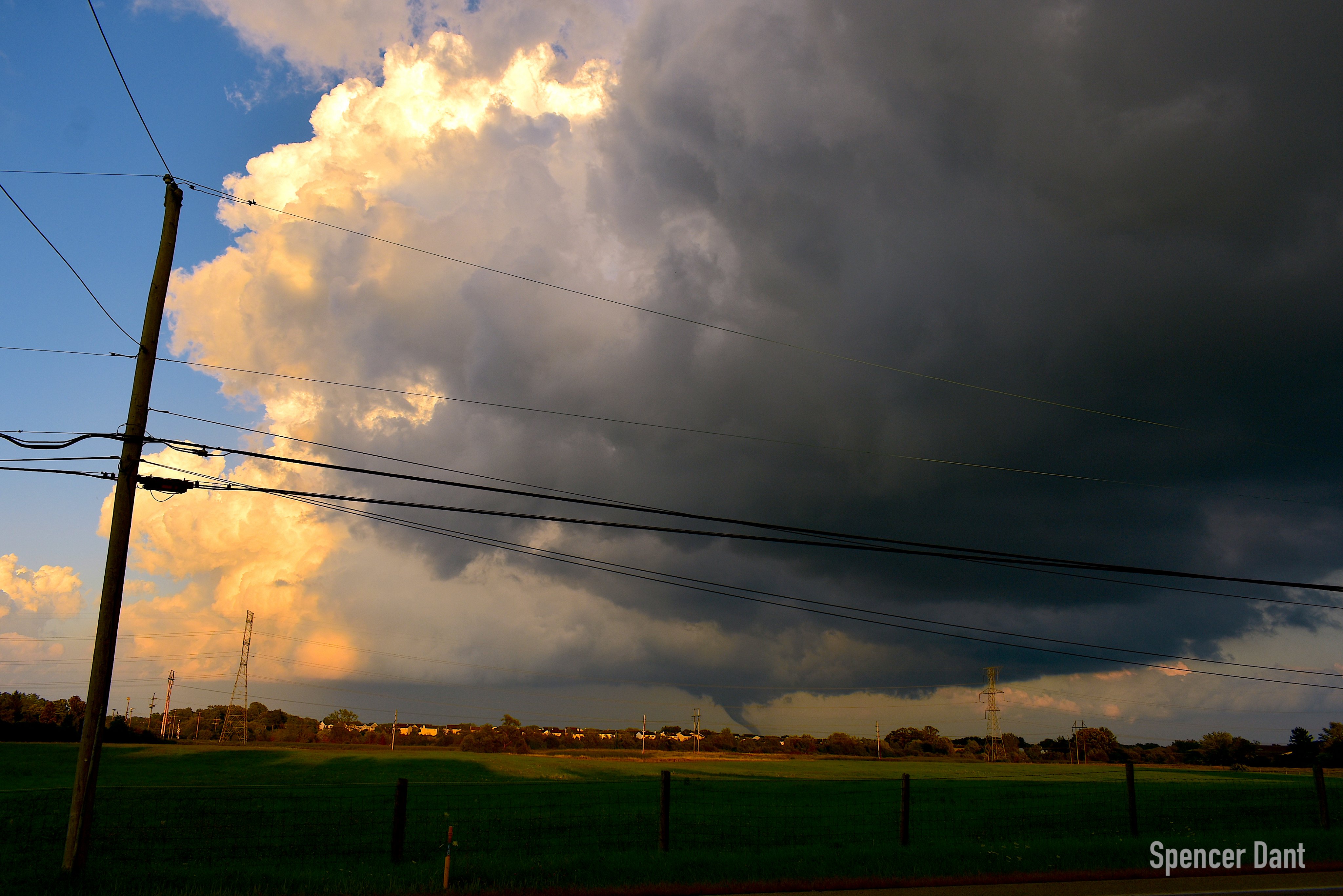
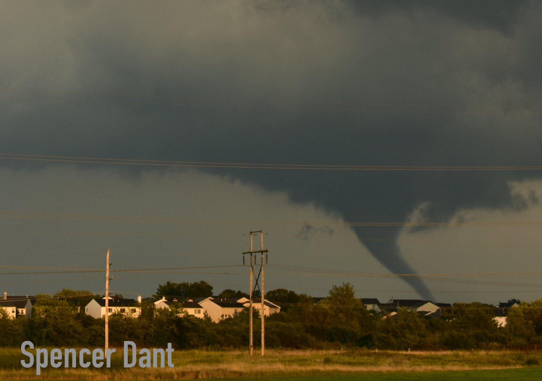
| Photos of the tornado as it developed near the York House Road & Lewis Avenue intersections near the Waukegan Airport. Photos courtesy of Spencer Dant. | |||
Radar:
|
|
Environment
 |
 |
||
| Satellite water vapor imagery depicting a strong upper system for early September moving across the Great Lakes. The local area is on the far southern edge of the stronger forcing for deep lift. This lift in tandem with enough moisture and instability can assist in deeper thunderstorms. The Waukegan area storm can be seen on this satellite band but almost not until it is out over the lake and deep enough. | Hand surface analysis from 2 pm on September 3, with observations, fronts, and other features plotted. |
 |
| NWS Storm Prediction Center (SPC) RAP Model mesoanalysis graphics. The upper left is deep layer shear showing >50 kt, more than sufficient for storm organization and supercells, which was the expected storm mode for the day. The upper right depicts effective storm relative helicity, with much of this located in the lowest 1 km. In the lower left is mixed-layer CAPE (instability) which was around 3,000 J/kg. Combined with the shear, this spectrum space is plenty sufficient for supercells with rapidly accelerating updrafts. However, the convective inhibition (CIN) had just eroded or quite possible was not completely eroded despite the model above indicating it had over such a large area. We suspect that was the case because storms were very isolated ahead of the cold front throughout the entire evening. Finally, and maybe one of the most important for this case of tornadogenesis, is the lower right plot of 0-3km CAPE and surface vorticity. The values in excess of 100 J/kg are very high and indicate quickly accelerating updrafts in the low-levels. This |
Takeaways
The Lake County tornado reminds us that it is still thunderstorm season and severe weather can happen in September and actually can anytime of the year.
The warning process includes radar analysis, environmental analysis, and what our trained storm spotters are reporting. Despite recent advances in tornado forecasting, there are still some tornadoes that go unwarned. These are primarily the shorter-lived, quickly developing tornadoes, as opposed to the significant, long-track ones.
This quickly-developing tornado formed out of what is known as a "Low precipitation" and "Miniature Supercell." Miniature supercells are still rotating thunderstorms, but are smaller in spatial and vertical extent. This supercell also produced very little rainfall, hence the "Low Precipitation" terminology. The wind fields in these types of supercells are much more difficult for the Doppler Radar to "see" than the larger "Classic" or "High Precipitation" supercells, which makes the tornadic signatures much more difficult to detect. Only about 20-25% of supercells ever produce tornadoes.
We are in the process of researching this event and will continue to in the coming weeks in order to better understand the event evolution.
Forecasts for multiple days and leading up to the event had noted the potential for severe weather, including tornadoes, in northern Illinois and northwest Indiana. It's a good practice to check your forecast daily, especially hazardous weather potential (such as our EHWO and Weather Story graphics), and if there is a threat for severe weather to check the forecast more frequently and be vigilant when skies darken.
While tornadoes themselves are rare, basic thunderstorm safety is important and the first step in severe weather safety too. We like to say when thunder roars, go indoors!
 |
Media use of NWS Web News Stories is encouraged! Please acknowledge the NWS as the source of any news information accessed from this site. Additional recaps can be found on the NWS Chicago Past Events Page |
 |