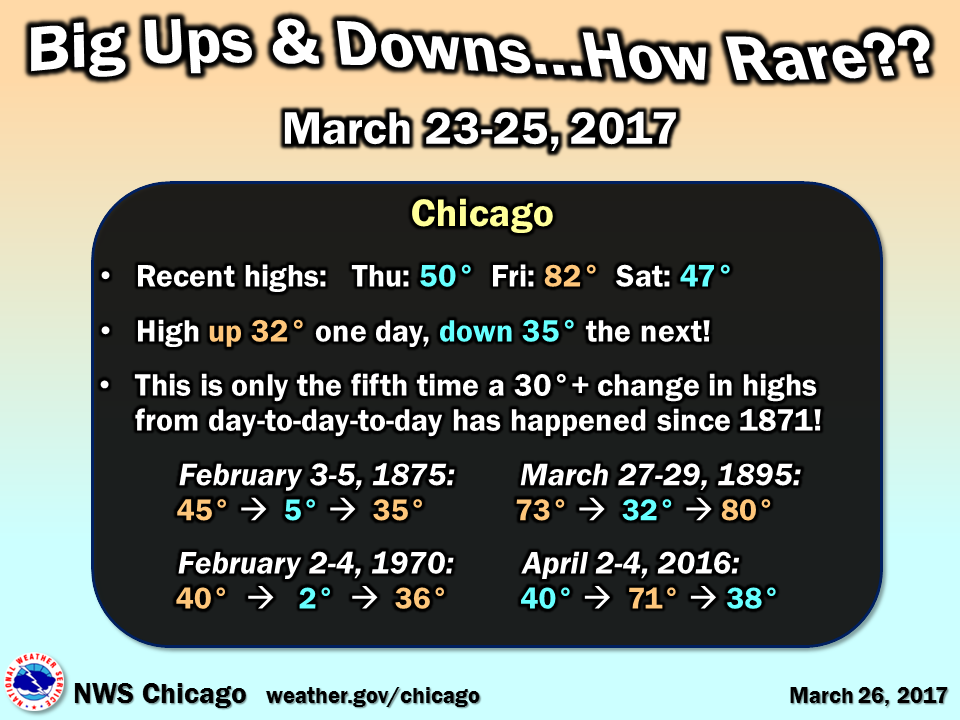
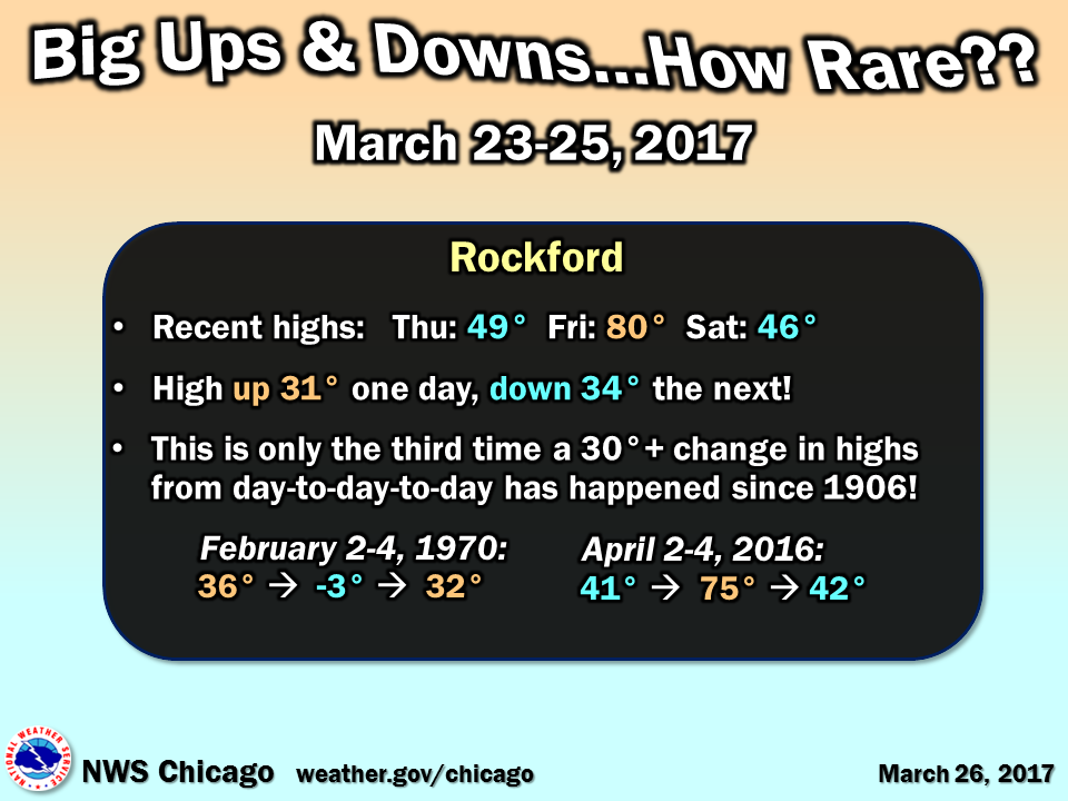
March 23-25, 2017 Day-to-Day Change
 |
 |
||
| Chicago temperature change from March 23-25, 2017 | Rockford temperature change from March 23-25, 2017 |
Near-Record Quick Temperature Drop on March 24
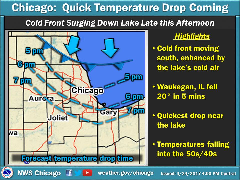
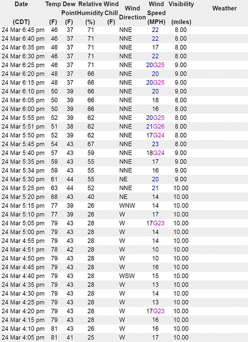
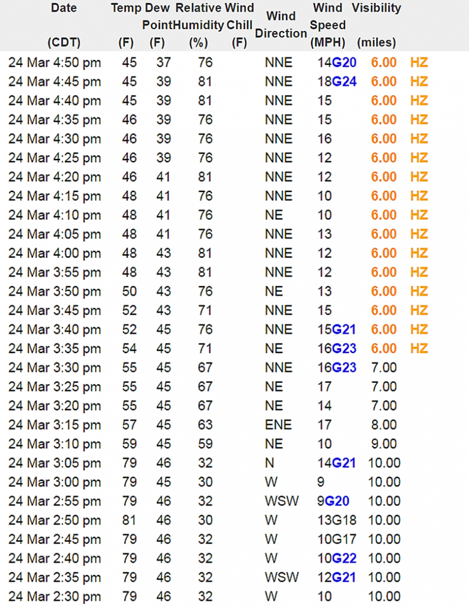
March 24, 2017 brought a sharp late afternoon temperature fall to northeast Illinois and far northwest Indiana. This includes a 20° drop in five minutes near the lake front, and around 30° in just 30-60 minutes!
The meteorological feature responsible for this was a cold front, but one with strong lake enhancement. While this marine enhancement to a cold front can happen over the early spring chilled waters of the Great Lakes, to this extreme of magnitude is rare. These type of cold fronts are sometimes referred to as pneumonia fronts by meteorologists. These cold fronts tend to progress rapidly southward down the lake and shoreline areas due to the strong density and pressure differences between the air mass behind the front and ambient air mass ahead of it.
 |
 |
||||
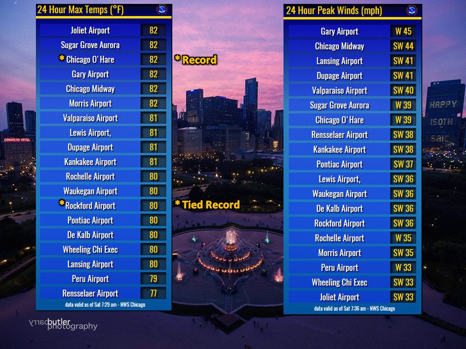
| March 24 Observed Highs and Peak Gusts | March 24 Graphical NOWcast of Pneumonia Front |
On Friday, March 24, strong southwest winds had steered in near-record to record warm air, with mid-afternoon highs in the lower 80s. Both Chicago and Rockford had only seen four other years reaching 80°+ this early in the season. Lake Michigan water temperatures on the other hand were in the upper 30s to lower 40s. As a cold front slowly moved down the lake during the daytime hours (peak heating over land), this thermal contrast set the stage for the surging cold front.
|
|
 |
|||
| Chicago O'Hare Temperatures | Chicago O'Hare Observations |
|
|
 |
|||
| Waukegan Temperatures | Waukegan Observations |
Other significant temperature drops in Chicago's history include:
NWS Chicago Science & Past Events Page