
Life-threatening, potentially catastrophic flash flooding expected along the central Gulf Coast as the remnants of Arthur track across the area. Isolated brief tornadoes and damaging gusts remain possible overnight in the Southeast. Isolated to scattered dry thunderstorms may cause lightning-ignited fires and erratic behavior due to gusty winds across parts of the West Friday. Read More >
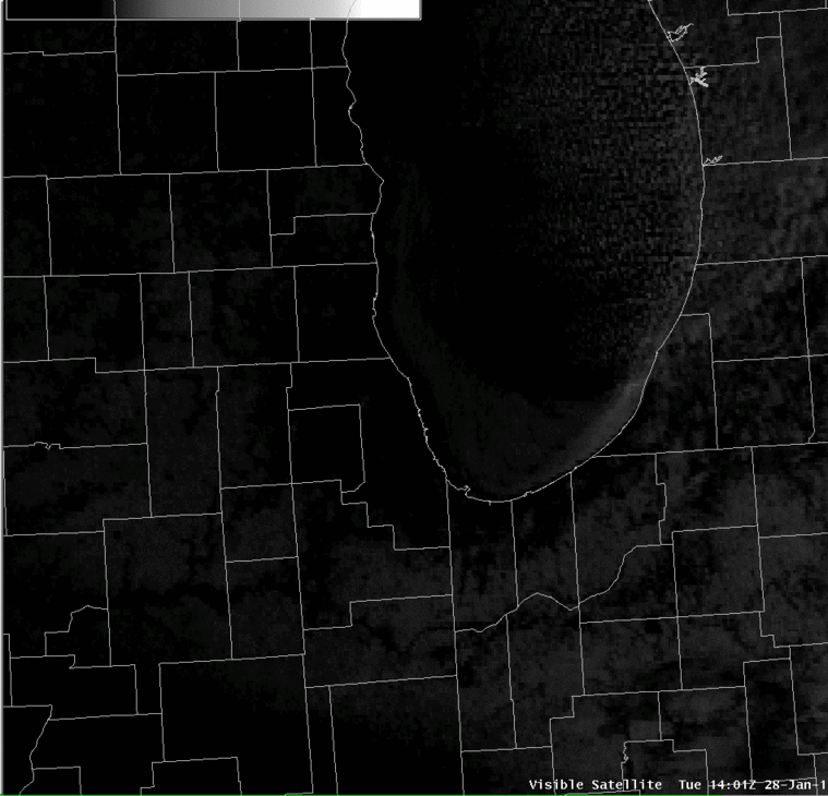
In addition to tracking and forecasting weather conditions over land, the Chicago NWS office also is responsible for forecasts of winds, wave heights, and weather on much of Lake Michigan. Part of the task of predicting wave heights involves knowing which parts of the lake are covered in ice. This information, which can change greatly even over the course of a day, is provided by the National Ice Center (NIC) in Suitland, Maryland. On Tuesday, 28 January 2014, clear skies and a steady west wind provided perfect conditions for viewing relatively rapid ice movements on Lake Michigan, both from a NOAA webcam on the Harrison Crib and from a NOAA satellite.
Below is a NOAA GOES satellite loop from 9 AM through 2:30 PM CST. In the early images with a lower sun angle, it is a little hard to see the ice starting to move away from the Illinois and Wisconsin shore. In later images the growing gap between the ice and the shoreline becomes more apparent. East of the ice-covered area and into lower Michigan, clouds are forming as bitter cold air moves west to east over the relatively warm water.
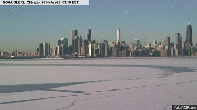
The loop below shows the view from a webcam on Chicago's Harrison Crib. This camera is operated by NOAA's Great Lakes Environmental Research Laboratory (GLERL) in Ann Arbor, MI. The loop, which runs from 8:10 AM through 2:00 PM CST, covers approximately the same time period as the satellite image above. In the early images it is possible to see a few breaks in the ice, as well as a narrow gap right along the Chicago shoreline. In later images the lake has almost entirely opened up and the warm water is starting to steam (just like Gordon Lightfoot described). In these later frames it also looks like someone drew a word in the snow by shuffling over the ice while it was still close to shore, though that might just be an effect of the motion of the ice. Either way, such an act would have been extremely dangerous.
The two images below from the National Ice Center show the change in ice conditions on the western Great Lakes from two weeks ago. The first image, from 14 January 2014, shows relatively little ice coverage across both Lake Superior and Lake Michigan. The second image, from 28 January 2014, shows how much ice has formed on both lakes as a result of the bitterly cold air over the area in recent days.


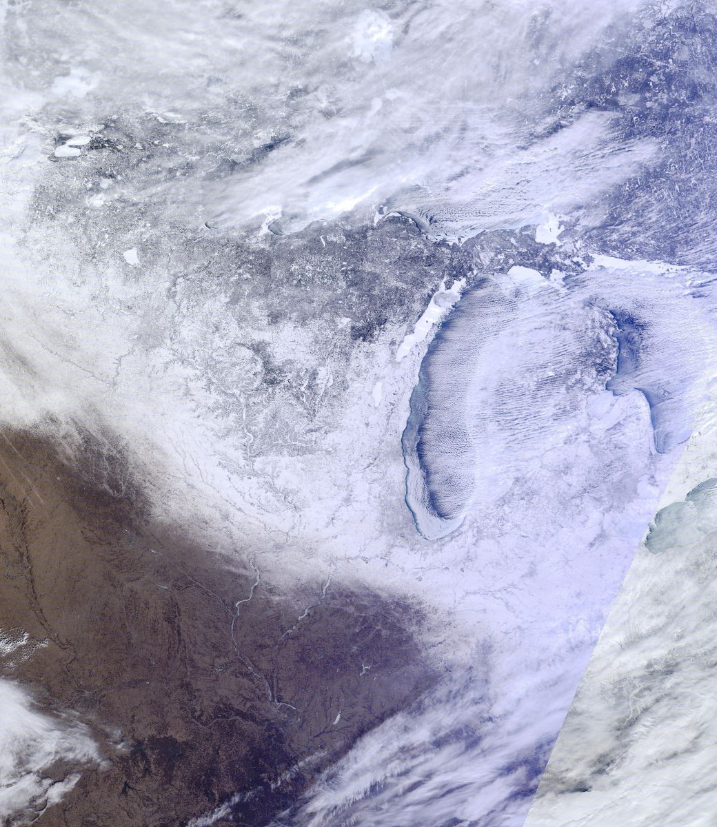
The final image below, also obtained on 28 January, is from the MODIS Terra satellite. It shows a hi-res color view of the ice, snow, and cloud coverage around southern Lake Michigan. Click on the image for a high-resolution view of the entire western Great Lakes.
Author: EML

