Rainfall | Thunderstorms | Storm Reports | Why so Active? | Photos | Other Links

June 17-21 Rainfall Totals
PUBLIC INFORMATION STATEMENT
NATIONAL WEATHER SERVICE CHICAGO IL
347 AM CDT SUN JUN 22 2014 /447 AM EDT SUN JUN 22 2014/

...FIVE DAY RAINFALL TOTALS FROM JUNE 17-21 2014...

LOCATION                         AMOUNT
-----------------------------------------
AURORA AIRPORT                   3.93 IN.
CHICAGO DUPAGE AIRPORT           3.11 IN.
CHICAGO MIDWAY INTL AIRPORT      1.95 IN.
CHICAGO O`HARE INTL AIRPORT      2.26 IN.
CHICAGO EXECUTIVE AIRPORT        1.49 IN.
ROCKFORD                         3.81 IN.
ROMEOVILLE                       3.04 IN.
VALPARAISO                       3.10 IN.
WAUKEGAN                         2.13 IN.

THE 3.81 INCHES OBSERVED AT ROCKFORD IS THE MOST IN A FIVE DAY
SPAN SINCE BASICALLY ONE YEAR AGO...WHEN 4.81 INCHES WERE
OBSERVED BETWEEN JUNE 22-26 2013.

$$

MTF
|
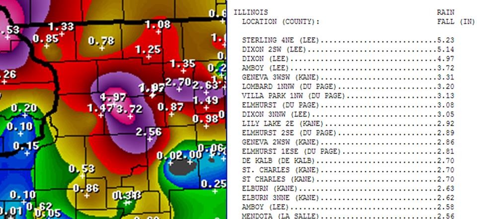
June 18th-19th a.m. Rainfall Reports |
|
|
Rainfall Reports from June 18th-June 20th
|
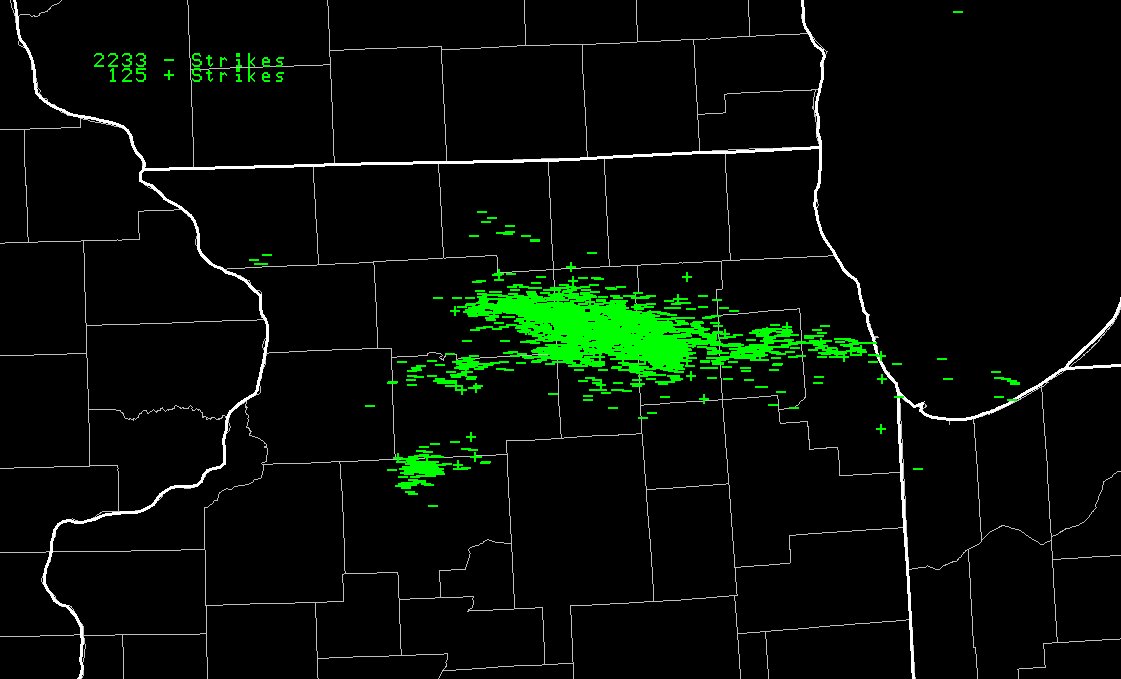
Cloud-to-Ground Lightning on June 19th from 6 pm to 7 pm |
|
|
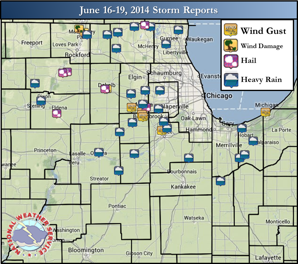
Local Storm Reports From June 17th-19th
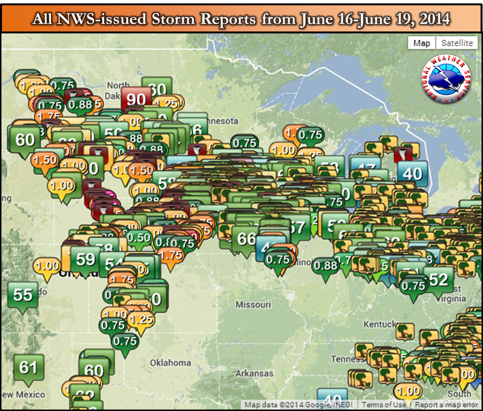
June 21st Severe Weather & Heavy Rain Event
The "Why" Behind the Active Pattern
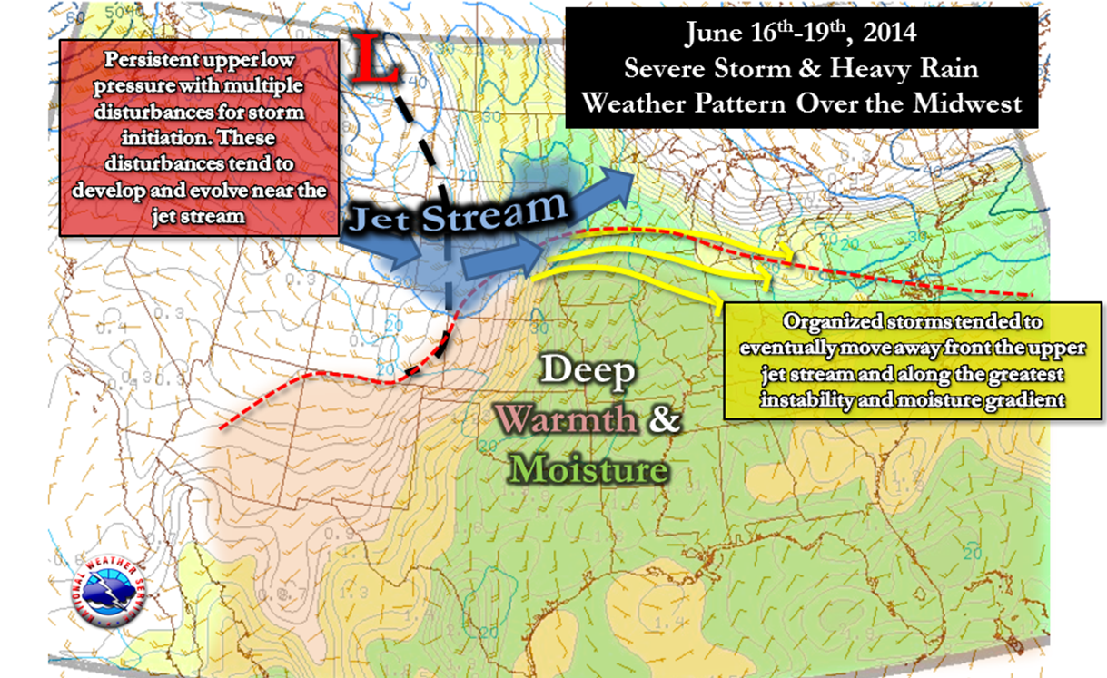
The weather pattern established across the United States was one conducive for numerous rounds of thunderstorms tracking over the same areas, including northern Illinois and northwest Indiana. A strong slow-moving upper level weather system continued to evolve within an active jet stream, and because of that multiple disturbances emanated from this. Each of these triggered robust thunderstorms, namely across South Dakota, Nebraska, southern Minnesota, and northern Iowa. Some of these places experienced tornadoes as well as substantial flash flooding. Storms tended to morph, or congeal, and drive themselves eastward feeding on the instability and moisture. These complexes were the main mode across northern Illinois and northwest Indiana. Severe weather was not that common here because the storms lacked the forcing and shear that was deeper in the atmosphere, such as seen to the west of the area. Despite very efficient rainfall rates in some of these complexes of storms, somewhat dry antecedent conditions across much of the forecast area prevented flash flooding.
|
|
 |
|
|
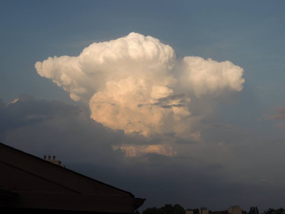
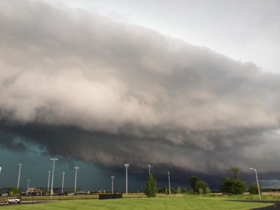
Cumulonimbus viewed from Schaumburg, IL courtesy of Donna Boomgarden |
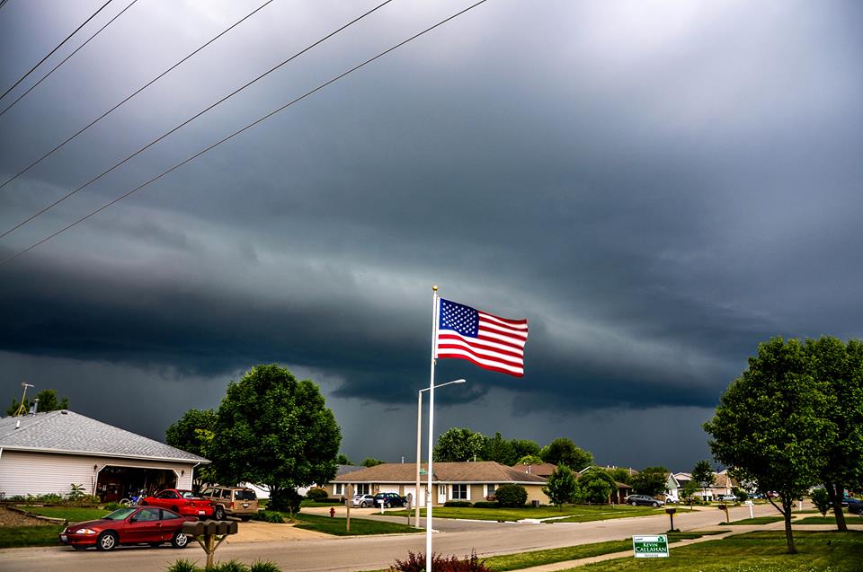
Montgomery on June 18th courtesy of Katie Ode. |
 |
 |
 |
|
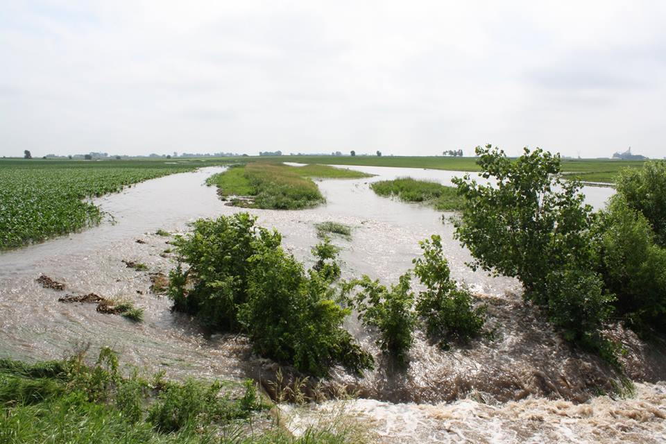
Flooding in Lee County observed on the morning of June 19th, courtesy of Lee County Emergency Management |
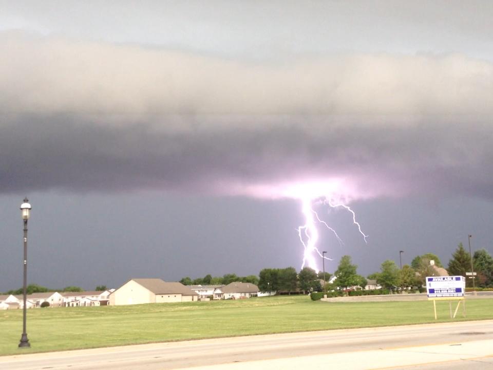
Bourbannais on June 19th, courtesy of David Fisher. |
Coal City on June 19th, courtesy of Rick Lee. |