Sunday saw a strong cold front move through the region in the early to mid-morning hours, which turned winds northwesterly and ended the mild temperatures we had seen earlier in the weekend. Behind this front was a cloud layer with a depth between ~700ft and 5000ft that rapidly expanded across the area. As the cold air continued to funnel in, the regime actually enabled some weak lift within this cloud layer, possibly helping condensation. In addition, as the cold air advanced within the cloud layer winds turned and increased in speed markedly over a very short vertical distance. This favored these supercooled droplets to collide and coalesce, and thus grow and fall as drizzle or even light rain. With temperatures at the surface falling further below freezing, this allowed the liquid to freeze on contact with many untreated surfaces.
|
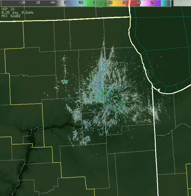
11 am: Freezing Drizzle/Light Rain as Seen on Radar (only a small area of the drizzle is seen!) |
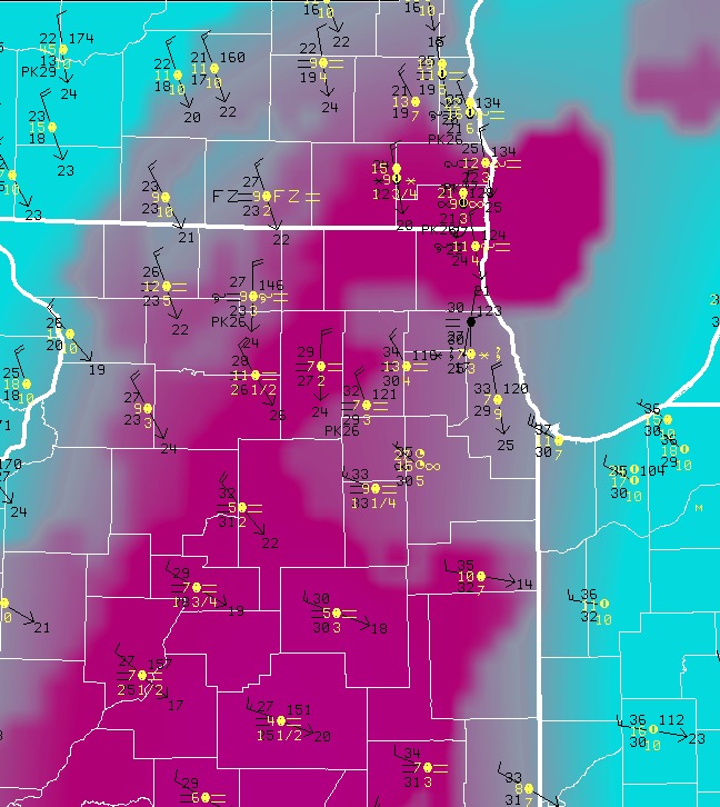
11 am: Freezing Drizzle/Light Rain Depicted in Pink Area (Reduced Visibility) |
|
|
|
|
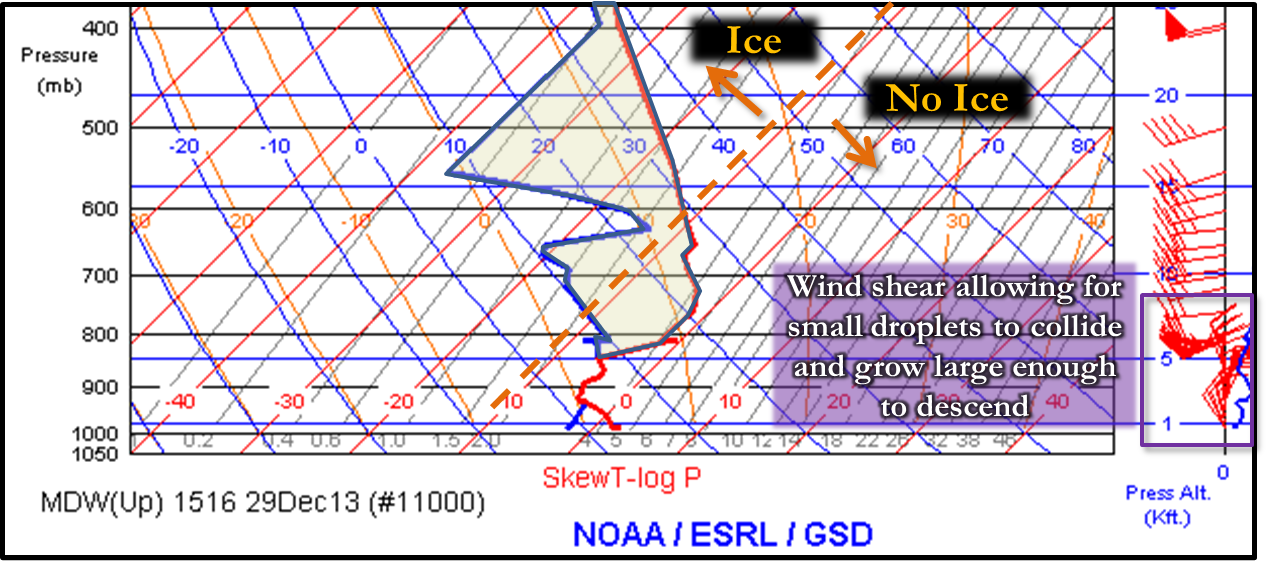
10 am: Aircraft Weather Observation from Near Midway Airport |
 |
|
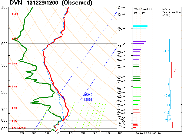
See a very similar profile from the NWS Davenport's balloon launch at 6 am Sunday morning |
|
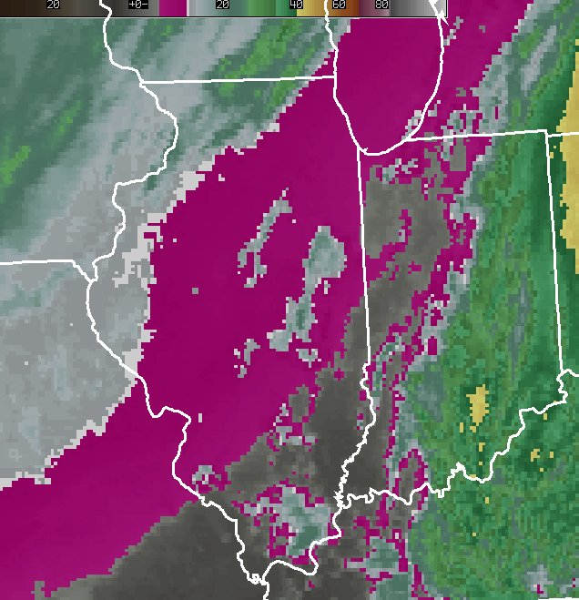
Mid-Morning Sunday Infrared Satellite |
|
|
|
Infrared satellite (IR) remotely measures cloud top temperatures. In the above IR image, pink indicates cloud top temperatures of -4°C to -10°C, which almost always is too warm for ice crystal formation in a cloud. So the precipitation developing in these clouds were supercooled liquid and not ice crystals. |
The aforementioned elements to detect freezing drizzle can often be subtle in both the forecasting and observational worlds, and slight changes in the temperature profile could easily lead to a different precipitation type. For instance, temperatures just above freezing at the surface, such as they had been hours prior on Saturday night would have allowed for just plain drizzle. Also, temperatures slightly cooler in the clouds (which was initially forecast), would have allowed for crystals in the clouds instead of supercooled water, and thus likely flurries. Lift and/or wind shear to allow for drizzle formation within the clouds is also challenging to forecast, and observational trends are key. Observational networks such as upper air data from weather balloons and the aforementioned aircraft example, radar and its Doppler profiler, and surface observations from spotters, the public, and automated equipment all better help meteorologists to recognize rapidly changing conditions, especially these somewhat subtly forced ones.
One way you can help report freezing precipitation is through the mPing app! Check it out and if interested, please feel free to download and use!

