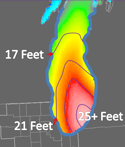
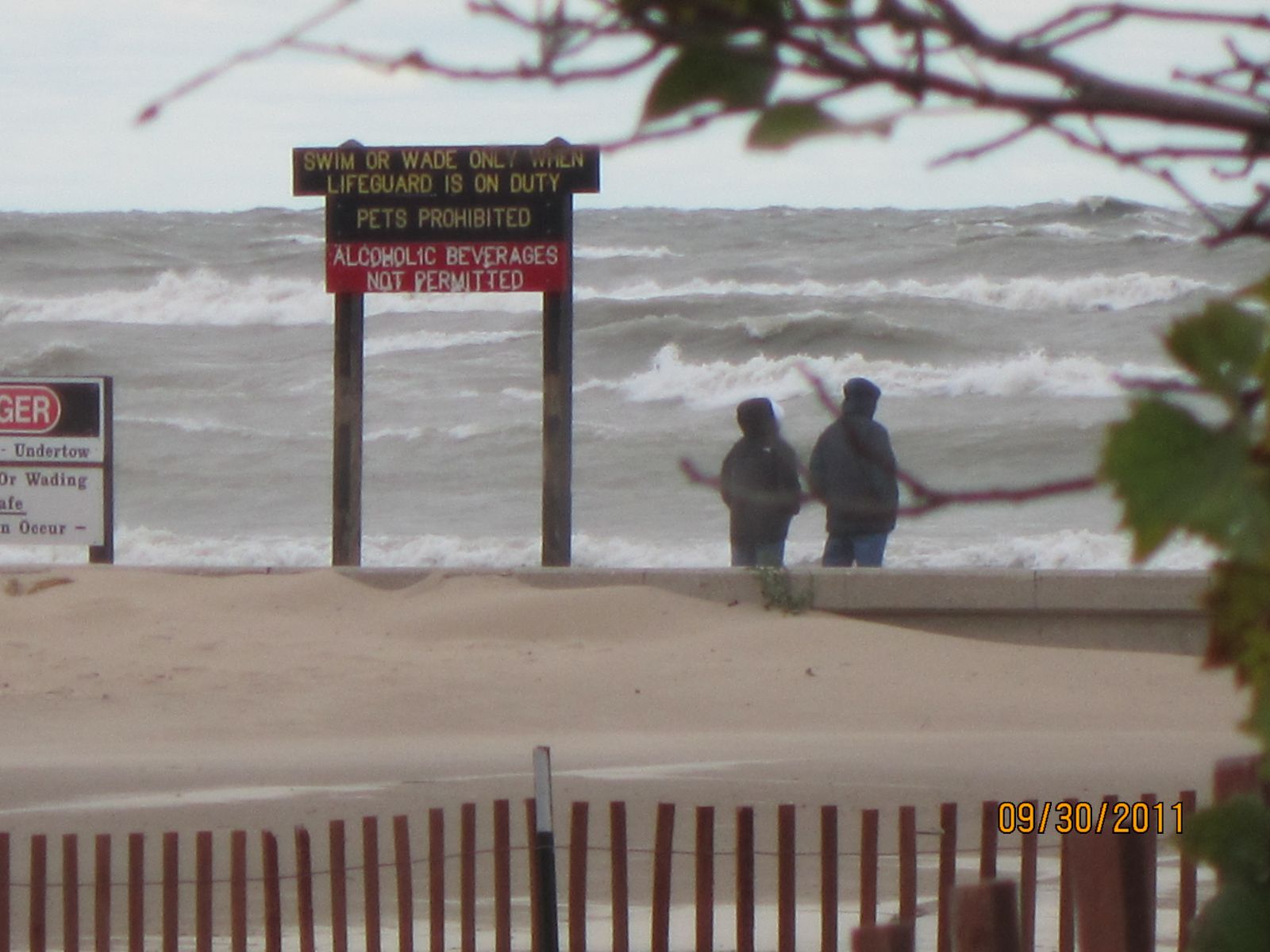
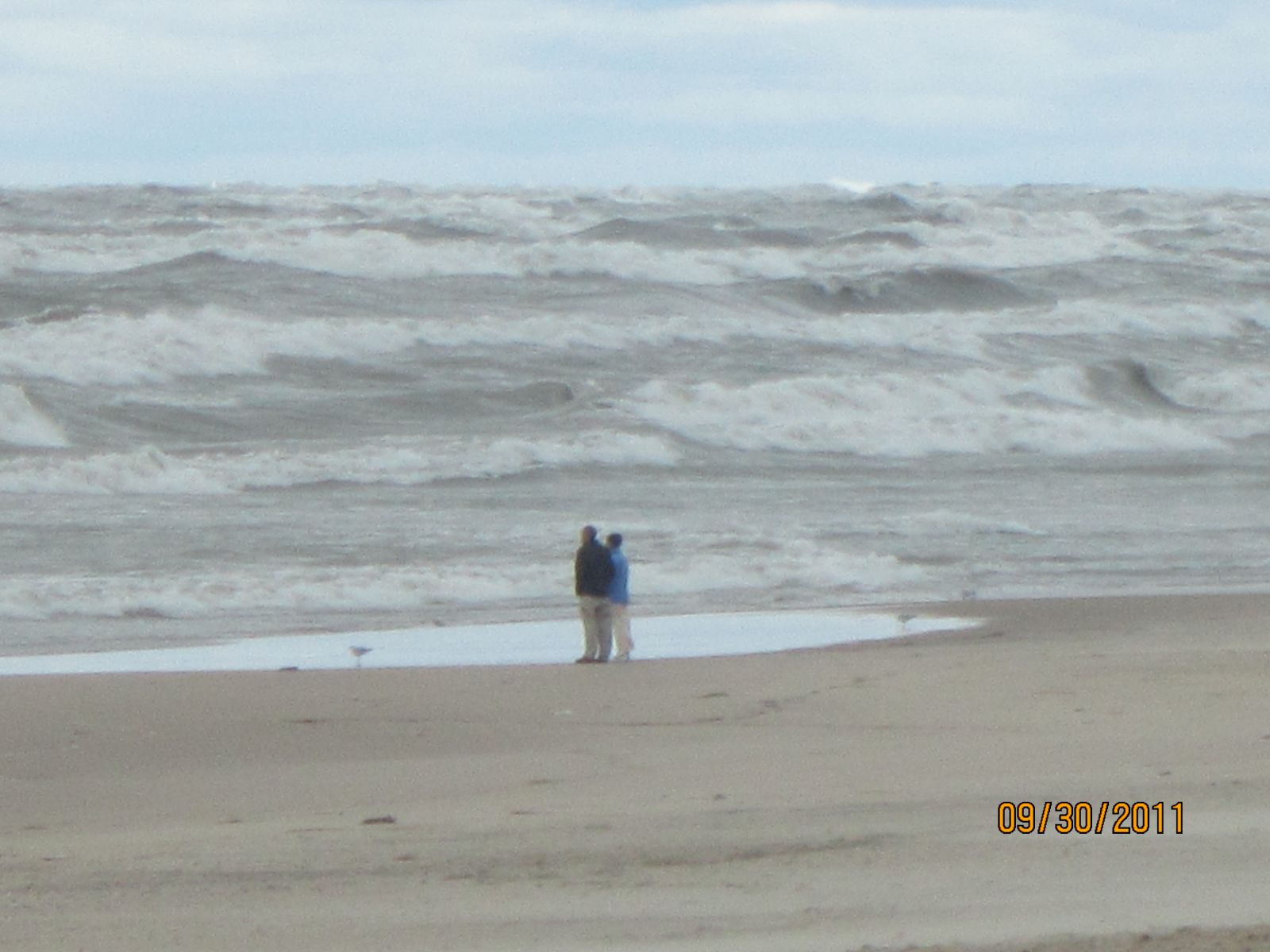
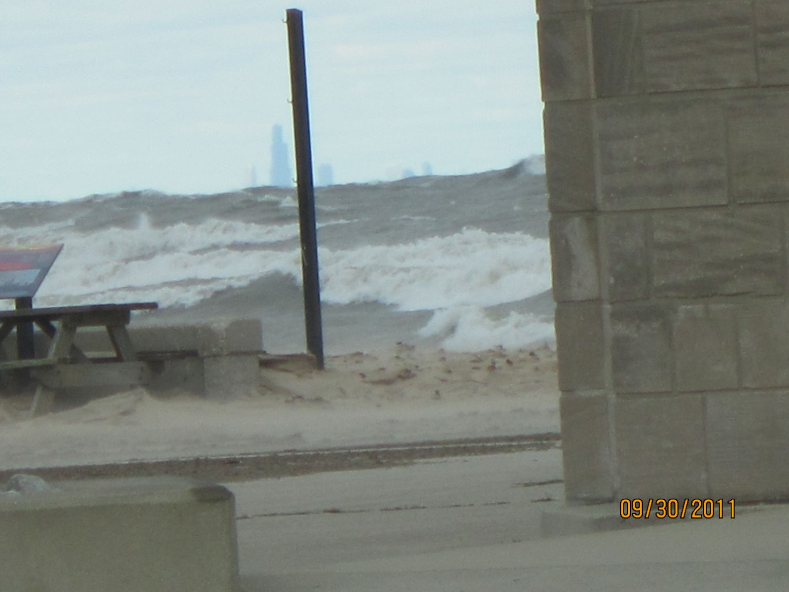
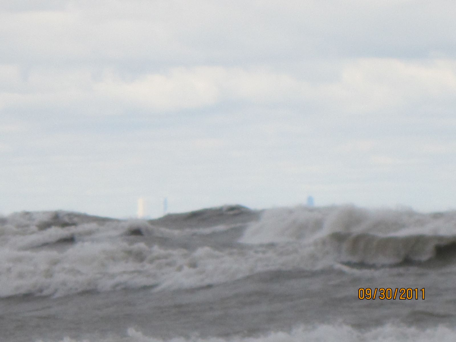
A truly windy autumn storm passed across the Great Lakes region from September 29th-30th, 2011 and produced some very impressive waves on Lake Michigan. The combination of winds occasionally gusting as high as 60 mph, and a long north-northwest fetch of up to 200 miles, resulted in waves building into the 20 to 25 foot range (trough to crest) on southern Lake Michigan late on the nigh of the 29th and into the 30th. The NOAA south Lake Michigan buoy, around 50 miles east-southeast of Milwaukee, measured waves as high 23 feet at 4 am CDT Friday, The buoy sporadically lost wave height data during the period of maximum waves, possibly because of the extreme conditions. A tug captain at Burns Harbor Indiana estimated waves crashing over the break wall on the morning of the 30th to be in the 25 foot range! The graphic below is a rough estimation of the peak wave heights during the storm.
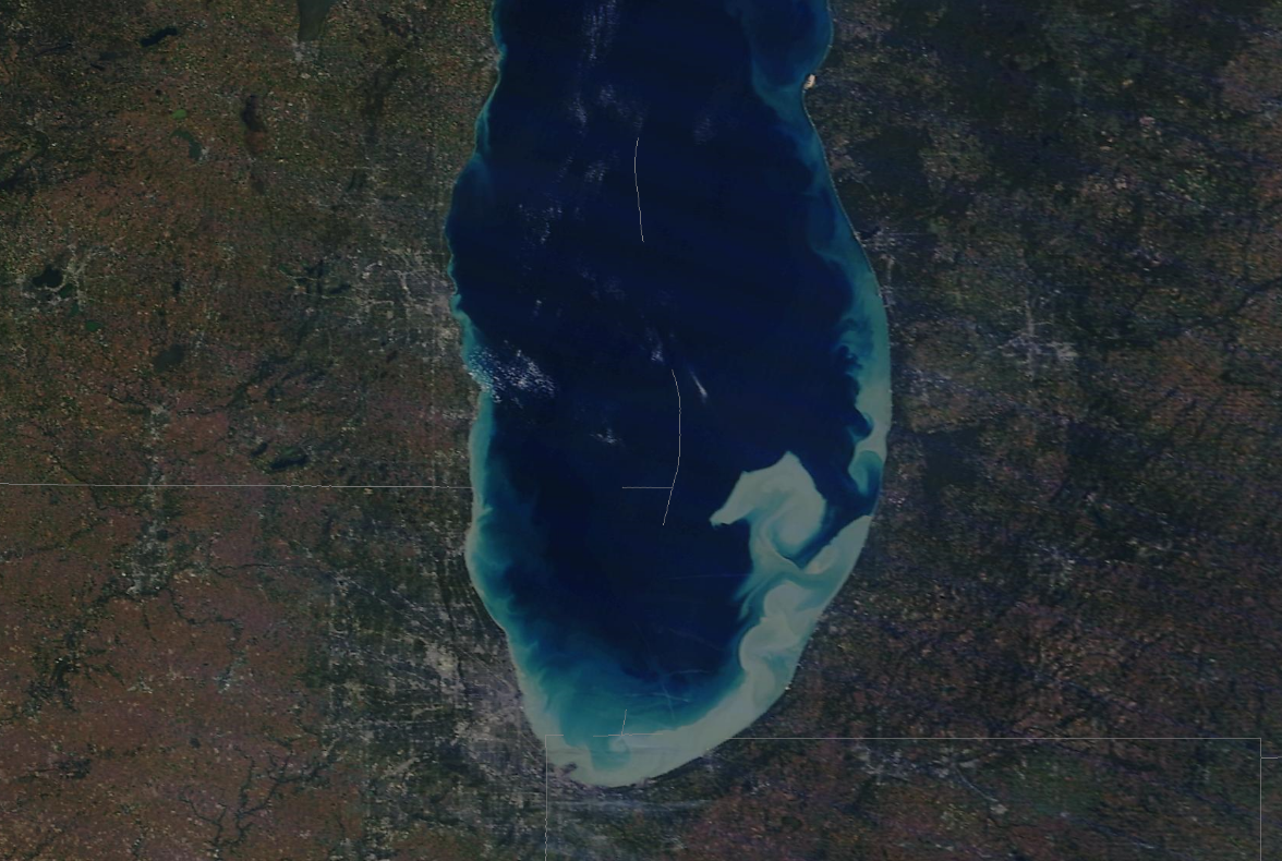
High resolution, true-color imagery from NASA's polar-orbiting AQUA-MODIS satellite, clearly shows the discoloration of the water in this image of Lake Michigan from the afternoon of the 1st. This is a 250 meter resolution image (each pixel is 250 meters square or 820 feet) taken from an orbit of approximately 438 miles above the earth's surface.

(Click the graphic to enlarge)
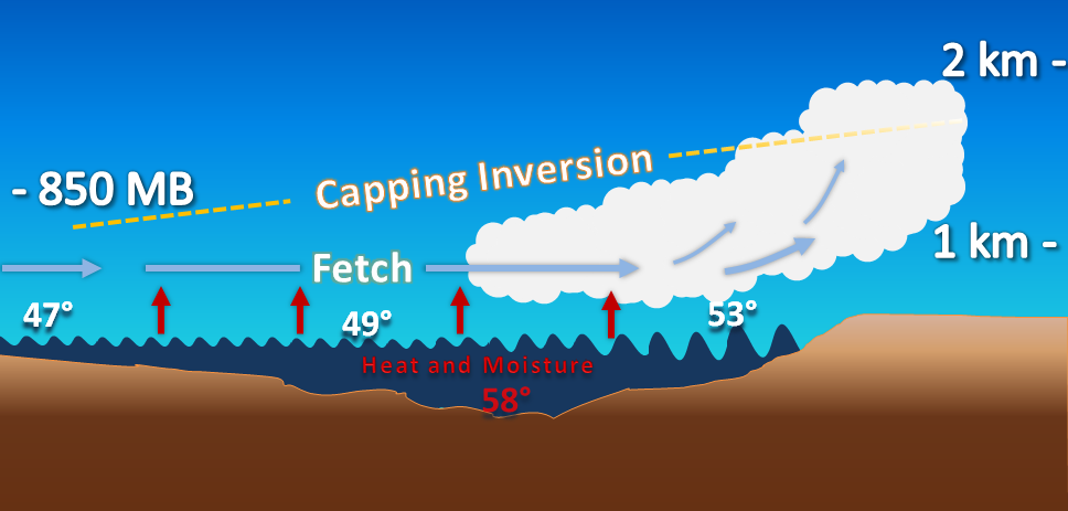
In addition to the discoloration of the lake due to the wave-churned sediment, the AQUA-MODIS image also clearly depicts stratocumulus clouds over and downwind of the lake. These clouds, which unfortunately become quite common across the lake in the cool season, form due to the advection of colder air over the still relatively mild lake waters. This results in an unstable thermodynamic profile, which leads to convective updrafts as the cold air traverses the warmer lake waters. Heat and moisture are transported upward from the surface of the lake by these updrafts, which develop into stratocumulus clouds as the moisture cools and condenses. If the cold air is sufficiently deep, these stratocumulus clouds may even produce lake-induced rain or snow showers. These clouds (or showers) typically align with the direction of the mean wind flow across the lake, and may extend well inland from the downwind shore. This is the "Lake Effect" of which residents of the Great Lakes region are so familiar with during the cold season. The following cross-sectional image depicts this process.
(Click the graphic to enlarge)
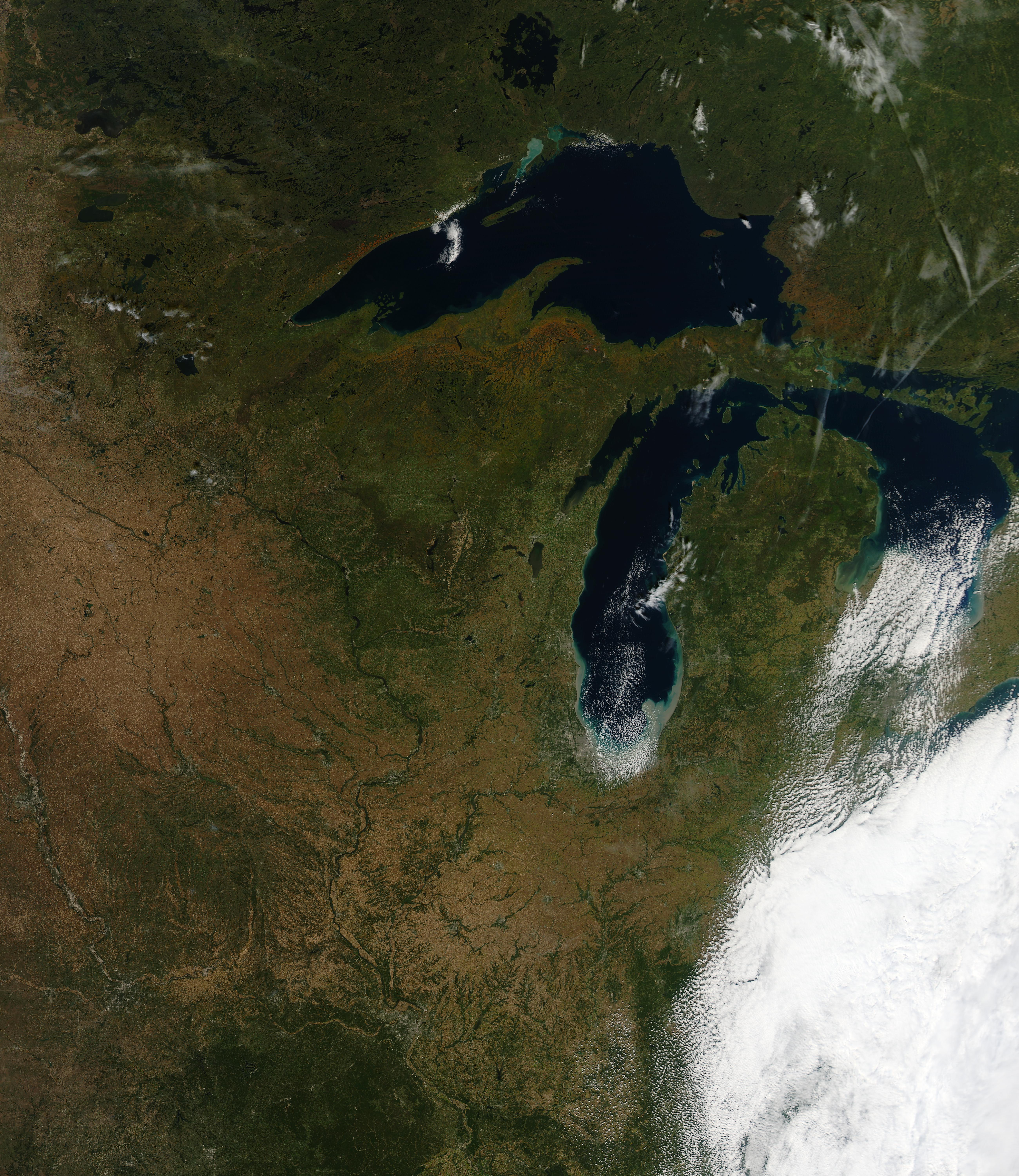
The sediment, and lake effect clouds, were also be seen in 1 km resolution GOES weather satellite imagery. Warming temperatures aloft resulted in decreased lake-induced instability, and therefore shallower cloud depth and gradual dissipation of clouds during the course of the afternoon.
Maximum Wind Gusts
PUBLIC INFORMATION STATEMENT
NATIONAL WEATHER SERVICE CHICAGO IL
1209 PM CDT FRI SEP 30 2011 /109 PM EDT FRI SEP 30 2011/
...STRONG WINDS OVER NORTHERN ILLINOIS...NORTHWEST INDIANA...
   AND LAKE MICHIGAN...
PEAK WIND REPORTS OVER LAST 24 HOURS...
ILLINOIS                             PEAK WIND
LOCATION (COUNTY):                  SPEED (MPH)

ROCKFORD (WINNEBAGO).....................58
ROCHELLE (OGLE)..........................46
DIXON (LEE)..............................47
PERU (LA SALLE)..........................43
PONTIAC (LIVINGSTON).....................41
DE KALB (DE KALB)........................45
AURORA (KANE)............................46
WAUKEGAN (LAKE)..........................40
DUPAGE (DUPAGE)..........................49
WHEELING (COOK)..........................43
MIDWAY (COOK)............................45
O`HARE(COOK).............................46
MORRIS (GRUNDY)..........................45
ROMEOVILLE (WILL)........................41
JOLIET (WILL)............................46
KANKAKEE (KANKAKEE)......................45
INDIANA                              PEAK WIND
LOCATION (COUNTY):                  SPEED (MPH)

GARY (LAKE)..............................48
VALPARAISO (PORTER)......................37
RENSSELAER (JASPER)......................43
LAKE                                 PEAK WIND
MICHIGAN                            SPEED (MPH)

WAUKEGAN HARBOR (IL).....................44
CHICAGO CRIB (IL)........................55
CALUMET HARBOR (IL)......................37
BURNS HARBOR (IN)........................53
MICHIGAN CITY (IN).......................60
KENOSHA (WI).............................46
MILWAUKEE (WI)...........................39
PORT WASHINGTON (WI).....................45
SHEBOYGAN (WI)...........................51
KEWAUNEE (WI)............................53
ALGOMA CITY (WI).........................60
GREEN BAY ENTRANCE LIGHTHOUSE (WI).......71
CHAMBERS ISLAND (WI).....................68
DEATHS DOOR (WI).........................64
FAIRPORT (MI)............................39
PORT INLAND (MI).........................37
NAUBINWAY (MI)...........................39
MACKINAW CITY (MI).......................45
GRAND TRAVERSE (MI)......................51
MANISTEE HARBOR (MI).....................64
BIG SABLE POINT (MI).....................61
LUDINGTON (MI)...........................38
MUSKEGON (MI)............................41
HOLLAND (MI).............................54
SOUTH HAVEN (MI).........................55
ST JOSEPH (MI)...........................55
SOUTH BUOY...............................54
NORTH BUOY...............................56
Ratzer/Shea - 01 October 2011

