Summary
|
 |
Tornadoes
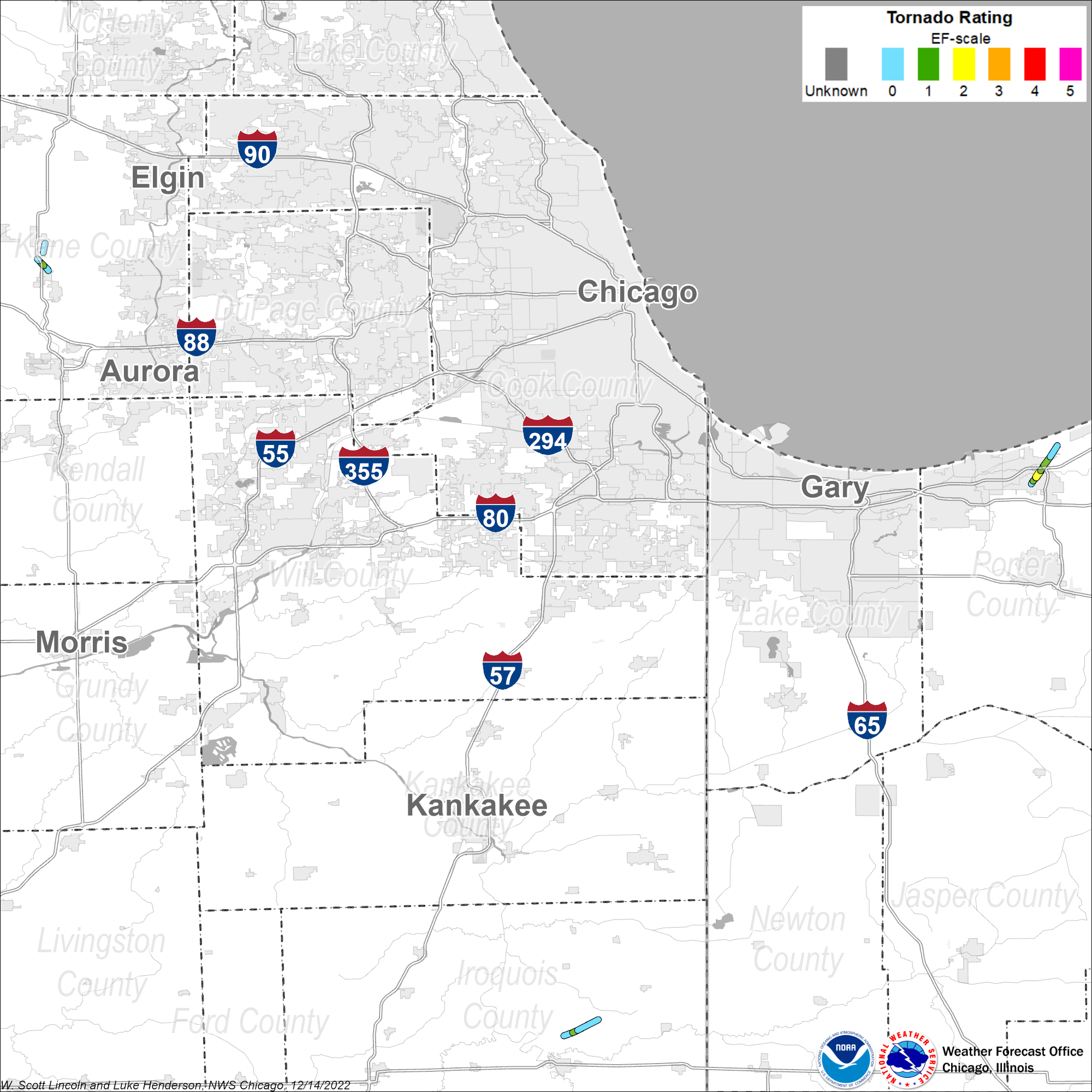
Pittwood EF1
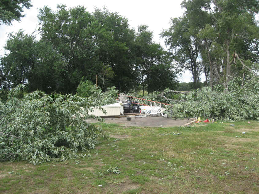
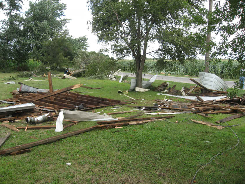
Summary: A tornado touched down along County Road 2100 East, north of the intersection of County Roads 2100 North and 2100 East. The initial touchdown was in a corn field where the corn was laid down in a convergent pattern. At this location, the tornado was approximately 20 yards wide. The tornado then crossed County Road 2100 North where it caused damage to trees and a small corn silo next to a farm house. Just behind this farm house, several large trees were broken near their base with one tree uprooted. Most of these trees were around three feet in diameter. Some internal rot was noted in a few of the trees making them more susceptible to wind damage. The tornado then appears to have lifted briefly before touching down again just behind a home along County Road 2200 East, between County Roads 2100 North and 2150 North. At this location, significant tree damage was observed with multiple limbs between one and two feet in diameter being broken and falling in a convergent manner. Also at this location, a detached garage was destroyed with debris being scattered 50 to 100 feet to the northeast. This appears to be the point along the damage path where the tornado reached its maximum intensity with an estimated peak wind speed of 105 mph and a width of 50 yards. The tornado then crossed County Road 2100 East causing damage to corn along both County Road 2100 East and County Road 2150 North. After crossing County Road 2150 North, the tornado destroyed a barn housing farming equipment, measuring 44 by 72 feet. Debris from this barn was scattered in all directions from the barn's original location. Several pieces of farm equipment estimated to weigh between 5,000 and 15,000 pounds were moved several feet north and northeast of their original location including a grain wagon which was lifted and placed on top of other farm equipment. After destroying the barn, the tornado moved northeast through a corn field where additional crop damage was observed. The tornado then again briefly lifted before striking a home and a detached garage along County Road 2340 East. Siding and minor roof and shingle damage was observed on the house and the detached garage lost its roof and suffered a collapse of the south wall. At this location, the tornado was estimated to be about 40 yards wide. The tornado appears to have lifted as it crossed County Road 2340 East. This tornado had a path length of 2.8 miles and maximum width of 50 yards. It began at 600 PM CDT and ended at 607 PM CDT. |
Elburn EF0
Summary: A tornado touched down just north of Route 38. At this location, a field of corn was flattened in a covergent manner towards the northwest. Damage was rated EF0 with winds near 65 mph and a path width of 20 yards. The tornado moved northwest and intensified as it moved along Route 47 where it snapped off and uprooted multiple large hardwood and softwood trees. The damage at this location was blown in a convergent pattern to the northwest. EF1 damage was observed with winds estimated near 105 mph and a path width of 40 yards. The tornado continued to the northwest maintaining its strength causing more tree damage along Route 47. Several trees were snapped off and consistently blown in the same direction to the northwest. Several cars were damaged by falling tree limbs. Damage was rated EF1 at this location with winds near 105 mph and a path width of 40 yards. Several residences along Route 47 continued to receive damage to many trees on their property even as the tornado was weakening. The last of the damage observed was in a corn field just to the west of Route 47. Here corn was flattened and twisted before the the tornado lifted with the damage rated EF0 with winds near 65 mph. This tornado had a path length of 1 mile and maximum path width of 40 yards. This tornado began at 600 PM CDT and ended at 602 PM CDT. |
Lily Lake EF0
Summary: A tornado touched down in a subdivision about a half mile north of Route 64. At this location, several large hardwood tree limbs were snapped and twisted off. Damage here was rated EF0 with winds near 75 mph and a path width of 30 yards. The tornado quickly moved to the northeast where it continued to cause damage to multiple large trees in this subdivision. The tornado began to weaken and produced the last of its damage about a quarter mile north of Route 64 where several large tree limbs were snapped off. Damage was rated EF0 with winds near 70 mph and a path width of 30 yards. This tornado had a path length of 0.8 miles and maximum path width of 30 yards. This tornado began at 615 PM CDT and ended at 616 PM CDT. |
Chesterton EF2
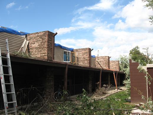
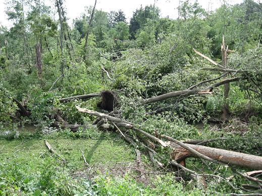
Summary: A tornado touched down in southern Chesterton east of 11th Street and southwest of South Park Drive. The tornado quickly intensified as it moved to the northeast and caused the partial collapse of a gymnasium roof at the Chesterton Junior High School. Numerous trees were either uprooted or snapped in the vicinity. The tornado was rated EF1 at this point with a path width of 40 yards. The tornado continued to track to the northeast across the New York Central railroad tracks toward Grant Avenue where the roof of a warehouse was peeled off and thrown about 15 yards to the north. The tornado continued to the northeast where the roof was removed from an apartment building on Brown Avenue. The tornado damage was rated EF2 through this area with a path width of 60 yards. In the city of Chesterton, 211 structures sustained damage; 8 were completely destroyed; 54 suffered major damage, such as trees falling through roofs. The remaining 149 structures sustained damage such as missing shingles or damaged gutters. Multiple vehicles were damaged by falling debris from buildings or trees. Numerous power lines were blown down along with utility poles blown down or snapped. This EF2 damage continued northeast where an entire field of healthy old hardwood tree trunks were snapped off or uprooted. The tornado then started to slightly weaken as it approached I-94 at US-49. A home had a garage roof blown off with numerous trees uprooted or snapped nearby. The tornado continued northeast across US-49 and toward US-20 near Hadenfelt Road where some aluminum roofing material of a storage facility had been peeled off. Tornado was rated EF1 in this area with a path width of 30 yards. The tornado continued to move through a heavily forested area in the Indiana Dunes National Lakeshore, eventually crossing US-12. Radar imagery and an aerial survey suggests that the tornado dissipated north of Highway 12. This tornado had a path length of 4 miles and a maximum width of 60 yards. This tornado began at 732 PM CDT and ended at 745 PM CDT. |
The Enhanced Fujita (EF) Scale classifies tornadoes into the following categories:
| EF-0 Weak 65-85 mph |
EF-1 Moderate 86-110 mph |
EF-2 Significant 111-135 mph |
EF-3 Severe 136-165 mph |
EF-4 Extreme 166-200 mph |
EF-5 Catastrophic 200+ mph |
 |
|||||
Photos
 |
 |
 |
 |
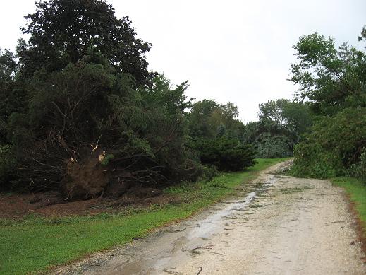
| Tree damage north of Elburn (NWS Storm Survey) |
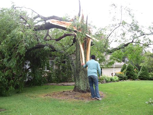
Hardwood tree snapped north of Elburn (NWS Storm Survey) |
Damage to corn north of Elburn (NWS Storm Survey) |
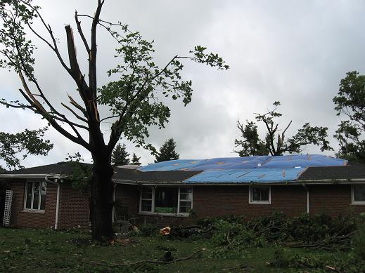
Damage to tree and residence north of Elburn (NWS Storm Survey) |
 |
 |
 |
 |
| Damage to corn northwest of Watseka (NWS Storm Survey) |
Garage damage northwest of Watseka (NWS Storm Survey) |
Garage damage northwest of Watseka (NWS Storm Survey) |
Garage damage near Pittwood (NWS Storm Survey) |
 |
 |
 |
 |
| Damage to warehouse in Chesterton (NWS Damage Survey) |
Damage to apartment building in Chesterton (NWS Damage Survey) |
Damage to trees in Chesterton (NWS Damage Survey) |
Damage to trees near I-94 and US-49 (NWS Damage Survey) |
 |
|||
| Tornado near Indian Boundary Road and IN-49 (photo courtesy Ian Covert) |
 |
Media use of NWS Web News Stories is encouraged! Please acknowledge the NWS as the source of any news information accessed from this site. Additional recaps can be found on the NWS Chicago Past Events Page |
 |