
Severe thunderstorms will be possible from the central Plains to the Mid-Atlantic and Northeast on Monday. Hazardous heat will linger across the southern U.S. and build across the West through mid-week. Hot and dry conditions will fuel fire weather concerns for Interior Alaska and the Four Corners region through Monday. Read More >
Chicago, IL
Weather Forecast Office
Late Thursday-early Friday June 12-13 a fast moving, bowing line of thunderstorms moved across north central and northeast Illinois. The line of storms produced widespread winds of 40 to 50 mph with isolated pockets of very intense, damaging winds of 60 to 100 mph. These winds downed tree limbs, power lines, and outbuildings. A house was unroofed near Kirkland.
National Weather Service Doppler radar indicated a small wind velocity couplets along the line from time to time. One in particular occurred over Boone County around 1230 AM.
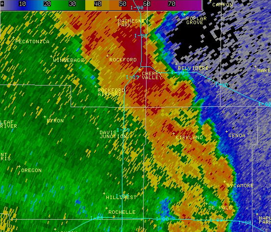
Base reflectivity showing leading edge of line of thunderstorms from western and southern Boone County to eastern DeKalb County
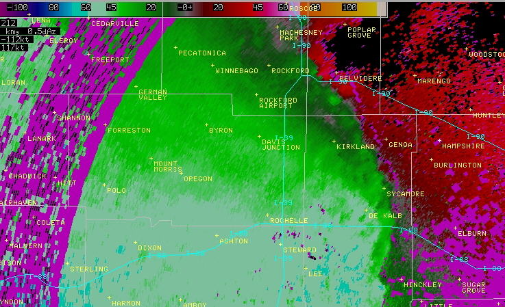
Velocity display showing strong inbound (west to east) winds behind the line of storms and a small embedded rotational couplet south of Belvidere.
Based on information from the radar signature, reports from Boone County Emergency Management Agency and a NWS storm damage survey, it has been determined that a tornado occurred over Boone County. The tornado snapped and uprooted trees, and damaged or detstroyed farm buildings. It was rated EF1 with winds estimated to be 86 to 110 mph.
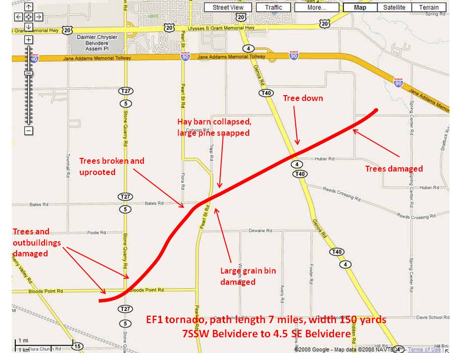
The most intense damage was along the path plotted here. There was minor damge to trees, shingles, and siding along either side of the path and a widening area of minor tree damage northeast from the end of the tornado path across I-90 to around US 20 and Garden Prairie Road.
Hazards
Enhanced Hazardous Weather Outlook
Hazardous Weather Outlook
National Briefing
Storm Spotter Training and Seminars
Outlooks
Watch/Warning/Advisory Criteria
Snow Squall Warnings
Local Forecasts
Marine
Aviation
Fire
Text Products
Great Lakes Marine Portal
Lake Michigan Beach Forecast
El Nino
Snow and Ice Probabilities
US Dept of Commerce
National Oceanic and Atmospheric Administration
National Weather Service
Chicago, IL
250 George J Michas Dr.
Romeoville, IL 60446
815-834-1435 8am-8pm
Comments? Questions? Please Contact Us.

