Summary
|
  |
Tornadoes / Straight-Line Winds
DuPage and Cook Counties Straight-Line Winds
|
Summary: A broad area of straight-line wind damage occurred from Kane County east through DuPage and Cook counties. The area of highest wind gusts occurred along the northern edge of a bowing area of storms. Peak wind gusts were generally in the 60-70 mph range with this line of storms, with isolated winds up to 80 mph. |
Bloomingdale EF-1 #1
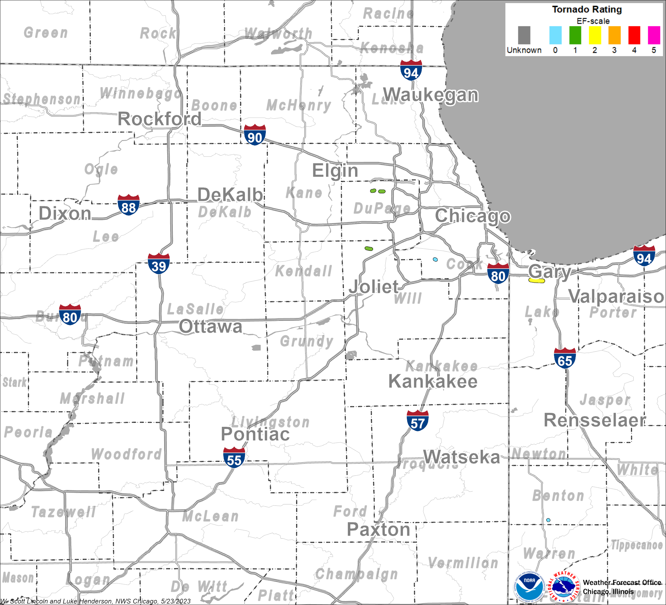
Summary: A brief tornado touched down in an industrial area near Fox Court. It continued east northeast across South Gary Drive and dissipated near Stratford Square Mall. A large warehouse had a wall blown out near Fox Court and Madsen Drive. This tornado had a path length of 0.6 miles and a maximum width of 40 yards. The tornado began at 7:45 PM CDT and ended at 7:46 PM CDT. |
Bloomingdale EF-1 #2
Summary: A second, brief tornado touched down in Bloomingdale, near an apartment complex on Century Point Lane. There was roof and window damage at two apartment buildings. Significant damage was done to roofs of houses and to trees from Cardinal Drive east across Bloomingdale Road through Norton Lane and into the area around Sterling Drive. This tornado had a path length of 0.8 miles and a maximum width of 50 yards. The tornado began at 7:47 PM CDT and ended at 7:48 PM CDT. |
Bolingbrook EF-1
Summary: A tornado developed about one half mile east of Plainfield Naperville Road and about one block south of Boughton Road. There was a narrow path of more intense damage in a subdivision where several homes had sections of roofing torn off, siding and soffits torn loose, trees snapped and limbs blown down. The most intense damage was on Sparrow Lane, Maroon Bell Lane and Silverado Street. The tornado was rated EF1 at this point. Here one house was likely a total loss due to structural damage to the roof, covered porch, garage and one wall. A garage was destroyed at another home. The tornado weakened to EF0 east of this area from Kings Road to Indian Chase Meadows. There was sporadic damage to trees and limbs and a few homes had damage to shingles, siding and soffits. A small section of roof was removed from a house just east of Indian Chase Meadows. At this point, the tornado appears to have dissipated, but strong straight line winds fanned out. This tornado had a path length of 1.1 miles and a maximum width of 50 yards. The tornado began at 7:45 PM CDT and ended at 7:46 PM CDT. To the east of the tornado track, a corridor of straight-line wind damage occurred. Fences were blown down and sporadic minor tree damage continued for several miles from Bolingbrook to northern Romeoville. Small limbs were down at Jane Adams School. From the school east southeast to Schmidt Road, a few homes had minor roof and siding damage. A construction trailer was destroyed on the I-55 Frontage Road east of Woodcreek Drive. South of I-55, a large metal hotel sign was broken. There was damage to an air conditioning unit on the roof of an industrial building. Tree damage continued along Old Chicago Road, Joliet Road, and Bluff Road. |
Orland Park EF-0
Summary: A tornado touched down along the south side of 135th Street, one block east of LaGrange Road. It moved southeast through the neighborhood along Howe Drive snapping off numerous tree tops, downing three or four large trees, blowing down a fence, sending a gazebo swirling 30 feet into the air before depositing it in a neighbor's yard and damaging a roof on an auto shop along Southwest Highway. A car was also damaged by a falling tree limb. At this point, the weakening tornado was wiped out by a microburst as it crossed the railroad trucks just east of Southwest Highway about a quarter mile south of 135th Street. This tornado had a path length of 0.3 miles and a maximum width of 30 yards. The tornado began at 7:59 PM CDT and ended at 8:00 PM CDT. |
Griffith EF-2
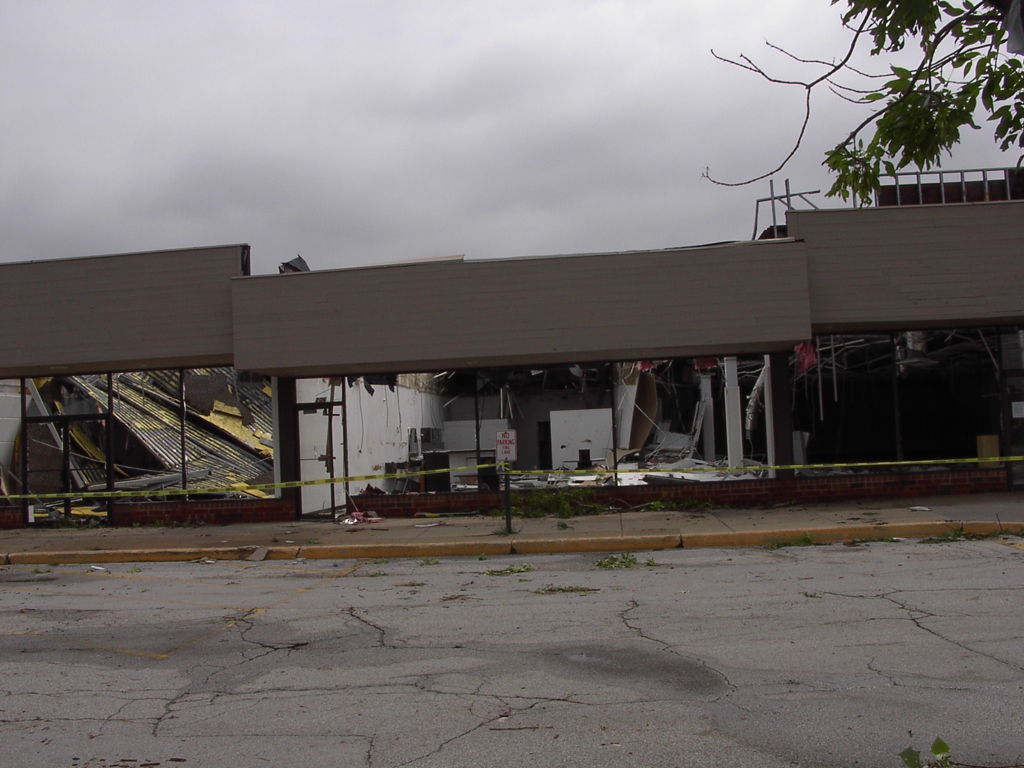
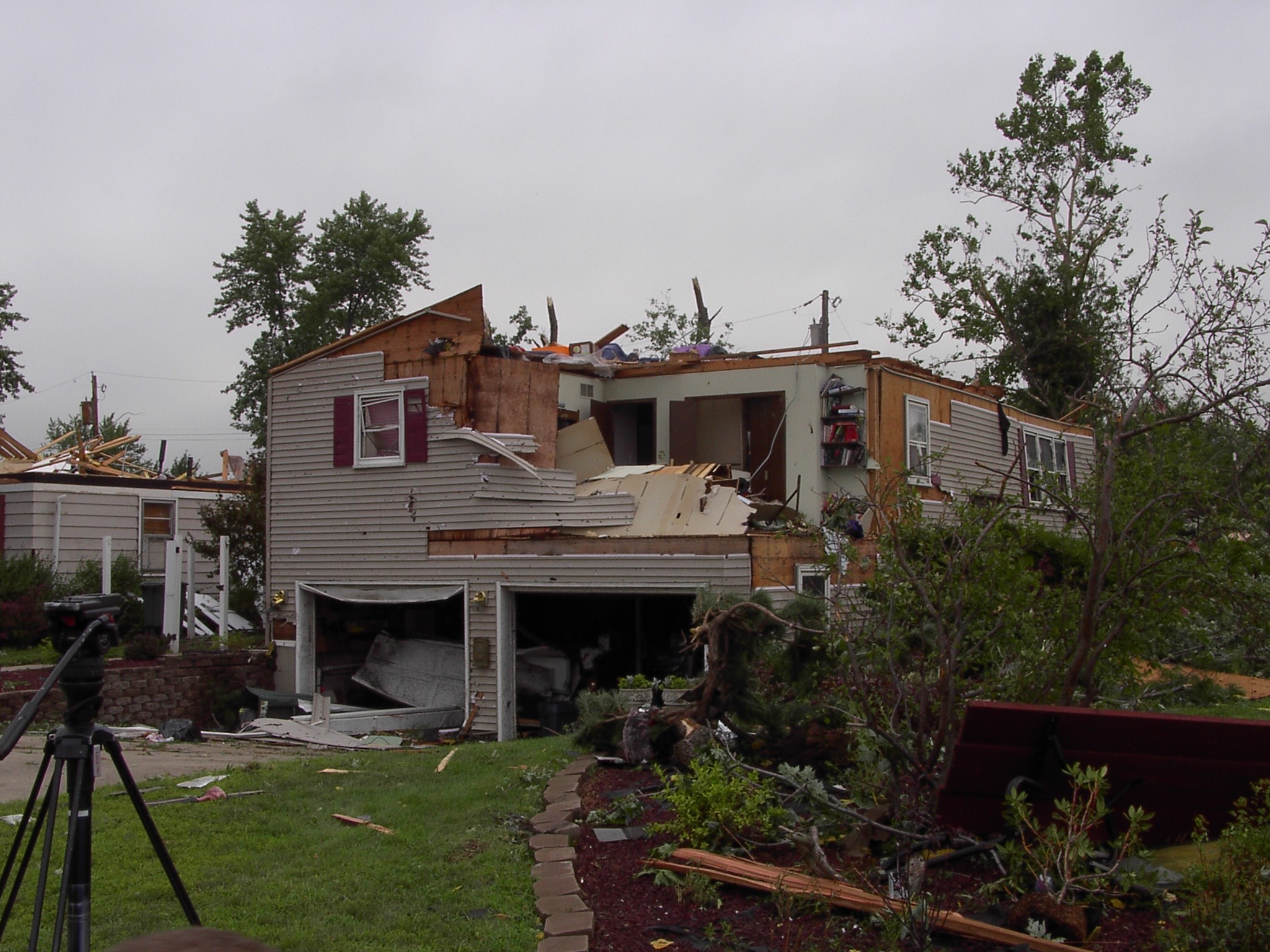
Summary: A tornado touched down just northeast of the Ridge Road and Cline Avenue intersection. Damage occurred at the Griffith Park Plaza Mall where windows were blown out of a row of stores and a portion of a roof was blown off of a vacant store. The damage path continued to the east, behind the mall. Two parked semi-trailers in the back of the mall were shifted eastward while a third was completely knocked over. The area to the east of this mall in the subdivision along and north of 37th Avenue near Lafayette Avenue and Rensselaer Avenue sustained some of the strongest wind damage from this tornado. Two houses on Lafayette Avenue had their roofs blown off with another house on Rensselaer Avenue also having its roof collapsed and a garage door pushed inward. Other significant damage that occurred was at the Habitat for Humanity storage building at Colfax and Ridge Road. Here, a cinder block storage building completely toppled to the ground. Although the building was knocked over, it appears as though the main cause of it faltering was due to a large tree that fell on top of it. At a nearby gas station within feet of this building, no damage occurred and people actually witnessed the tornado descend on the shelter. This tornado had a path length of 2.8 miles and a maximum width of 30 yards. The tornado began at 8:27 PM CDT and ended at 8:31 PM CDT. |
Kankakee Straight-Line Winds
|
Summary: An area of widespread damage occurred in the southern portions of Kankakee. The extensive wind damage began along W. Jeffrey Street and extended to east of the Cobb Park area. Many roads were impassable across these locations on Tuesday due to downed trees. Several very large trees were uprooted and power lines were downed. One very large tree landed on the roof of a home across the western portion of the main damage area. Peak wind gusts were estimated at 60-80 mph across Kankakee. |
Watseka area Straight-Line Winds
|
Summary: A corridor of straight line winds occurred near the intersection of county roads 2100N and 2100E approximately 2 to 3 miles north of Watseka. A machine shed was completely destroyed. Another pocket of significant straight line wind damage occurred near Route 1 just south of Route 24 approximately 1 mile east of Watseka. Here significant tree damage and its resultant damage debris caused broken windows to a glass patio area. Tree damage continued eastward to Sheldon. The wind damage that occurred across these areas likely was caused by thunderstorms that moved through Iroquois County during the early morning hours of August 5, just after 6:00 AM CDT. Peak wind gusts were estimated at 60-80 mph near and to the northeast of Watseka. |
Boswell EF-0
Summary: A brief tornado touched near 7651S and 125W. A tool shed was destroyed and crop damage indicated swirling winds. This tornado had a path length of 0.1 miles and a maximum width of 10 yards. The tornado began at 12:20 AM CDT and ended at 12:21 AM CDT. This brief tornado was surrounded by a corridor of straight-line wind damage with 70-80 mph winds occurring over an area about a mile wide and several miles long. Satellite imagery indicated significantly flattening of crops in some areas and farm outbuilding debris spread hundreds of yards. |
The Enhanced Fujita (EF) Scale classifies tornadoes into the following categories:
| EF-0 Weak 65-85 mph |
EF-1 Moderate 86-110 mph |
EF-2 Significant 111-135 mph |
EF-3 Severe 136-165 mph |
EF-4 Extreme 166-200 mph |
EF-5 Catastrophic 200+ mph |
 |
|||||
Radar
|
|
|
|
|
|
|
|
|
|
|
|
|
|
Photos
 |
 |
 |
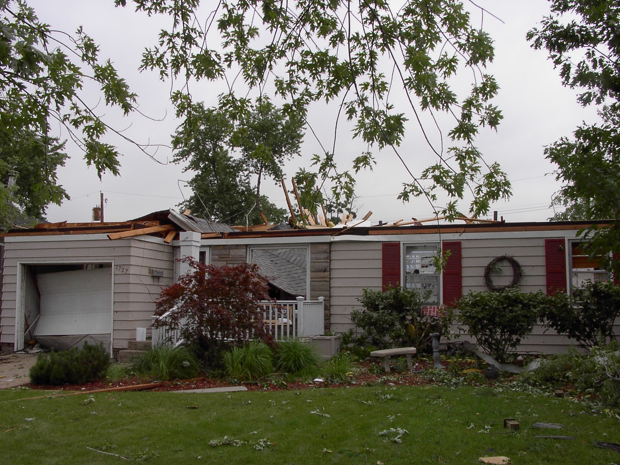 |
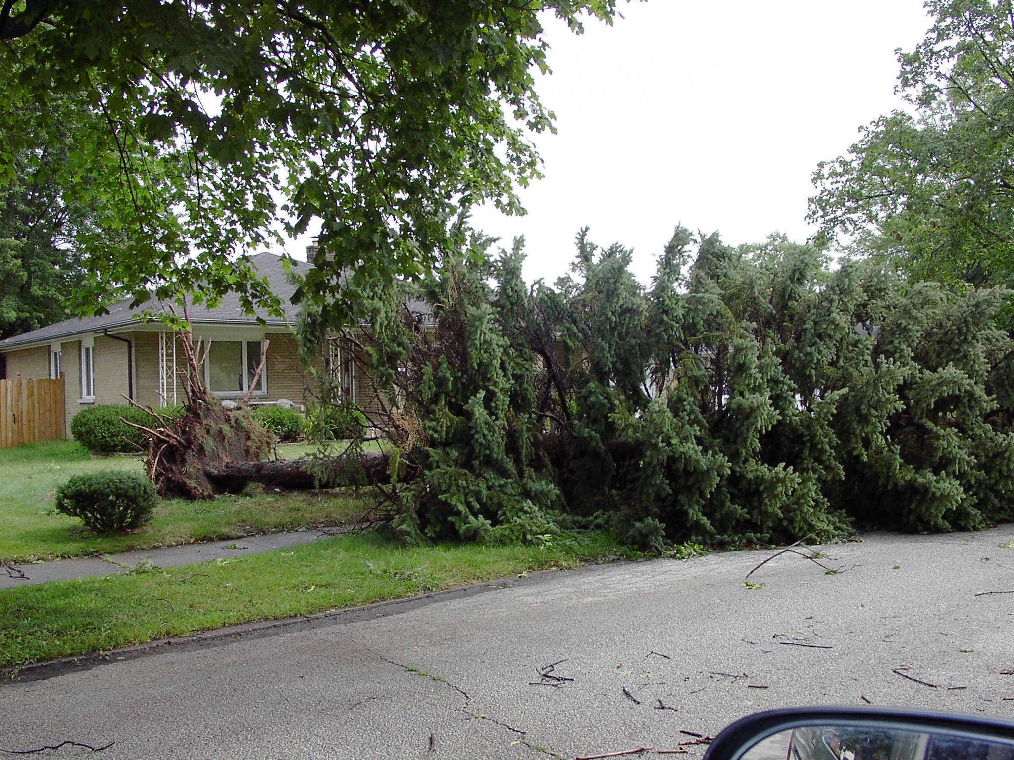
| Griffith tornado damage (NWS Damage Survey) |
Griffith tornado damage (NWS Damage Survey) |
Griffith tornado damage (NWS Damage Survey) |
Griffith tornado damage (NWS Damage Survey) |
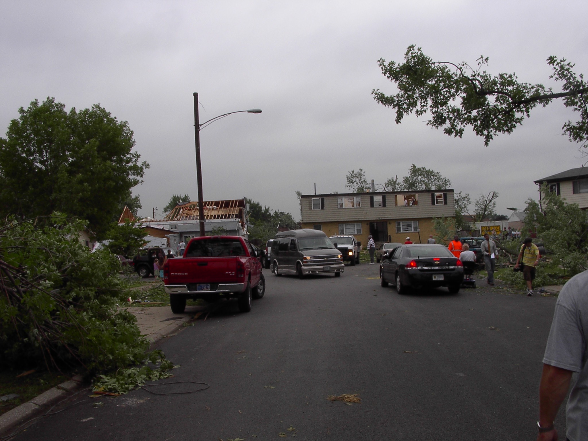 |
 |
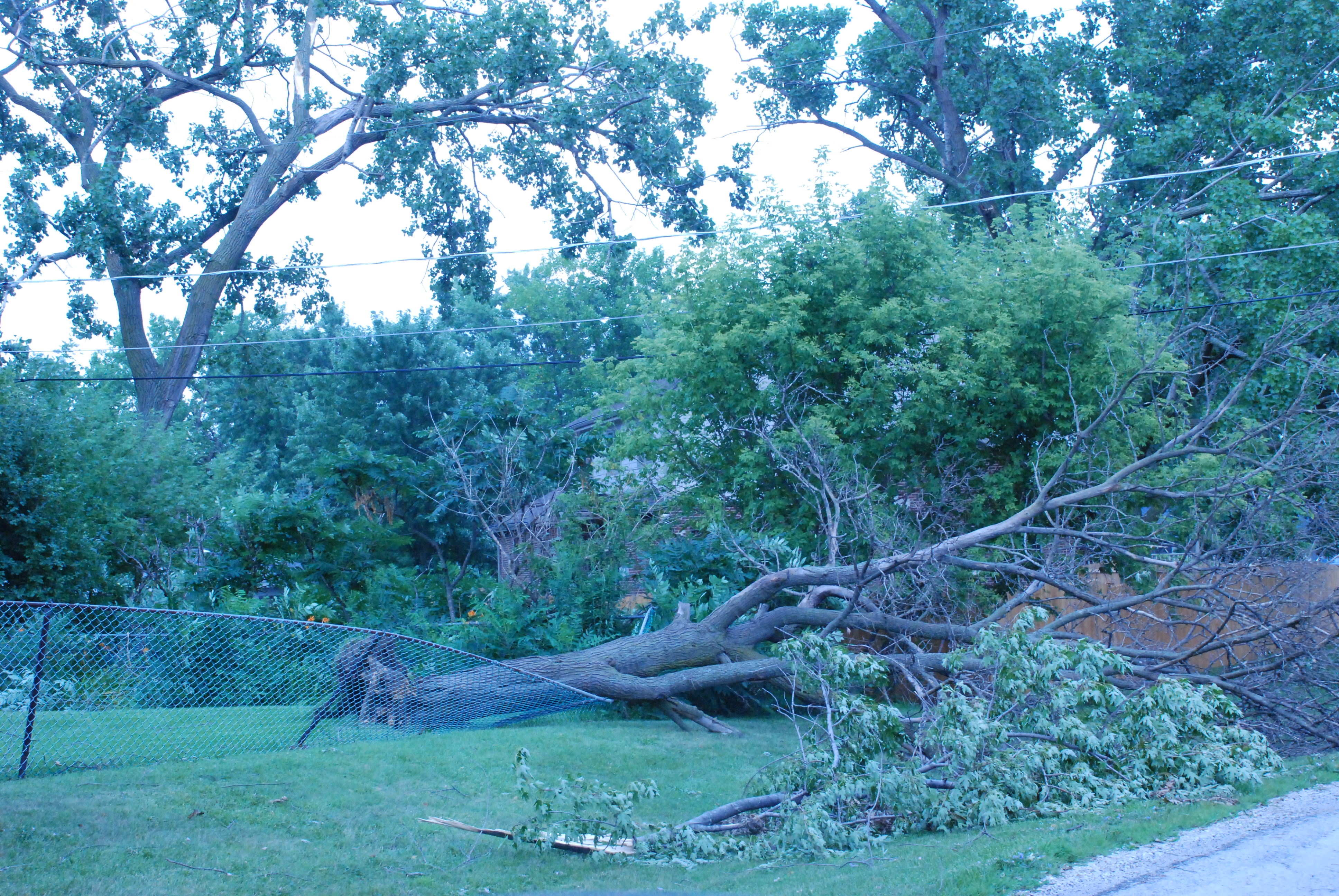 |
|
| Griffith tornado damage (NWS Damage Survey) |
Griffith tornado damage (NWS Damage Survey) |
Orland Park tornado damage (NWS Damage Survey) |
Environment
A cluster of thunderstorms which moved across northern Illinois and northwest Indiana spanning many miles, for several hours, affecting many locations. Events such as this are not uncommon for northern Illinois and northwest Indiana for the month of August. The pattern is distinguished by upper level winds orienting themselves in a northwest flow pattern. Combining this with warm, moist, unstable conditions can trigger thunderstorm development and lead to a storm complex similar to what occurred on August 4, 2008. As this pattern persists, multiple waves of energy move across the region, providing several rounds of thunderstorm activity.
The atmosphere on August 4 was quite unstable. Persistent southerly winds allowed a stream of very warm and moist air to move into the region. Temperatures climbed to near 90F by the afternoon and dew point temperatures were in the mid to upper 70s. This environmental combination provided the needed energy for thunderstorms. Around 6:00 PM, a thunderstorm complex moved into far northwest Illinois. As the line of storms neared Winnebago and Ogle counties, a portion of the storm began to form the shape of a bow, indicative of damaging winds. At some locations along this line, conditions were briefly favorable for the creation of small circulations which caused brief tornadoes.
 |
Media use of NWS Web News Stories is encouraged! Please acknowledge the NWS as the source of any news information accessed from this site. Additional recaps can be found on the NWS Chicago Past Events Page |
 |