Summary
|
|
Tornadoes that occurred in the NWS Chicago forecast area: |
Tornadoes
1.) Granville - North Utica F3
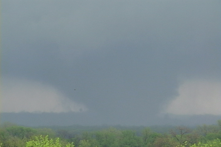
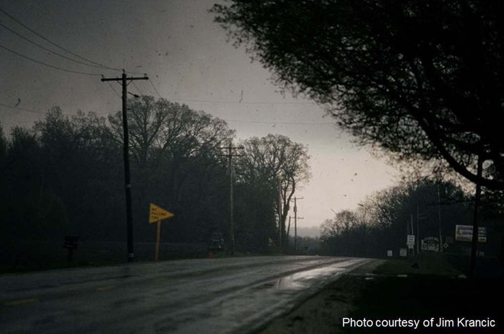
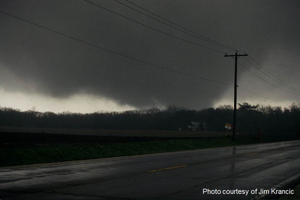
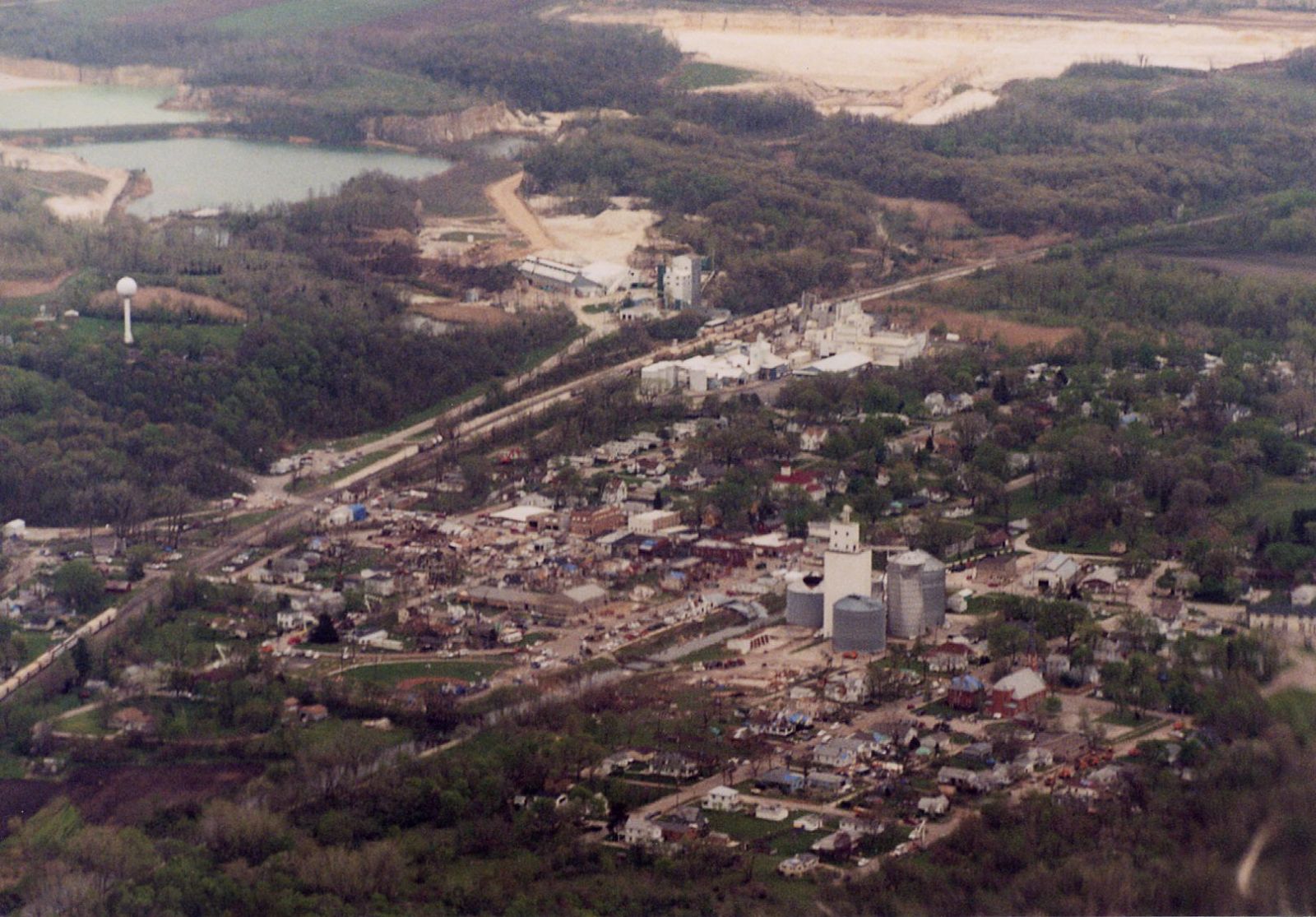
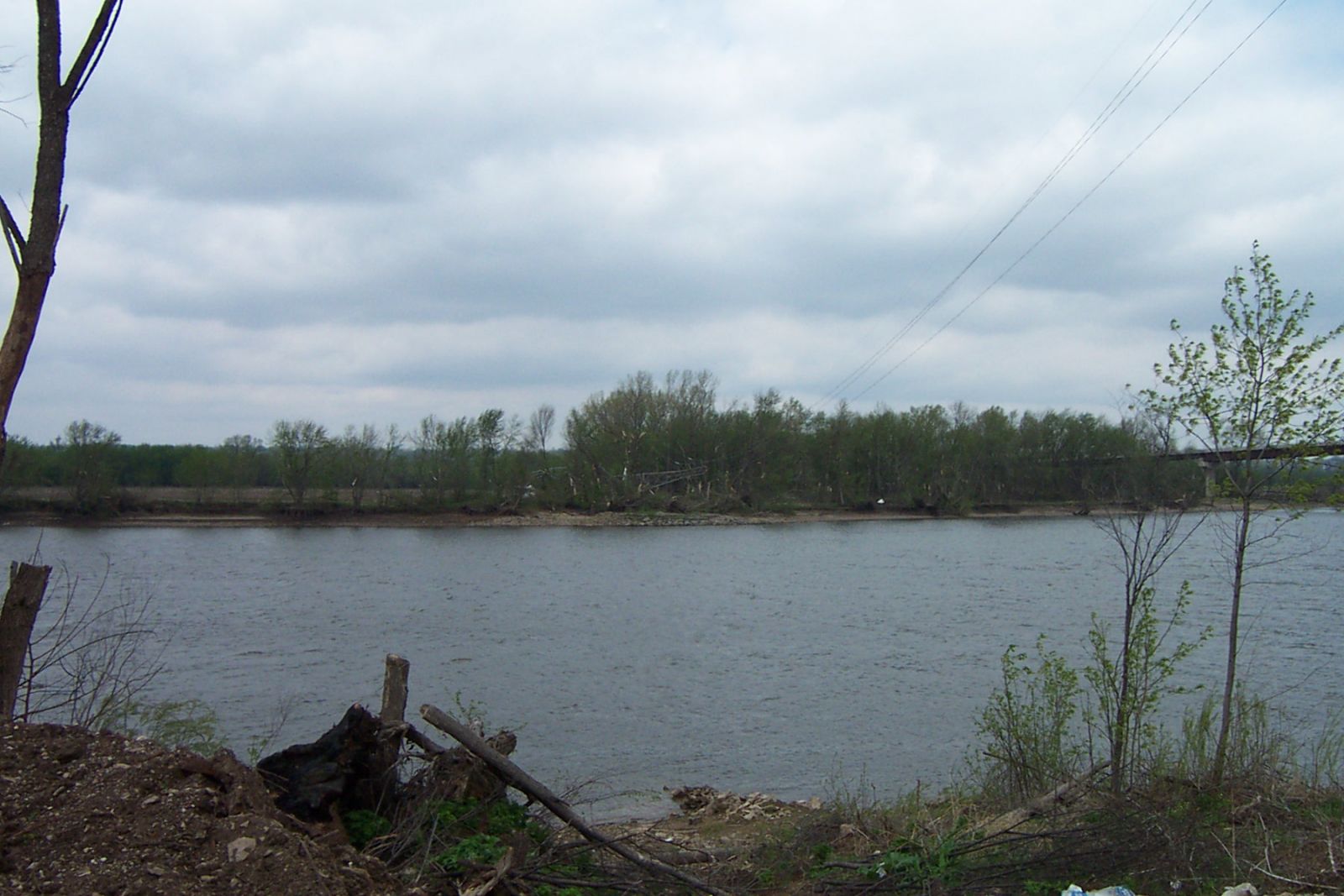
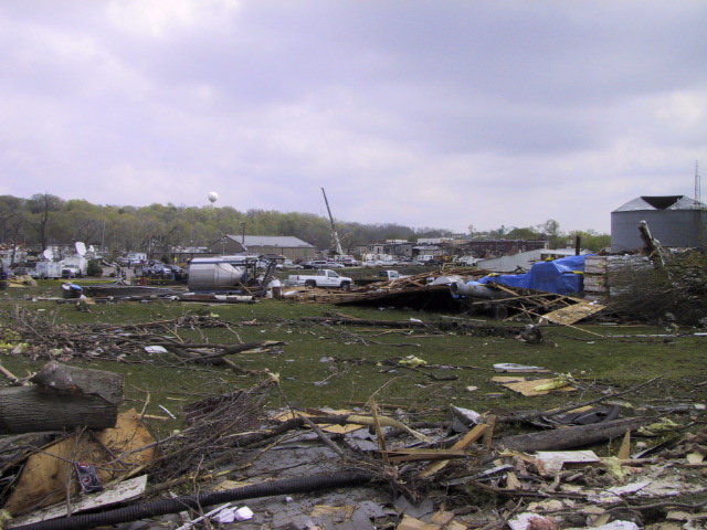
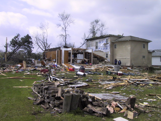
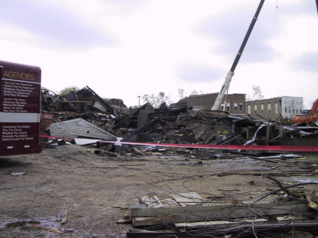
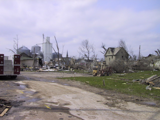
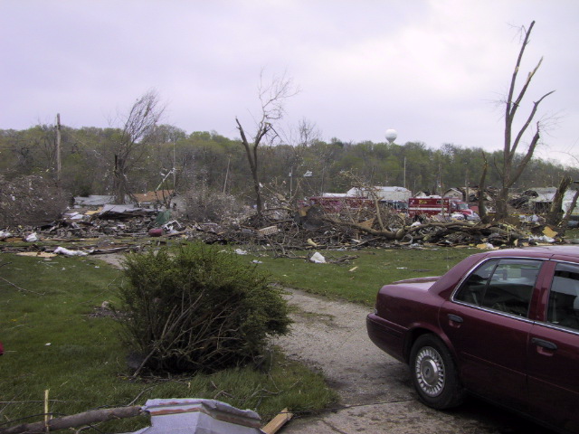
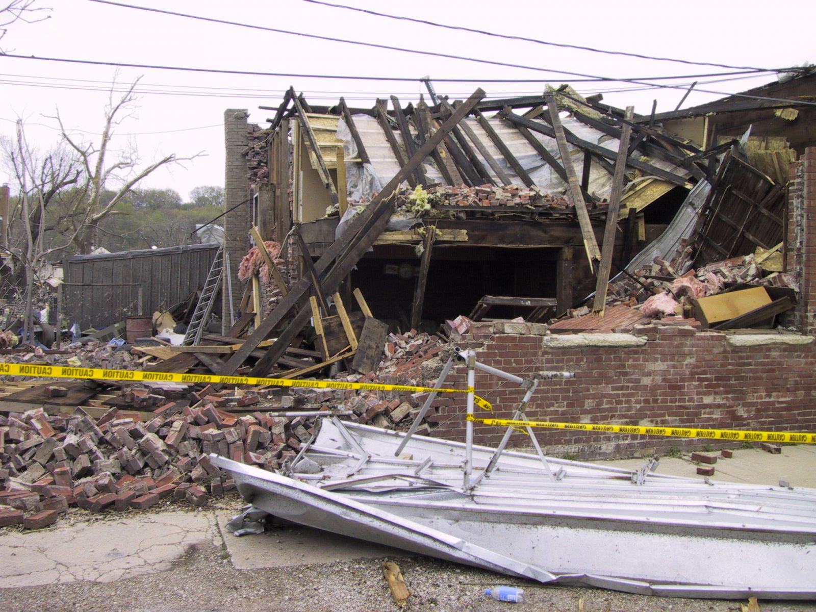
Summary: This tornado started just north-northeast of Florid and moved northeast toward Granville. The tornado widened to an approximately 1/2 mile wide, multi-vortex tornado as moved through Granville. Damage occurred to numerous buildings, including the elementary school. Additional information on the Putnam County portion of the tornado can be found on NWS Quad Cities' summary web page for this event. The tornado continued northeast, eventually crossing the LaSalle County border and producing F0 intensity damage in a wooded area southwest of Peru. As the tornado continued northeast, several homes in a subdivision near the intersection of East 250th and 2569th Roads suffered F2 damage, having their roofs blown off and suffering damage to external walls. Significant tree damage occurred as well. Path width was estimated at 50 yards at this location. The tornado then continued northeast, crossing the Illinois River twice as it moved toward the town of North Utica, downing a steel high tension tower on the north bank of the river, immediately west of IL-251. The tornado moved into the southwest side of North Utica while it was at F0 intensity. The tornado rapidly increased to F3 intensity on the north side of Johnson Street, where one home had its roof taken off and north walls blown out. A machinery building was completely destroyed on the south side of the canal, and a semi-tractor trailer was blown into the canal. The tornado then moved north of the canal into the heart of town where several homes were severely damaged, garages were destroyed, and brick buildings collapsed. Eight people died and seven were rescued from the basement of a tavern. On the east edge of the vortex along Mill Street, in downtown, buildings suffered damage to facades, roofs and windows. The tornado crossed the railroad tracks and dissipated on a steep bluff on the northeast side of town. |
2.) North Utica - Ottawa F2
Summary: The tornado formed on the ridge northeast of Utica and moved across County Road 2803, west of 10th Street. A garage was destroyed and trees were damaged. The tornado became a wide multiple-vortex tornado and caused damage to two homes, trees, and outbuildings on Route 6, west of 11th Street. Part of the roof of a house was torn off. A storage building was damaged and a garage roof removed on 11th Street. A garage and grain bin were destroyed on County Road 2950. The tornado crossed I-80 at 12th Street, damaging a building and flipping a semi-tractor trailer. The tornado destroyed a machine shed on 13th Street and knocked down power poles. On 31st Street west of 14th Street, big pine trees were snapped and a house suffered roof damage. A barn was destroyed on 14th Street north of 31st Street. On 32nd Street west of 15th Street, a two story house was hit. The top floor was mostly destroyed. A machine shed was destroyed on 16th Street between 32nd and 33rd streets. The tornado ended at 33rd Street and Route 23, where there was minor tree damage. North of I-80, a small satellite tornado formed behind the large parent tornado. It had a damage path 2 miles long and 5 to 20 yards wide. Its track was about 1/4 to 3/4 mile south of the main track. It caused no damage. |
3.) Wedron F1
Summary: The tornado began in an open area west of town. It knocked over a camper at a house, snapped pine trees and blew over a shed. The tornado struck a detached garage, completely destroying it. Trees were also damaged. |
4.) Sheridan F0
Summary: The tornado was spotted by a storm chaser near the correctional facility south of Sheridan. It tracked northeast for about 2 miles, causing only minor tree damage. |
5.) Piper City F0
|
Summary: The tornado occurred briefly at a farm north of Piper City, damaging a grain bin and an outbuilding. |
6.) Piper City/Ashkum F0
|
Summary: A weak tornado originated in Ford County 9 miles north-northeast of Piper City and moved into Iroquois County, ending about 9 miles west of Ashkum. This tornado moved through open farm land and caused no damage. |
7.) Channahon F0
Summary: The tornado struck an industrial complex on the far west side of Channahon. A wastewater treatment building at Tabler Road, south of Route 6, was destroyed with its walls getting blown out and structural beams getting bent. There was damage to overhead doors, and an air handling unit was torn from a roof of a building on the east side of Tabler Road. Farther to the east, there was damage to the walls and roof of an outbuilding. Antennas were blown down at the fire station on Route 6. |
8.) Hopkins Park F2
Summary: The tornado began in an open field and moved north-northeast along County Road 11000 East, knocking down trees and limbs. The tornado intensified from County Road 2630 South to 2430 South, where homes were damaged, a mobile home was destroyed, and large trees were knocked down or damaged. The most intense damage occurred at a church, where the roof was taken off and walls were pushed down. The tornado continued across a farm field, knocking over 2 pivot irrigation systems. It ended near 1000 South, where trees were damaged. |
9.) Kankakee F1
Summary: This tornado formed just southwest of the intersection of County Roads 5000S and 3000W. Eyewitnesses stated there were multiple funnels aloft occasionally lowering at this point. The developing vortex continued northeast across 3000S just west of 1000W. A brick one story house was was hit with the roof torn off and scattered northeast into a field across the street. Numerous large trees were snapped or uprooted. An empty corrugated grain bin was pushed into a tree. The tornado continued northeast, damaging the brick wall of a chemical plant and damaging a chain link fence. Several cinder block buildings were damaged or destroyed in this complex. The vortex moved across railroad tracks and damaged corrugated metal roofs at the River Valley Metro building (city bus storage) and other nearby businesses. The final damage occurred at a farm at the corner of US-45/US-52 and River Road. A barn and several large sheds were destroyed. The tornado lifted as it moved just west of Kankakee Community College to the Kankakee River. Areas of debris could be seen in the trees north of River Road, but no tree damage was noted. |
10.) Joliet F1
Summary: This brief tornado moved through a mainly residential area just west of downtown Joliet. Initial damage was found near the intersection of Jefferson St. (U.S. Route 52) and William Street. The damage path then continued northeastward to a point near the intersections of Ruby Street, Bluff Street, and the Des Plaines River. Most of the damage was of F0 intensity, with extensive tree damage and very minor damage to structures. However, there were three pockets of more substantial primary structural damage, which consisted mainly of roofs being torn off residences and garages being totally demolished. In all, 10 residences were declared uninhabitable. |
11.) Grant Park F0
Summary: This tornado began about 1 mile southwest of Grant Park in an open field, where it was spotted by the fire department. It crossed Route 1 west of town, damaging a fence. The tornado moved into town, causing minor roof damage to a few homes. Part of the roof of the fire station was peeled off, and a large tree fell in the yard behind the fire station. The tornado moved across an open field, then knocked down a large tree at 9000N and Route 1. It also caused minor roof damage to a farm building northeast of the intersection. |
12.) Beecher F0
|
Summary: A weak tornado pulled shingles off two mobile homes near the corner of 319th and Yates. It also caused minor roof damage to a barn. |
Environment
This tornado outbreak, including a handful of significant tornadoes with the strongest hitting Utica, was particularly unique in that a severe weather environment was not markedly evident just a few hours prior to the event. However, a rapid change occurred. Below to the left is a collection of surface observation maps from three hour intervals during April 20, 2004 (12Z = 7 am, 00Z = 7 pm). Note the cool conditions and rain early in the afternoon and then the significant change that follows in North Central Illinois. To the below right is a hand analyzed graphic at 7 pm showing the warm air approaching the south Chicago metro, where a tornado would occur as far north as Joliet.
|
|
|
|
Weeks after the event, meteorologists in the weather enterprise (that included NWS Chicago forecasters) researched the quickly changing and deceptive tornadic environment. Their technical assessment can be found to the right. The rapidly warming and moistening atmosphere during the mid to late afternoon across north central Illinois created instability that was sufficient for thunderstorms. The focus for these storms was along an evolving warm front which was surging northward. This type of boundary is often favorable for rotating storms and low cloud bases, both ingredients for potential significant tornadoes. Many of the weather forecast models struggled with this scenario, however, and indicated little-to-no instability. At first, weather observations early in the afternoon matched this prediction. The warmer airmass in southern Illinois raced northward through the day, combining with morning rain, to further moisten the atmosphere. This helped support low cloud bases and possible tornadoes. |
Photos
 |
 |
 |
 |
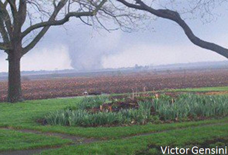
| Granville-Utica Tornado (courtesy of Victor Gensini) |
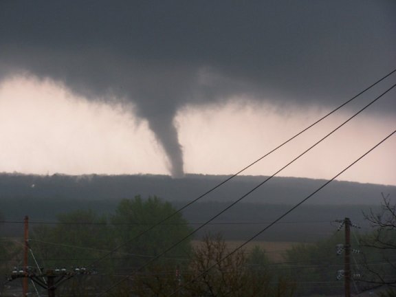
Granville-Utica Tornado (courtesy of Matt Weaver) |
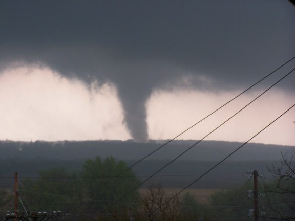
Granville-Utica Tornado (courtesy of Matt Weaver) |
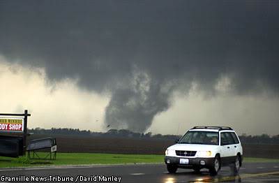
Granville-Utica Tornado (courtesy of David Manley) |
 |
 |
 |
 |
| Granville-Utica Tornado (courtesy of Jerry Funfsinn) |
Granville-Utica Tornado (courtesy of Jim Krancic) |
Granville-Utica Tornado (courtesy of Jim Krancic) |
Damage in North Utica (unknown attribution) |
 |
 |
 |
 |
| Damage in North Utica (NWS Damage Survey) |
Damage in North Utica (NWS Damage Survey) |
Damage in North Utica (NWS Damage Survey) |
Damage in North Utica (NWS Damage Survey) |
 |
 |
 |
 |
| Damage in North Utica (NWS Damage Survey) |
Damage in North Utica (NWS Damage Survey) |
Damage in North Utica (NWS Damage Survey) |
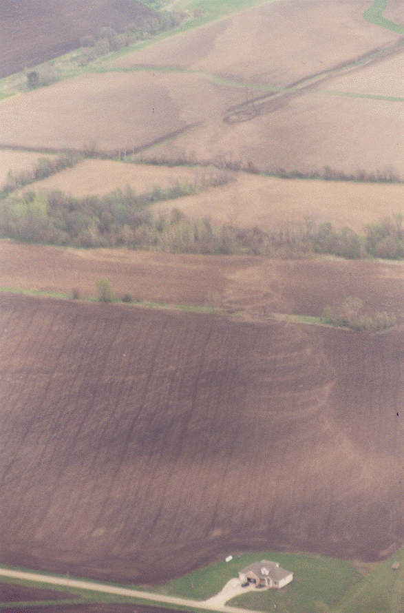
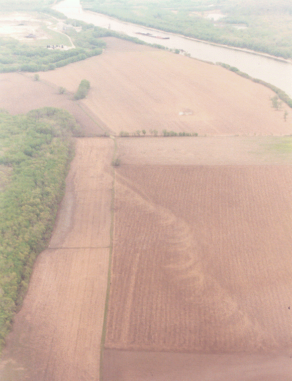
Ground swirl pattern produced by Granville-Utica tornado (Unknown Attribution) |
 |
|||
| Ground swirl pattern produced by Granville-Utica tornado (Unknown Attribution) |
Accounts
The following accounts of the Granville-Utica Tornado were collected at the 10-year anniversary of this event in 2014
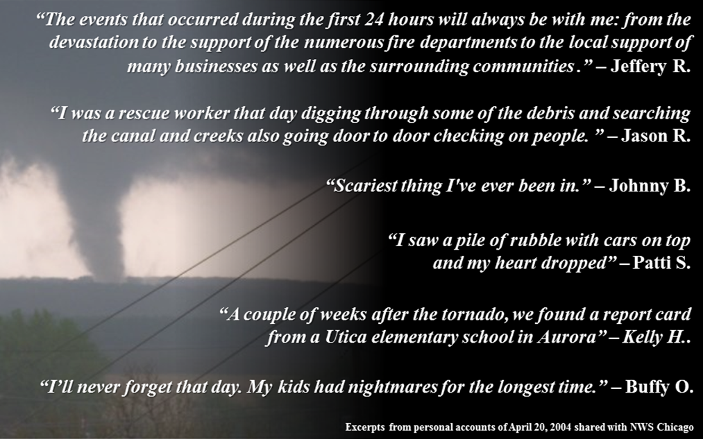
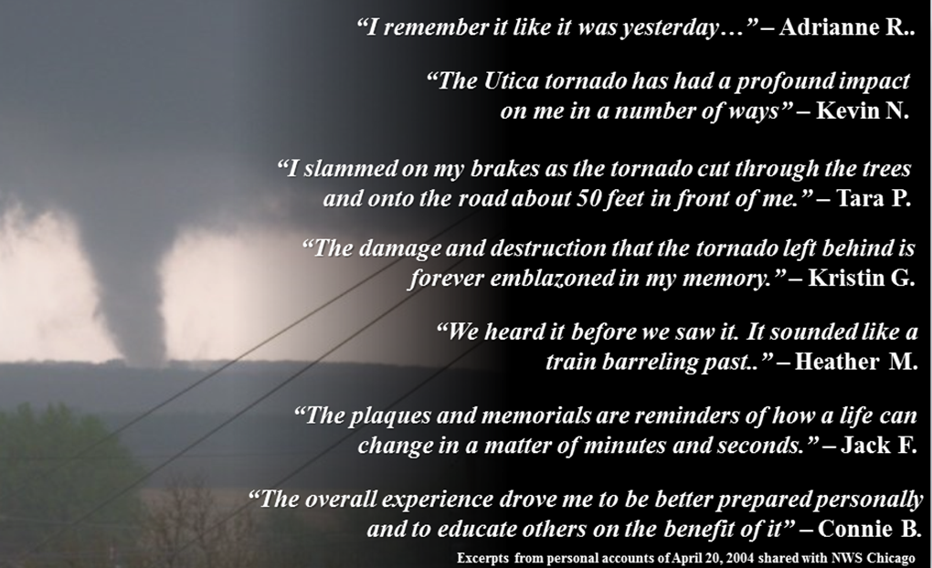
For numerous detailed accounts as well as the impacts that this day had, please take some time and read the full accounts below:
"The people of Utica never stop amazing me. Nothing stops them; floods, tornadoes. They always pull together and get through the roughest of moments." - Nicole Marie Wilcox
Advancements
The following information about weather forecasting advancements was collected at the 10-year anniversary of this event in 2014
Preparedness & Weather Message Dissemination
While there was a Tornado Warning issued for Utica over 20 minutes prior to the tornado striking the town, there were still eight direct fatalities and one indirect fatality. In the past decade, the NWS has worked closely with the entire weather enterprise and its emergency management and broadcast media partners, as well as team with social scientists to better understand response to weather threats and the conveying of that in NWS messages. Much has changed in this realm since 2004, and below is a listing of some of these improvements.
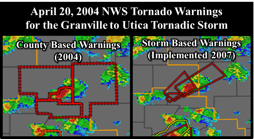
A quote from Patti S. in the Accounts section of this event summary web page was "...thinking it was just like any other of the hundred tornado warnings we've seen in our county." While any one area is actually rarely under a Tornado Warnings (sometimes going years without any), it was true that in 2004 all Tornado Warnings were basically created equal. The entire NWS Central Region (including NWS Chicago) is now issuing Impact-Based Warnings. Within these warnings, more information about the threat level and impacts can be conveyed by NWS meteorologists, if the environment, radar, and spotter reports support as such. For instance, during the November 17, 2013 tornado outbreak, a heightened degree of potential damage was mentioned in multiple warnings given the favored environment and radar signatures for long-lived, destructive tornadoes.
Tornadoes on April 20, 2004 passed within two miles of Illinois Valley Community College, Kankakee Community College, and Joliet Junior College, and even directly impacted the IVCC campus. Warnings from NWS Chicago now often mention colleges and universities, as well as other areas where there may be large groups of people, including outdoor venues.
The NWS continues to work closely with emergency managers and expand its reach with community leaders and other public officials toward preparedness for severe weather. The NWS has a program called StormReady to help prepare communities, universities, and other locations to ensure reception and communication of severe weather threats. The NWS Chicago office is very active with this program, having over 60 entities certified. There were only a handful in 2004.
Computer Modeling
The April 20, 2004 event proved to be an extremely difficult one to forecast at that time. Just a couple hours prior to the tornado and numerous others in the region, it was thought that storms may not even develop, let alone produce significant severe weather.
Meteorologists rely upon high capacity computing systems to run millions of mathematical equations every hour, on massive weather datasets. The computer models provide a visual forecast as to how a particular weather system may evolve in the future. For the most part, Numerical Weather Prediction (NWP) has kept pace with technological advancements, with the National Weather Service (NWS) leveraging these tools extensively when preparing for possible convection. One advancement of NWP that has greatly benefited forecasters has been the ability to perform retrospective analysis of significant events through the Weather Research and Forecasting (WRF) model. By ingesting past data, forecasters can simulate that event in order to gain further insight of the evolution process.
In the early 2000's NWP was limited on resolution capacity; however, this has greatly changed over recent years with newer hi-resolution models coming online and updating on a frequent basis. Forecasters now have tools that analyze mesoscale features which were once very limiting from the 1990's. Below are examples from simulations performed for April 20, 2004, retrospectively.
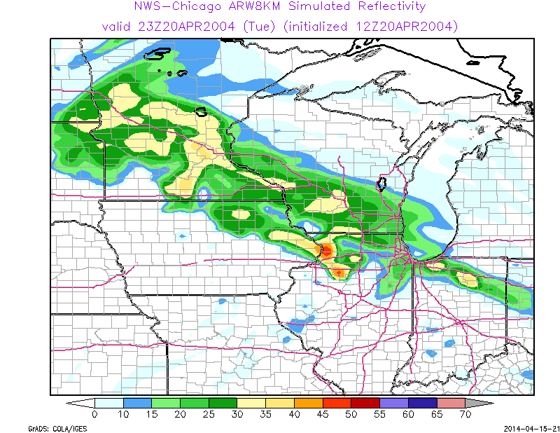
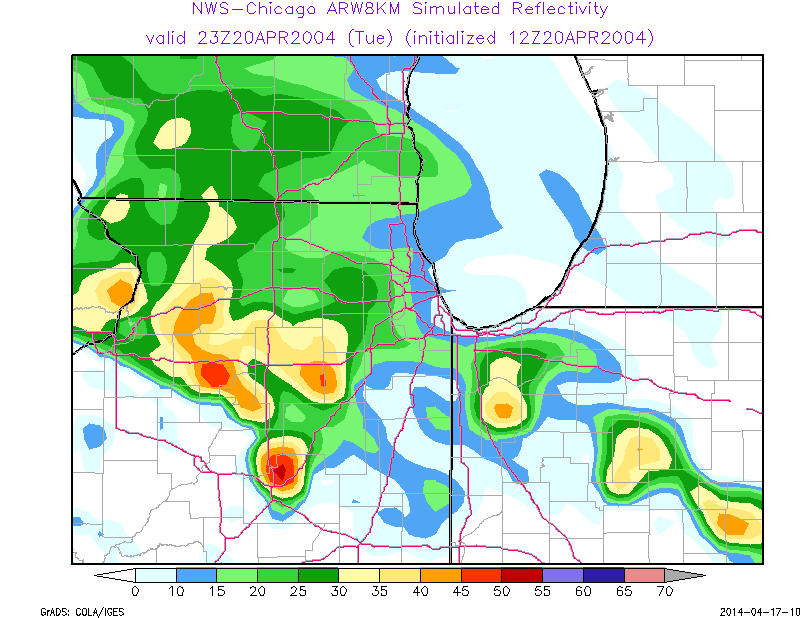
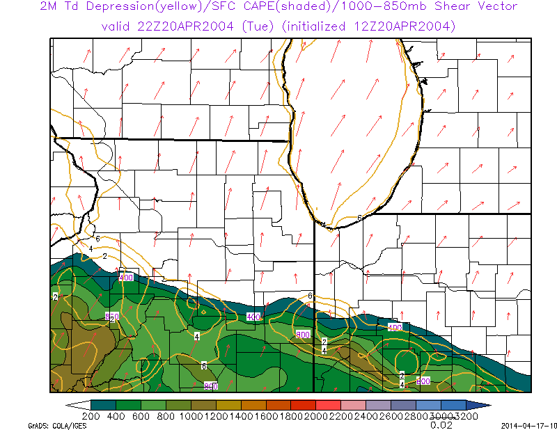
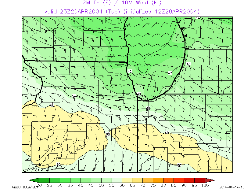
In addition to the above images displaying simulated reflectivity, forecasters now have the ability to display the antecedent conditions before seeing the main thunderstorms/supercells develop. Meteorologist scour these environmental parameters, in order to prepare for convective initiation. Below are just a couple parameters forecasters use in solving the meteorological puzzle.
Radar
In the past decade, there have been several advancements in the computer processing and displaying of radar data. The below image captures the difference in radar resolution that NWS warning forecasters have when interrogating radar data.
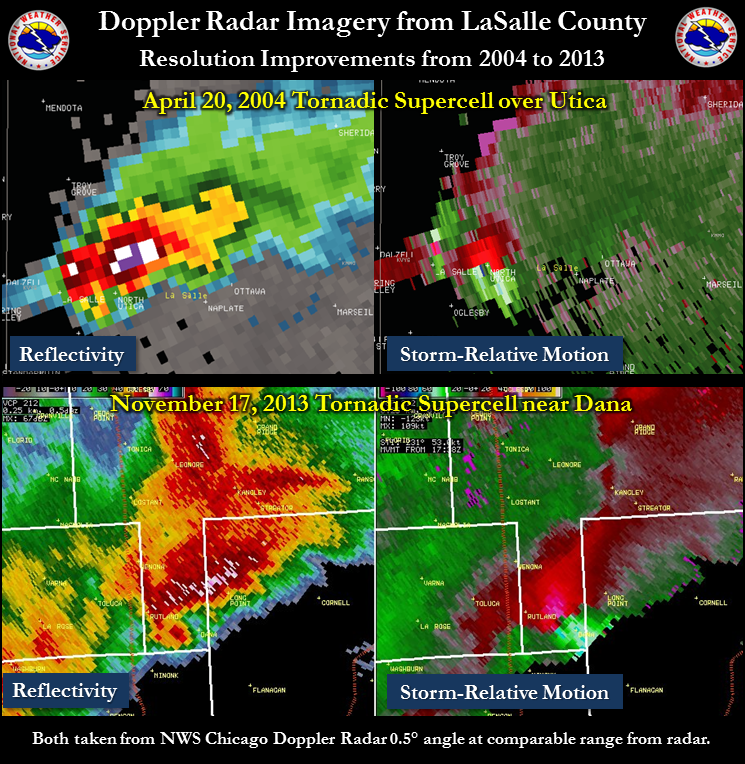
In addition, the NWS radars were upgraded to dual-polarization in 2011-2013. This advancement allowed for better detection of precipitation types, including hail, but it also allowed for meteorologists to better detect non-meteorological echoes, including tornadic debris. During the storm pictured above from November 17, 2013, NWS meteorologists could tell there was a destructive tornado based on concentrated debris signatures on radar from Washington to Dana.
Additional Information
Based upon a page originally created by Matt Friedlein, David Beachler, Richard Castro, and student volunteer Stephanie Gizzi. Maps and page updated by W. Scott Lincoln, Rafal Ogorek, and student volunteer Luke Henderson (spring 2023).
 |
Media use of NWS Web News Stories is encouraged! Please acknowledge the NWS as the source of any news information accessed from this site. Additional recaps can be found on the NWS Chicago Past Events Page |
 |