Overview
|
Fast Facts:
|
.png) Map showing the reports of wind reports, thunderstorm damage, and heavy rainfall from the morning of July 19th. |
Storm Reports and Photos
|
|
 |
| Wind damage in Forest Park, IL (courtesy of Zack Pearson) |
Wind damage in Summit, IL (courtesy of Anastasia Kwit) |
|
|
|
| Wind damage in Oak Park, IL (courtesy of Richard and Gloria Ballard) |
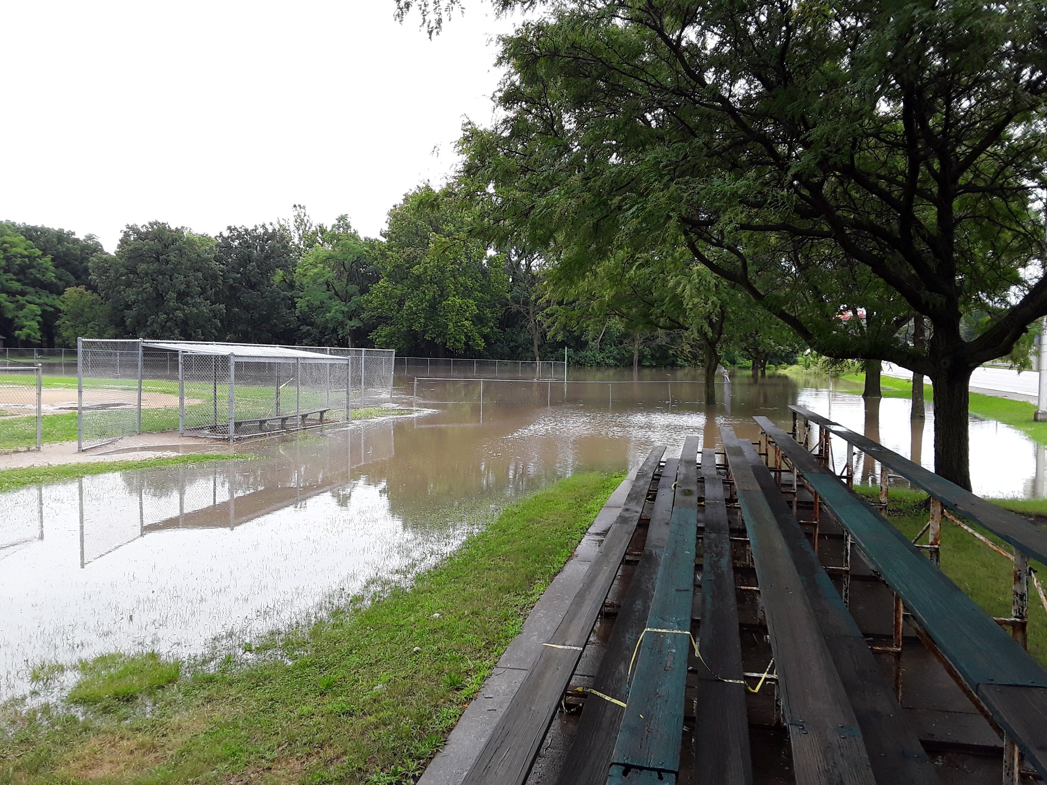
Flooding in Joliet, IL (courtesy of Twitter user @Axel48696392) |
PRELIMINARY LOCAL STORM REPORT...SUMMARY
NATIONAL WEATHER SERVICE CHICAGO IL
108 PM CDT MON JUL 20 2020

..TIME...   ...EVENT...      ...CITY LOCATION...     ...LAT.LON...
..DATE...   ....MAG....      ..COUNTY LOCATION..ST.. ...SOURCE....
            ..REMARKS..

1200 PM     TSTM WND GST     4 SW BAILEYS CORNER     41.03N 87.05W
07/19/2020  M86 MPH          JASPER             IN   TRAINED SPOTTER

            .

1140 AM     TSTM WND GST     3 SW MIDWAY AIRPORT     41.74N 87.78W
07/19/2020  M65 MPH          COOK               IL   CO-OP OBSERVER


1150 AM     MARINE TSTM WIND 3 NE NAVY PIER          41.92N 87.57W
07/19/2020  M61 MPH          LMZ741             IL   C-MAN STATION

            CORRECTS PREVIOUS TSTM WND GST REPORT FROM 3
            NE NAVY PIER FOR WIND SPEED. MEASURED AT THE
            CHICAGO HARRISON-DEVER CRIB.

1138 AM     TSTM WND GST     MIDWAY AIRPORT          41.78N 87.75W
07/19/2020  M55 MPH          COOK               IL   ASOS


1125 AM     TSTM WND GST     2 N PAPINEAU            40.99N 87.71W
07/19/2020  M52 MPH          IROQUOIS           IL   MESONET

            .

0920 AM     TSTM WND GST     3 ESE VALPARAISO        41.45N 87.01W
07/19/2020  M51 MPH          PORTER             IN   ASOS


0815 AM     TSTM WND GST     MORRIS                  41.36N 88.42W
07/19/2020  M42 MPH          GRUNDY             IL   EMERGENCY MNGR

            PEAK MEASURED WIND GUST OF 42 MPH. TREE
            LIMBS ARE DOWN AND ON POWER LINES ACROSS
            MORRIS AND NEAR COAL CITY. TIME ESTIMATED BY
            RADAR.

1207 PM     HEAVY RAIN       OAK FOREST              41.60N 87.74W
07/19/2020  M3.25 INCH       COOK               IL   TRAINED SPOTTER

            FROM THIS MORNING.

1140 AM     HEAVY RAIN       3.1 N CARBON HILL       41.34N 88.30W
07/19/2020  M3.06 INCH       GRUNDY             IL   COCORAHS

            STORM TOTAL NOW. RAIN HAS ENDED.

0912 AM     HEAVY RAIN       0.1 ESE HOMEWOOD        41.56N 87.66W
07/19/2020  M2.45 INCH       COOK               IL   COCORAHS

            STORM TOTAL SINCE 634 AM.

1035 AM     HEAVY RAIN       3.1 N CARBON HILL       41.34N 88.30W
07/19/2020  M1.94 INCH       GRUNDY             IL   COCORAHS

            STORM TOTAL SO FAR.

1027 AM     HEAVY RAIN       LANSING                 41.57N 87.54W
07/19/2020  M1.77 INCH       COOK               IL   CO-OP OBSERVER


1125 AM     HEAVY RAIN       1.3 SE LOCKPORT         41.58N 88.04W
07/19/2020  M1.19 INCH       WILL               IL   COCORAHS

            THUNDERSTORM WITH STRONG GUSTY WINDS, VERY
            HEAVY RAINFALL, OFTEN BLOWING HORIZONTAL SO
            AMOUNT IN GAUGE IS PROBABLY LESS THAN ACTUAL
            RAINFALL AMOUNT.

0812 AM     HEAVY RAIN       HOMEWOOD                41.56N 87.66W
07/19/2020  M1.08 INCH       COOK               IL   COCORAHS

            RAIN FELL IN 27 MINUTES.

0938 AM     HEAVY RAIN       4.7 ENE MANHATTAN       41.45N 87.90W
07/19/2020  M1.02 INCH       WILL               IL   COCORAHS

            RAIN FELL IN 60 MINUTES.

1130 AM     HEAVY RAIN       3 ESE PLAINFIELD        41.59N 88.15W
07/19/2020  M0.94 INCH       WILL               IL   COCORAHS

            RAIN FELL IN LAST 30 MINUTES.

1202 PM     TSTM WND DMG     4 W RENSSELAER          40.94N 87.23W
07/19/2020                   JASPER             IN   LAW ENFORCEMENT

            TREE BLOWN ONTO HOUSE.

1157 AM     TSTM WND DMG     REMINGTON               40.77N 87.15W
07/19/2020                   JASPER             IN   PUBLIC

            LARGE LIMBS DOWN IN REMINGTON. REPORTED BY
            COCORAHS OBSERVER. TIME ESTIMATED BY RADAR.

1150 AM     TSTM WND DMG     LAKEVIEW - CHICAGO      41.94N 87.66W
07/19/2020                   COOK               IL   PUBLIC

            PORTION OF LARGE TREE DOWNED ONTO ROAD.

1145 AM     TSTM WND DMG     LAKEVIEW - CHICAGO      41.94N 87.65W
07/19/2020                   COOK               IL   PUBLIC

            6-8 TREE BRANCH DOWN NEAR PARKED CARS. TIME
            ESTIMATED FROM RADAR. REPORT FROM SOCIAL
            MEDIA.

1144 AM     TSTM WND DMG     1 SSE CHICAGO LOOP      41.87N 87.62W
07/19/2020                   COOK               IL   BROADCAST MEDIA

            REPORTS OF LARGE TREE LIMBS AND NUMEROUS
            SMALLER LIMBS DOWN ALONG BALBO AND MICHIGAN
            AVENUE. TIME ESTIMATED BASED ON RADAR.

1142 AM     TSTM WND DMG     1 ESE OAK LAWN          41.71N 87.73W
07/19/2020                   COOK               IL   LAW ENFORCEMENT

            A TREE AND WIRES DOWN ON KOSTNER AVE AROUND
            99TH ST. TIME ESTIMATED PER RADAR.

1140 AM     TSTM WND DMG     OAK PARK                41.88N 87.78W
07/19/2020                   COOK               IL   PUBLIC

            VERY LARGE TREE LIMB DOWN IN A BACKYARD.
            SOCIAL MEDIA REPORT. TIME ESTIMATED FROM
            RADAR.

1135 AM     TSTM WND DMG     FOREST PARK             41.87N 87.82W
07/19/2020                   COOK               IL   PUBLIC

            A FEW TREES DOWNED IN FOREST PARK. TIME
            ESTIMATED BY RADAR.

1135 AM     TSTM WND DMG     1 ENE SUMMIT            41.79N 87.80W
07/19/2020                   COOK               IL   PUBLIC

            LOST A MASSIVE BRANCH ON A TREE AT ST.
            JOSEPH CHURCH IN SUMMIT. A FEW OTHER TREES
            LOST SMALLER LIMBS DOWN THE BLOCK, TOO.
            REPORT VIA SOCIAL MEDIA. TIME ESTIMATED VIA
            RADAR.

1120 AM     TSTM WND DMG     PALOS HEIGHTS           41.68N 87.80W
07/19/2020                   COOK               IL   PUBLIC

            LARGE TREE UPROOTED. TIME ESTIMATED BY
            RADAR.

1120 AM     TSTM WND DMG     PEOTONE                 41.33N 87.79W
07/19/2020                   WILL               IL   PUBLIC

            ROTTEN TREE DOWN ON A HOUSE -- 100 BLK OF
            WEST STREET IN PEOTONE. VIA SOCIAL MEDIA.
            TIME ESTIMATED BY RADAR.

1119 AM     TSTM WND DMG     LOCKPORT                41.58N 88.06W
07/19/2020                   WILL               IL   PUBLIC

            TRANSFORMER BLOWN DOWN FROM POWER POLE
            REPORTED AT DIVISION & HAMILTON ST.

1119 AM     TSTM WND DMG     1 NW DOWNERS GROVE      41.80N 88.02W
07/19/2020                   DUPAGE             IL   PUBLIC

            FENCE BLOWN DOWN BY STRONG WINDS. TIME
            ESTIMATED BY RADAR.

1117 AM     TSTM WND DMG     HOMER GLEN              41.60N 87.94W
07/19/2020                   WILL               IL   PUBLIC

            LARGE TREE SNAPPED. TIME ESTIMATED BY RADAR.

1117 AM     TSTM WND DMG     2 S LISLE               41.77N 88.07W
07/19/2020                   DUPAGE             IL   PUBLIC

            LARGE BRANCH DOWNED. TIME ESTIMATED.

1116 AM     TSTM WND DMG     NEW LENOX               41.51N 87.96W
07/19/2020                   WILL               IL   PUBLIC

            TREE DOWN ON ROUTE 30 IN NEW LENOX. TIME
            ESTIMATED BY RADAR.

1115 AM     TSTM WND DMG     LOCKPORT                41.58N 88.06W
07/19/2020                   WILL               IL   PUBLIC

            LARGE TREE DOWN ON A POWER LINE ON A POWER
            POLE NEAR DIVISION AND HAMILTON. REPORT VIA
            SOCIAL MEDIA.

1108 AM     TSTM WND DMG     CHANNAHON               41.43N 88.23W
07/19/2020                   WILL               IL   PUBLIC

            MULTIPLE MEDIUM SIZED BRANCHES DOWNED, UP TO
            SIX INCHES IN DIAMETER. TIME ESTIMATED PER
            RADAR.

1105 AM     TSTM WND DMG     OSWEGO                  41.67N 88.36W
07/19/2020                   KENDALL            IL   PUBLIC

            3-6 DIAMETER TREE BRANCH DOWN. REPORT VIA
            SOCIAL MEDIA. TIME ESTIMATED FROM RADAR.

1104 AM     TSTM WND DMG     1 WNW BOULDER HILL      41.72N 88.35W
07/19/2020                   KENDALL            IL   911 CALL CENTER

            LARGE TREE DOWN COMPLETELY BLOCKING THE
            ROADWAY. RELAYED BY KENDALL COUNTY DISPATCH.
            TIME ESTIMATED BASED ON RADAR.

1057 AM     TSTM WND DMG     COAL CITY               41.29N 88.28W
07/19/2020                   GRUNDY             IL   PUBLIC

            SEVERAL TREES AND TREE LIMBS DOWNED IN COAL
            CITY. TIME ESTIMATED BY RADAR.

1056 AM     TSTM WND DMG     CARBON HILL             41.29N 88.30W
07/19/2020                   GRUNDY             IL   911 CALL CENTER

            TREES AND POWERLINES DOWN. RELAYED BY GRUNDY
            COUNTY SO. TIME ESTIMATED BASED ON RADAR.

1050 AM     TSTM WND DMG     MORRIS                  41.36N 88.42W
07/19/2020                   GRUNDY             IL   911 CALL CENTER

            POWERLINES DOWN ACROSS THE BOAT LAUNCH AT
            STRATTON PARK. RELAYED BY GRUNDY COUNTY SO.
            TIME ESTIMATED BASED ON RADAR.

1048 AM     TSTM WND DMG     MORRIS                  41.36N 88.42W
07/19/2020                   GRUNDY             IL   911 CALL CENTER

            TREES AND POWERLINES DOWN. RELAYED BY GRUNDY
            COUNTY SO. TIME ESTIMATED BASED ON RADAR.

1045 AM     TSTM WND DMG     PONTIAC                 40.88N 88.63W
07/19/2020                   LIVINGSTON         IL   LAW ENFORCEMENT

            LARGE TREE DOWN; KNOCKED DOWN POWER LINES;
            REQUIRED CREWS TO REMOVE.

1040 AM     TSTM WND DMG     RANSOM                  41.16N 88.65W
07/19/2020                   LA SALLE           IL   PUBLIC

            TREE DOWNED ONTO POWER LINES. TIME ESTIMATED
            BY RADAR.

1031 AM     TSTM WND DMG     MARSEILLES              41.33N 88.71W
07/19/2020                   LA SALLE           IL   PUBLIC

            SEVERAL LARGE TREE LIMBS DOWNED. ALSO MINOR
            STREET FLOODING. TIME ESTIMATED BY RADAR.

1023 AM     TSTM WND DMG     MENDOTA                 41.54N 89.12W
07/19/2020                   LA SALLE           IL   PUBLIC

            NUMEROUS TREE LIMBS DOWN ON THE SOUTH SIDE
            OF MENDOTA. TIME ESTIMATED BY RADAR. RELAYED
            VIA NWS EMPLOYEE.
&&

$$
 |
Media use of NWS Web News Stories is encouraged! Please acknowledge the NWS as the source of any news information accessed from this site. Additional recaps can be found on the NWS Chicago Past Events Page |
|