| Fast Facts | Reports | Photos and Video | Radar & Meteorology |
Isolated supercell thunderstorms developed during the late afternoon over Livingston and McLean counties and tracked northeast toward the Chicago metro through the early evening.
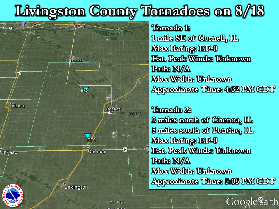
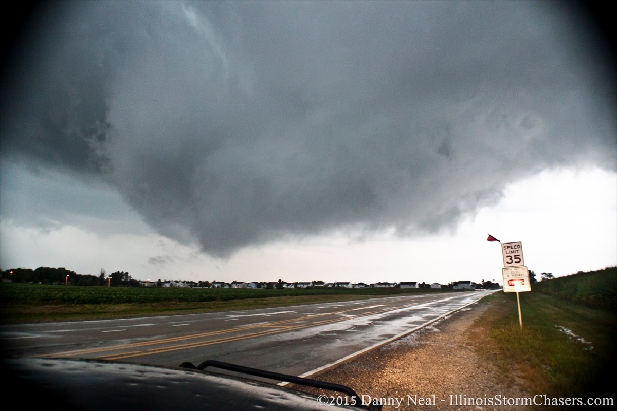
There were two separate and brief EF-0 tornado touchdowns in Livingston County, one near Cornell and the other north of Chenoa. No damage was observed with these brief touchdowns.
The supercell thunderstorm that produced a brief EF-0 tornado near Cornell maintained persistent rotation as it tracked across Grundy County, with numerous photos of a very low wall cloud, and reports of possible brief funnel clouds at times near Kinsman and Mazon.
Rotation increased at the lower levels as the storm tracked from Grundy into Will County and the storm exhibited a classic hook echo on radar reflectivity as it moved over Joliet, prompting a Tornado Warning to be issued for northern Will County. The storm very nearly produced a tornado almost directly over the NWS Chicago office in Romeoville, with staff taking shelter and NWS Lincoln IL taking over backup warning responsibility for a brief time. Part of the advance planning for severe weather in the NWS is to have established backup offices that can issue timely warnings for our area of responsibility even in the rare cases when we have to take shelter.
A line of strong to severe storms producing torrential rainfall moved in behind the supercell thunderstorms, producing sporadic wind damage in portions of northern Illinois and also flash flooding in portions of Rockford. Another Tornado Warning was issued for southeast DuPage county for rotation embedded within the line of storms. Two additional EF-0 tornadoes associated with rotation embedded within the line of storms were confirmed on August 21st, the first from extreme southeast Naperville to far eastern Woodridge, and the second a brief path through Downers Grove.
The 2.87" of rain that fell at Rockford Airport on August 18th set a new record for the date, breaking the previous record set in 2005.
Reports, Tornado Information and Rainfall Map
| Map of Livingston County EF-0 Tornadoes (click to enlarge) |
 |
| Extreme Southeast Naperville to Bolingbrook to Woodridge EF-0 Tornado (click to enlarge) |
.png) |
| Downers Grove EF-0 Tornado (click to enlarge) |
 |
| Listing of 1"+ Rain Amounts and 24-Hour Rainfall Map (click to enlarge) |
 |
Photos (click to enlarge)
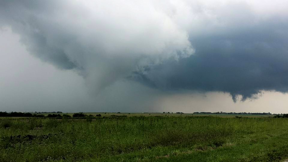
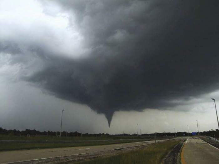
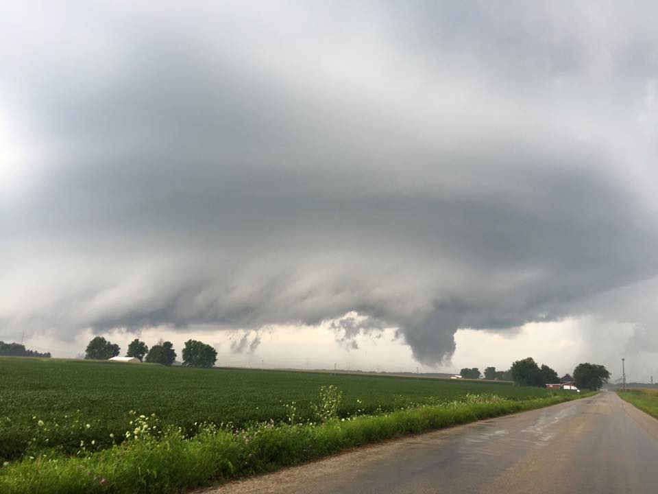
| Matt Spika - near Cornell, IL | Rich Lewis - north of Chenoa, IL | Cory Matthews - near Kinsman, IL |
 |
 |
 |
| Kevin Sheely - Mazon, IL | Danny Neal - Romeoville, IL | Flooding in Rockford via WIFR |
 |
 |
 |
Video
Rotating Wall Cloud over Romeoville, Illinois, August 18th 2015: YouTube video courtesy of Illinois Storm Chasers
(note: brief mild profane language)
Radar
| Cornell IL: Left - Base Reflectivity Right - Base Velocity |
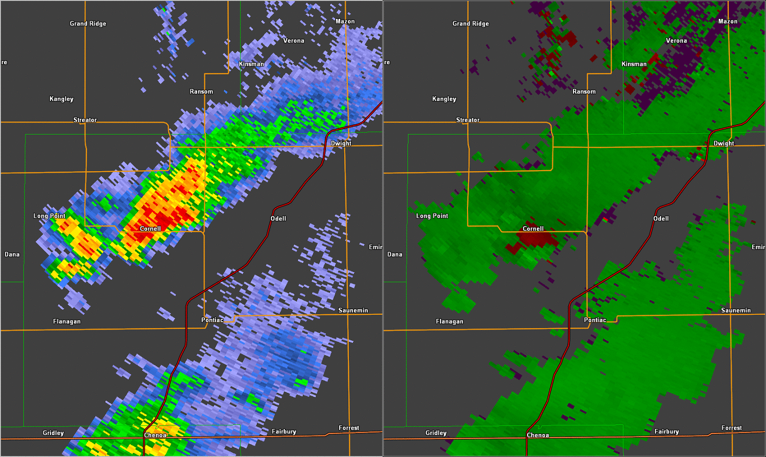 |
| Chenoa - Pontiac: Left - Base Reflectivity Right - Base Velocity |
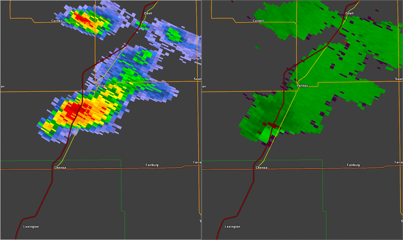 |
----------------------------------------------------------------------------------------------------------------------------------------------------------------------------------------------------------------------------------------------
Meteorology
Why Were there Only Brief Tornado Touchdowns in Livingston County and No Tornado With the Will County Supercell?
Isolated supercell thunderstorms developed over portions of central Illinois in the mid to late afternoon hours on Tuesday August 18th. Two of these supercells produced brief EF-0 torndado touchdowns in Livingston County IL, one near Cornell and the second touchdown north of Chenoa. The parent supercell of the Cornell tornado maintained its rotating updraft aloft, known as a mesocyclone, and tracked northeast across Grundy County, where there were numerous reports and photos of a very low wall cloud and possibly brief funnel clouds at times near Kinsman and Mazon. The same storm then strengthened over Will County and very nearly produced a tornado almost directly over the NWS Chicago office in Romeoville IL, followed by gradual weakening as the storm tracked northeast into Cook County. Why did these supercell thunderstorms not produce damaging tornadoes?
Late Afternoon and Early Evening Environment (images are from SPC Mesoanalysis Page)
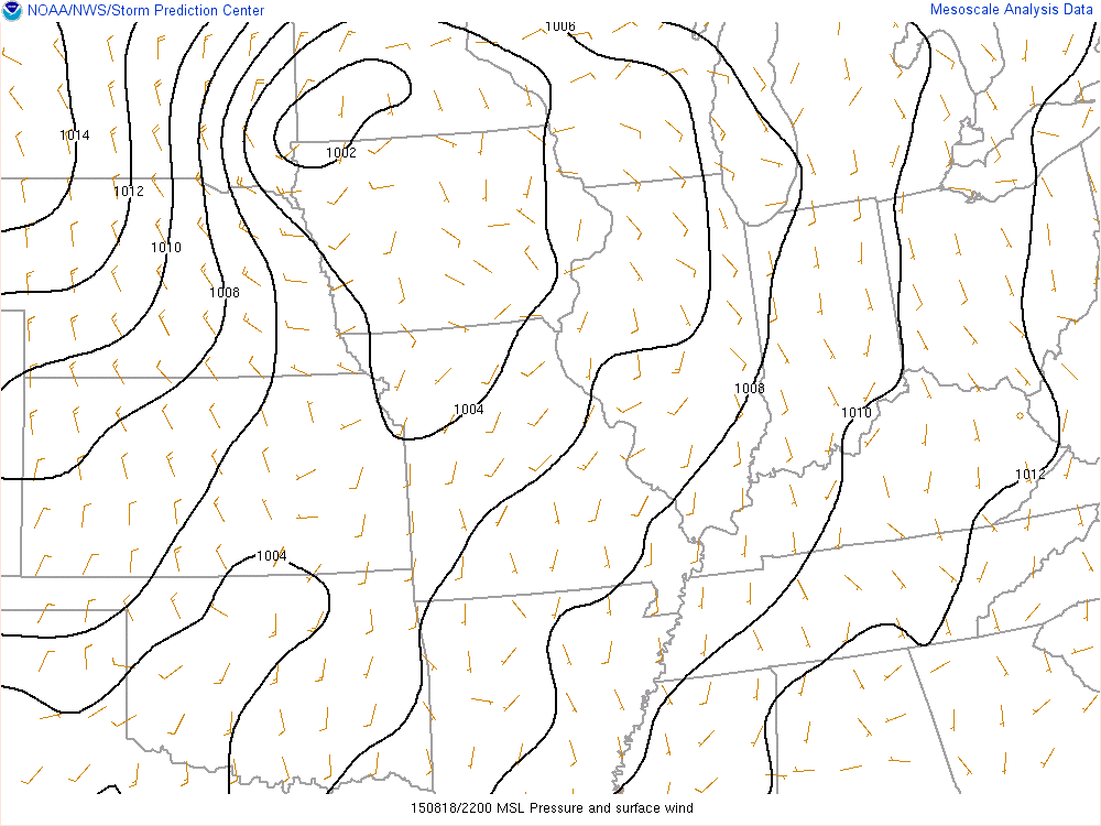
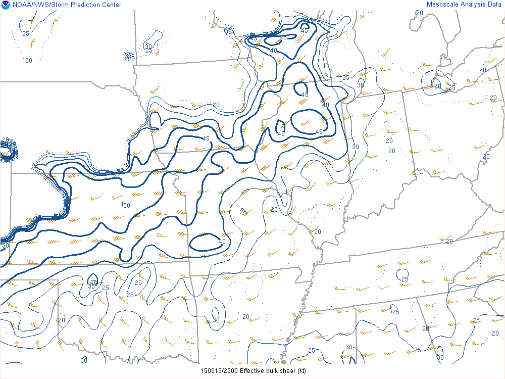
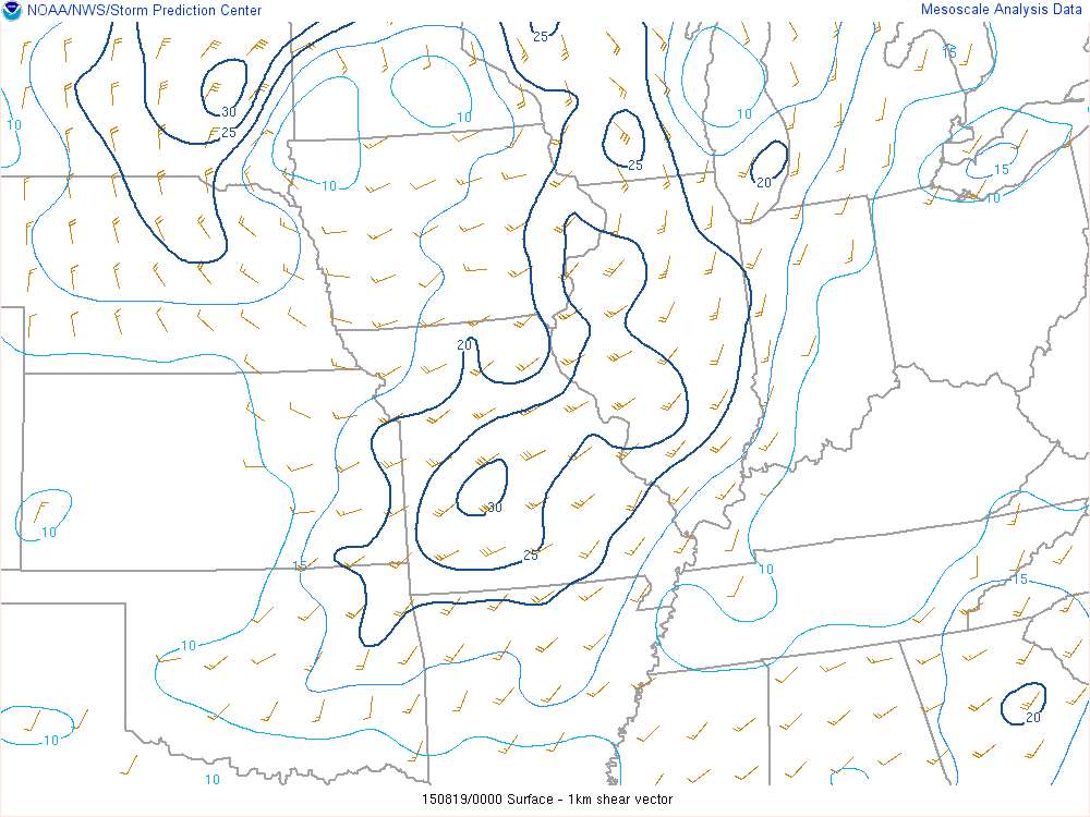
A fairly deep low pressure system for mid August around 1000 mb tracked from northern Iowa into southern Minnesota (Figures 1 and 2). This resulted in southeast winds at the surface over central and northern Illinois, topped by stronger south-southwest winds at about 5,000 up in the atmosphere and then southwest winds at 10,000 and 15,000 feet. This environment was very favorable for supercell thunderstorms, with about 35 to 45 kt of effective bulk wind shear that also featured good directional shear for rotating updrafts. 30 kts or more of bulk wind shear are considered to be favorable for supercell thunderstorms (Figure 3 and 4).
|
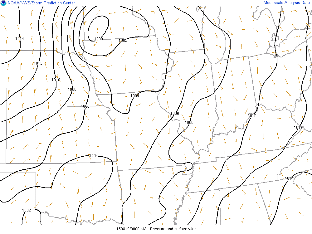
Figure 1 Surface Map at 5pm (around Time of Livingston Co. Tornadoes) Wind barbs on map denote direction wind is coming from and speed. Lines extending from wind barb are every 5 knots. Shortest line = 5 knots, slightly longer line = 10 knots, 15 knots = 10 kt and 5 kt lines, 20 kt = Two 10 kt lines etc. Note that wind speeds were southeast but only about 10 mph on the analysis. |
Figure 2 Surface Map at 7pm (Shortly Before Wall Cloud Passed over NWS Chicago) At 7pm, winds were still out of the southeast at only around 10 mph. |
 |
 |
|
Figure 3 Effective Bulk Shear at 5pm (click to enlarge) Values of 30 kt or more are considered favorable for supercell thunderstorms. |
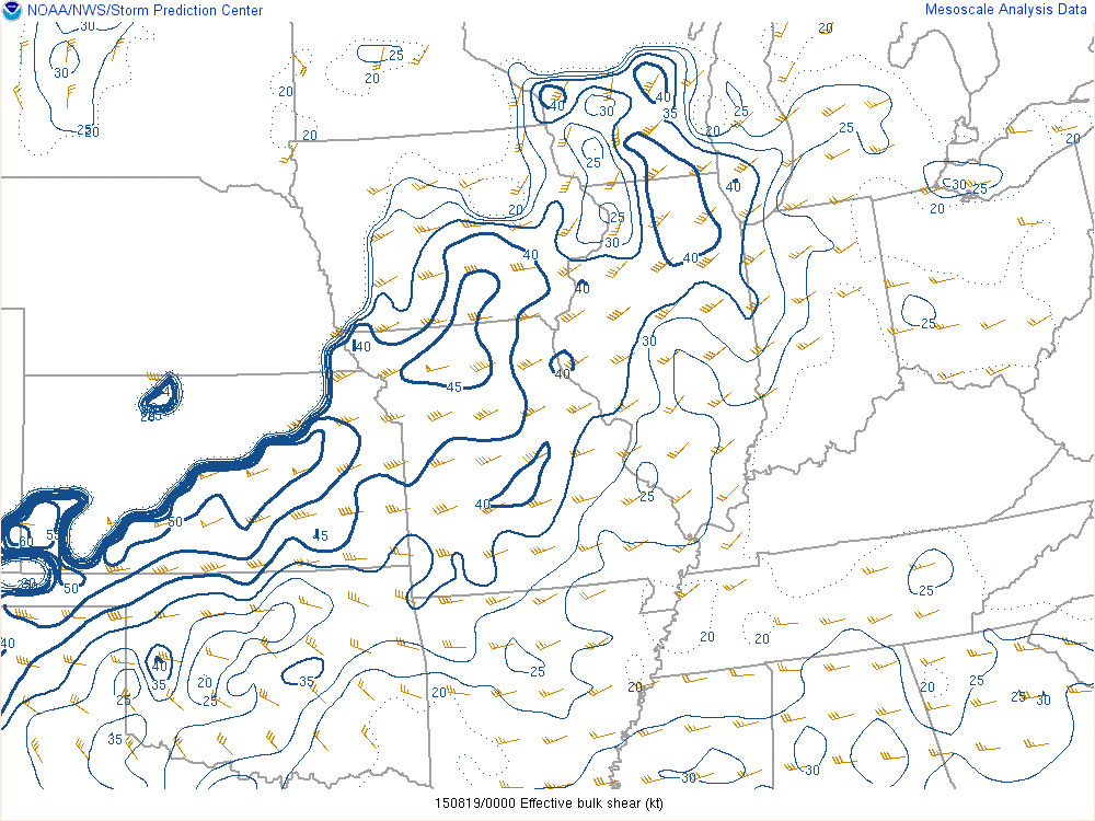
Figure 4 Effective Bulk Shear at 7pm (click to enlarge) |
 |
 |
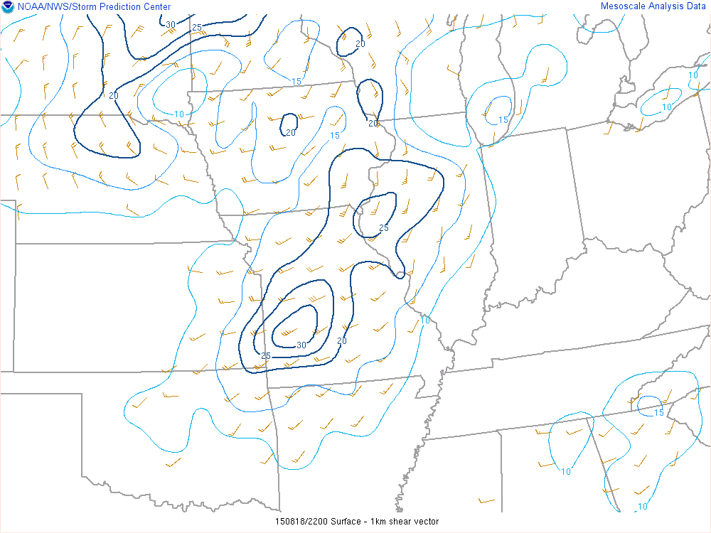
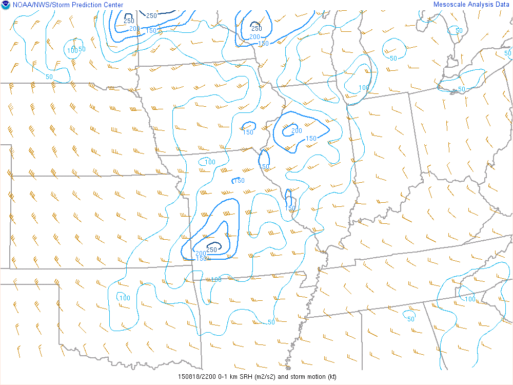
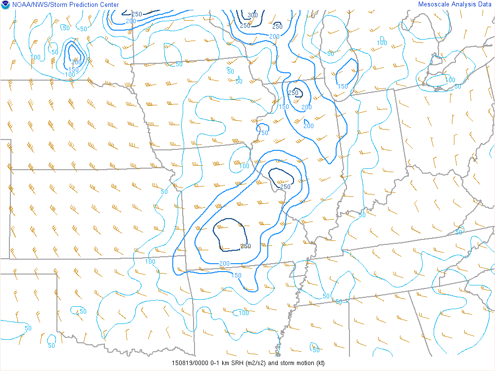
In addition, the southeast surface winds in place, known as “backed winds” are a favorable signal for tornadoes when topped by winds veering to south and southwest up to the 5,000 foot level. This created 20 to 30 kt of 0-1km wind shear (Figures 5 and 6) and storm relative helicity (SRH) of 150-250 m2/s2 (Figures 7 and 8). Typically, 0-1 km wind shear values of 15-20 kt or more and 0-1 SRH of 100 m2/s2 or more are considered sufficient for damaging tornadoes.
|
Figure 5 0-1 km Wind Shear (knots) at 5pm (click to enlarge) Values of 15-20 knots or more are typically considered favorable for damaging supercell tornadoes. |
Figure 6 0-1 km Wind Shear at 7pm (click to enlarge) |
 |
 |
|
Figure 7 0-1 Storm Relative Helicity (m2/s2) at 5pm (click to enlarge) Values of 150 m2/s2 or higher are considered favorable for damaging supercell tornadoes. |
Figure 8 0-1 Storm Relative Helicity (m2/s2) at 7pm (click to enlarge) |
 |
 |
So, Again, Why No Damaging Tornadoes?
Looking closer at the surface observations, the relatively distant location of the low pressure center only supported surface wind speeds of 5-15 mph. Commonly, near-storm tornado environments feature southerly winds of 15 to 20 mph or more, which increases the inflow of warm, moist air into the wall cloud (updraft) of the supercell thunderstorm, further increasing low level shear and creating a better balance with the cool rear flank downdraft air wrapping around the mesocyclone and supporting tornadogenesis. Therefore, our theory is that the surface wind speeds were ever so slightly lacking to support sufficient warm, moist inflow for stronger, damaging tornadoes. Had the surface low tracked slightly closer to our area, wind speeds would have been stronger and possibly more supportive of damaging tornadoes in our area (Figure 9).
| Tornadogenesis Description & our Theory on Why Supercell Storms Didn't Produce Damaging Tornadoes |
.png) |

