Fast Facts
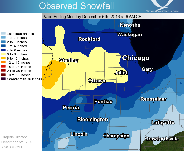
Snow/Ice Totals
 |
Public Information Statement
National Weather Service Chicago IL
1016 AM CST Mon Dec 05 2016

...Morning Snowfall Roundup...

   The following are snow amounts for the previous 24 hours
   as measured in the morning by NWS Cooperative Observers
   and CoCoRaHS observers.
   Observations are usually taken at 7 AM.

   24-hour Snowfall Amounts for Monday(12/05/16)...


Northern Illinois                              Snow
  Location (County):                           fall(inches)

  Elburn (Kane).................................9.0
  De Kalb (De Kalb).............................8.5
  Dixon 3NNW (Lee)..............................8.5
  Romeoville (Will).............................8.1
  De Kalb (De Kalb).............................7.6
  Somonauk 2NE (De Kalb)........................7.5
  Minooka (Grundy)..............................7.5
  Sublette (Lee)................................7.5
  Ottawa 2N (La Salle)..........................7.5
  Joliet 2n (Will)..............................7.5
  Schaumburg 2E (Cook)..........................7.4
  Geneva 4WSW (Kane)............................7.4
  St. Charles (Kane)............................7.3
  La Salle (La Salle)...........................7.3
  Earlville 3S (La Salle).......................7.2
  Plainfield 2SSE (Will)........................7.2
  Amboy (Lee)...................................7.0
  Elburn (Kane).................................7.0
  Plainfield 5SW (Kendall)......................7.0
  Elburn (Kane).................................7.0
  North Aurora 2NE (Kane).......................7.0
  Elgin 2W (Kane)...............................7.0
  Ottawa 1NW (La Salle).........................7.0
  Bull Valley 2WNW (McHenry)....................7.0
  Downers Grove 0.4NNE (Du Page)................6.9
  Buffalo Grove 2N (Lake).......................6.9
  Elk Grove Village 1ESE (Cook).................6.8
  Elk Grove Village 2WSW (Cook).................6.8
  Hoffman Estates 5W (Cook).....................6.7
  Naperville 1NW (Du Page)......................6.7
  Ashton (Lee)..................................6.6
  Plainfield (Will).............................6.6
  Genoa (De Kalb)...............................6.5
  Batavia 2WNW (Kane)...........................6.5
  Geneva 1SSW (Kane)............................6.5
  Dixon 2SW (Lee)...............................6.5
  New Lenox 4SE (Will)..........................6.5
  Westmont (Du Page)............................6.5
  Montgomery 1SSE (Kendall).....................6.4
  New Lenox 3E (Will)...........................6.4
  Ohare (Cook)..................................6.4
  Batavia 1WSW (Kane)...........................6.3
  Riverwoods (Lake).............................6.3
  Manhattan 2SE (Will)..........................6.3
  Manhattan (Will)..............................6.3
  Woodstock (McHenry)...........................6.3
  Batavia 1WNW (Kane)...........................6.2
  Elgin (Kane)..................................6.1
  Homewood (Cook)...............................6.1
  Bolingbrook 3NE (Du Page).....................6.1
  Aurora (Kane).................................6.0
  Batavia (Kane)................................6.0
  Botanic Gardens (Cook)........................6.0
  Harvard (McHenry).............................6.0
  Oak Lawn (Cook)...............................6.0
  Chicago Ridge (Cook)..........................6.0
  Park Forest 1SW (Cook)........................6.0
  Morris 6ESE (Grundy)..........................6.0
  Sugar Grove 1NE (Kane)........................6.0
  New Lenox 2SE (Will)..........................6.0
  Lockport 1SE (Will)...........................6.0
  Joliet Lock/dam (Will)........................6.0
  Lake Zurich (Lake)............................6.0
  Mendota (La Salle)............................6.0
  Morris (Grundy)...............................6.0
  Ottawa (La Salle).............................6.0
  Willow Springs (Cook).........................6.0
  Cortland (De Kalb)............................5.9
  Wonder Lake 1WNW (McHenry)....................5.9
  Coal City 4NNW (Grundy).......................5.8
  Countryside 1ENE (Cook).......................5.8
  Burr Ridge 2SW (Du Page)......................5.8
  Carbon Hill 3.1N (Grundy).....................5.8
  Peotone (Will)................................5.8
  Mundelein (Lake)..............................5.8
  Peotone (Will)................................5.8
  Lisle 1SE (Du Page)...........................5.6
  Cary (McHenry)................................5.6
  Homer Glen 1ENE (Will)........................5.6
  Elgin (Kane)..................................5.5
  Worth (Cook)..................................5.5
  Park Ridge (Cook).............................5.5
  Oak Lawn 2WNW (Cook)..........................5.5
  Elmhurst 1ESE (Du Page).......................5.5
  Naperville 2SE (Du Page)......................5.5
  Elgin 1S (Kane)...............................5.5
  Gurnee 2W (Lake)..............................5.5
  Lakemoor 2SE (Lake)...........................5.5
  Streator 4ENE (La Salle)......................5.5
  Wilmington 3SE (Will).........................5.5
  Midway Coop (Cook)............................5.5
  Paw Paw (Lee).................................5.5
  St. Charles 6NW (Kane)........................5.4
  La Grange Park 1SSW (Cook)....................5.3
  Fox Lake 2SE (Lake)...........................5.3
  Byron 3N (Ogle)...............................5.3
  Marengo (McHenry).............................5.3
  Rockford (Winnebago)..........................5.3
  Barrington (Lake).............................5.2
  Highwood 1S (Lake)............................5.2
  Antioch 4W (Lake).............................5.0
  Dwight (Livingston)...........................5.0
  Oak Park 2S (Cook)............................5.0
  Alsip (Cook)..................................5.0
  Aurora 4SE (Du Page)..........................5.0
  Mazon 0.5ENE (Grundy).........................5.0
  Mundelein 2WNW (Lake).........................5.0
  Algonquin 1N (McHenry)........................5.0
  Rockford 1NW (Winnebago)......................5.0
  Lansing (Cook)................................5.0
  Marseilles (La Salle).........................5.0
  Lisle Morton Arb (Du Page)....................5.0
  Dwight 4NNW (Grundy)..........................4.9
  Rochelle (Ogle)...............................4.9
  Seneca 2SSW (La Salle)........................4.7
  Bonfield 4WSW (Kankakee)......................4.5
  Streator 1WSW (La Salle)......................4.5
  Rockford 2ENE (Winnebago).....................4.5
  Momence (Kankakee)............................4.5
  Braceville (Grundy)...........................4.4
  Roscoe 2ESE (Winnebago).......................4.4
  Roscoe 2se (Winnebago)........................4.4
  Bourbonnais (Kankakee)........................4.2
  Capron (Boone)................................4.2
  Beach Park 1W (Lake)..........................4.2
  Crete 3E (Will)...............................4.2
  Hebron (McHenry)..............................4.1
  Burnham-hegewisch 2NNW (Cook).................4.1
  Polo (Ogle)...................................4.1
  Palatine 1E (Cook)............................4.0
  Mount Prospect 3NE (Cook).....................4.0
  Lincolnshire 1N (Lake)........................4.0
  Kankakee (Kankakee)...........................4.0
  Mchenry (McHenry).............................4.0
  Pontiac (Livingston)..........................4.0
  Ashkum 5.6E (Iroquois)........................3.3
  Watseka 6.9WNW (Iroquois).....................3.3
  Chatsworth (Livingston).......................3.0
  Glen Ellyn 2SSE (Du Page).....................3.0
  Lake Forest 2NNE (Lake).......................3.0
  Chatsworth (Livingston).......................3.0
  Park Forest (Cook)............................3.0
  Oak Park 1NNE (Cook)..........................2.9
  Winnetka 1ESE (Cook)..........................2.8
  St Anne (Kankakee)............................2.8
  Lincolnwood 2E (Cook).........................2.6
  Chicago 6ESE (Cook)...........................2.5
  Waukegan 2N (Lake)............................2.1
  Fairbury (Livingston).........................2.0
  Lincolnwood 3E (Cook).........................1.8
  Cissna Park 1S (Iroquois).....................1.6
  Paxton (Ford).................................1.0

Northwest Indiana                              Snow
  Location (County):                           fall(inches)

  (w9mal)Merrillville 2NNW (Lake)...............5.9
  Valparaiso 2WNW (Porter)......................5.0
  Dyer 1WNW (Lake)..............................4.8
  Valparaiso 6SSW (Porter)......................4.6
  Valparaiso 6WSW (Porter)......................4.5
  Hebron 4NE (Porter)...........................4.4
  Portage 3E (Porter)...........................4.2
  Crown Point (Lake)............................4.1
  Crown Point 1N (Lake).........................4.1
  Porter 1S (Porter)............................4.1
  Crown Point 2WSW (Lake).......................4.0
  Valparaiso 1SE (Porter).......................4.0
  St. John (Lake)...............................3.7
  Valparaiso 4SW (Porter).......................3.6
  Rensselaer (Jasper)...........................3.5
  Gary 5ENE (Lake)..............................3.3
  Remington (Jasper)............................3.1
  (w9opr)Wheatfield 1ENE (Jasper)...............3.0
  (kb9f)Valparaiso 4S (Porter)..................3.0
  De Motte 4SW (Jasper).........................2.5
  Remington (Jasper)............................2.3
  De Motte 1NNW (Jasper)........................2.0
  De Motte 1SSW (Jasper)........................2.0
  Morocco (Newton)..............................2.0

$$
Meteorology
The first winter storm of the season for northern Illinois and northwest Indiana was a quick-moving but efficient one. The most favorable meteorological elements in place for this storm were 1.) robust upper forcing producing high snowfall rates, 2.) high moisture (especially for the type of weather system), and 3.) ideal thermal and wind profiles for larger snowflakes reaching the surface.
The moisture and its degree of replenishment for "only" a ~9-10 hour event were challenging ones for forecasters, as typically a progressive system with little surface reflection (i.e. no surface low) do not have enough moisture return for snow water equivalents of 0.35 to 0.70 inches (which were observed). While the strong forcing and the favored profiles for larger flakes were better forecast, this higher moisture supported snowfall amounts higher than forecast, and in some areas by quite a bit. In addition, the higher rates were more persistent than initially thought. By radar analysis alone, this appeared to not be from the typical banded snow, but more so owing to the somewhat compact but very strong upper forcing in the presence of conditionally unstable air. Finally, underneath those heaviest snow rates, snow ratios observed were more on the order of 13:1 or higher, which was higher than forecast (~10:1). Ratios on that order point toward the strong forcing being collocated within the dendritic growth zone (DGZ).
The timing of the snow was a factor forecast fairly well for a couple days in advance. In addition, little impacts from wind and temperatures (e.g. not falling well below 32°) were elements well forecast leading up to this event.
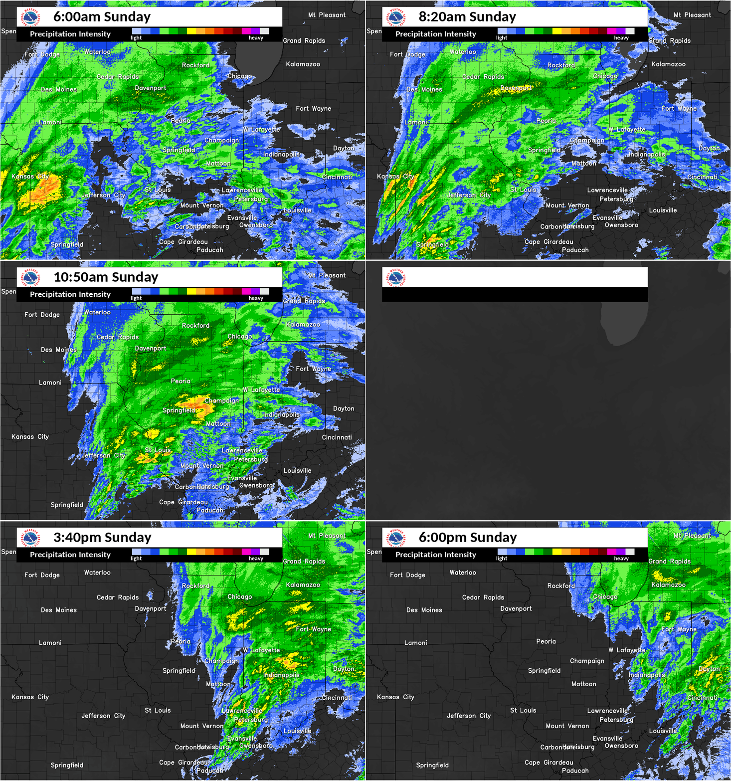 |
| December 4, 2016: Radar loop from 6 a.m.-6 p.m. (missing data 1 p.m.-2 p.m.) |
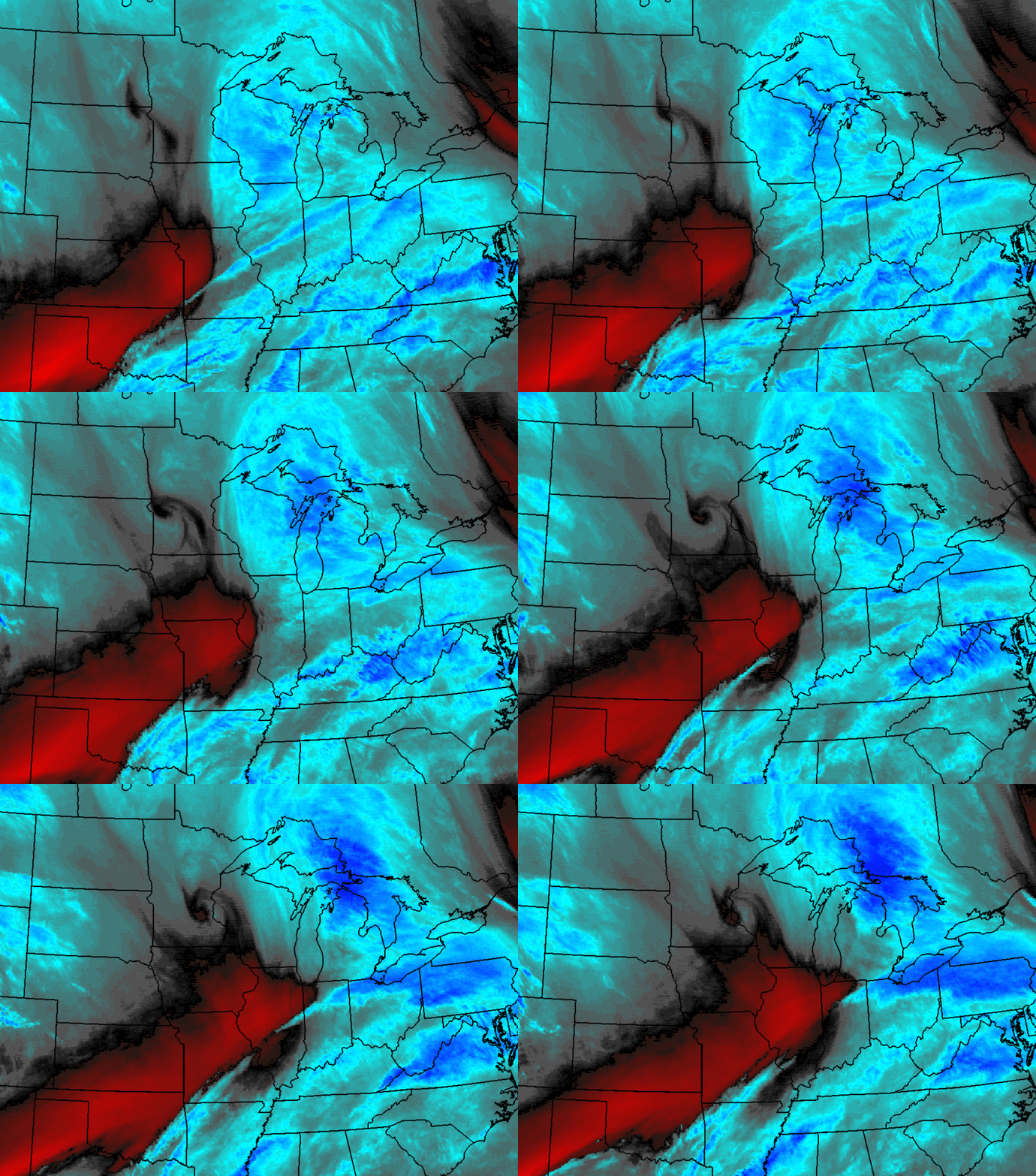 |
| December 4, 2016: GOES Water Vapor loop from 12 p.m. to 7 p.m. |
 |
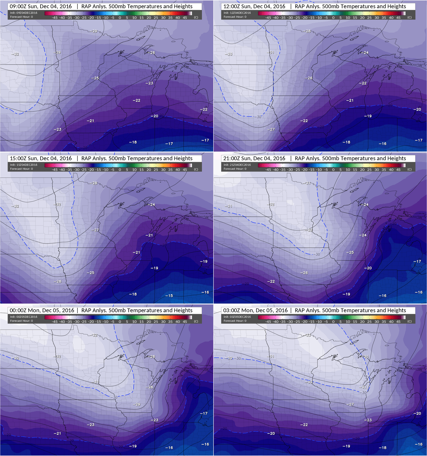 |
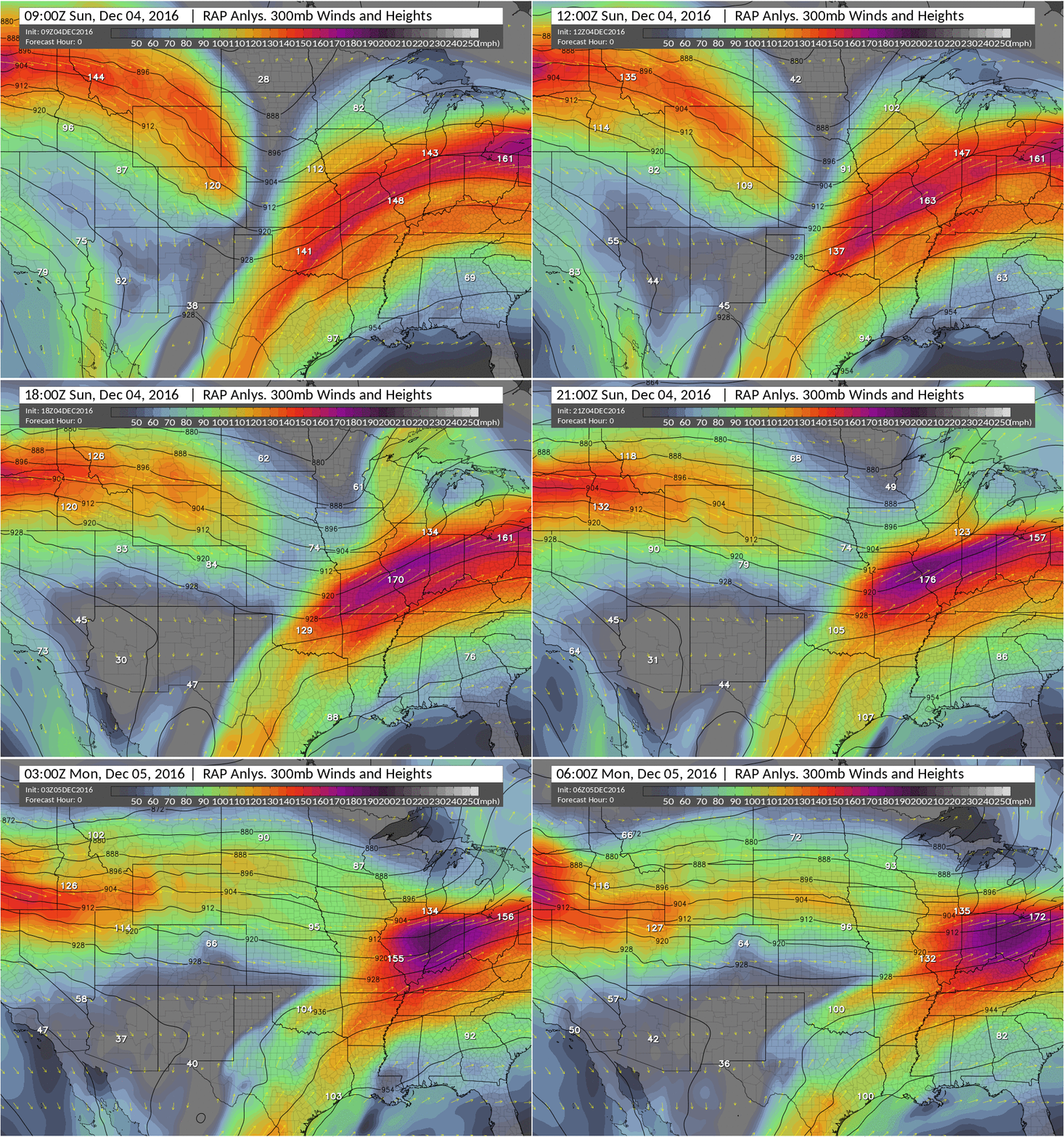
| December 4, 2016: RAP 3-hour Analysis of 300 mb from 3 a.m. to 12 a.m. The colors indicate the upper jet that peaks at an impressive 180 kt (~200 mph) over central Illinois across the northern Ohio River Valley. Northern Illinois and northwest Indiana were under a pronounced left exit region of this jet during the morning through mid-afternoon, favoring rapid ascent of air (lift). This supported broad areas of moderate to heavy snow, and likely more so than typical low to mid-level banded parameters that meteorologists look at. | December 4, 2016: RAP 3-hour Analysis of 500 mb from 3 a.m. to 9 p.m. The colors indicate temperatures while the black lines are heights. The upper wave (trough) was low amplitude, however it acquired a more negative tilt (northwest-to-southeast alignment) in the afternoon thanks to the upper jet in the image to the left. This evolution is a good signature correlating with strong forcing for lift ahead of this disturbance, and often can mean instability is realized too. |
 |
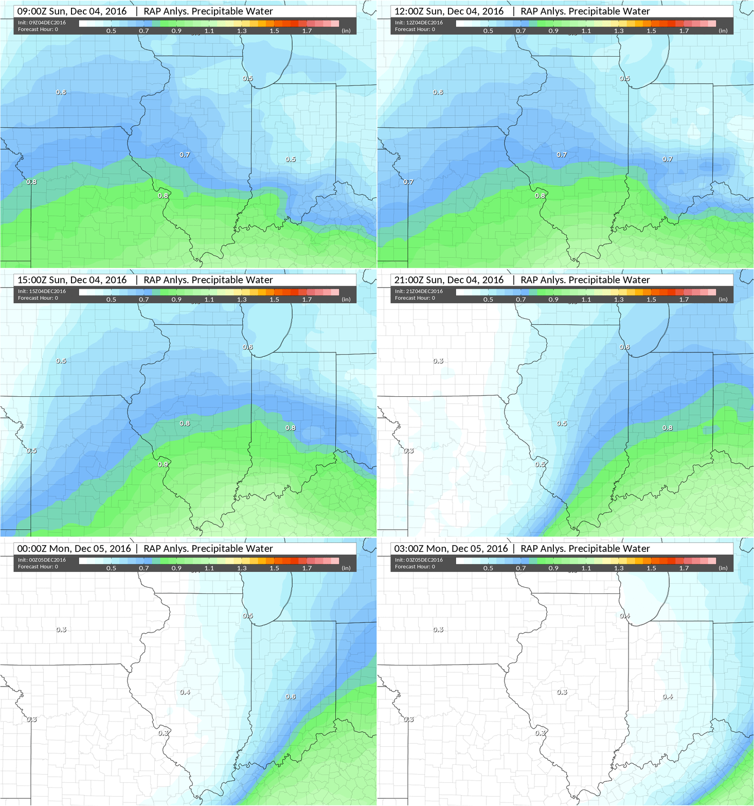 |
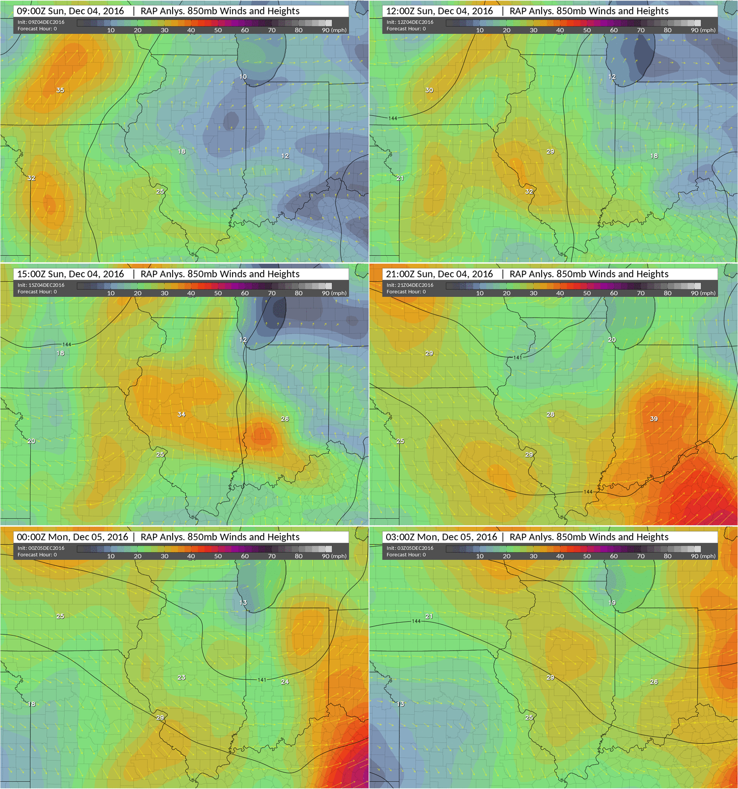
| December 4, 2016: RAP 3-hour Analysis of 850 mb from 3 a.m. to 9 p.m. The colors indicate wind speed. Higher speeds at 850 mb often can be a good proxy for magnitude of moisture return when the wind is southerly. Speeds in excess of 25 kt developed in response to the deepening upper wave shown above. This replenishment of moisture was more so than expected and resulted in higher moisture presence during snowfall time, especially considering this was a fairly low amplitude system with little surface reflection. | December 4, 2016: RAP 3-hour Analysis of Precipitable Water (PW) from 3 a.m. to 9 p.m. A value indicating moisture through the atmospheric column is Precipitable Water. Amounts of 0.6+ inches were steered into the area during the peak forcing time. While these values are not off the chart for early December, for the type of weather system they were quite high. |
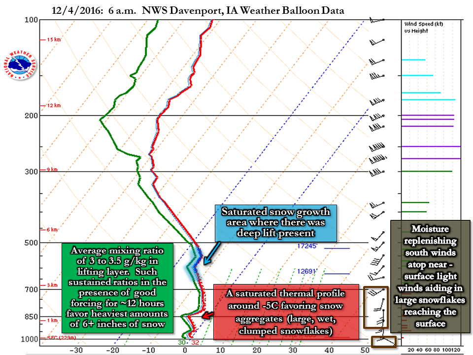 |
| December 4, 2016: Davenport, IA weather balloon data (sounding) at 6 a.m. |
Additional
Photos
 |
 |
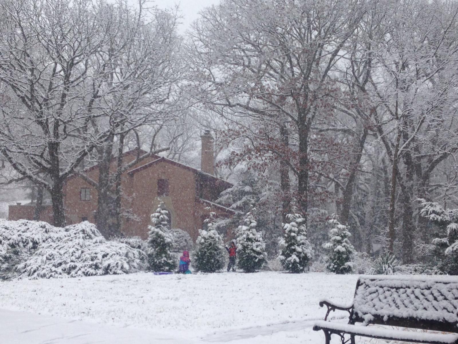 |
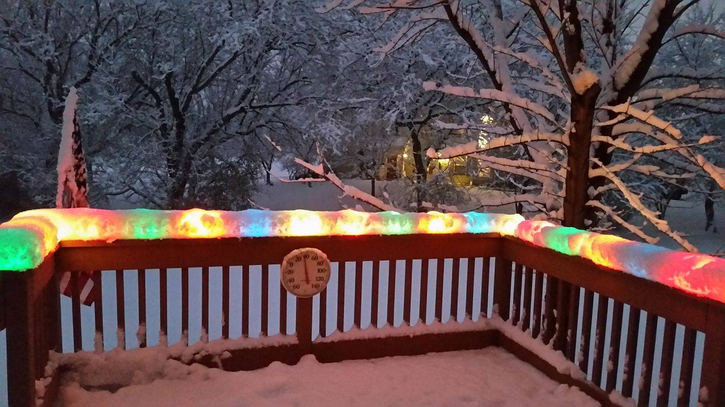
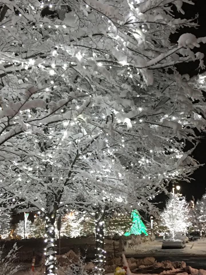
| Photo courtesy of Bill Malarski | Photo courtesy of Liz Bateman | Photo courtesy of Sasha Engle |
Links
 |
Media use of NWS Web News Stories is encouraged!
|
 |