
Excessive rainfall continues to produce life-threatening, locally catastrophic flash flooding along the central Gulf Coast. Isolated to scattered dry thunderstorms may cause lightning-ignited fires and erratic behavior due to gusty winds across parts Oregon, California, and the Great Basin into the weekend. Read More >
Important Disclaimer
The following plots are experimental and not an official forecast product. They were created as a test based upon user feedback as a way to display 28-day forecasts for locations along the Lower Mississippi and Lower Ohio Rivers. Although 28-day forecasts using 2 days of forecast rainfall (QPF) are considered operational, 28-day forecasts using 16 days of forecast rainfall remain experimental.
Experimental products may not always update in a timely manner and may be discontinued at a future date. Experimental products may not always reflect accurate, quality controlled information and should be used with caution.
Official forecasts remain available from the main LMRFC web page or AHPS (water.weather.gov).
Click here for important information about uncertainty in long range Mississippi River forecasts


 Water Story
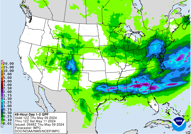