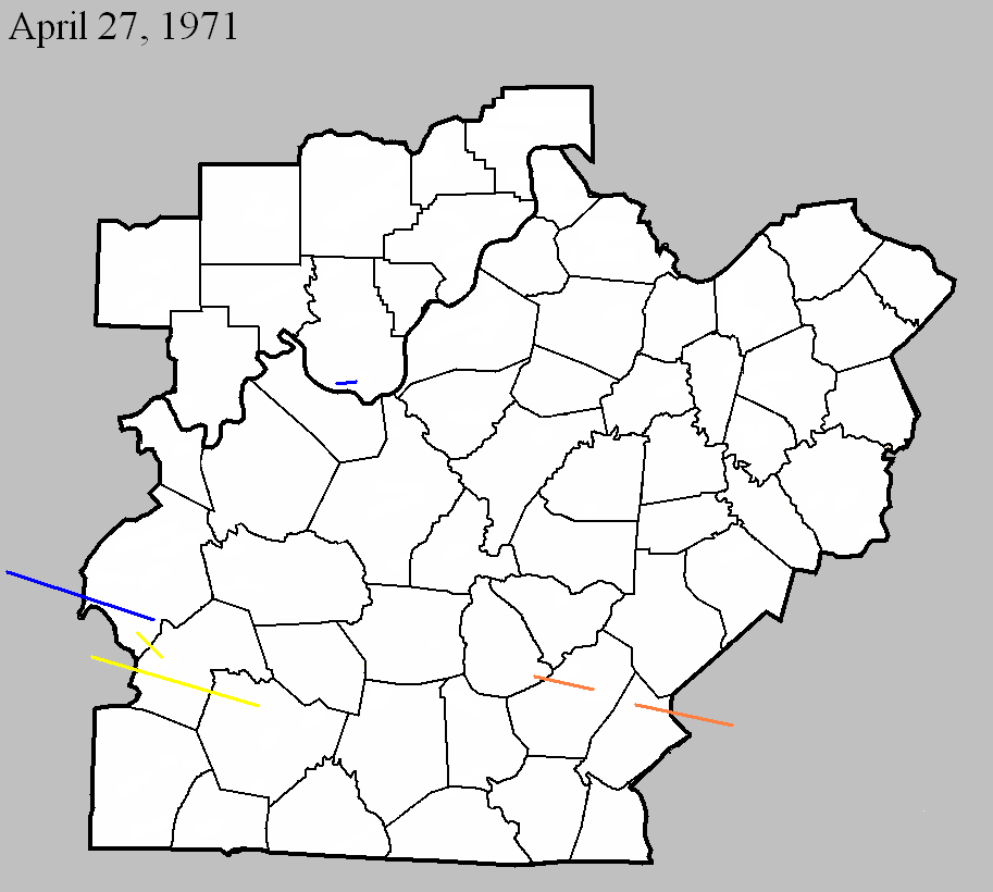
April 27, 1971
Counties: Ohio (from McLean and Hopkins)
F-scale: F1
Deaths:
Injuries:
Path width:
Path length: 34 miles
Time: 6:45pm CDT
Noted discrepancies: Only Hopkins County is listed at NCDC. SPC gives a path width of 10 yards, NCDC give 30 yards. SPC and NCDC agree on a path length of 36 miles, suggesting the tornado must have continued beyond Hopkins County. Storm Data lists a path length of 34 miles. The SPC/NCDC liftoff lat/lon is in Oho County but makes no sense for a tornado coming from Hopkins and McLean counties, especially without passing through Muhlenberg County. Interestingly, though, SvrPlot gives a very realistic plot for this tornado. Storm Data says the tornado touched down near Slaughters in Hopkins County, proceeded to Sacramento in McLean County, and then went on to Prentiss in Ohio County.
Notes: Will use the Storm Data description.
April 27, 1971
Counties: Ohio, Butler
F-scale: F3
Deaths:
Injuries:
Path width:
Path length: 11 miles
Time: 7:10pm CDT
Notes: There is considerable disagreement among data sources regarding the end point of this tornado (despite excellent agreement on the touchdown point). After further research, it has been decided that this tornado touched down west of Cool Springs and north of Wysox in Ohio County. It proceeded to the east-southeast through Little Bend (near Mining City) and into Butler County. This project will end the tornado about two miles into Butler County. Damage was found as far east as the Reedyville and Roundhill areas along the Butler County/Edmonson County line, however these locations are not really in line with the earlier known tornado locations, and also there have been no damage reports found between the end point described above and these two locations. Damage in Roundhill and Reedyville may have been from straight-line winds or a separate small tornado. At this tornado's touchdown point in Ohio County a witness said it "swerved" as it approached his house, just grazing the home but destroying the garage and a nearby barn. Multiple vortices may have been visible. The tornado was witnessed at Little Bend and was described as being about 17 yards wide while moving at about 40mph (and accompanied by large hail). In this area a barn was destroyed and roof shingles were found embedded two inches deep into an oak tree. Will not disagree with the official strength ranking of F3, but it sounds like this tornado was a minimal F3 at best.
Noted discrepancies: SPC and NCDC rank this as an F3, Grazulis call it an F2. SPC and NCDC list a path width of 20 yards, Grazulis says 50 yards, Storm Data 14 yards.
April 27, 1971
Counties: Harrison IN
F-scale: F1
Deaths: 0
Injuries: 2
Path width: 50 yards
Path length: 15 miles
Time: 6:30pm
Grazulis narrative: Moved east from three and a half miles east of Mauckport to west of Laconia. A barn was destroyed and the debris was carried a quarter mile. Four other farm buildings were damaged. A trailer was carried 30 yards, then dropped and smashed. Two people were hospitalized. Minimal F2.
Noted discrepancies: SPC and NCDC list this as an F1, Grazulis ranks it as an F2 (albeit "minimal").
April 27, 1971
Counties: Butler, Warren (from Muhlenberg)
F-scale: F3
Deaths: 1
Injuries:
Path width:
Path length:
Time: 8:20pm CDT
Grazulis narrative: Skipped east-southeast from four miles east of Drakesboro, to near Ennis, South Hill, and Riverside. A six room brick veneer home was completely destroyed, as were several large trailers. There were two injuries in one, and a death in another. Many homes sustained damage. South Hill, where several people were injured and trailers were swept away, and Dunbar were especially hard hit. Cherry Chapel Church near Richardsville was destroyed. Damage was found along Stringtown Road in Butler County.
Noted discrepancies: SPC and NCDC list no injuries, Grazulis lists 20, Storm Data lists 7. SPC lists a path length of 27 miles, NCDC 28 miles, Grazulis and Storm Data 30 miles. Grazulis ends this tornado closer to Riverside, SPC and NCDC end it closer to Richardsville (both in Warren County). According to Storm Data, radar first showed a hook echo four miles east of Drakesboro. The storm struck South Hill, 1.75 miles east of Ennis, and "probably" on to Riverside and Richardsville.
April 27, 1971
Counties: Green, Adair
F-scale: F4
Deaths: 6
Injuries: 58
Path width: 100 yards
Path length: 15 miles
Time: 9:30pm CDT
Notes: Moved east-southeast from Bramlett, passing three miles northeast of Columbia, to Vester and Christine. Six people were killed when the tornado demolished a number of homes in the Mount Pleasant Church area on KY 551. The church itself was leveled. A total of 51 homes, 33 barns, three churches, four trailers, and 100 other buildings were destroyed, and fifty more homes had major damage.
Noted discrepancies: SPC and NCDC give a path length of 14 miles, Grazulis and Storm Data give 15.
April 27, 1971
Counties: Russell (to Pulaski)
F-scale: F4
Deaths: 2 (Mr and Mrs Bulon Swanson)
Injuries: 72 (70 in Russell County, 2 in Pulaski County)
Path width: 100 yards
Path length: 14 miles
Time: 10:53pm CDT
Grazulis narrative: Moved east from east of Russell Springs, to Salem, and to Faubush. At Gosser Ridge two people were killed on a farm as most of the buildings were swept away. Along the path, 35 homes, four trailers, 60 barns, and 79 other buildings were destroyed. There was major damage to 105 more homes. The Salem School was damaged. At one point, there were two distinct paths, as two funnels moved parallel to one another. See this YouTube video.
Noted discrepancies: SPC and NCDC give a path length of 13 miles, Storm Data and Grazulis give 14. SPC, NCDC, and Storm Data give a path width of 100 yards, Grazulis gives 200 yards. According to Storm Data this tornado touched down two miles north of Russell Springs (Grazulis starts it east of Russell Springs).


 Weather Story
 Weather Map
 Local Radar