
April 30, 1852
Counties: Scott KY
F-scale:
Deaths:
Injuries:
Path width:
Path length:
Time:
Narrative: A possible tornado hit four miles north of Georgetown.
April 13, 1876
Counties: Jefferson KY
F-scale: F2
Deaths: 2
Injuries: 10
Path width: 50 yards
Path length: 3 miles
Time: 6:30pm
Narrative: A tornado touched down west of present-day University of Louisville and moved to the north-northeast across eastern sections of the city. The tornado struck the brand new baseball park, located where Saint James Court is today, built to host Louisville's new National League baseball team, the Louisville Grays. The park was badly damaged, just 12 days before the season's Opening Day. The park was quickly repaired and was ready to go in time for the first pitch. The tornado continued northeast across the land that would become Central Park, and into Eagle Park between Ormsby and Park Avenues and Third and Fifth Streets. Eagle Park was Louisville's baseball park before the new one to the south was constructed. Eagle Park was demolished, and the baseball diamond's bleachers were destroyed. Damage was then fairly sparse until the tornado entered the Germantown and Phoenix Hill neighborhoods. Germantown was hardest hit. A two story brick home was damaged "about as complete(ly) as it could possibly be" and a man and his son were killed in the home, on the northeast corner of Payne and Logan Streets (those streets do not intersect today, so this exact location is unknown). Mills on Broadway at Beargrass Creek were wrecked. Houses were severely damaged on Green Street (now Liberty Street) near Campbell. Blacksmith shops on Preston "near the railroad crossing (?) were blown down. Half a dozen houses were damaged on Milk Street (?) at Shelby Street. The Exposition Building and its skating rink were damaged. Light damage was reported on Walnut Street (now Muhammad Ali Blvd). Most of the injuries in the tornado were in a street car that was hit by the roof of a house. Click here for a detailed map of the approximate path of the tornado.
April 22, 1887
Counties: Warren
F-scale: F2
Deaths: 0
Injuries: 5
Path width: 125 yards
Path length: 3 miles
Time:
Narrative: A tornado hit near Boat Island on the Barren River. One home and at least six barns were destroyed.
April 22, 1887
Counties: Bourbon
F-scale: F2
Deaths: 0
Injuries: 0
Path width: 400 yards
Path length:
Time: 8:00am
Notes: More specific information is needed to accurately map this tornado. A tornado leveled trees and unroofed houses along a track 400 yards wide "at Paris" or "near Paris" (depending on the source used). White's Distillery's roof was blown "out of sight." The Turney, Clark, and Company livery stable was blown across the street. Mrs. Herrick's boarding house was nearly demolished, and the Paris Flour Mill's roof was damaged. Mrs. Carson's roof was carried across the street. The Daily Press said, "A tornado struck the city with inconceivable energy." While there were heavy property losses, no one was killed.
April 28, 1887
Counties: Clark KY
F-scale: F2
Deaths:
Injuries:
Path width:
Path length:
Time: 5:00pm
Narrative: Homes and barns were destroyed at Wade's Mill.
April 4, 1892
Counties: Logan
F-scale: F2
Deaths: 0
Injuries: 15
Path width: 150 yards
Path length: 4 miles
Time: 11:30pm
Narrative: Moved north, passing seven miles west of Russellville. At least five small homes were destroyed. Two people may have died.
April 3, 1903
Counties: Crawford, Harrison IN
F-scale: F2
Deaths: 1
Injuries: 6
Path width:
Path length: 16 miles
Time: 1:00pm
Narrative: Moved east-northeast from near Grantsburg to northwest of Hancock. One man was killed, and his son may have died as two homes were destroyed three miles southeast of English. The tornado was said to have been "thrashing about like the tail of a mad beast".
April 8, 1948
Counties: Fayette
F-scale: F2
Deaths: 1
Injuries: 4
Path width: 200 yards
Path length:
Time: 2:00pm
Narrative: A "bounding-type" tornado destroyed barns and stables at the Keeneland Race Track. A groom was killed. Minimal F2.
April 12, 1948
Counties: Madison
F-scale: F2
Deaths: 0
Injuries: 0
Path width:
Path length:
Time: 4:45am
Narrative: Large buildings were destroyed at the Bluegrass Ordnance Depot at Richmond.
April 6, 1954
Counties: Dubois
F-scale: F2
Deaths:
Injuries:
Path width: 30 yards
Path length:
Time: 7:00am
Noted discrepancies: SPC and NCDC list this as an F2, Grazulis does not list it. SPC gives a path width of 10 yards, NCDC gives 30 yards.
April 24, 1955
Counties: Madison
F-scale: F1
Deaths: 0
Injuries: 2
Path width: 800 yards
Path length: 3 miles
Time: 3:45am
Grazulis Narrative: Moved northeast near Eastern State College in Richmond. Homes were unroofed in the student housing area. Hundreds of trees were uprooted.
Noted discrepancies: Grazulis lists this tornado as having occurred at 3:00am...Storm Data lists it at 3:45am...SPC lists it at 3:45pm. Storm Data also mentions it lifted at 4:00am. Would tend to believe Storm Data here. Storm Data says most damage was in and around Eastern State College in Richmond. Grazulis lists this tornado as an F2.
April 3, 1956
Counties: Washington IN
F-scale: F2
Deaths: 0
Injuries: 12
Path width: 150 yards
Path length: 23 miles
Time: 5:45pm
Grazulis Narrative: Moved northeast from seven miles southwest of Salem to near Little York. A large bridge five miles southwest of Salem was moved. Over a hundred buildings were damaged or destroyed. A church and a school were struck at Canton. A freezer was reportedly carried half a mile from the home site. Newspapers called this a "barnado" because of the large number of barns destroyed. One of the women injured in this tornado would be killed by another tornado on March 19, 1963.
Noted discrepancies: SPC and NCDC list this as an F2, Grazulis says F3. SPC gives a path length of 1/10 of a mile...NCDC gives nothing...Grazulis gives 15 miles...Storm Data gives 23 miles. SPC gives a path width of 10 yards...NCDC gives nothing...Grazulis and Storm Data say 150 yards. SPC and NCDC list only a touchdown point...no lift-off point is given.
April 3, 1957
Counties: Warren
F-scale: F1
Deaths:
Injuries:
Path width:
Path length:
Time: 5:30pm
Grazulis Narrative:
Noted discrepancies: SPC gives a path length of 1/10 of a mile...NCDC gives nothing. SPC gives a path width of 10 yards, NCDC gives nothing.
April 2, 1958
Counties: Logan
F-scale: F1
Deaths:
Injuries: 1
Path width:
Path length:
Time: 2:20pm
Noted discrepancies: SPC gives a path length of 1/10 of a mile...NCDC gives nothing. SPC gives a path width of 10 yards, NCDC gives nothing.
April 20, 1958
Counties: Washington IN
F-scale: F1
Deaths:
Injuries:
Path width:
Path length:
Time: 4:00pm
Noted discrepancies: None.
April 20, 1958
Counties: Madison
F-scale: F1
Deaths:
Injuries:
Path width:
Path length:
Time: 4:30pm
Noted discrepancies: SPC gives a path length of 1/10 of a mile...NCDC gives nothing. SPC gives a path width of 10 yards, NCDC gives nothing.
April 22, 1958
Counties: Warren
F-scale: F1
Deaths:
Injuries:
Path width:
Path length:
Time: 9:00am
Noted discrepancies: SPC gives a path length of 1/10 of a mile...NCDC gives nothing. SPC gives a path width of 10 yards, NCDC gives nothing.
April 21, 1963
Counties: Woodford
F-scale: F2
Deaths: 0
Injuries: 3
Path width: 200 yards
Path length: 2 miles
Time: 10:50pm
Grazulis narrative: Moved northeast from northeast of Versailles. Fourteen farm buildings were damaged and a tenant home was destroyed. (Storm Data says this tornado struck three and a half miles northeast of Versailles at Maplewood Farm.)
Noted discrepancies: None.
April 29, 1963
Counties: Logan
F-scale: F2
Deaths:
Injuries:
Path width:
Path length:
Time: 8:10pm
Noted discrepancies: SPC and NCDC list this as an F2, Grazulis does not list it. SPC gives a path width of 170 yards and a path length of 9 miles...NCDC gives nothing for either.
Notes: Storm Data says that the central and northern parts of Russellville were hardest hit, including the Kaintuck Hotel.
April 29, 1963
Counties: Edmonson
F-scale: F2
Deaths:
Injuries:
Path width:
Path length:
Time: 8:30pm
Noted discrepancies: SPC and NCDC list this as an F2, Grazulis does not list it. SPC gives a path width of 10 yards and a path length of 1/10 of a mile...NCDC gives nothing for either.
Notes: Storm Data says this tornado struck at Rocky Hill Crossroad.
April 21, 1967
Counties: Jefferson IN (from Jennings)
F-scale: F2
Deaths: 0
Injuries: 2
Path width:
Path length: 6 miles
Time: 5:10pm
Grazulis narrative: Moved east from Commiskey to Dupont. Two homes were unroofed and torn apart, injuring two people inside one of them. A trailer was demolished, and farm buildings were destroyed.
Noted discrepancies: SPC and NCDC give a path length of 6 miles, Grazulis gives 7. SPC gives a path width of 10 yards, NCDC 30 yards, Grazulis nothing.
April 23, 1968
Counties: Jessamine
F-scale: F2
Deaths: 0
Injuries: 3
Path width: 75 yards
Path length: 3 miles
Time: 5:34pm
Grazulis narrative: Moved northeast at Nicholasville. A house was shifted off its foundation. Many homes had roof damage, and at least one was unroofed. A barn was picked up and scattered over 60 to 70 acres.
Notes: (This information was discovered on an internal Weather Bureau memo from Charles E. Hardy at WSO Lexington) The violent storm moved from the southwest part of Nicholasville near Shun Pike and reached the center of the city near the police station at Oak and Main. Near Lake Street some trees were felled and some monuments were overturned in Maple Grove Cemetery. An estimated number of 75 to 100 trees were uprooted or blown over. Some roofs on the southwest side of Nicholasville had the tin rolled or twisted toward the northeast. Several windows were broken in an elementary school, which was in session, and flying glass injured one student on their finger. Damage to houses and other buildings was mainly to roofs and windows of the upper floors. One house had its foundation shifted a few feet, and one roof was completely blown off. Power and telephone lines were downed. A car was overturned on Main Street. Mrs. Bloomfield, whose house was in the path of the storm, stated that she heard a noise like a jet airplane. Another witness, Patrolman Swallows of the police department, said he noticed a short appendage looking like a trail of smoke hanging down from the parent cloud and a noise like a freight train was heard. Mr Hammonds, another policeman on duty at the time of the storm, said that he noticed nothing like a funnel, but he observed a violent rotation apparently about a vertical axis in a black ominous looking cloud assoicated with the storm. Two women were injured by flying glass but the injuries were not serious.
Noted discrepancies: SPC and NCDC give 3 injuries, Grazulis gives 6, Storm Data gives 0. SPC and NCDC give a path width of 60 yards, Grazulis 80 yards, Storm Data 75 yards.
April 1, 1970
Counties: Jefferson KY
F-scale: F1
Deaths: 0
Injuries: 0
Path width:
Path length: 2.8 miles
Time: 8:00pm
Notes: (Taken from an internal Weather Bureau memo) A roof was severely damaged in Plantation on Hermitage Way. Many trees were uprooted and there were signs of rotation on Goose Creek Road. At 4022 Simcoe Road a barn was overturned, killing a horse inside, and 100 yards of plank fence were demolished. At 4510 Chamberlain Lane on the J. W. Head farm the roof of the residence was destroyed, portions of which were found several hundred yards downstream. Most of the roof was lifted up and over power lines that were 20 feet above the ground 150 feet distant from the house. A store at the intersection of Brownsboro Road and Ballardsville Road was unroofed. Outside of these points, weak trees were felled, signs were blown over, and minor roof damage occurred.
Notes: Storm Data says this tornado touched down eleven miles northeast of Standiford Field and traveled northeast for three miles.
April 23, 1970
Counties: Scott KY
F-scale: F3
Deaths: 0
Injuries: 0
Path width: 50 yards
Path length: 1/2 mile
Time: 4:20am
Grazulis narrative: At Great Crossing, four miles west of Georgetown, a small tornado destroyed a home. Another home was badly damaged, and several barns and outbuildings were blown down.
Noted discrepancies: SPC and NCDC rank this as an F3...Grazulis gives it an F2.
April 27, 1971
Counties: Ohio (from McLean and Hopkins)
F-scale: F1
Deaths:
Injuries:
Path width:
Path length: 34 miles
Time: 6:45pm CDT
Noted discrepancies: Only Hopkins County is listed at NCDC. SPC gives a path width of 10 yards, NCDC give 30 yards. SPC and NCDC agree on a path length of 36 miles, suggesting the tornado must have continued beyond Hopkins County. Storm Data lists a path length of 34 miles. The SPC/NCDC liftoff lat/lon is in Oho County but makes no sense for a tornado coming from Hopkins and McLean counties, especially without passing through Muhlenberg County. Interestingly, though, SvrPlot gives a very realistic plot for this tornado. Storm Data says the tornado touched down near Slaughters in Hopkins County, proceeded to Sacramento in McLean County, and then went on to Prentiss in Ohio County.
Notes: Will use the Storm Data description.
April 27, 1971
Counties: Ohio, Butler
F-scale: F3
Deaths:
Injuries:
Path width:
Path length: 11 miles
Time: 7:10pm CDT
Notes: There is considerable disagreement among data sources regarding the end point of this tornado (despite excellent agreement on the touchdown point). After further research, it has been decided that this tornado touched down west of Cool Springs and north of Wysox in Ohio County. It proceeded to the east-southeast through Little Bend (near Mining City) and into Butler County. This project will end the tornado about two miles into Butler County. Damage was found as far east as the Reedyville and Roundhill areas along the Butler County/Edmonson County line, however these locations are not really in line with the earlier known tornado locations, and also there have been no damage reports found between the end point described above and these two locations. Damage in Roundhill and Reedyville may have been from straight-line winds or a separate small tornado. At this tornado's touchdown point in Ohio County a witness said it "swerved" as it approached his house, just grazing the home but destroying the garage and a nearby barn. Multiple vortices may have been visible. The tornado was witnessed at Little Bend and was described as being about 17 yards wide while moving at about 40mph (and accompanied by large hail). In this area a barn was destroyed and roof shingles were found embedded two inches deep into an oak tree. Will not disagree with the official strength ranking of F3, but it sounds like this tornado was a minimal F3 at best.
Noted discrepancies: SPC and NCDC rank this as an F3, Grazulis call it an F2. SPC and NCDC list a path width of 20 yards, Grazulis says 50 yards, Storm Data 14 yards.
April 27, 1971
Counties: Harrison IN
F-scale: F1
Deaths: 0
Injuries: 2
Path width: 50 yards
Path length: 15 miles
Time: 6:30pm
Grazulis narrative: Moved east from three and a half miles east of Mauckport to west of Laconia. A barn was destroyed and the debris was carried a quarter mile. Four other farm buildings were damaged. A trailer was carried 30 yards, then dropped and smashed. Two people were hospitalized. Minimal F2.
Noted discrepancies: SPC and NCDC list this as an F1, Grazulis ranks it as an F2 (albeit "minimal").
April 27, 1971
Counties: Butler, Warren (from Muhlenberg)
F-scale: F3
Deaths: 1
Injuries:
Path width:
Path length:
Time: 8:20pm CDT
Grazulis narrative: Skipped east-southeast from four miles east of Drakesboro, to near Ennis, South Hill, and Riverside. A six room brick veneer home was completely destroyed, as were several large trailers. There were two injuries in one, and a death in another. Many homes sustained damage. South Hill, where several people were injured and trailers were swept away, and Dunbar were especially hard hit. Cherry Chapel Church near Richardsville was destroyed. Damage was found along Stringtown Road in Butler County.
Noted discrepancies: SPC and NCDC list no injuries, Grazulis lists 20, Storm Data lists 7. SPC lists a path length of 27 miles, NCDC 28 miles, Grazulis and Storm Data 30 miles. Grazulis ends this tornado closer to Riverside, SPC and NCDC end it closer to Richardsville (both in Warren County). According to Storm Data, radar first showed a hook echo four miles east of Drakesboro. The storm struck South Hill, 1.75 miles east of Ennis, and "probably" on to Riverside and Richardsville.
April 27, 1971
Counties: Green, Adair
F-scale: F4
Deaths: 6
Injuries: 58
Path width: 100 yards
Path length: 15 miles
Time: 9:30pm CDT
Notes: Moved east-southeast from Bramlett, passing three miles northeast of Columbia, to Vester and Christine. Six people were killed when the tornado demolished a number of homes in the Mount Pleasant Church area on KY 551. The church itself was leveled. A total of 51 homes, 33 barns, three churches, four trailers, and 100 other buildings were destroyed, and fifty more homes had major damage.
Noted discrepancies: SPC and NCDC give a path length of 14 miles, Grazulis and Storm Data give 15.
April 27, 1971
Counties: Russell (to Pulaski)
F-scale: F4
Deaths: 2 (Mr and Mrs Bulon Swanson)
Injuries: 72 (70 in Russell County, 2 in Pulaski County)
Path width: 100 yards
Path length: 14 miles
Time: 10:53pm CDT
Grazulis narrative: Moved east from east of Russell Springs, to Salem, and to Faubush. At Gosser Ridge two people were killed on a farm as most of the buildings were swept away. Along the path, 35 homes, four trailers, 60 barns, and 79 other buildings were destroyed. There was major damage to 105 more homes. The Salem School was damaged. At one point, there were two distinct paths, as two funnels moved parallel to one another. See this YouTube video.
Noted discrepancies: SPC and NCDC give a path length of 13 miles, Storm Data and Grazulis give 14. SPC, NCDC, and Storm Data give a path width of 100 yards, Grazulis give 200 yards. According to Storm Data this tornado touched down two miles north of Russell Springs (Grazulis starts it east of Russell Springs).
April 11, 1972
Counties: Green
F-scale: F2
Deaths: 0
Injuries: 0
Path width:
Path length:
Time: 11:45pm
Grazulis narrative: Near Allendale three trailers and three barns were destroyed in a brief touchdown. A frame home was damaged.
Noted discrepancies: SPC gives a path length of 1/10 of a mile and a path width of 10 yards...NCDC and Grazulis give nothing for either.
April 13, 1972
Counties: Clark IN
F-scale: F1
Deaths:
Injuries:
Path width:
Path length:
Time: 4:42am
Noted discrepancies: None
April 14, 1972
Counties: LaRue, Nelson
F-scale: F1
Deaths:
Injuries:
Path width:
Path length:
Time: 1:10am
Noted discrepancies: NCDC only includes LaRue County. Storm Data says the tornado unroofed a home in LaRue County before crossing the Rolling Fork River in Nelson County at New Haven.
Notes: Will map this as touching down just barely inside LaRue County. (SPC's lat/lon is actually in Nelson County).
April 21, 1972
Counties: Butler
F-scale: F3
Deaths: 0
Injuries:
Path width:
Path length: 5 miles
Time: 8:00pm
Grazulis narrative: Moved from three miles south of Cromwell to near Gilstrap. Three small homes were blown down. Twelve other homes and a church were damaged, and two barns were destroyed.
Noted discrepancies: SPC, Storm Data, and NCDC list no injuries, Grazulis lists 2. SPC and NCDC give a path length of six miles, Grazulis and Storm Data give 5. SPC gives a path width of 10 yards, NCDC 30 yards, Grazulis nothing.
April 21, 1972
Counties: Grayson
F-scale: F3
Deaths: 0
Injuries: 4
Path width:
Path length: 1 mile
Time: 9:00pm
Grazulis narrative: Hit two miles east of Clarkson. Two trailers were destroyed, and pieces were carried for a mile. Six frame homes were damaged.
Noted discrepancies: SPC and NCDC rank this as an F3, Grazulis gives it an F2. SPC gives a path width of 10 yards, NCDC 30 yards, Grazulis nothing.
Notes: According to Storm Data, the tornado touched down 2 miles east of Clarkson, and moved northeast for about a mile.
April 21, 1972
Counties: Mercer
F-scale: F2
Deaths:
Injuries:
Path width:
Path length:
Time: 10:10pm
Grazulis narrative: Moved northeast from six miles west of Salvisa to one mile east of Ballard. Five barns were destroyed, two of which had concrete foundations. A house and a metal silo were destroyed. Two cars and a truck were destroyed, and a 400-gallon water tank was moved three-quarters of a mile. A 16-inch rafter was driven into the ground.
Noted discrepancies: Grazulis lists this tornado at 11:10pm. SPC/NCDC stop this tornado at Salvisa, but Grazulis takes it into Anderson County, ending it one mile east of Ballard. In Storm Data the tornado touched down six miles west of Salvisa in Mercer County (one mile east of Ballard) and moved northeast along Stratton Road, Kirkwood Road, Gash Road, and Hickory Grove Road, all of which are in Mercer County. At this point, prefer to plot this tornado only in Mercer County.
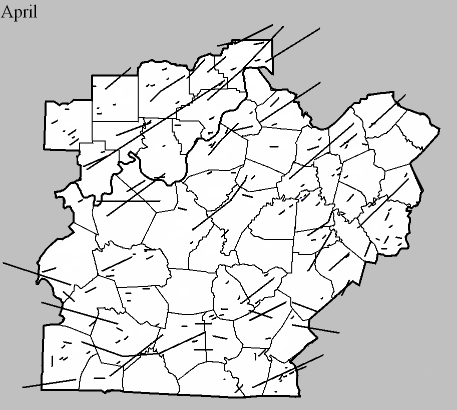
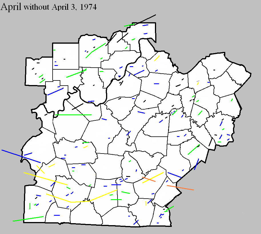
April 1, 1974
Counties: Henry
F-scale: F3
Deaths: 1
Injuries: 20
Path width: 300 yards
Path length: 3 miles
Time: 6:20pm
Grazulis narrative: About 100 of the 500 residents of Campbellsburg were left homeless. Nineteen homes and 23 businesses were destroyed or damaged.
Noted discrepancies: SPC and NCDC list this as an F3, Grazulis calls it an F2.
April 3, 1974
Counties: Orange (to Lawrence)
F-scale: F1
Deaths:
Injuries:
Path width:
Path length:
Time: 1:15pm
Noted discrepancies: NCDC only lists Orange County, but the NCDC liftoff lat/lon is in Lawrence County. Storm Data seems only to list Lawrence County, with the tornado hitting form the junction of US 50 and IN 235 to just north of Freetown. More research is needed.
April 3, 1974
Counties: Perry, Crawford, Harrison IN, Washington IN, Clark IN, Scott IN
F-scale: F5
Deaths: 6
Injuries: 76
Path width:
Path length:
Time: 1:20pm
Grazulis narrative: Moved east-northeast and northeast from three miles south of Huffman, passing southeast of Branchville, north of Sulphur Springs and Pilot Knob, south of Sulphur and Curby, across the southeast part of DePauw, hitting two miles east of Palmyra, passing through Martinsburg, crossing the southeast half of Daisy Hill, passing between Bunker Hill and New Liberty, and ending two miles north of IN 160. This tornado immediately killed a woman as it destroyed her mobile home. As the tornado passed along southeast of Branchville it killed again. Two people, riding in a school bus, saw the tornado and took shelter in a nearby ditch. The bus was thrown fifty feet into the ditch, crushing the couple and killing the woman. Moving across Crawford County, the tornado widened to over a mile, missing many small communities and levelling several farms. In Harrison County the tornado killed a woman in her mobile home in southeast Depauw. Another woman was killed in her home two miles east of Palmyra. In the southeastern corner of Washington County the tornado struck the town of Martinsburg, destroying 38 of the town's 48 homes. Homes in the Daisy Hill area were completely swept away.
Noted discrepancies: SPC and Grazulis list 6 deaths for this tornado, NCDC lists 5. SPC lists 86 injuries, NCDC 53, Grazulis 76, Storm Data 95. SPC lists a path length of 68 miles, NCDC 50 miles, Grazulis 62 miles, Storm Data 67 miles. SPC gives a path width of 10 yards (obviously incorrect), NCDC 30 yards (obviously incorrect), Grazulis 1760 yards, Storm Data 700 yards. This tornado is split into two tornadoes at SPC. Grazulis lists an incorrect ending point for the tornado. Storm Data begins this tornado between Huffman and Tarry in Perry County and lifts it a few miles northeast of Lexington in Scott County. SPC lat/lon ends the tornado southwest of Lexington, rather than northeast. It's been mapped here according to the information in Storm Data, but additional research would be helpful.
April 3, 1974
Counties: Clark IN, Scott IN, Jefferson IN (to Ripley)
F-scale: F4
Deaths: 11
Injuries: 190
Path width: 1200 yards
Path length:
Time: 2:19pm
Grazulis narrative: Moved northeast from just northeast of Henryville, passing near Nabb, hitting Hanover and North Madison and the northwest edge of China, passing northwest of Canaan and ending three miles west of Cross Plains. One person was killed in Scott County. The tornado then moved into Jefferson County, heading towards Hanover. Hanover College was torn apart, sustaining ten million dollars in damage, with a few students injured. No homes were leveled there, but the tornado intensified as it passed north of Madison, and killed seven people in that area. About 300 homes were destroyed along the northern edge of Madison. Many of the homes that were leveled were the most expensive in the county. Continuing to the northeast and north-northeast the tornado killed people as it passed along the edge of China.
Noted discrepancies: NCDC doesn't list Ripley County. SPC gives a path length of 36 miles, NCDC gives 35 miles, Grazulis 38 miles. SPC and NCDC give a path width of 1200 yards, Grazulis give 800 yards.
April 3, 1974
Counties: Breckinridge, Meade, Harrison IN
F-scale: F5
Deaths: 31
Injuries: 270
Path width:
Path length: 32 miles
Time: 2:20pm
Grazulis narrative: Touching down five miles southwest of Hardinsburg, Breckinridge County, the tornado passed along the northern edge of that town, with F3 damage to homes. Thirteen people were injured and 35 homes were destroyed as the funnel moved to the northeast across Breckinridge County and into Meade County. The tornado gradually enlarged and intensified as it approached Brandenburg. The funnel devastated that town and crossed the Ohio River into Harrison County, Indiana. At Brandenburg 128 homes were completely destroyed, many of them levelled and swept away. Thirty businesses were destroyed and damage totalled over ten million dollars. There were 28 deaths in the Brandenburg area. The F4 damage occurred from north of Irvington, into Indiana.
Noted discrepancies: SPC and NCDC give a time of 2:20pm, Grazulis gives 3:25pm, Storm Data 3:30pm. SPC and NCDC give a path length of 32 miles, Grazulis gives 34. SPC and NCDC give a path width of 430 yards, Grazulis give 800 yards.
April 3, 1974
Counties: Jefferson IN (to Switzerland, Ohio IN, Dearborn)
F-scale: F4
Deaths: 0
Injuries: 104
Path width:
Path length: 28 miles
Time: 2:40pm
Grazulis narrative: While the Madison tornado veered to its left, this tornado touched down just south of Manville. It moved northeast, leveling homes and forests west of Fairview, leveling a church north of Bear Branch, passing south of Milton, and lifting near Wilmington.
Noted discrepancies: SPC gives a path length of 27 miles, NCDC and Grazulis 28 miles. SPC and NCDC give a path width of 1133 yards, Grazulis give 800 yards.
April 3, 1974
Counties: Grayson
F-scale: F4
Deaths: 0
Injuries: 2
Path width: 150 yards
Path length:
Time: 3:00pm
Grazulis narrative: Moved east-northeast from Tanyard to south of Caneyville, passing north of Leitchfield and ending near Big Clifty. The F4 rating is based on a single leveled home south of Caneyville
Noted discrepancies: Grazulis takes this tornado into Hardin County, though he says the damage ended at Big Clifty, which is in Grayson County about two miles from the Hardin County line. SPC/NCDC end it on the northwest side of Leitchfield. SPC and NCDC give a time of 3:00pm, Grazulis and Storm Data give 4:00pm. SPC and NCDC give a path length of 14 miles, Grazulis give 28 miles. Storm Data begins this tornado in Grayson County east of Tan Yard, takes it through Caneyville, north of Leitchfield, to Big Clifty. Storm Data seems to then continue the tornado into Hardin County to Colesburg (or could that be part of the tornado listed at 3:45pm from Hardin to Spencer counties?). For now will map using SPC coordinates, ending the tornado just northwest of Leitchfield. Further research necessary.
April 3, 1974
Counties: Jefferson KY, Oldham
F-scale: F4
Deaths:
Injuries:
Path width: 200 yards
Path length:
Time: 3:37pm
Grazulis narrative: Moved northeast from the Kentucky State Fairgrounds in Louisville. Dozens of buildings and hundreds of trees were destroyed in Louisville. About a dozen expensive homes were destroyed in affluent suburbs of northeast Louisville. About 425 homes were destroyed in Jefferson County, and 25 were damaged in Oldham County. Losses on one Oldham County farm amounted to $200,000.
Noted discrepancies: SPC and NCDC list three fatalities, Grazulis 2, Storm Data 6. SPC and NCDC list 225 injuries, Grazulis lists 228, Storm Data 243. SPC lists a path length of 19 miles, NCDC 18 miles, Grazulis 21 miles. SPC lists a path width of 10 yards (obviously incorrect), NCDC 30 yards (obviously incorrect), and Grazulis 200 yards.
April 3, 1974
Counties: Hardin, Nelson, Spencer
F-scale: F4
Deaths: 3
Injuries: 81
Path width: 400 yards
Path length: 40 miles
Time: 3:45pm
Eyewitness narrative: I was 15 years old at the time and I lived on KY 44 just east of Elk Creek in Spencer County. The storm came up from near Cox's Creek where the Whitney Horse Farm was damaged, crossing Lilly Pike where several homes, barns, and trailers were demolished, across Murray Road, and then across KY 44 and on to the Elk Creek community. On Murray Road a father and son were in their milking barn when they saw the storm approach. They got under some heavy equipment for shelter and the barn came down around them. They were rescued several hours later as workers and neighbors cleared Murray Road of trees and debris. The father was taken to the hospital in critical condition but the son was OK. As the twister crossed Murray Road and Elk Creek it was about 300 yards wide. The tornado broke into vortices at my home on KY 44 and circled around the house. Our neighbors between us and the creek lost their roof, which landed 300 yards to the east of their home mostly intact. Witnesses said that the main tornado broke into two vortices, the larger one of which hit the house to our west while the other went to the east and damaged a farm on Carl Monroe Road just south of KY 44. My home was in between the two vortices and was spared. The two vortices came together on the north side of KY 44 across from my house and destroyed a large tobacco barn. Debris from the barn could be seen circling the tornado and was thrown to the southeast. I saw the tornado start to rope out at this point. It touched down again in Elk Creek but didn't do much more damage.
Grazulis narrative: Moved northeast from northwest of Elizabethtown, destroying businesses as it passed two miles north of that town along the miracle mile strip on US 31W. Two people were killed in this area. One person was killed as 15 homes were destroyed near Cox's Creek, Nelson County. The funnel lifted two miles north of Fairfield. Nelson County lost 52 homes and about 100 barns.
Noted discrepancies: Grazulis takes this tornado into Bullitt County as well. The path Grazulis describes seems to keep the tornado just barely inside Nelson County, though it does indeed come very close to the Bullitt County line. Grazulis lifts the tornado two miles north of Fairfield, but SPC/NCDC take it to north of Wakefield. Storm Data may begin this tornado at Colesburg in Hardin County...then it reports continuous damage from 3 miles north of Boston to Samuels to 2 miles north of Fairfield. Storm Data lists Hardin, Nelson, and Spencer counties. SPC/NCDC give a path length of 38 miles, Grazulis gives 42 miles. SPC gives a path width of 10 yards, NCDC 30 yards, Grazulis 400 yards. Grazulis' path width is probably the most correct.
April 3, 1974
Counties: Simpson, Warren, Barren
F-scale: F3
Deaths: 3
Injuries: 57
Path width:
Path length:
Time: 3:45pm
Grazulis narrative: Moved northeast from west of Gold City to east of Smiths Grove. One person was killed in Simpson County at Temperance as seven homes and 40 barns were destroyed. Two people died in Warren County: one at Three Forks and one at Rocky Springs.
Noted discrepancies: SPC, NCDC, and Grazulis give a time of 3:45pm...Storm Data says 4:45pm. SPC and NCDC give a path length of 31 miles...Grazulis says 25 miles. SPC gives a path width of 10 yards...NCDC 30 yards...Grazulis nothing.
April 3, 1974
Counties: Henry (to Owen)
F-scale: F1
Deaths: 0
Injuries: 18
Path width: 30 yards
Path length: 32 miles
Time: 4:15pm
Noted discrepancies: SPC gives a path length of 32 miles, NCDC 31 miles. SPC gives a path width of 10 yards, NCDC 30 yards.
April 3, 1974
Counties: Green, Taylor
F-scale: F4
Deaths: 0
Injuries: 56
Path width: 800 yards
Path length:
Time: 4:40pm
Grazulis narrative: Moved northeast from south of Greensburg to Mannsville, destroying a large part of that town. About 50 homes and 60 barns were destroyed, and 40 of those were at Mannsville, with seven of them leveled to the ground.
Noted discrepancies: SPC and NCDC give a time of 4:40pm, Grazulis and Storm Data give 5:40pm. SPC gives a path length of 20 miles...NCDC gives 21 miles...Grazulis give 29 miles. SPC gives a path width of 10 yards...NCDC 30 yards...Grazulis 800 yards. Grazulis' width is probably most correct.
Notes: Storm Data says this tornado hit Mannsville, Burdick, Meadow Creek, and White Ridge.
April 3, 1974
Counties: Anderson, Franklin, Scott KY
F-scale: F4
Deaths: 4
Injuries: 122
Path width: 800 yards
Path length:
Time: 4:50pm
Grazulis narrative: Moved northeast near Alton, passing along the south and southeast edge of Frankfort, where homes were leveled and four people were killed. About 120 homes were damaged or destroyed near Frankfort, as were businesses and factories. Twelve homes were destroyed near Alton. The funnel passed near Stamping Ground and lifted near Sadieville.
Noted discrepancies: NCDC does not give a liftoff lat/lon. SPC gives a path length of 79 miles...NCDC gives 81 miles (including 54 miles in Scott County, which is impossible), and Grazulis gives 36 miles. NCDC/SPC start this tornado on the western Anderson County line west of Gee...Grazulis starts it in Anderson County but farther east at Alton. SPC gives a path width of 10 yards, NCDC 30 yards, Grazulis 800 yards. Grazulis probably has the most correct path width. For this mapping project we used the official start/stop lat/lons, but further research is needed to verify. (The ending lat/lon given by NCDC for the Franklin County portion of the track is wrong.)
April 3, 1974
Counties: Casey, Lincoln, Boyle
F-scale: F3
Deaths: 1
Injuries: 98
Path width:
Path length: 18 miles
Time: 5:35pm
Grazulis narrative: Moved north-northeast from five miles southwest of Hustonville, passing through Junction City and ending at the south end of Lake Herrington northeast of Danville. Over 100 homes were severely damaged or destroyed at Junction City. Losses totalled five million dollars in Lincoln County.
Noted discrepancies: SPC and NCDC give a path length of 21 miles...Grazulis give 18 miles. SPC gives a path width of 10 yards, NCDC gives 30 yards, Grazulis doesn't know. Grazulis lists this tornado at 6:35pm.
April 3, 1974
Counties: Cumberland, Clinton (to Wayne)
F-scale: F4
Deaths:
Injuries: 96
Path width: 800 yards
Path length:
Time: 5:40pm
Grazulis narrative: Moved northeast from two miles south of Kettle, to Ida, eight miles northwest of Albany, to 76-Falls, to Piney Woods, and finally to Mill Springs. Eight people were killed in five different small Clinton County communities as 50 homes were damaged or destroyed.
Noted discrepancies: Grazulis and Storm Data list this tornado at 6:40pm...SPC and NCDC say 5:40pm. This time disagreement may have something to do with the tornado being near a time zone boundary. SPC and NCDC list 8 fatalities, Grazulis and Storm Data list 10. Storm Data and NCDC list 113 injuries, Grazulis 96. SPC gives a path length of 38 miles...NCDC says 39 miles...Grazulis 30 miles...Storm Data 35 miles. SPC gives a path width of 10 yards, NCDC gives 30 yards, Storm Data 587 yards, Grazulis 800 yards. Grazulis probably has the more correct path width. There were two F4's in Wayne County on this day, so that may be adding to some of the confusion, especially with the injury numbers.
Notes: Storm Data lists this as "twin tornadoes" from two miles south of Kettle to Ida to 76-falls to Piney Woods to Mill Springs. Will go ahead and list 96 injuries for this tornado since that number is known for Cumberland and Clinton counties, and Wayne County is not in this project's area of concern.
April 3, 1974
Counties: Harrison KY (to Robertson)
F-scale: F3
Deaths: 0
Injuries: 27
Path width:
Path length:
Time: 5:55pm
Grazulis narrative: Moved northeast from Lee's Lick to west of Cynthiana, east of Poindexter, ending near Claysville. Forty homes and 75 barns were destroyed. Near-F4.
Noted discrepancies: SPC and NCDC give a path length of 19 miles...Grazulis gives 25 miles. SPC gives a path width of 10 yards...NCDC says 30 yards...Grazulis doesn't say. Storm Data seems to only list Harrison County. Grazulis puts this tornado at 6:55pm.
April 3, 1974
Counties: Boyle, Mercer
F-scale: F2
Deaths: 0
Injuries: 10
Path width:
Path length: 16 miles
Time: 6:12pm
Grazulis narrative: Moved north-northeast from five miles west of Danville to the east side of Pleasant Hill, passing two miles east of Harrodsburg and ending about eight miles northeast of that town. Ten people were injured in rural Boyle County. In Mercer County four homes and 26 homes were destroyed. Thirty-four homes were damaged.
Noted discrepancies: NCDC gives no liftoff lat/lon. SPC gives a path length of 16 miles, NCDC 17 miles, Grazulis 18 miles. SPC gives a path width of 10 yards, NCDC 30 yards, Grazulis nothing.
Notes: Storm Data begins this tornado near Nevada, moving it to the east side of Burgin, then curving northward to 3/4 of a mile west of Dix Dam, to the east side of Pleasant Hill.
April 3, 1974
Counties: Garrard, Madison, Clark KY
F-scale: F4
Deaths: 7
Injuries:
Path width: 300 yards
Path length:
Time: 6:20pm
Grazulis narrative: Moved northeast from near Hackley and Cottonburg, passing just north of Richmond, and lifting east of Mount Sterling. Thirty homes were destroyed, with F4 damage and deaths in southwest Madison County, mostly near Richmond. About 100 people were left homeless in Clark County.
Noted discrepancies: SPC, Storm Data, and NCDC give 28 injuries, Grazulis give 27. SPC and NCDC give a path length of 32 miles, Grazulis give 35 miles, Storm Data 22 miles. SPC gives a path width of 10 yards, NCDC 30 yards, Storm Data 133 yards, Grazulis 300 yards. Grazulis takes this tornado into Montgomery County, ending it east of Mount Sterling. SPC and NCDC end the tornado in Clark County east of Mount Zion. Grazulis places this tornado at 7:20pm.
Notes: Grazulis' path width is probably the most correct. Storm Data begins this tornado at Cottonburg, moving it to two miles north of Whitehall and beyond. According to the Garrard County weekly Central Herald, there were seven injuries in Garrard County, which are not accounted for at the NCDC webpage (it lists zero injuries for the Garrard County portion of this tornado). Grazulis doesn't many any specific locations of the injuries he reported.
April 3, 1974
Counties: Madison, Fayette
F-scale: F2
Deaths:
Injuries: 0
Path width:
Path length:
Time: 6:30pm
Grazulis narrative: Moved northeast near Valley View, destroying buildings in the southeast part of (Fayette County).
Noted discrepancies: Grazulis does not include Madison County. NCDC does not include Fayette County. NCDC gives no endpoint lat/lon. SPC starts the tornado in Madison County just south of Valley View, which is in Madison County near the point where Madison, Jessamine, and Fayette counties meet (but definitely in Madison County). The way the Kentucky River winds through the area, the SPC track takes the tornado from near Valley View in Madison County, into southernmost Lexington in Fayette County, and then back into Madison County. Storm Data mentions only that this tornado "touched down briefly" near where I-75 crosses the Fayette/Madison County line. SPC and NCDC give a path length of 5 miles, Grazulis gives 9 miles. SPC gives a path width of 10 yards, NCDC 30 yards, Grazulis nothing.
April 3, 1974
Counties: Scott KY
F-scale: F2
Deaths: 0
Injuries: 20
Path width:
Path length:
Time: 7:15pm
Grazulis narrative: Moved east-northeast from five miles southeast of Stamping Ground to Muddy Ford. There were 134 "uninhabitable" homes.
Noted discrepancies: SPC and NCDC list a path length of 10 miles, Grazulis says 14 miles. SPC gives a path width of 10 yards, NCDC 30 yards, Grazulis nothing. Grazulis lists this tornado at 8:15pm.
April 3, 1974
Counties: Butler
F-scale: F1
Deaths:
Injuries:
Path width:
Path length:
Time: 7:25pm
Noted discrepancies: SPC/NCDC lat/lon place this tornado in Mason County. Unable to plot, pending further research.
April 3, 1974
Counties: Russell (to Pulaski, Rockcastle)
F-scale: F3
Deaths:
Injuries:
Path width:
Path length:
Time: 10:30pm
Noted discrepancies: NWS ranks this as an F3, but Grazulis does not list it. NCDC lists only Pulaski and Rockcastle counties. SPC lists only Pulaski County lat/lons. SPC lists a path width of 10 yards, NCDC 30 yards. The SPC/NCDC touchdown lat/lon is just barely inside Pulaski County. Storm Data moves this tornado from near Mount Victory, which is nowhere near the lat/lons given for Pulaski County, then along the Laurel/Rockcastle county line (but listing only Rockcastle County). This tornado is unplottable, pending further research.
April 21, 1976
Counties: Boyle
F-scale: F1
Deaths:
Injuries:
Path width:
Path length:
Time: 11:30am
Notes: Storm Data places this tornado in Danville at the Corning Glass Works.
April 16, 1982
Counties: Clinton
F-scale: F1
Deaths:
Injuries:
Path width:
Path length:
Time: 7:00pm
Notes: Storm Data begins this tornado at Browns Crossroads and takes it northeast for two miles.
April 2, 1983
Counties: Russell
F-scale: F1
Deaths:
Injuries: 1
Path width:
Path length:
Time: 9:35am
Noted discrepancies: None
April 28, 1983
Counties: Logan
F-scale: F1
Deaths:
Injuries:
Path width:
Path length:
Time: 8:47pm
Noted discrepancies: None
April 5, 1985
Counties: Harrison IN
F-scale: F2
Deaths: 0
Injuries: 0
Path width:
Path length: 1 miles
Time: 2:49pm
Grazulis narrative: A barn and a 222-foot long hog house were destroyed on separate farms, four miles north of Depauw.
Noted discrepancies: SPC and NCDC list a path width of 17 yards, Grazulis lists 20 yards, Storm Data says 33 yards.
Notes: Storm Data puts this tornado four miles north of Depauw.
April 5, 1985
Counties: Scott IN
F-scale: F2
Deaths:
Injuries:
Path width:
Path length:
Time: 3:22pm
Noted discrepancies: NWS ranks this as an F2, Grazulis does not list it.
April 5, 1985
Counties: Jefferson IN
F-scale: F2
Deaths:
Injuries:
Path width:
Path length:
Time: 3:25pm
Noted discrepancies: NWS ranks this as an F2, Grazulis does not list it.
Notes: Storm Data puts this tornado at Kent.
April 5, 1985
Counties: Washington IN
F-scale: F2
Deaths:
Injuries:
Path width:
Path length:
Time: 3:28pm
Noted discrepancies: NWS ranks this as an F2, Grazulis does not list it.
April 20, 1986
Counties: Cumberland
F-scale: F3
Deaths: 0
Injuries: 2
Path width:
Path length: 3 miles
Time: 4:45pm
Grazulis narrative: Two farms were struck, and one was completely destroyed three miles north of Burkesville. A couple was hurt in their destroyed homes. The woman was badly cut by glass, and her husband was caught between fireplace bricks and a collapsed wall. The roof of the house was set down three miles away. A barn "exploded", killing thirty chickens. A satellite dish was blown about a mile. Large pieces of tin roofing were twisted around trees and wadded up into balls.
Noted discrepancies: SPC and NCDC list a path width of 400 yards, Grazulis says 100 yards. Grazulis lists this storm at 5:45pm.
April 20, 1986
Counties: Cumberland
F-scale: F1
Deaths:
Injuries:
Path width:
Path length:
Time: 5:10pm
Notes: Storm Data says this tornado struck Bakerton (touching down on the southwest side of town) and lifted at the Adair County line after following Little Renox Creek.
April 6, 1988
Counties: Taylor
F-scale: F0
Deaths:
Injuries:
Path width:
Path length:
Time: 6:10am
Noted discrepancies: None
April 2, 1989
Counties: Lincoln
F-scale: F0
Deaths:
Injuries:
Path width:
Path length:
Time: 7:10pm
Noted discrepancies: None
April 3, 1989
Counties: Bullitt
F-scale: F0
Deaths:
Injuries:
Path width:
Path length:
Time: 8:09pm
Notes: Storm Data says this tornado struck the Brooks Hill neighborhood.
April 3, 1989
Counties: Spencer
F-scale: F0
Deaths:
Injuries:
Path width:
Path length:
Time: 11:15pm
Notes: Storm Data says this tornado touched down three miles east of Waterford.
April 9, 1991
Counties: Logan (from Todd)
F-scale: F2
Deaths: 0
Injuries: 0
Path width: 75 yards
Path length: 21 miles
Time: 11:50
Grazulis narrative: Skipped from Guthrie to Keysburg and Schochoh. Trees were uprooted. Mobile homes and outbuildings were damaged.
Noted discrepancies: NWS calls this an F2, Grazulis says F1.
April 9, 1991
Counties: Barren
F-scale: F2
Deaths: 0
Injuries: 3
Path width: 400 yards
Path length: 1/2 mile
Time: 12:45pm
Grazulis narrative: A tornado touched down briefly two miles southeast of Glasgow "destroying" 13 trailers and 34 frame homes as well as feed mills and silos.
Noted discrepancies: None
April 9, 1991
Counties: Madison
F-scale: F1
Deaths:
Injuries:
Path width:
Path length:
Time: 2:00pm
Noted discrepancies: SPC gives a time of 2:00pm, NCDC 1:00pm, Storm Data 3:00pm.
Notes: Storm Data says this tornado touched down just north of Berea, then moved northeast for four miles.
April 15, 1994
Counties: Warren
F-scale: F1
Deaths:
Injuries:
Path width:
Path length:
Time: 9:15am
Noted discrepancies: Not listed at NCDC.
April 15, 1994
Counties: Anderson
F-scale: F0
Deaths:
Injuries:
Path width:
Path length:
Time: 9:45am
Noted discrepancies: Not listed at NCDC.
April 15, 1994
Counties: Franklin
F-scale: F0
Deaths:
Injuries:
Path width:
Path length:
Time: 9:45am
Noted discrepancies: Not listed at NCDC.
April 15, 1994
Counties: Madison
F-scale: F0
Deaths:
Injuries:
Path width:
Path length:
Time: 11:29am
Noted discrepancies: Not listed at NCDC.
April 28, 1994
Counties: Hancock
F-scale: F0
Deaths:
Injuries:
Path width:
Path length:
Time: 3:05pm
Noted discrepancies: Not listed at NCDC.
April 30, 1994
Counties: Logan
F-scale: F0
Deaths:
Injuries:
Path width:
Path length:
Time: 7:17pm
Noted discrepancies: Not listed at NCDC.
April 20, 1996
Counties: Floyd
F-scale: F2
Deaths:
Injuries:
Path width:
Path length:
Time: 12:08am
Notes: Storm Data mentions damage at the intersection of Georgetown and Greenville roads.
April 20, 1996
Counties: Bullitt
F-scale: F1
Deaths:
Injuries:
Path width:
Path length:
Time: 12:40am
Notes: Storm Data mentions damage in County Trace Estates and on Zoneton Road east of Mount Washington.
April 20, 1996
Counties: Barren
F-scale: F1
Deaths:
Injuries: 4
Path width:
Path length:
Time: 2:30am
Noted discrepancies: None
April 20, 1996
Counties: Barren, Metcalfe
F-scale: F1
Deaths:
Injuries:
Path width:
Path length:
Time: 2:34am
Notes: Storm Data mentions damage at Queens Chapel Church and on KY 314, Spillman Road, and Thurmon-Sexton Road.
April 20 1996
Counties: Green
F-scale: F0
Deaths:
Injuries:
Path width:
Path length:
Time: 2:45am
Notes: Storm Data mentions damage between US 68 and Russell Creek.
April 20, 1996
Counties: Lincoln
F-scale: F2
Deaths:
Injuries: 7
Path width:
Path length:
Time: 3:26am
Notes: Storm Data says this tornado went from near McKinney to Preachersville to near the Garrard County line, damaging the county fairgrounds and Maywood.
April 20, 1996
Counties: Garrard
F-scale: F1
Deaths: 0
Injuries: 0
Path width: 200 yards
Path length: 6 miles
Time: 4:30am to 4:40am EST
Notes: Trees were downed and a dozen barns were destroyed. One farmer lost 6 cows when a barn collapsed on them.
April 20, 1996
Counties: Madison
F-scale: F2
Deaths:
Injuries: 10
Path width:
Path length:
Time: 3:45am
Notes: Storm Data says this tornado touched down on the east side of I-75 at the KY 21 exit. Berea College was damaged.
April 30, 1997
Counties: Perry
F-scale: F1
Deaths:
Injuries:
Path width:
Path length:
Time: 8:00pm
Notes: Storm Data says the hardest hit areas were Apalona and Branchville.
April 16, 1998
Counties: Logan, Warren, Allen, Barren
F-scale: F3
Deaths: 2
Injuries: 9
Path width:
Path length: 58 miles
Time: 2:35pm
Notes: After researching this tornado (see discrepancies below), including reviewing radar data, it appears this tornado touched down at Chandlers Chapel in northeast Logan County, moving through Warren County crossing I-65 about seven and a half miles south of Bowling Green, continuing eastward into northernmost Allen County passing just north of Meador, then turning to the northeast near Finny, Haywood, three miles south of Glasgow, and ending at the Metcalfe County line near where the parkway crosses the border. The worst damage was in Barren County. Homes on Needmore School Road southwest of Haywood were extensively damaged, and a mobile home was flipped over near the intersection of Riddle Road and KY 249. In Glasgow one person was killed in his mobile home and another was killed by flying debris. In the Glasgow area one house was destroyed (F3 damage) and 45 badly damaged. Winds estimated at 175mph near Glasgow damaged or destroyed 35 mobile homes and 25 barns.
Noted discrepancies: SPC mistakenly replaces Warren County with Lawrence County. SPC gives a beginning latitude of 36.92...NCDC gives 36.95. SPC gives a path width of 100 yards, NCDC gives 200 yards. The lat/lons given for this event are all over the place. Going by the beginning lat/lon in Logan County and the ending lat/lon in Barren County, the track would go through the south side of Glasgow and would end at the Barren/Metcalfe county line, which agrees with the narrative given at NCDC. However, this path would completely miss Allen County. Storm Data has it in Logan County (Chandlers Chapel to six miles east of Chandlers Chapel), Warren County (ten miles southwest of Bowling Green to sixteen miles southeast of Bowling Green), Allen County (three miles west of Meador to two miles east of Meador), and Barren County (fourteen miles southwest of Glasgow to ten miles east of Glasgow, with Glasgow hard hit).
April 16, 1998
Counties: Metcalfe
F-scale: F2
Deaths: 1
Injuries: 0
Path width:
Path length:
Time: 3:53pm
Notes: Storm Data takes this tornado from Wisdom to two miles east of Edmonton.
April 16, 1998
Counties: Adair
F-scale: F3
Deaths:
Injuries:
Path width:
Path length:
Time: 4:15pm
Notes: Storm Data says Pellyton was hard hit...tornado went from Portland to one mile northeast of Pellyton.
April 9, 1999
Counties: Jefferson IN (to Jennings and Ripley)
F-scale: F3
Deaths: 0
Injuries: 2
Path width:
Path length: 18 miles
Time: 1:56am EDT
Notes: Touched down at DuPont where it removed the roof from a home and threw a woman 2,000 feet resulting in serious injuries. Several homes and barns in far northern Jefferson County were damaged. The tornado intensified as it moved into Jennings and Ripley Counties.
Noted discrepancies: SPC lists a path width of 250 yards...NCDC says 400 yards...Storm Data has up to 450 yards.
April 20, 2000
Counties: Washington KY
F-scale: F1
Deaths:
Injuries: 4
Path width:
Path length:
Time: 4:55pm
Noted discrepancies: SPC lists a path width of 70 yards, NCDC 73 yards, Storm Data 50 yards.
Notes: Storm Data takes this tornado from half a mile north of Willisburg to two miles northeast of Willisburg.
April 20, 2000
Counties: Washington KY
F-scale: F0
Deaths: 0
Injuries: 0
Path width: 40 yards
Path length: 1/3 of a mile
Time: 5:00pm
Noted discrepancies: This tornado is not listed at SPC or NCDC, but is in Storm Data. Storm Data lists this tornado in Mercer County, but it takes this storm from 4.3 miles southwest of Dugansville to 4 miles southwest of Dugansville near Tablow. This distance from Dugansville would put it in Washington County. Tablow is directly on the county line. Will plot it in Washington County.
April 20, 2000
Counties: Mercer
F-scale: F1
Deaths:
Injuries:
Path width:
Path length:
Time: 5:05pm
Notes: Storm Data takes this tornado from 1.7 miles southwest of Dugansville to 1.6 miles southwest of Dugansville, or half a mile east of Tablow.
April 20, 2000
Counties: Mercer
F-scale: F1
Deaths: 0
Injuries: 0
Path width: 40 yards
Path length: 1/10 of a mile
Time: 5:07pm
Noted discrepancies: SPC and NCDC do not list this tornado.
Notes: Storm Data takes this tornado from one mile west of Dugansville to 9/10 of a mile west of Dugansville.
April 20, 2000
Counties: Mercer
F-scale: F1
Deaths: 0
Injuries: 0
Path width: 40 yards
Path length: 1/10 of a mile
Time: 5:10pm
Noted discrepancies: This tornado is not listed at SPC or NCDC.
Notes: Storm Data takes this tornado from Dugansville to 1/10 of a mile east of Dugansville.
April 20, 2000
Counties: Clinton
F-scale: F0
Deaths:
Injuries:
Path width:
Path length:
Time: 6:00pm
Noted discrepancies: SPC gives a path width of 20 yards, NCDC says 27 yards, Storm Data says 25 yards. The lat/lon for this tornado at SPC is in Tennessee. The NCDC begin location and end location (8 miles southwest of Albany) also places this tornado in Tennessee, or, depending on the degree of "southwest", in the middle of Dale Hollow Lake. Narrative at NCDC gives no additional location information. Storm Data also plots this tornado "8 miles southwest of Albany" and mere mentions that "a piece of scaffolding and a cement mixer pan were moved 50 yards at Ootens Store." Further research is necessary.
April 28, 2002
Counties: Perry, Breckinridge, Meade
F-scale: F2
Deaths:
Injuries: 7
Path width:
Path length:
Time: 2:05am
Noted discrepancies: SPC lists a path width of 50 yards, NCDC and Storm Data list 150 yards. Storm Data takes this tornado from 3/10 of a mile southwest of Tobinsport to 1.8 miles east northeast of Tobinsport. Storm Data mentions that this tornado crossed into Kentucky from Perry County...hitting Irvington, two miles east northeast of Cloverport, and two and a half miles south of Garrett.
April 28, 2002
Counties: Ohio
F-scale: F1
Deaths:
Injuries:
Path width:
Path length:
Time: 2:40am
Noted discrepancies: SPC lists a path width of 30 yards...NCDC and Storm Data say 100 yards.
Notes: Storm Data takes this tornado from five miles west of Centertown, on Shrull Lane, to Hartford.
April 28, 2002
Counties: Hardin
F-scale: F1
Deaths:
Injuries:
Path width:
Path length:
Time: 2:55am
Noted discrepancies: SPC lists a path width of 20 yards, NCDC and Storm Data says 50 yards.
Notes: Storm Data takes this tornado from two miles west of Radcliff to Radcliff.
April 28, 2002
Counties: Edmonson
F-scale: F1
Deaths:
Injuries:
Path width:
Path length:
Time: 3:35am
Noted discrepancies: SPC lists a path width of 30 yards...NCDC and Storm Data say 100 yards.
Notes: Storm Data takes this tornado from two miles east of Broadway to five miles east of Broadway.
April 22, 2005
Counties: Jefferson KY
F-scale: F0
Deaths: 0
Injuries: 0
Path width: 50 yards
Path length:
Time: 5:47pm
Notes: The tornado touched down near the intersection of Campbell and Market streets, where the roof on a business was destroyed, and a telephone pole was snapped. An empty trailer was flipped over near this location. The Stockyard Farm Supply Company on South Johnson Street sustained roof damage.
April 2, 2006
Counties: Shelby
F-scale: F1
Deaths: 0
Injuries: 0
Path width: 150 yards
Path length: 2 miles
Time: 10:15pm
Notes: Tree damage and other debris.
April 2, 2006
Counties: Logan
F-scale: F1
Deaths: 0
Injuries: 0
Path width: 100 yards
Path length: 2 miles
Time: 10:30pm Central time
Notes: Intermittent track.
April 7, 2006
Counties: Barren, Metcalfe
F-scale: F2
Deaths: 0
Injuries: 4
Path width: 200 yards
Path length: 2.7 miles
Time: 4:04pm
Notes: Fifteen to twenty homes were destroyed, mainly in the Temple Hill area. Another dozen or so homes, along with barns and outbuildings, sustained heavy damage. Four people in the area were treated for minor injuries. The tornado formed about a mile northeast of Temple Hill just south of Barbour Road. Numerous trees were topped, and several homes were damaged. Most of the structural damage occurred along Moore Road, where several mobile homes were moved considerable distances and were destroyed. A large RV was flipped over...a large tractor trailer was moved about five feet...and a horse trailer was thrown over 75 yards. The tornado reached its peak intensity near the intersection of Moore Road and KY 839. The storm then crossed into Metcalfe County about three miles northeast of Nobob. Several homes and barns were destroyed on Froedge-Dubree and Pitcock roads in the Summer Shade area.
April 3, 2007
County: Taylor
EF-Scale: EF0
Deaths: 0
Injuries: 0
Path width: 25 yards
Path length: 1.3 miles (skipping)
Time: 8:01pm EDT
Notes: This small tornado first destroyed a 2-car garage 0.4 miles south of KY 744 on Smith Chapel School Road. It skipped northeast, damaging trees and two homes. It lifted just north of KY 744. Wind speeds were estimated around 85 mph.
April 3, 2007
Counties: Casey
EF-scale: EF1
Deaths: 0
Injuries: 0
Path width: 200 yards
Path length: 13 miles (skipping)
Time: 8:23pm EDT
Notes: The tornado touched down four miles northwest of Dunnville and skipped along ridgetops to the east-southeast, exiting Casey County at Mintonville. The worst damage, near the upper bound of EF1 around 105 mph, was done to a well-constructed home west of Mintonville.
April 11, 2008
Counties: Clinton
EF-scale: EF1
Deaths: 0
Injuries: 0
Path width: 150 yards
Path length: 0.4 miles
Time: 11:39am CST to 11:40am CST
Notes: Touchdown was west of KY 639 south of Wago. The tornado destroyed a barn and brick silo along KY 639, and downed several trees. Trees were felled onto a farmhouse and a SUV just north of the silo, destroying the SUV and doing extensive damage to the home. Minor damage was sustained east of KY 639 to several outbuildings.
April 11, 2008
Counties: Clinton
EF-scale: EF1
Deaths: 0
Injuries: 0
Path width: 150 yards
Path length: 0.5 miles
Time: 11:41am CST to 11:42am CST
Notes: Four utility poles were snapped along US 127 near Snow, as were several large diameter trees in a narrow path on a wooded hill to the east of the highway.
April 11, 2008
Counties: Clinton
EF-scale: EF2
Deaths: 0
Injuries: 0
Path width: 300 yards
Path length: 3.1 miles
Time: 11:44am CST to 11:47am CST
Notes: Several homes and outbuildings were damaged between Cartwright and Narvel. Scores of trees were downed, along with power lines. A witness at the end of this tornado's path reported seeing two tornadoes on the ground simultaneously, as the fourth tornado produced by this supercell touched down about a quarter mile north of the ending point of this one.
April 11, 2008
Counties: Clinton
EF-scale: EF2
Deaths: 0
Injuries: 0
Path width: 300 yards
Path length: 1.4 miles
Time: 11:46am CST to 11:50am CST
Notes: This tornado hit several residences in a rural subdivision along Pleasure Ridge Road. After moving through uninhabited hillside for a mile, uprooting and snapping trees in a near quarter mile wide path, the tornado tore off the roof of a ranch-style brick home and destroyed its nearby outbuildings. Continuing along and parallel to Pleasure Ridge Road, the tornado destroyed a mobile home and barn in its path, and heavily damaged at least three other homes before exiting the county.
April 5, 2009
Counties: Casey
EF-scale: EF1
Deaths: 0
Injuries: 0
Path width: 50 yards
Path length: 1/2 mile
Time: 9:20pm EDT
Notes: One well-constructed home lost its roof, two barns were demolished, and numerous trees were felled.
April 10, 2009
Counties: Lincoln (from Pulaski)
EF-scale: EF1
Deaths: 0
Injuries: 0
Path width: 100 yards
Path length: 6.5 miles
Time: 3:17pm EDT - 3:27pm EDT
Notes: Once the tornado crossed into Lincoln County, it first destroyed a metal shed and blew it 700 feet away. Half of the roof of a mobile home was also taken off. The tornado then crossed US 27, destroying several barns, uprooting and snapping trees, and damaging several homes. Three miles east of Waynesburg a mobile home was completely destroyed and a house was pushed 30 feet off of its foundation. The tornado was at its strongest right before it dissipated. The tornado went over a hill and down into a holler where multiple vortices were witnessed. A mobile home was destroyed and a conventional home was shoved 10 feet off of its foundation. The tornado dissipated about a minute later.
April 24, 2010
County: Edmonson
EF-scale: EF1
Deaths: 0
Injuries: 0
Path width: 50 yards
Path length: 1.1 miles
Time: 5:40pm - 5:42pm CDT
Notes: A well-built home suffered significant damage and a shed was destroyed. Several outbuildings were damaged and numerous trees were uprooted or snapped in the Sunfish area.
April 24, 2010
County: Mercer
EF-scale: EF1
Deaths: 0
Injuries: 0
Path width: 50 yards
Path length: 1.4 miles
Time: 8:25pm - 8:27pm EDT
Notes: Near Patterson Lane and McAfee Lane between McAfee and Ebenezer a well-built barn had two walls blown out and its roof blown one-half mile downstream. Two other barns were also damaged or destroyed, and many trees were uprooted or damaged.
April 4, 2011
Counties: Butler
F-scale: EF1
Deaths: 0
Injuries: 0
Path width: 50 yards
Path length: 3.4 miles
Time: 12:26pm CDT to 12:30pm CDT
Notes: This tornado touched down 1.7 miles west-northwest of Sugar Grove near the intersection of Dimple and Belcher Roads. The tornado continued for four minutes along a 3.4 mile long path with winds to 100 mph, lifting 0.7 miles northeast of Needmore. The path was 50 yards wide. Near Needmore trees were snapped and a section of a residence's roof was removed. Elsewhere along the path minor roof damage occurred and a mobile home was moved from its foundation. The tornado lifted just east of the William H. Natcher/Green River Parkway.
April 4, 2011
Counties: Grayson
F-scale: EF1
Deaths: 0
Injuries: 0
Path width: 125 yards
Path length: 3 miles
Time: 12:38pm CDT to 12:42pm CDT
Notes: The tornado began at the Butler/Grayson County line just north of Dog Creek Road and ended near the intersection of J. D. Hudson Road and Coats Road. Winds reached 100 mph along its path. The storm cut a very narrow swath through trees immediately west of KY 79 near Gracie Lane, with a number of trees snapped and uprooted. One of the trees along Gracie Lane fell on power lines, tearing them down. Metal roofing on a barn was blown off and pushed a few hundred yards downwind into the woods. A small well-constructed shed was pushed over onto its side, and another small shed was destroyed. In addition a nearby house had its metal roof blown off. The tornado may have begun to skip intermittently through some woods east of KY 79 as only a few trees lost some limbs near the intersection of Delmar Lindsey Lane and Lawrence Hayes Road. However, just to the east of this location, along Coats Road, a metal outbuilding was destroyed consistent with EF-1 damage.
April 4, 2011
Counties: Grayson
F-scale: EF1
Deaths: 0
Injuries: 0
Path width: 200 yards
Path length: 1 mile
Time: 12:41pm CDT to 12:43pm CDT
Notes: The tornado touched down in Caneyville and lifted a mile east of Caneyville, with wind speeds to 100 mph. The funnel reached the ground near the intersection of North Main Street and River Park Drive where a tree was blown down onto a restaurant. Next to that location a baseball field had the metal roofs blown off the cinder block dugout with a number of cinder blocks blown several feet east of the dugout. A few trees were snapped as well. About half a mile to the east along US 62 at the Caneyville Milling Company three large empty metal grain bins were moved off their foundations causing damage to nearby objects. A mobile home had its metal roof blown off into a nearby pond and insulation was blown along the ground and into a couple of trees. A tractor trailer was blown over and several trees were uprooted or snapped.
April 4, 2011
Counties: Monroe
F-scale: EF1
Deaths: 0
Injuries: 0
Path width: 75 yards
Path length: 0.15 mile
Time: 2:55pm CDT to 2:56pm CDT
Notes: A tornado with 90 mph winds touched down one mile west of the intersection of KY 214 and KY 953. A 60x30 foot barn was damaged with parts of it thrown 400 yards toward the east, northeast, and southeast. Multiple trees were snapped and uprooted.
April 4, 2011
Counties: Clinton
F-scale: EF1
Deaths: 0
Injuries: 0
Path width: 100 yards
Path length: 0.20 mile
Time: 3:14pm CDT
Notes: A short-lived tornado with winds to 90 mph touched down 4.25 miles southwest of Albany. A large boat storage barn, 125 x 30 feet, had its roof lifted and thrown approximately 90 yards. A second storage shed was also destroyed. A house along the path had a window blown out and the metal roof peeled back. Multiple trees were uprooted as well. On either side of the tornado track straight-line wind damage extended out 100 yards with limbs and trees blown down. The straight-line winds were estimated at 70 mph.
April 4, 2011
Counties: Clinton
F-scale: EF0
Deaths: 0
Injuries: 0
Path width: 60 yards
Path length: 0.14 mile
Time: 3:16pm CDT
Notes: A tornado with winds to 85 mph struck about three-quarters of a mile north-northeast of Seventy-Six. Multiple pine, ash, and oak trees were snapped and uprooted.
April 19, 2011
Counties: Dubois
EF-scale: EF1
Deaths: 0
Injuries: 0
Path width: 200 yards
Path length: 3.1 miles
Time: 11:22pm EDT
Notes: A well constructed 75-foot tall grain silo had the top 40 foot portion sheared off north of Ireland. A 40 ft by 50 ft outbuilding was destroyed in the vicinity of the grain silo, with siding thrown up to 500 yards downwind.
April 19, 2011
Counties: Dubois
EF-Scale: EF0
Deaths: 0
Injuries: 0
Path width: 200 yards
Path length: 0.3 mile
Time: 11:22pm EDT
Notes: A large swath of hardwood trees were snapped or uprooted three miles north of Huntingburg.
April 19, 2011
Counties: Dubois
EF-Scale: EF-0
Deaths: 0
Injuries: 0
Path width: 200 yards
Path length: 2 miles
Time: 11:25pm EDT
Notes: At the beginning point of this tornado a few small trees, some dead, were blown over and branches were blown off of some of the trees. Several trees were blown over in Haysville. The most intense damage occurred as the tornado lifted east of Haysville in the woods along IN 56. At that point several trees up to two feet in diameter were blown down.
April 19, 2011
Counties: Dubois
EF-Scale: EF-2
Deaths: 0
Injuries: 0
Path width: 300 yards
Path length: 3.3 miles
Time: 11:26pm EDT
Notes: A large number of trees were snapped and uprooted north of Bretzville and Saint Anthony. Several barns and outbuildings were destroyed.
April 19, 2011
Counties: Dubois
EF-Scale: EF-1
Deaths: 0
Injuries: 0
Path width: 100 yards
Path length: 0.4 mile
Time: 11:26pm EDT
Notes: Hardwood trees were snapped and uprooted southwest of Saint Anthony. A residence north of Indiana 64 was damaged.
April 19, 2011
Counties: Orange
EF-Scale: EF-2
Deaths: 0
Injuries: 0
Path width: 200 yards
Path length: 1 mile
Time: 11:39pm EDT
Notes: This tornado began on the county line near Roland, then crossed US 150 into Roland and onto CR 275N. Numerous trees were uprooted and snapped in a convergent pattern. In one concentrated spot two dozen trees were snapped off. A house had its windows blown in on its southwest side. A well constructed log cabin lost shingles. A very well constructed large barn had its metal roofing torn off and wrapped into tree tops up to 200 yards downwind. A wood shed was destroyed.
April 19, 2011
Counties: Orange
EF-Scale: EF-1
Deaths: 0
Injuries: 0
Path width: 125 yards
Path length: 1.5 miles
Time: 11:40pm EDT
Notes: The tornado touched down 7.7 miles south of French Lick just west of Tony's Marina near IN 145. Trees were uprooted and snapped. A large metal barn with cinder block walls was destroyed. The tornado then crossed IN 145 and moved into the marina. Three metal outbuildings were damaged or destroyed. One of the buildings had its doors blown in, on another the metal roof was peeled back, and the third was leveled and blown 300 yards downwind. Trees were uprooted in a convergent pattern, some of which fell on power lines causing the poles to snap. A pontoon boat was flipped over.
April 19, 2011
Counties: Orange
EF-Scale: EF-1
Deaths: 0
Injuries: 0
Path width: 75 yards
Path length: 0.75 mile
Time: 11:40pm EDT
Notes: This tornado began near the intersection of IN 145 and Base Line Road where it destroyed a metal roofed barn. Trees were uprooted and snapped. A house on Base Line Road had its front porch ripped off and thrown over the house into the back yard. A cluster of tall evergreens was snapped off and strewn chaotically in all directions.
April 19, 2011
Counties: Orange
EF-Scale: EF-0
Deaths: 0
Injuries: 0
Path width: 100 yards
Path length: 0.5 mile
Time: 11:47pm EDT
Notes: Several trees were uprooted along West CR 390S. A couple of trees were snapped. A metal roof was peeled off of a small outbuilding.
April 19, 2011
Counties: Breckinridge, Meade
EF-Scale: EF-0
Deaths: 0
Injuries: 0
Path width: 50 yards
Path length: 11 miles (skipping)
Time: 11:54pm EDT
Notes: This tornado touched down 7.3 miles southwest of Payneville and skipped to 4.3 miles west of Brandenburg. It reached its peak strength on Sirocco Road where a carport attached to a house blew across a field, trees were snapped or uprooted, a barn door was blown in, and shingles were blown off of a nearby house.
April 19, 2011
Counties: Washington IN
EF-Scale: EF-1
Deaths: 0
Injuries: 0
Path width: 200 yards
Path length: 1.4 miles
Time: 11:59pm EDT
Notes: The track began near the intersection of South John Batt Road and West Batts Road. Along the path a grain bin was destroyed and several trees were felled. It threw a 10,000 pound large grain silo leg. At that same location two other silos were destroyed as well as a 20 foot by 30 foot outbuilding. A ranch style home suffered significant damage. Near the end of the track a house's roof was partially torn off a gravel from the driveway was lifted and pelted into the side of the house. The tornado lifted just northeast of the intersection of West Mount Tabor Road and Southwest Washington School Road.
April 20, 2011
Counties: Washington IN
EF-Scale: EF-1
Deaths: 0
Injuries: 0
Path width: 75 yards
Path length: 0.7 mile
Time: 12:00am EDT
Notes: This tornado touched down just downwind of the previous event, on the property of West Washington High School. Along the path two barns and a silo were damaged. Several trees were knocked down or snapped. The tornado lifted at the intersection of West Mount Tabor Road and Smedley Road.
April 20, 2011
Counties: Washington IN
EF-Scale: EF-0
Deaths: 0
Injuries: 0
Path Width: 50 yards
Path length: 0.6 mile
Time:12:07am EDT
Notes: The tornado touched down along Jim Day Road about a quarter mile south of Lewellen Road where a 30 foot by 40 foot outbuilding was destroyed and its roof thrown about 75 yards to the north and east. At the end of the path a house suffered roof damage, a 30 foot by 50 foot shed was destroyed, and a small grain bin was twisted and thrown 100 feet.
April 20, 2011
Counties: Harrison IN
EF-Scale: EF-0
Deaths: 0
Injuries: 0
Path width: 50 yards
Path length: 0.3 mile
Time: 12:09am EDT
Notes: Numerous hardwood and softwood trees were snapped or uprooted along the northern bank of Indian Creek two miles northeast of Corydon.
April 20, 2011
Counties: Washington IN, Scott IN
EF-Scale: EF-0
Deaths: 0
Injuries: 0
Path width:200 yards
Path length: 13 miles (skipping)
Time: 12:14am EDT
Notes: Though this tornado was weak it had a fairly long path from four miles south southwest of Little York to five miles north northeast of Austin. Several trees were snapped or uprooted and a roof was damaged near Rutherford Hollow Road. The rest of the damage along the path was restricted to trees.
April 20, 2011
Counties: Scott IN, Jefferson IN
EF-Scale: EF-0
Deaths: 0
Injuries: 0
Path width: 100 yards
Path length: 12 miles
Time: 12:19am EDT
Notes: This tornado began at the Holiday Inn Express in Scottsburg, damaging the east side of the second floor. Also in Scottsburg trees were felled and roofs were damaged. Near IN 203 and North Bethlehem Road several trees were down and agricultural buildings and residential roofs were damaged. This tornado caused primarily tree damage, and also tore the roof off of a large barn. The twister lifted 2.4 miles east of Deputy.
April 20, 2011
Counties: Clark IN
EF-Scale: EF-1
Deaths: 0
Injuries: 0
Path width: 200 yards
Path length: 1.2 miles
Time: 12:28am EDT
Notes: This tornado hit about three and a half miles north northeast of Jeffersonville in Sunset Trailer Park where two dozen trailers were damaged. Several trailers were moved off of their foundations and had roof damage. One trailer roof was thrown 65 yards. Trees and power lines were damaged as well. The tornado then weakened slightly as it moved into a subdivision damaging several small trees, sheds, and roofs. A trampoline was thrown and wrapped around a shed and a tree. Continuing to the northeast, a church off of Holmans Lane suffered significant damage when its entire south wall was blown out. Sheds were destroyed and trees uprooted. Insulation was thrown from north to southeast. Across Holmans Lane trees and roofs were damaged before the tornado lifted near IN 62.
April 20, 2011
Counties: Clark IN
EF-Scale: EF-0
Deaths: 0
Injuries: 0
Path width: 75 yards
Path length: 0.1 mile
Time: 12:28am EDT
Notes: This tornado began near the previous event, on the east side of the same trailer park, and ended at Charlestown Pike. Trees were snapped, a shed was damaged, and shingle damage was found.
April 20, 2011
Counties: Jefferson IN
EF-Scale: EF-1
Deaths: 0
Injuries: 0
Path width: 125 yards
Path length: 2.4 miles (skipping)
Time: 12:40am EDT
Notes: The tornado touched down near the intersection of IN 62 and E400N, severely damaging several outbuildings. A 2x4 from one of the outbuildings was driven through the exterior wall and into the kitchen of a home 1/10 mile away. The skipping storm then raced northeast across hilly rural terrain. Numerous large hardwood trees were snapped or uprooted at a Girl Scout campground on Geyman Hill Road. After exiting the campground, the tornado then destroyed a large barn and damaged the roofs of nearby homes and other outbuildings, as well as uprooting more trees. It lifted shortly after crossing China-Manville Road.
April 20, 2011
Counties: Jefferson IN
EF-Scale: EF-1
Deaths: 0
Injuries: 0
Path width: 100 yards
Path length: 3.3 miles
Time: 12:41am EDT
Notes: This fast-moving tornado began along US 421 one half mile south of the Jefferson-Ripley County line, then raced eastward, doing minor damage to a home, sucking the door out of a large garage, and taking off much of the roof off of a large tobacco barn. The most extensive damage was done near the end of the tornado's path, where it destroyed a mobile home, took the roof off a cinder block outbuilding, and did extensive damage to the roofs of several large barns.
April 20, 2011
Counties: Oldham
EF-Scale: EF-1
Deaths: 0
Injuries: 0
Path width: 80 yards
Path length: 0.2 mile
Time: 12:49am EDT
Notes: The tornado destroyed a barn and snapped large hardwood trees where it touched down just northwest of LaGrange. Further to the northeast it destroyed another barn and damaged the roof of a house.
April 20, 2011
Counties: Franklin
EF-Scale: EF-0
Deaths: 0
Injuries: 0
Path width: 30 yards
Path length: 4.7 miles
Time: 1:28am EDT
Notes: This tornado began on the south side of Frankfort and tracked to the northeast. It damaged several trees and knocked shingles off of houses. The most intense damage was found near Frankfort Cemetery and the Kentucky State Capitol.
April 20, 2011
Counties: Scott KY
EF-Scale: EF-1
Deaths: 0
Injuries: 0
Path width: 50 yards
Path length: 0.5 mile
Time: 1:54am EDT
Notes: This tornado struck about seven miles northeast of Georgetown. A tied-down trailer was overturned. Several outbuildings were destroyed or damaged. A garage wall of a well-built home buckled.
April 20, 2011
Counties: Simpson
EF-Scale: EF-1
Deaths: 0
Injuries: 0
Path width: 100 yards
Path length: 3.3 miles
Time: 1:30am CDT
Notes: The tornado moved from three and a half miles west of Franklin to the north side of town. Near KY 100 the twister destroyed a barn and threw debris about a quarter mile. The tornado then moved east damaging the roof of another barn and uprooting or snapping at least 100 trees.
April 22, 2011
Counties: Woodford
EF-Scale: EF-0
Deaths: 0
Injuries: 0
Path width: 60 yards
Path length: 0.75 mile
Time: 7:07pm EDT
Notes: This tornado caused relatively minor damage to fences, trees, and a few roofs on the east side of Versailles.
April 22, 2011
Counties: Woodford
EF-Scale: EF-0
Deaths: 0
Injuries: 0
Path width: 40 yards
Path length: 0.25 mile
Time: 7:13pm EDT
Notes: This small tornado damaged trees and roofs near KY 1967 north of US 60.
April 23, 2011
Counties: Harrison KY
EF-Scale: EF-0
Deaths: 0
Injuries: 0
Path width: 75 yards
Path length: 0.5 mile
Time: 6:09am EDT
Notes: Two dozen large trees were uprooted or snapped about two miles east of Connersville. Two large barns had pieces of tin roofing ripped off and thrown. A small garage was completely destroyed with only minor damage to its contents. Pieces of oak fencing were tossed around and two small outbuildings were damaged.
April 26, 2011
Counties: Grayson
EF-Scale: EF-2
Deaths: 0
Injuries: 0
Path width: 440 yards
Path length: 2.9 miles
Time: 7:18pm CDT
Notes: The tornado touched down along Danny Sadler Road and crossed KY 920 and KY 720, lifting near Burkhead Lane. On Danny Sadler Road a single wide trailer was destroyed and farm equipment was thrown 50 yards. Elsewhere along the path numerous large hardwood trees were snapped and uprooted. Numerous barns and outbuildings were destroyed with their siding thrown 500 yards. A new 24 foot travel trailer was destroyed. Fifteen homes had major roof damage.
April 26, 2011
Counties: Grayson
EF-Scale: EF-0
Deaths: 0
Injuries: 0
Path width: 60 yards
Path length: 0.3 mile
Time: 7:19pm CDT
Notes: This small tornado touched down just south of Danny Sadler Road west of KY 920. Trees were snapped and uprooted, and power lines were blown down.
April 26, 2011
Counties: Hardin
EF-Scale: EF-1
Deaths: 0
Injuries: 0
Path width: 125 yards
Path length: 0.7 mile
Time: 8:53pm EDT
Notes: The tornado formed just west of Interstate 65 and crossed the highway, the Hardin County Fairgrounds, and lifted just east of the intersection of First Union Church Road and Sportsman Lake Road. On the fairgrounds the tornado struck a large livestock barn as well as the fairgrounds' restaurant. The roof of the restaurant was thrown westward on top of a livestock barn. Metal siding was thrown 250 yards and several trees were snapped and uprooted. Near the end of the path there was roof damage to a one story house as well as downed power lines.
April 27, 2011
Counties: Green
EF-Scale: EF-1
Deaths: 0
Injuries: 0
Path width: 150 yards
Path length: 2.8 miles
Time: 6:32am CDT
Notes: Numerous windows and chimneys were damaged in downtown Greensburg. Trees were snapped and uprooted along US 68 throughout the path. Greensburg's industrial park suffered the worst damage when a brick building suffered exterior and interior damage. North of Bluff Boom Road the tornado significantly damaged a mobile home and destroyed two barns.
April 27, 2011
Counties: Monroe, Cumberland
EF-Scale: EF-1
Deaths: 0
Injuries: 0
Path width: 616 yards
Path length: 6 miles
Time: 7:02am CDT
Notes: Two large barns and several outbuildings were destroyed. Hundreds of hardwood trees were snapped and uprooted, with a few trees landing on houses causing roof damage. A few other houses in the vicinity had minor structural damage as well.
April 7, 2015
County: Perry
EF-Scale: EF1
Deaths: 0
Injuries: 0
Path width: 100 yards
Path length: 2.6 miles
Time: 4:27pm - 4:30pm EDT
Notes: The tornado touched down just east of Lake Celina where one tree was uprooted and others were snapped. The tornado then continued east across IN-37 where it uprooted and snapped several dozen trees along Old IN-37. The damage continued east towards Ottoman Road where a carport was destroyed, along with additional trees that were snapped and uprooted. From there, the tornado took a jog to the northeast across Orchid and St. Croix Roads where it caused substantial tree damage, uprooting and/or snapping trunks 15-20 feet high on approximately 100 trees. The tornado then lifted just east of Saint Croix Road.
April 7, 2015
County: Madison
EF-Scale: EF0
Deaths: 0
Injuries: 0
Path width: 35 yards
Path length: 0.6 mile
Time: 6:57pm - 6:58pm EDT
Notes: The tornado first touched down near a ravine just northwest of Jessica Circle where it snapped a few trees. It then moved southeast, destroying two outbuildings. One of the outbuildings was fully packed, weighing several thousand pounds, and another larger outbuilding was pushed off its foundation. The tornado also did some damage to the roof and shingles of a residence at 326 Jessica Circle. The tornado then continued on an intermittent path to the southeast where it did some additional roof damage to another home and snapped several other trees. The tornado lifted just west of Cherokee Lane.
April 7, 2015
County: Madison
EF-Scale: EF1
Deaths: 0
Injuries: 0
Path width: 215 yards
Path length: 2 miles
Time: 7:03pm - 7:06pm EDT
Notes: The tornado touched down on a farm at 1235 Crooksville Road where it snapped and uprooted several trees, spreading them in several directions. It then continued southeast across Gumbottom Road, where a large oak tree was uprooted. Sporadic tree damage continued southeast towards Walter Lakes Road. Just before the tornado lifted, it did minor shingle and porch damage to a residence along Walter Lakes Road.
April 25, 2015
Counties: Edmonson
EF-Scale: EF2
Deaths: 0
Injuries: 0
Path width: 220 yards
Path length: 0.2 mile
Time: 7:12pm - 7:14pm CDT
Notes: A narrow tornado developed quickly just west of 3667 Grassland Black Gold Rd (Highway 1365) and snapped a few softwood and few large limbs. It then grew in width and intensity as it crossed Highway 1365 and uprooted, snapped and twisted over 200 trees in a heavily forested area around a deep karst ravine. A drone was used to pinpoint the exact storm end point which was about 100 yards east of Highway 1365 near a farmer's field.
April 25, 2015
County: Adair
EF-Scale: EF1
Deaths: 0
Injuries: 0
Path width: 150 yards
Path length: 3.8 miles
Time: 8:29pm - 8:36pm CDT
Notes: This tornado touched down 6 miles southeast of Columbia along Dale Morrison Road. Numerous trees were uprooted, a 145-foot barn was destroyed, and the top was sheared off an adjacent silo. The tornado then moved east into a wooded area, snapping and uprooting trees. It damaged three more barns and uprooted more trees along Montpelier Rd. A home near the intersection of Montpelier Rd and Old Montpelier Rd sustained minor siding damage.
April 5, 2017
County: Henry
EF-Scale: EF1
Deaths: 0
Injuries: 0
Path width: 100 yards
Path length: 1.7 mile
Time: 5:54pm - 5:56pm EDT
Notes:The first evidence of tornado damage was just south of US 421 where the tornado passed between two farms. Barns on either side of the path were damaged with the debris thrown clockwise, showing an anticyclonic rotation. The tornado crossed US 421 and continued northeast. The last evidence of a tornado was at a house on Point Pleasant Road where the tornado blew in a garage door.
April 5, 2017
County: Metcalfe
EF-Scale: EF1
Deaths: 0
Injuries: 0
Path width: 50 yards
Path length: 0.7 mile
Time: 5:11pm - 5:13pm CDT
Notes: This small tornado touched down near the intersection of Iron Mountain Road and Kidd Road where it heavily damaged a barn, then moved east-northeast over open farmland before hitting a farm on the west side of Center Three Springs Road. It tore the back end off of a large barn there and collapsed a 60-foot tall silo, then crossed the road and snapped several trees.
April 5, 2017
County: Metcalfe
EF-Scale: EF1
Deaths: 0
Injuries: 0
Path width: 50 yards
Path length: 0.4 mile
Time: 5:12pm - 5:13pm CDT
Notes: The tornado began in a field west of Center Peggyville Road, taking out several trees in a tree line before moving east where it destroyed a large, well-built barn, lofting debris into the air and sending it as far as 0.25 mile to the east. It then crossed the road and snapped several trees.
April 5, 2017
County: Green
EF-Scale: EF1
Deaths: 0
Injuries: 0
Path width: 250 yards
Path length: 0.8 mile
Time: 5:16pm - 5:17pm CDT
Notes: This tornado touched down in an open field and headed northeast toward Mahogany Lane. Two small vortices, one 50 yards wide and the other 100 yards wide, reached speeds of 105 mph as they destroyed a large, well-built barn and two smaller outbuildings in addition to a fifth-wheel trailer. The debris was blown up to 0.25 mile to the northeast and exhibited both convergence and rotation.
April 28, 2017
County: Oldham
EF-Scale: EF1
Deaths: 0
Injuries: 0
Path width: 250 yards
Path length: 1.3 mile
Time: 11:53pm - 11:56pm EDT
Notes: The tornado developed in a subdivision in Goshen and traveled to the east northeast. Numerous trees were snapped or uprooted. A couple of houses and two church buildings sustained roof damage. Power lines and power poles were downed.
April 3, 2018
County: Grayson
EF-Scale: EF1
Deaths: 0
Injuries: 0
Path width: 100 yards
Path length: 0.5 mile
Time: 6:52pm - 6:53pm CDT
Notes: This tornado touched down near several large metal outbuildings destroying two and heavily damaging two others. Insulation from the largest building was spattered onto the south and east facing walls and vehicles on the east side of the complex. Metal roofing material was lofted into nearby trees and spread up to a quarter mile to the east. Beyond the initial touchdown area, only minor roof damage and tree damage in the form of uprooted trees and snapped trunks, occurred before the funnel lifted at Childress Road.
April 3, 2018
County: Boyle
EF-Scale: EF1
Deaths: 0
Injuries: 0
Path width: 100 yards
Path length: 0.5 mile
Time: 9:34pm - 9:35pm EDT
Notes: Touchdown was on a hill along KY 1822 where a large hay barn was destroyed, a medium sized barn was damaged, and fencing was destroyed. The tornado then did some damage to trees and a grain silo. An antique horse sled was picked up and moved about 10 feet. The tornado then struck a residence on the east side of KY 1822 and lifted off the roof. Insulation from the roof was thrown eastward and also rotated back and covered the back of the house. Farther east on Webster Road another residence sustained significant roof, gutter, and siding damage. Pine trees were snapped.
April 12, 2019
County: Oldham
EF-Scale: EF1
Deaths: 0
Injuries: 0
Path width: 300 yards
Path length: 8.3 miles
Time: 6:45am - 6:54am EDT
Notes: The tornado mostly did damage to the upper halves of several trees along its path. There were a couple of areas where it fully descended to the surface and caused more widespread damage. Along Shelburn Dr, a front porch with four columns was lifted, collapsing the columns and throwing the front half of the roof 100 yards to the northeast. The last visible damage was on Georgie Way.
April 8, 2020
County: Nelson
EF-Scale: EF1
Deaths: 0
Injuries: 0
Path width: 45 yards
Path length: 4 miles
Time: 11:20-11:25pm EDT
Notes: The tornado initially touched down on the northwest side of a large family home and farm on Fairfield Road. The upper part of the roof of a two story home was lifted off and thrown in various directions. Several large 2x10s and 2x8s were impaled in the ground about 50 yards from the barn. Two trees on the property sustained extensive damage. The tornado at this point was only 35 yards wide with wind speeds of 95 mph. The owner of the house was upstairs sleeping when he felt his ears popping, then a large roar of wind on top of the house and bricks fell on his bed. The tornado then moved across a mixture of open farm fields and scattered forest. There was a significant swath of tree damage between Fairfield Road and Murrays Run Road with trees uprooted and snapped. Drone footage clearly showed trees lying in multiple directions. The tornado hit a property on Murrays Run Road ripping off the sides of a large well-built barn. The back part of the barn was thrown to the west while a wagon in the trailer was pushed out through the barn. A 72'x12' shed next to the barn was destroyed. Parts of that barn were impaled into the ground 75 yards from the damage path. Across the street the tornado did extensive roof damage to a family house and barn. Debris from the barn was thrown up to 300 yards downwind and in many different directions. The family said that they heard all the doors in the house shut tightly and heard a distinct roar. The tornado produced sporadic damage across farmland mainly in terms of trees, with more concentrated damage along Plum Run Road. Cedar tree damage was rather extensive with many cedars snapped. Winds here were around 90 mph with a width of 40 yards. The tornado destroyed an old barn on Chester Hahn Road but then weakened to an EF0 of 80 mph and ended with a few snapped trees before Dugan Lane.


 Weather Story
 Weather Map
 Local Radar
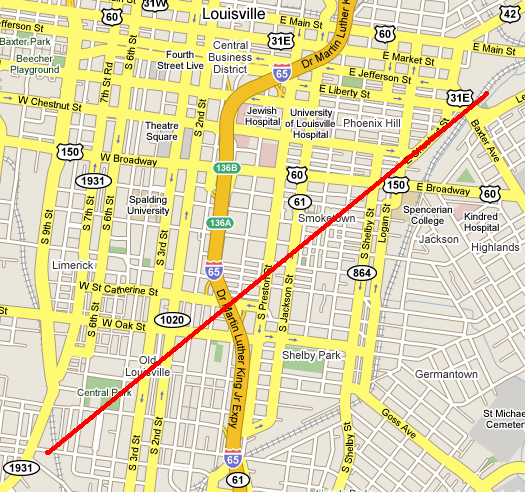