Louisville, KY
Weather Forecast Office
Hart County Straight Line Wind Damage
Begin Time: 4:53 PM EST
End Time: 4:55 PM EST
Begin Point: 2.5 miles east-northeast of Bonnieville
End Point: 4.5 miles east of Bonnieville
Wind Speed: 70 - 75 MPH
Injuries: 0
Fatalities: 0
The National Weather Service in conjunction with extensive preliminary work done by WBKO Chief Meteorologist Chris Allen conducted a storm damage survey in Hart County and found straight-line wind damage. Sporadic damage occurred over a 2-mile wide area.
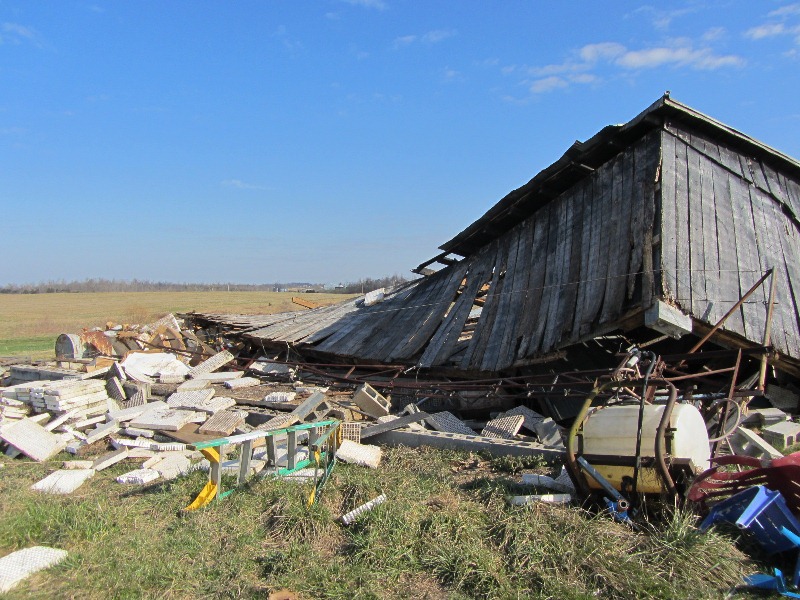
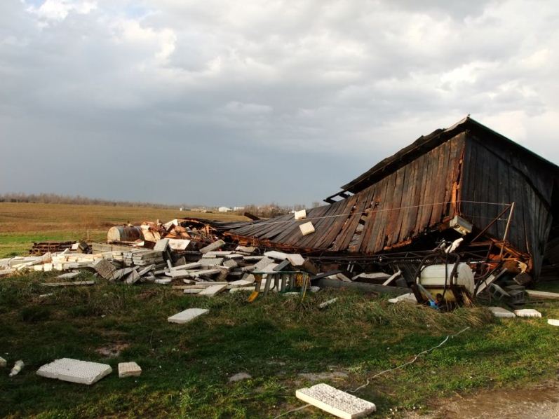
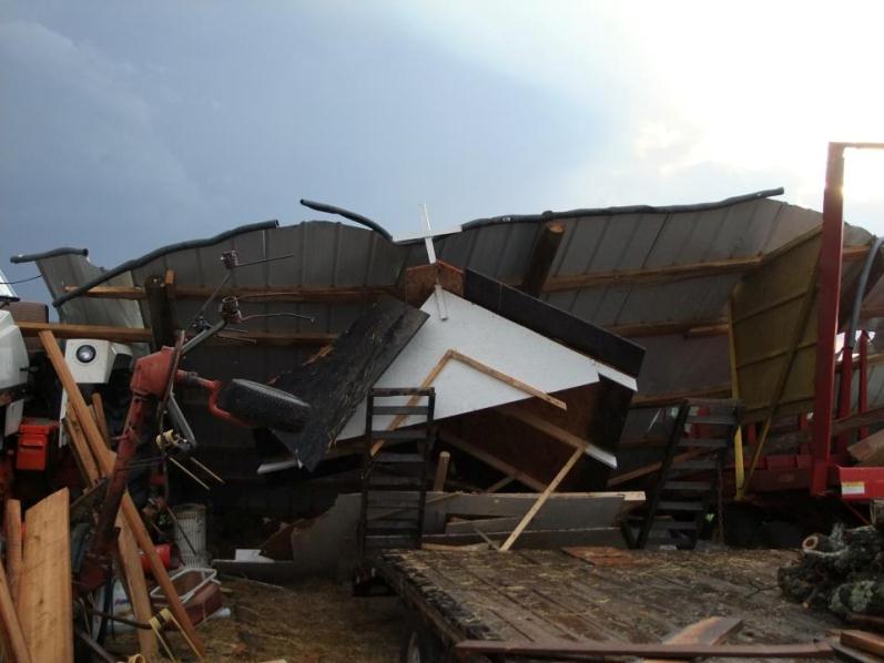
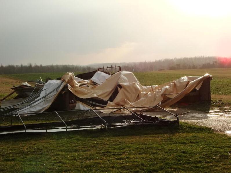
The first damage was found off Bacon Creek Spur Road, where a 30 by 145 foot greenhouse's canopy went flying and poles were bent. A 48 by 70 foot barn also experienced significant roof damage. Nickel to quarter-size hail occurred at this location.
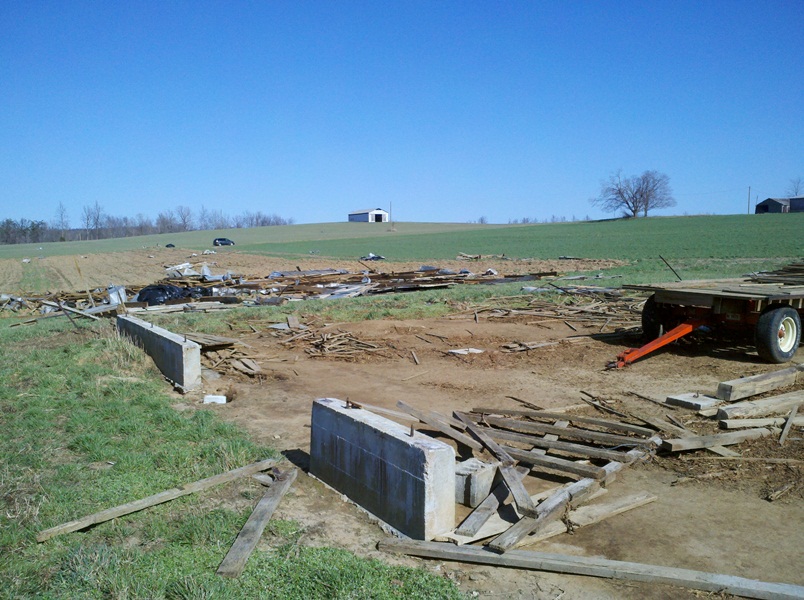
At 5140 Hwy 728, a 32-foot cabin was destroyed. Insulation was thrown approximately 150 yards due east. Further east, two older tobacco barns were destroyed, and one of those barns had its metal siding thrown 350 yards due east.
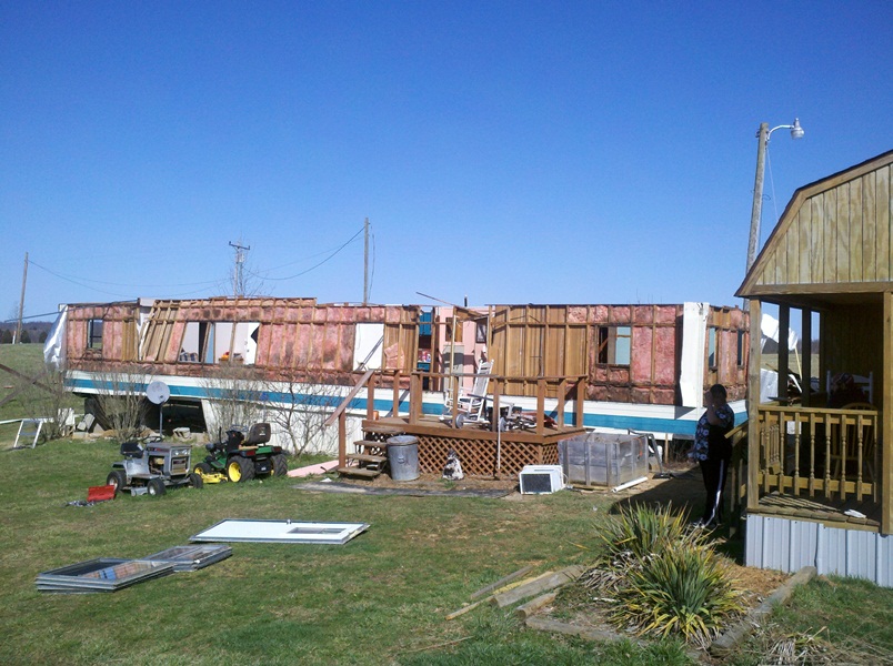
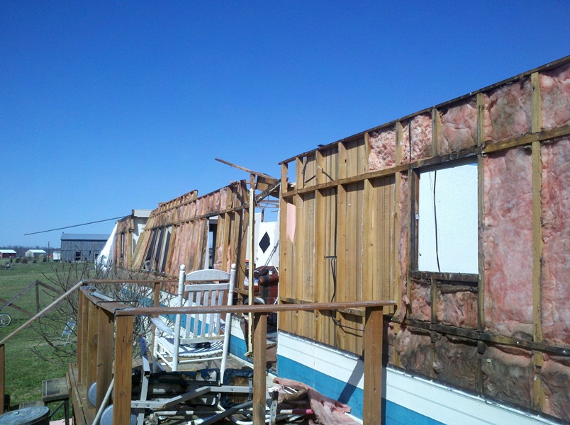
A barn canopy was bent and damaged at 11265 Hammonville Road. However, the worst damage occurred on Hwy 357 S, one mile south of Hwy 728. A single-wide mobile home was destroyed, with the roof and most of the exterior siding gone. The mobile home is now
uninhabitable. One old barn was also destroyed. At this location, winds were approximately 70-75 mph.
Click on an image for a larger version:
 |
 |
 |
|
|
|
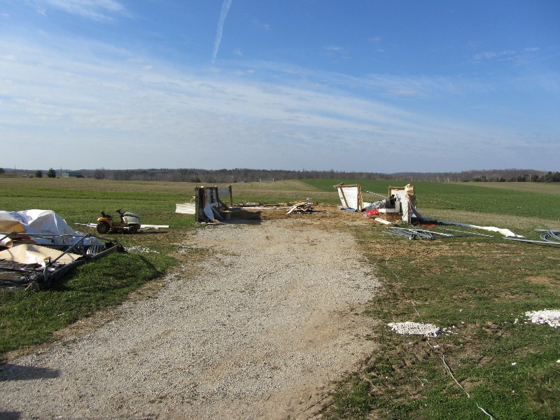
Hammonville |
Hammonville |
Hammonville |
|
|
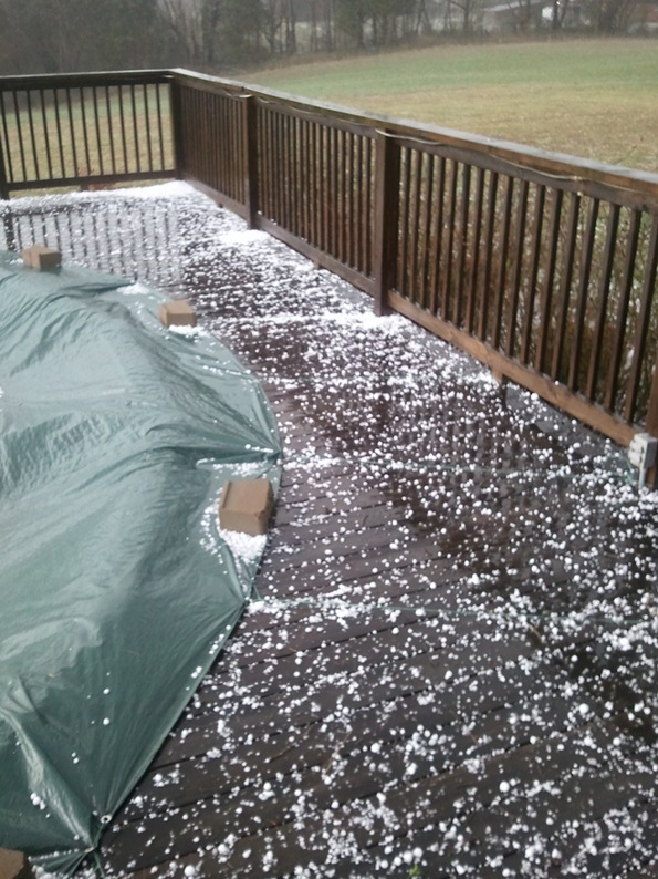
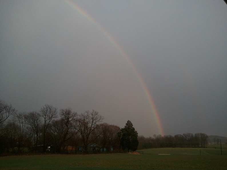
Hail in Munfordville, followed by a rainbow. Photos courtesy Chris Mueller.
 |
 |
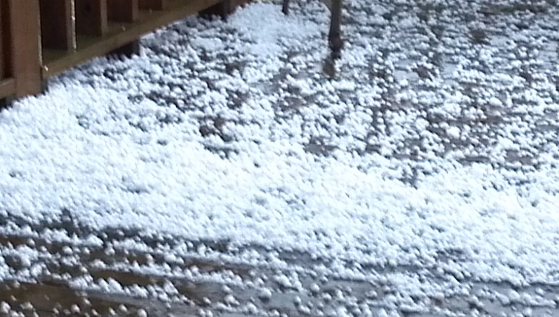
More hail in Munfordville. Photo courtesy Mark Pritchard.
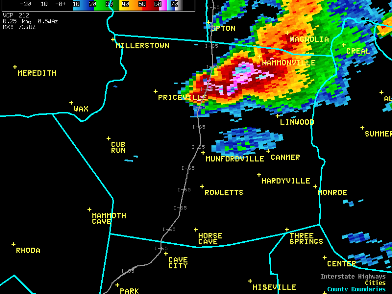
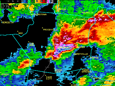
Radar images of the Bonnieville/Hammonville storm (left) and the Munfordville storm 46 minutes later (right):
 |
 |
Current Hazards
Hazardous Weather Outlook
Storm Prediction Center
Submit a Storm Report
Advisory/Warning Criteria
Radar
Fort Knox
Evansville
Fort Campbell
Nashville
Jackson
Wilmington
Latest Forecasts
El Nino and La Nina
Climate Prediction
Central U.S. Weather Stories
1-Stop Winter Forecast
Aviation
Spot Request
Air Quality
Fire Weather
Recreation Forecasts
1-Stop Drought
Event Ready
1-Stop Severe Forecast
Past Weather
Climate Graphs
1-Stop Climate
CoCoRaHS
Local Climate Pages
Tornado History
Past Derby/Oaks/Thunder Weather
Football Weather
Local Information
About the NWS
Forecast Discussion
Items of Interest
Spotter Training
Regional Weather Map
Decision Support Page
Text Products
Science and Technology
Outreach
LMK Warning Area
About Our Office
Station History
Hazardous Weather Outlook
Local Climate Page
Tornado Machine Plans
Weather Enterprise Resources
US Dept of Commerce
National Oceanic and Atmospheric Administration
National Weather Service
Louisville, KY
6201 Theiler Lane
Louisville, KY 40229-1476
502-969-8842
Comments? Questions? Please Contact Us.


 Weather Story
 Weather Map
 Local Radar