Louisville, KY
Weather Forecast Office
During the first half of the month a persistent cool pattern kept temperatures in check and prevented widespread severe weather from occurring. There was only one severe weather event in the first two weeks of June this year, when thunderstorms that erupted from Missouri to Ohio on the afternoon of the 5th moved southward into the Ohio Valley causing widespread wind damage that evening.
The cool weather was especially noticeable from the 11th to the 14th when average daily temperatures were up to 13 degrees below normal. Several locations had highs in the lower 70s on the 13th, and the following morning much of the region dropped into the 40s. Lexington's low of 45° that day was the city's coldest June temperature since hitting 45° on June 7, 2000. The last time it was colder in June in Lexington was June 7, 1998 with 44°.
Then, after just one severe weather event in the first half of the month, there were ten severe weather events in the second half! Most of the rough weather was in the form of wind damage, with a few reports of large hail mixed in. On the 21st a derecho roared from Missouri and Illinois through Indiana and Kentucky to the South Carolina coast, causing widespread wind damage along its path. Several tornadoes occurred in the Kentucky/Tennessee border region, including three EF1s in Simpson and Allen Counties.
| Average Temperature | Departure from Normal | Rain | Departure from Normal | |
| Bowling Green | 75.0° | 0° | 8.26" | +4.06" |
| Frankfort | 72.7° | +0.1° | 6.59" | +2.50" |
| Lexington | 72.5° | -0.2° | 7.44" | +3.00" |
| Louisville Bowman | 73.7° | -1.4° | 8.82" | +4.68" |
| Louisville International | 75.5° | -0.1° | 7.82" | +4.03" |
Records
14th: Record low of 45° at Lexington
9th wettest June on record at Bowling Green
6th wettest June on record at Louisville
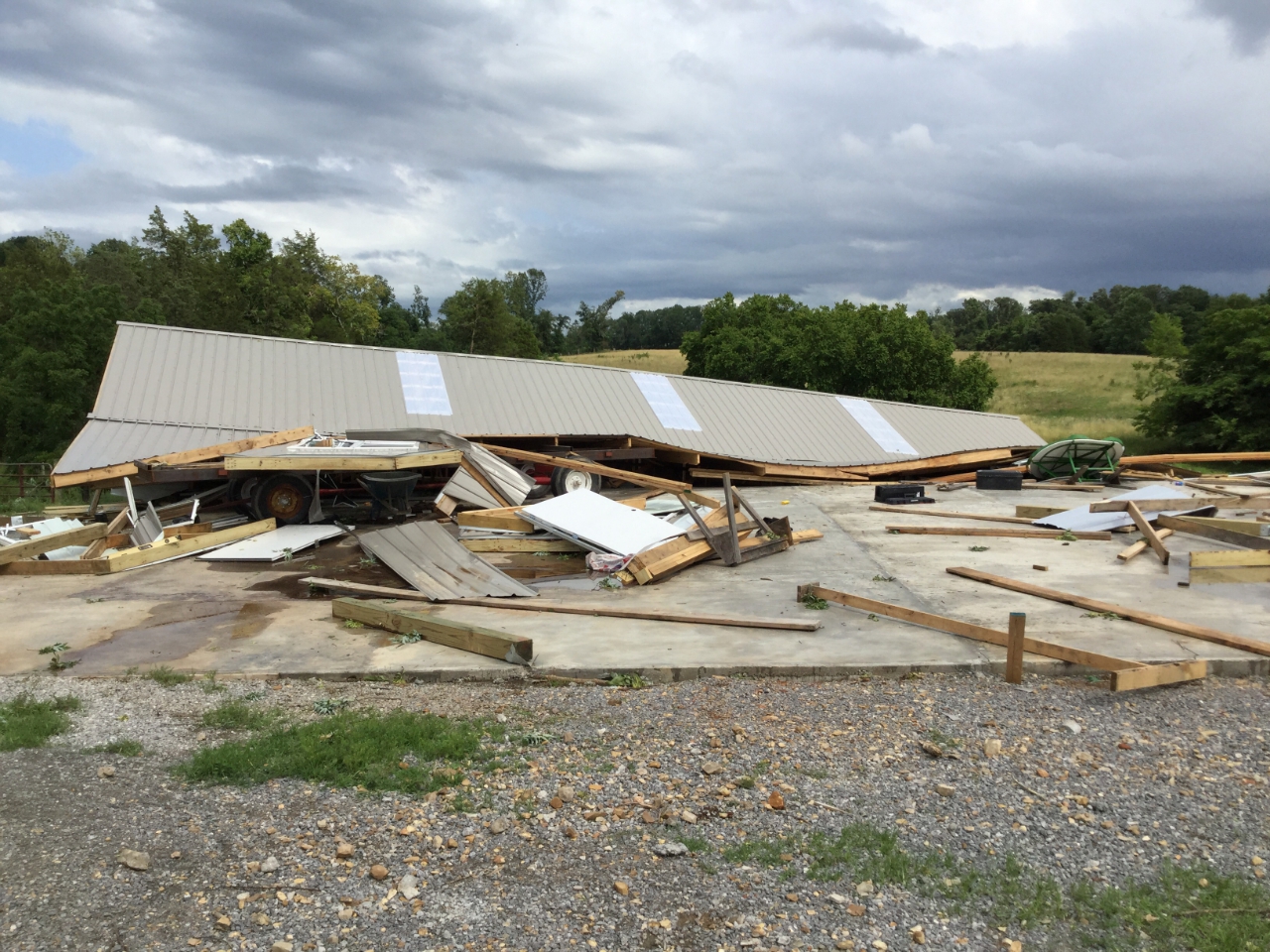
Tornado damage between Scottsville and Gold City on the 21st. NWS
Current Hazards
Hazardous Weather Outlook
Storm Prediction Center
Submit a Storm Report
Advisory/Warning Criteria
Radar
Fort Knox
Evansville
Fort Campbell
Nashville
Jackson
Wilmington
Latest Forecasts
El Nino and La Nina
Climate Prediction
Central U.S. Weather Stories
1-Stop Winter Forecast
Aviation
Spot Request
Air Quality
Fire Weather
Recreation Forecasts
1-Stop Drought
Event Ready
1-Stop Severe Forecast
Past Weather
Climate Graphs
1-Stop Climate
CoCoRaHS
Local Climate Pages
Tornado History
Past Derby/Oaks/Thunder Weather
Football Weather
Local Information
About the NWS
Forecast Discussion
Items of Interest
Spotter Training
Regional Weather Map
Decision Support Page
Text Products
Science and Technology
Outreach
LMK Warning Area
About Our Office
Station History
Hazardous Weather Outlook
Local Climate Page
Tornado Machine Plans
Weather Enterprise Resources
US Dept of Commerce
National Oceanic and Atmospheric Administration
National Weather Service
Louisville, KY
6201 Theiler Lane
Louisville, KY 40229-1476
502-969-8842
Comments? Questions? Please Contact Us.


 Weather Story
 Weather Map
 Local Radar