During New Year's Eve into New Year's Day active weather was observed across Kentucky as several waves of low pressure moved along a frontal boundary that was stalled out across the region. This resulted in multiple rounds of widespread precipitation and rainfall amounts of 2 to 4 inches with locally higher amounts were observed across the area, with some locations having their wettest New Year's Day on record. As the boundary lifted north as a warm front, strong to severe storms were able to develop within the warm sector ahead of an approaching cold front, with multiple tornadoes and scattered straight-line wind damage being observed. It was the warmest New Year's Day ever seen in Louisville, Bowling Green, and Frankfort.
After a spring-like start to the year winter returned with a vengeance on the 6th-7th. Average temperatures were around 15 to 25 degrees colder than normal with Bowling Green plummeting to 1 degree above zero on the morning of the 7th. Part of the reason for these cold temperatures was the deep snow cover laid down by the passage of a cold front that generated intense bands of snow within a larger area of lighter snow. Lexington got 9.9" of snow; 6.3" was recorded at Bowling Green. It was a new daily record snowfall at Lexington and the city's heaviest calendar day snowfall since March 5, 2015 (10.0").
Several smaller snows dotted the remainder of the month with persistently cold temperatures. At Lexington the last 12 days of the month were colder than normal and this was Lexington's coldest January since 2014.
| Average Temperature | Departure from Normal | Precipitation | Departure from Normal | Snow | Departure from Normal | |
| Bowling Green | 34.0° | -3.2° | 5.52" | +1.88" | 10.3" | +7.1" |
| Frankfort | 30.6° | -3.5° | 4.01" | +0.74" | ||
| Lexington | 28.7° | -5.2° | 5.25" | +1.83" | 17.1" | +12.4" |
| Louisville Ali | 32.5° | -3.2° | 4.49" | +1.10" | 6.4" | +1.9" |
| Louisville Bowman | 31.7° | -3.3° | 4.01" | +0.73" |
Records
1st: Warm low of 58° at Bowling Green, rainfall of 2.59" at Bowling Green, warm low of 55° at Frankfort, rainfall of 2.27" at Lexington, warm low of 55° at Louisville
6th: Snowfall of 9.9" at Lexington
7th snowiest January on record at Lexington
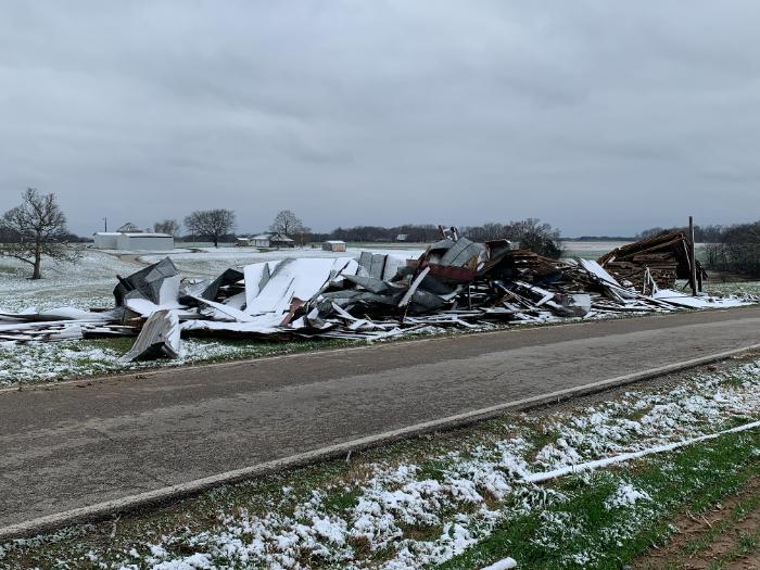
Tornado damage with snow on the ground in Logan County. NWS Storm Survey


 Weather Story
 Weather Map
 Local Radar