Louisville, KY
Weather Forecast Office
January 20, 2011 Snowfall
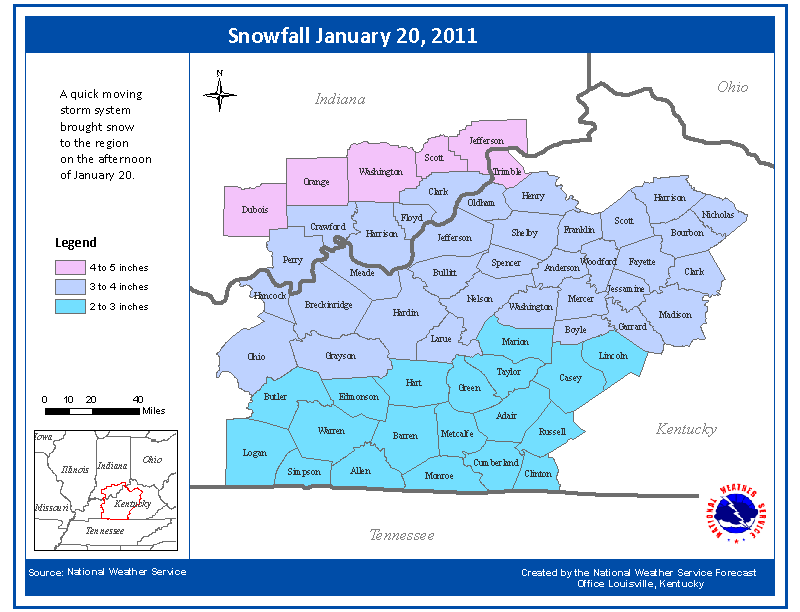
A quick-moving upper level wave and a surface trough of low perssure brought widespread snow to the region, with general snowfall totals of 2 to 5 inches. Louisville set a daily snowfall record of 3.6 inches.
If you would like to share your snowfall pictures with us, please feel free to send us your photos and video via email to our webmaster! Include your name and location so that we can give you proper credit for taking the picture. (Many thanks to those who have already sent us photos!)
Here are the approximate snowfall amounts from the event:

Photos
(click on an image to see a larger version)
Breckinridge County
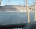
These photos were shared with us by Ksenia Carter near Rough River Lake:
 |
 |
Bullitt County
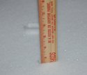
These photos were sent to us by our faithful CoCoRaHS observer near Brooks. (What is CoCoRaHS?) Note the picture of the rain gauge filled with snow ("snow gauge"?)!
 |
 |
 |
 |
Edmonson County
The following two photos are from Ken Smith in Huff.
Fayette County
|
WLEX |
WKYT |
|
|
John Bradshaw |
John Bradshaw |
John Bradshaw |
Grayson County
|
Four miles SSW of Leitchfield. Amanda Gilliam-Rose |
The following photos were taken by Scotty Gore in Clarkson:
 |
 |
 |
 |
 |
 |
 |
Green County
|
Hudgins. |
Harrison County, Indiana
|
Lanesville. Rob Davis |
Jefferson County, Kentucky
|
Downtown Louisville. Isaac Mingo |
Madison County
Here are a couple of shots from Nathaniel Shearer in Berea.
Nelson County
Some great photos from Bret Johnson in New Haven.
Oldham County
Pictures contributed by Dave Hamblin in Prospect:
 |
 |
 |
Orange County
|
Paoli. Matt Jacobs |
Scott County, Indiana
These photos were taken by Jeanne Newton in the Hardy Lake area.
 |
 |
 |
 |
 |
 |
 |
 |
Warren County
Here are some stills from WNKY's Sky Cam in Bowling Green.
Current Hazards
Hazardous Weather Outlook
Storm Prediction Center
Submit a Storm Report
Advisory/Warning Criteria
Radar
Fort Knox
Evansville
Fort Campbell
Nashville
Jackson
Wilmington
Latest Forecasts
El Nino and La Nina
Climate Prediction
Central U.S. Weather Stories
1-Stop Winter Forecast
Aviation
Spot Request
Air Quality
Fire Weather
Recreation Forecasts
1-Stop Drought
Event Ready
1-Stop Severe Forecast
Past Weather
Climate Graphs
1-Stop Climate
CoCoRaHS
Local Climate Pages
Tornado History
Past Derby/Oaks/Thunder Weather
Football Weather
Local Information
About the NWS
Forecast Discussion
Items of Interest
Spotter Training
Regional Weather Map
Decision Support Page
Text Products
Science and Technology
Outreach
LMK Warning Area
About Our Office
Station History
Hazardous Weather Outlook
Local Climate Page
Tornado Machine Plans
Weather Enterprise Resources
US Dept of Commerce
National Oceanic and Atmospheric Administration
National Weather Service
Louisville, KY
6201 Theiler Lane
Louisville, KY 40229-1476
502-969-8842
Comments? Questions? Please Contact Us.


 Weather Story
 Weather Map
 Local Radar