On Monday, April 8, 2024 the totality of a solar eclipse will cross the United States from Texas to Indiana to Maine.
Sky Forecast Sources:
|
The path of the eclipse's totality will run from southwest to northeast across Indiana. It will begin in Mount Vernon at 12:45pm CDT and end in Richmond at 4:24pm EDT. In the NWS Louisville area of responsibility, totality will begin in Jasper at 3:03pm EDT and end in Bryantsburg (north of Madison) at 3:09pm EDT.
Interactive Map
NASA general eclipse information
National Cloud Climatology
Eclipse eye safety
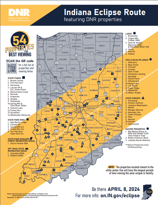
Source: https://www.in.gov/dnr/places-to-go/events/2024-solar-eclipse/
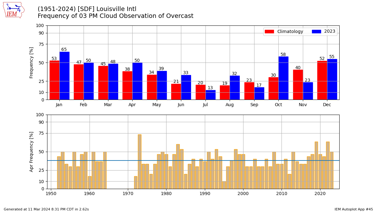
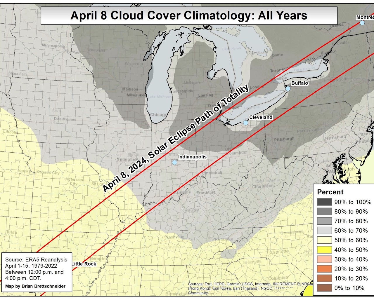
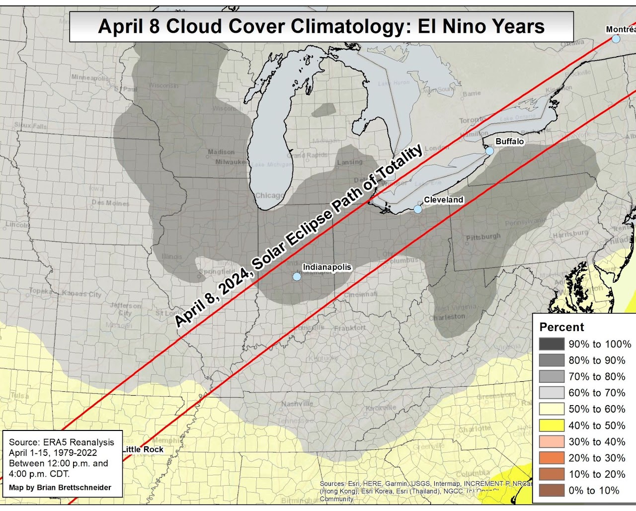
Climatologically speaking, on average about 60-70% of the sky is covered by cloud in southern Indiana in April:

Source: https://eclipsophile.com/2024tse/. Note: The date on the graphic above should say April 8, 2024.
38% of 3pm sky observations in April have been overcast in Louisville. (Louisville is used here because it has the most complete and thorough record of sky observations near southern Indiana.)
 |
 |
Historical probabilities of severe weather:
| Any Severe | Hail | Wind | Tornado |
 |
 |
 |
 |
Source: Storm Prediction Center
Past instances of severe or unusual weather on April 8 since 1950 in or near the path of totality in southern Indiana (in NWS Louisville CWA):
April 8, 1995: Dime and quarter sized hail in Floyd County (9pm and 11:19pm EDT)
April 8, 1998: Dime sized hail in Orange County (8-8:30am EDT)
April 8, 2015: Dime sized hail in Crawford County (3:50pm EDT)
April 8, 2016: Frost/freeze in Jefferson County
April 8, 2020: 62mph thunderstorm winds in Dubois County, 63mph winds in Orange County and Crawford County, 76mph winds in Harrison County, 60 mph winds in Washington County, 60mph winds in Floyd County, 90mph winds in Clark County (these storms struck between 9:42pm and 10:51pm)
Start of partial eclipse: 1:47pm EDT
Start of total eclipse: 3:03pm EDT
Maximum eclipse: 3:05pm EDT
End of total eclipse: 3:07pm EDT
End of partial eclipse: 4:21pm EDT
Climatological Information for Jasper on April 8:
Normal high: 64°
Normal low: 38°
Record high: 85° in 2001
Record cold high: 33° in 2007
Record low: 20° in 1972
Record warm low: 68° in 2001
Wettest: 1.81" in 2015
Snowiest: A trace in 1956
% of years with measurable rain: 39% (about two out of five)
(Data collected at the Southern Indiana Purdue Agriculture Center, period of record 1955 to present)
Below: click on image to see a larger version
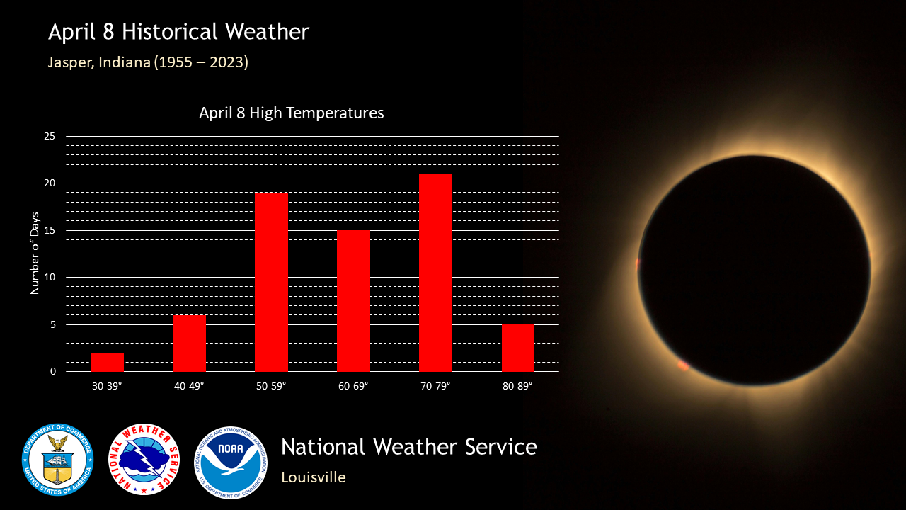
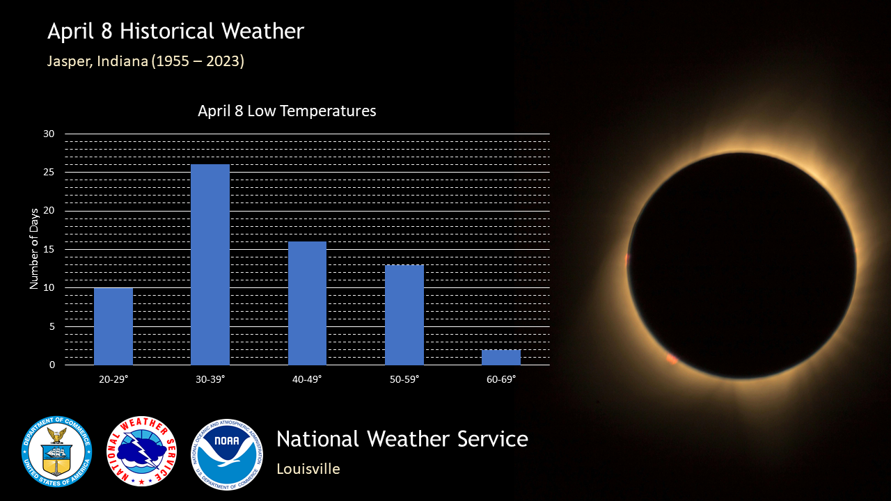
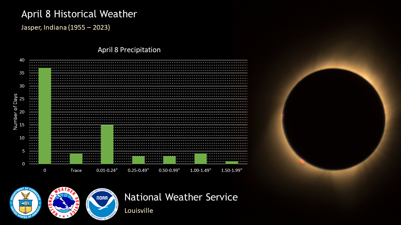
Weather in Jasper on April 8 over the past 20 years:
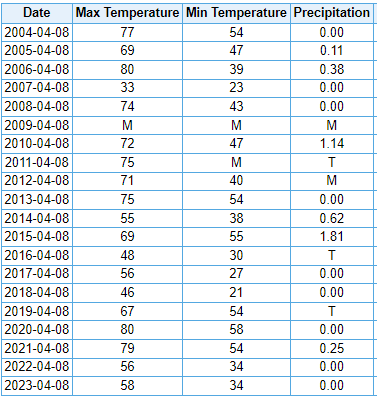
T = Trace M = Missing
Start of partial eclipse: 1:49pm EDT
Maximum eclipse (99.25%): 3:07pm EDT
End of partial eclipse: 4:22pm EDT
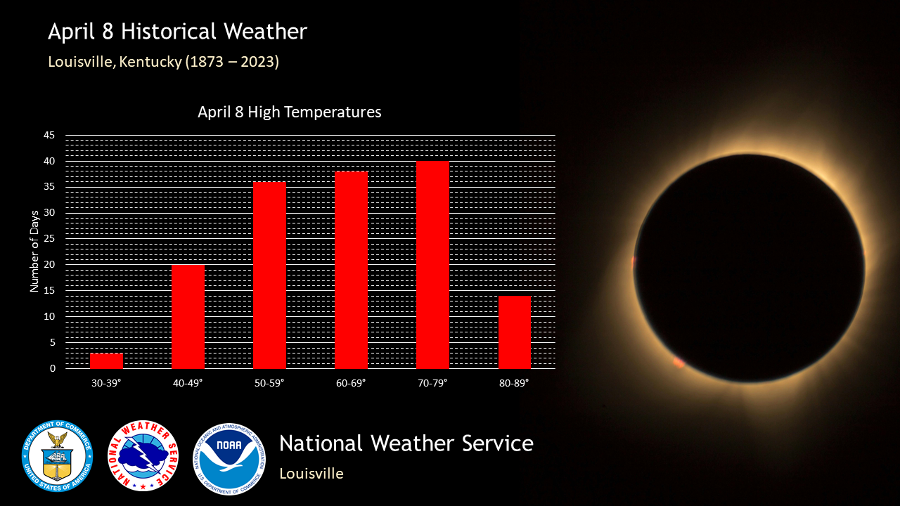
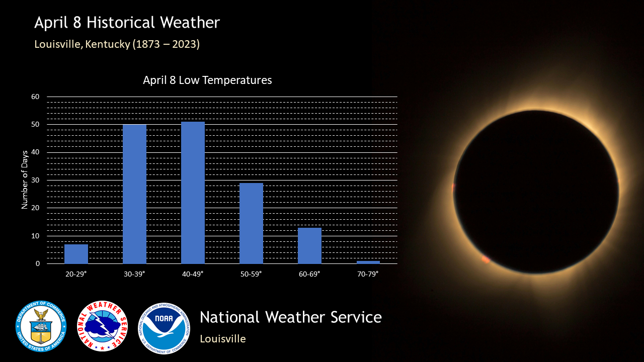
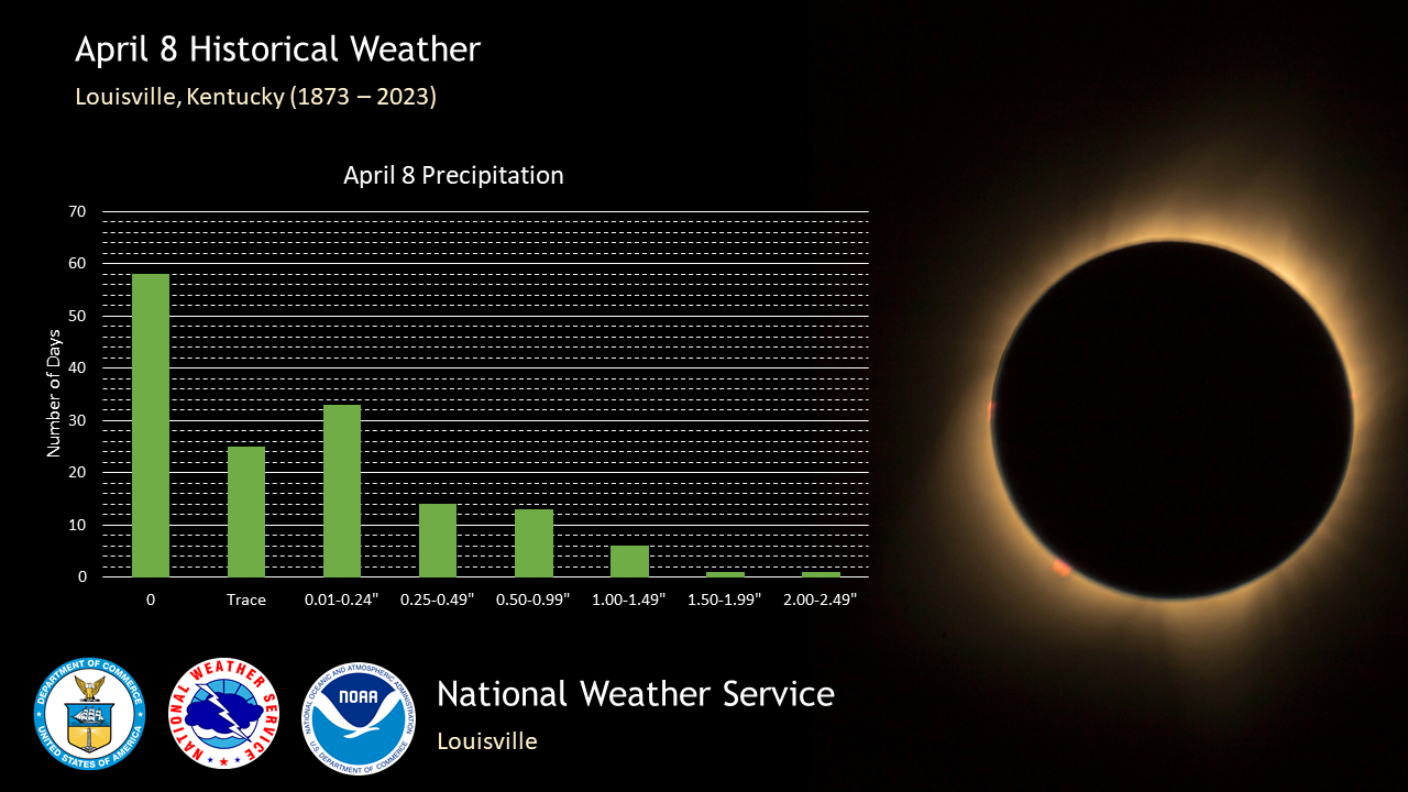
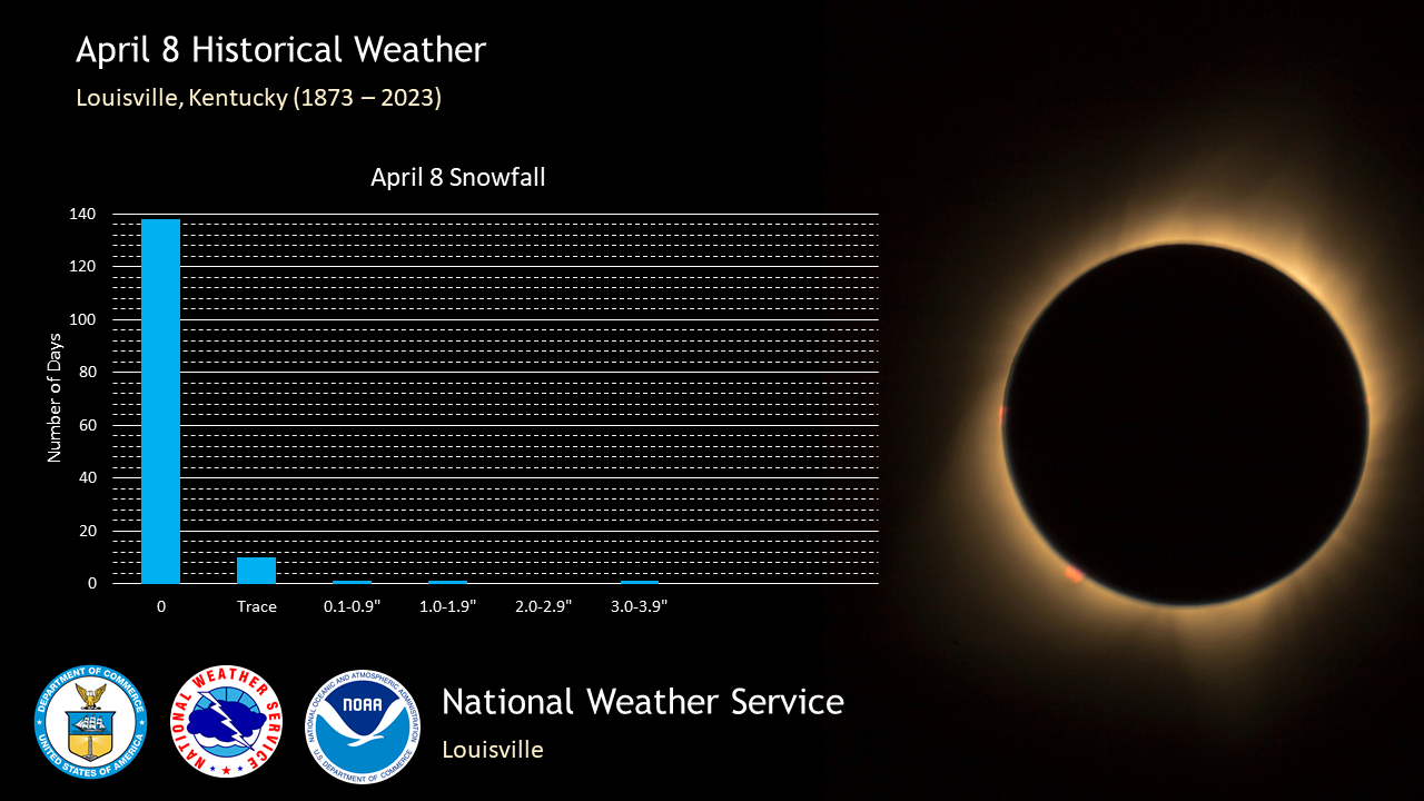
Climatological Information for Louisville on April 8:
Normal high: 67°
Normal low: 46°
Record high: 85° in 2020 and 2011
Record cold high: 34° in 1916
Record low: 24° in 1972
Record warm low: 70° in 1922
Wettest: 2.40" in 1942
Snowiest: 3.2" in 1917
Deepest Snow Depth: 1" in 1982 and 1917
​% of years with rain: 45%
3pm Normals:
Temperature: 65°
Dew Point: 41°
% clear skies: 10%
% a few clouds: 11%
% partly cloudy: 15%
% mostly cloudy: 27%
% cloudy: 37%
Wind speed: 12 mph
Wind direction: southwest
Below: click on image to see a larger version
Weather in Louisville on April 8 over the past 20 years:

T = Trace
Start of partial eclipse: 1:50pm EDT
Maximum eclipse (99.84%): 3:08pm EDT
End of partial eclipse: 4:23pm EDT
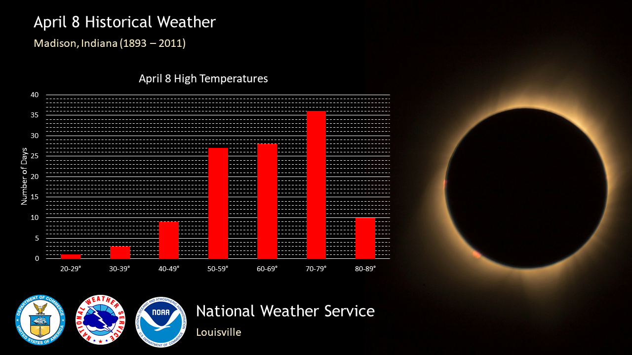
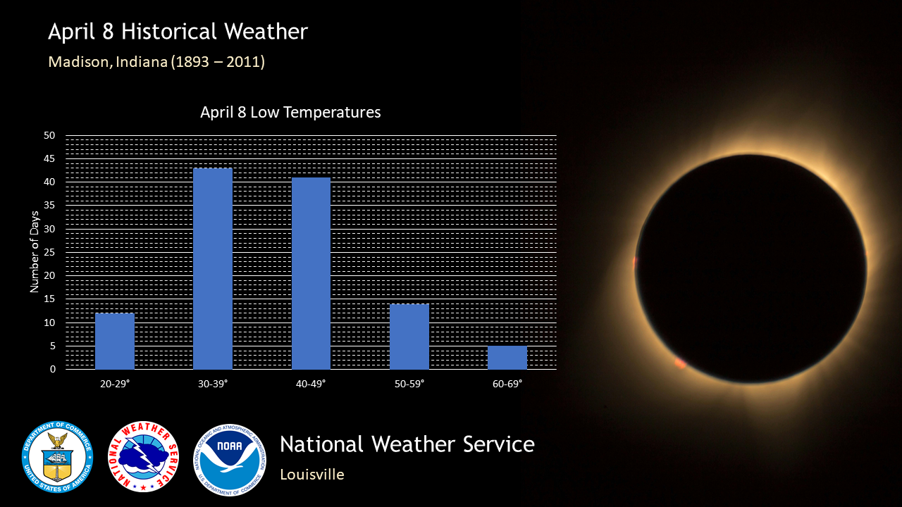
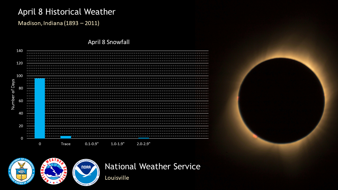
Climatological Information for Madison on April 8:
Normal high: 66°
Normal low: 40°
Record high: 85° in 1959
Record cold high: 26° in 2007
Record low: 21° in 1972 and 1936
Record warm low: 67° in 1959
Wettest: 1.69" in 1948
Snowiest: 2" in 1917
Deepest Snow Depth: 2" in 1917
​% of years with measurable rain: 40% (two out of five)
(Data taken at Madison Sewage Plant 1893-2011)
Below: click on image to see a larger version


 Weather Map
 Local Radar