Louisville, KY
Weather Forecast Office
The first week of the month was generally dry with seasonable temperatures. Though we have had roughly normal precipitation in 2021 as a whole, by August 10 we had dried out enough to introduce some areas of D0 (abnormally dry) on the U.S. Drought Monitor northeast of Louisville and in the Barren River Lake region.
From the 9th to the 19th we entered a wetter pattern and much of the month's rain fell during this time. Severe weather was sparse this month, but a few thunderstorms did manage to produce some damaging wind gusts during this period.
After another relatively dry period, the month ended on a wet note as the remnants of Hurricane Ida combined with a cold front to bring us thunderstorms on the 30th and rain on the 31st. Fortunately there was very little flooding due to dry ground and plenty of green vegetation. The most significant flooding took place on the 30th, well ahead of Ida, in Dubois, Orange, and Clark counties of southern Indiana. The gymnasium flooded at northeast Dubois Intermediate School.
| Average Temperature | Departure from Normal | Precipitation | Departure from Normal | |
| Bowling Green | 80.0° | +1.5° | 5.40" | +1.51" |
| Frankfort | 77.6° | +1.5° | 8.92" | +5.77" |
| Lexington | 75.6° | -0.1° | 7.50" | +3.79" |
| Louisville Ali | 80.9° | +2.0° | 3.27" | -0.44" |
| Louisville Bowman | 79.3° | +1.7° | 3.86" | +0.33" |
Records
11th: Warm low of 81° at Louisville
13th: Warm low of 75° at Bowling Green
19th: Wettest August day on record at Frankfort, 3.97"
29th: Warm low of 72° at Frankfort
31st: Rainfall of 2.11" at Bowling Green, rainfall of 2.21" at Frankfort
Wettest August on record at Frankfort
6th wettest August on record at Lexington

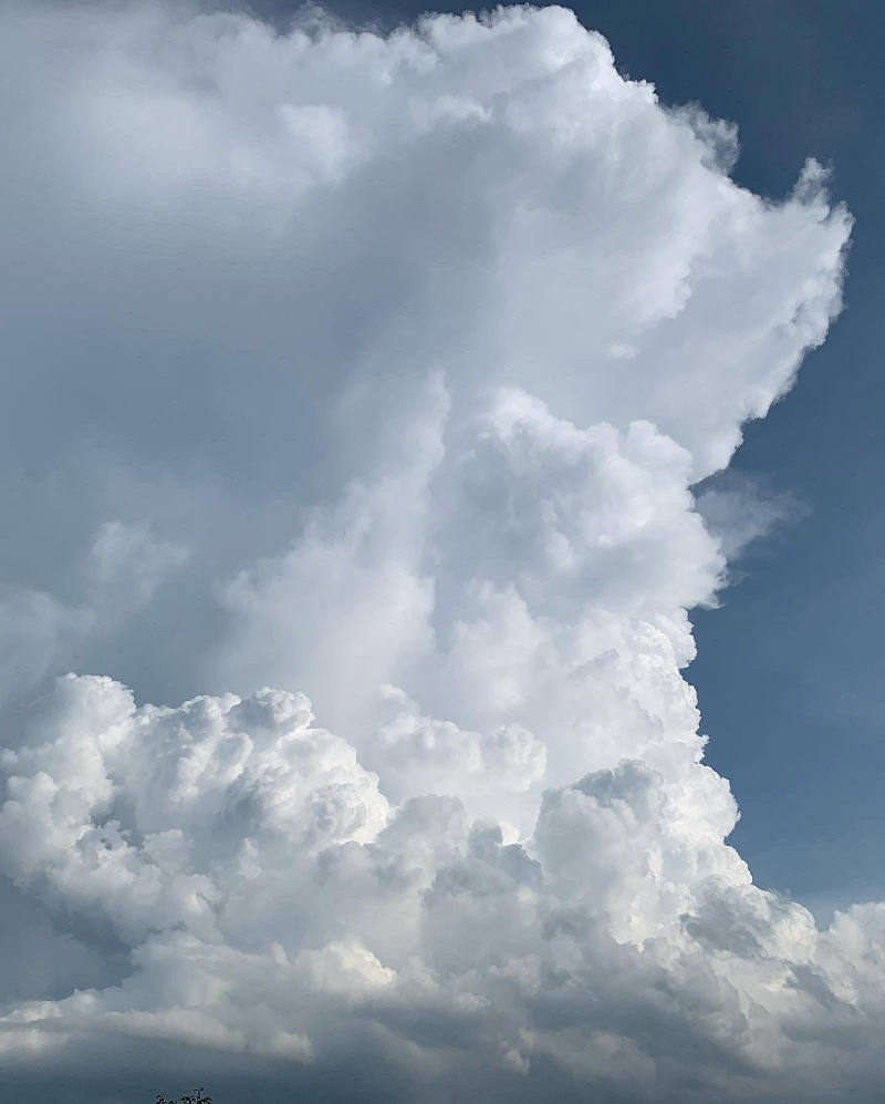
Storms building near Shepherdsville, Kentucky, on the 13th. Tyler Voelker
Current Hazards
Hazardous Weather Outlook
Storm Prediction Center
Submit a Storm Report
Advisory/Warning Criteria
Radar
Fort Knox
Evansville
Fort Campbell
Nashville
Jackson
Wilmington
Latest Forecasts
El Nino and La Nina
Climate Prediction
Central U.S. Weather Stories
1-Stop Winter Forecast
Aviation
Spot Request
Air Quality
Fire Weather
Recreation Forecasts
1-Stop Drought
Event Ready
1-Stop Severe Forecast
Past Weather
Climate Graphs
1-Stop Climate
CoCoRaHS
Local Climate Pages
Tornado History
Past Derby/Oaks/Thunder Weather
Football Weather
Local Information
About the NWS
Forecast Discussion
Items of Interest
Spotter Training
Regional Weather Map
Decision Support Page
Text Products
Science and Technology
Outreach
LMK Warning Area
About Our Office
Station History
Hazardous Weather Outlook
Local Climate Page
Tornado Machine Plans
Weather Enterprise Resources
US Dept of Commerce
National Oceanic and Atmospheric Administration
National Weather Service
Louisville, KY
6201 Theiler Lane
Louisville, KY 40229-1476
502-969-8842
Comments? Questions? Please Contact Us.


 Weather Story
 Weather Map
 Local Radar