Louisville, KY
Weather Forecast Office
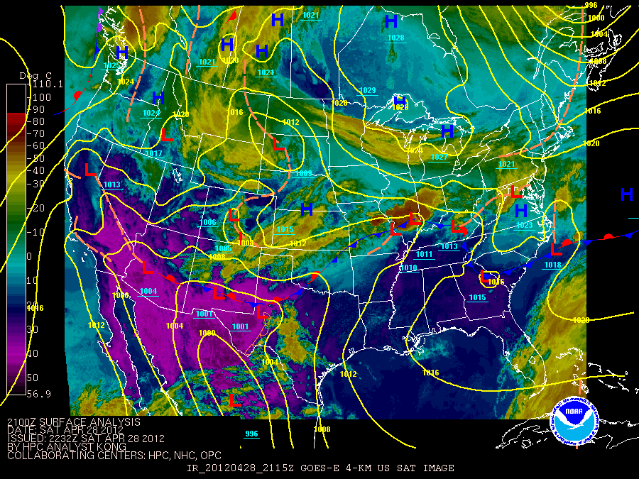
A stationary front draped along the I-64 corridor, combined with high temperatures around 80 degrees and much colder air above 10,000 feet, allowed for a severe thunderstorms to develop and track along the front late on April 28, 2012.

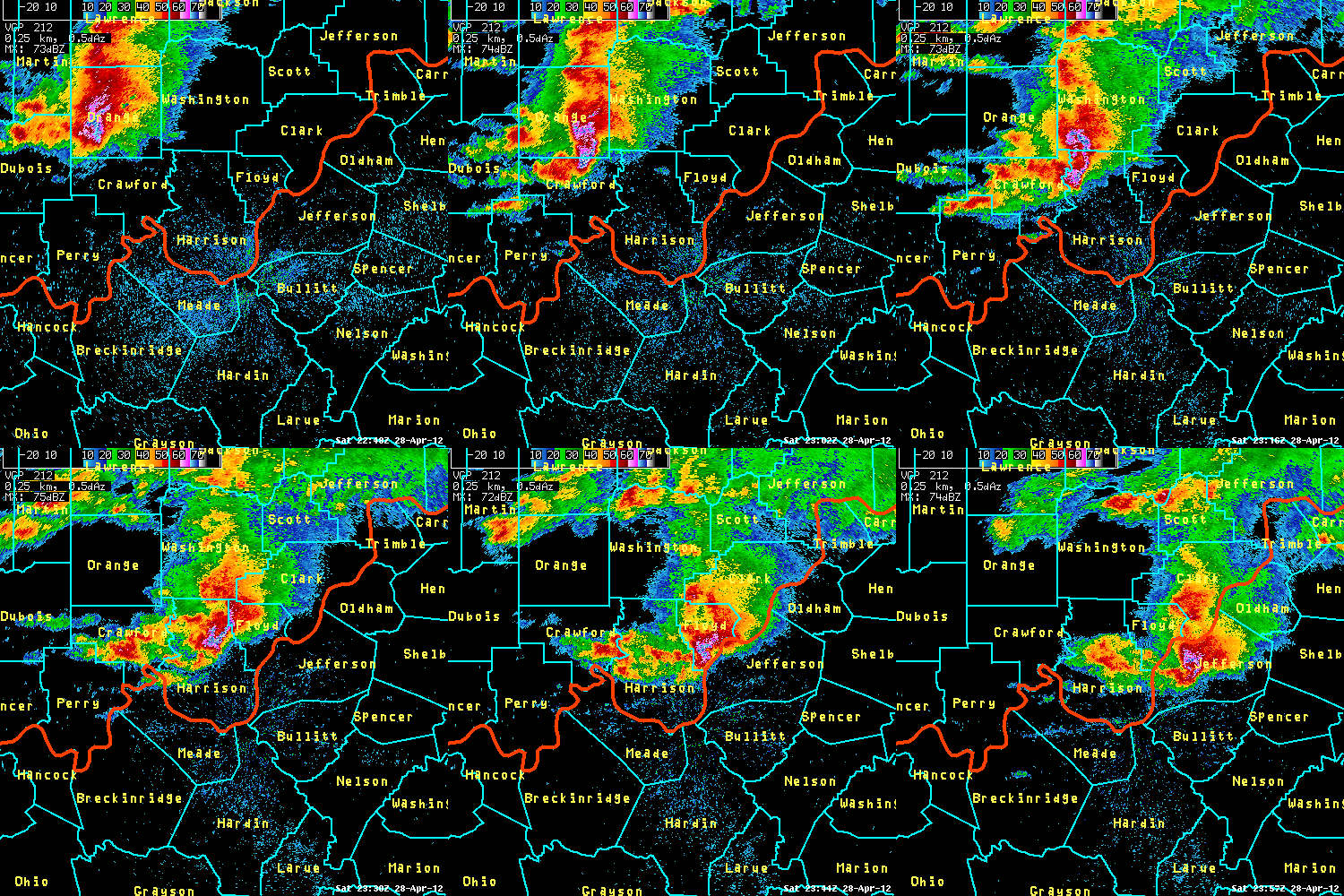
The storms that formed created hail as large as baseballs near French Lick, Indiana, with golf ball size hail reported along a line from Milltown to Palmyra and Georgetown in Indiana and then to the Churchill Downs, Highview, and Fern Creek areas in Louisville, and finally into Taylorsville, where the storm started to weaken. Trees were stripped of leaves in Fern Creek and along Billtown Road. 3500 brand new Ford Escapes, awaiting delivery at the Louisville Assembly Plant, were damaged by the hail. Derby trial races at Churchill Downs were interrupted.
The radar loop below shows the storm that generated the hail as it travelled toward Louisville.
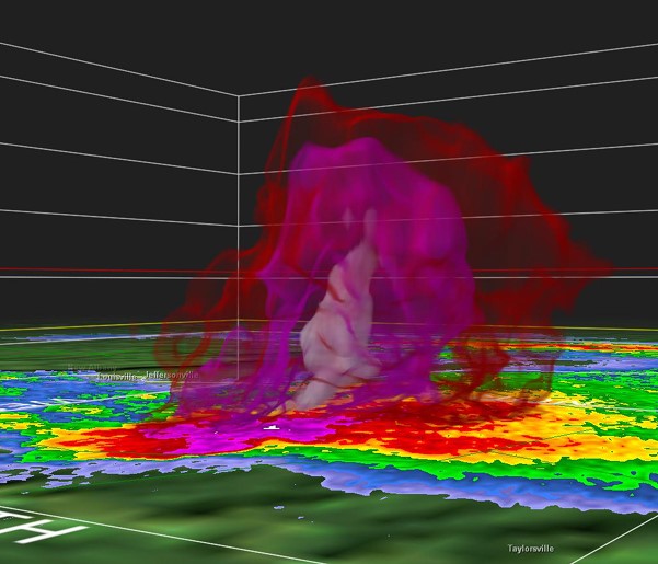
This image, using GR2Analyst software, allows us to see inside the storm. The white colors indicate an intense hail core. This still was captured when the storm was over Fern Creek.

Below are some pictures taken of the hail across the region. Click on an image to see a larger version.
|
Marengo, Indiana (courtesy of Jenny Caffrey) |
Shively, Kentucky (courtesy of Jason Kratzwald) |
Fern Creek, Kentucky (courtesy of Greg Watkins) |
Northwest of Taylorsville, Kentucky (courtesy of Jeff Sarver) |
Louisville skyline (courtesy of WLKY) |
|
From Jeffersontown, Kentucky (courtesy of Kris Rau) |
Audubon Park, Kentucky (courtesy Tyler Martin) |
Frankfort, Kentucky. (courtesy Mike Sparks) |
Current Hazards
Hazardous Weather Outlook
Storm Prediction Center
Submit a Storm Report
Advisory/Warning Criteria
Radar
Fort Knox
Evansville
Fort Campbell
Nashville
Jackson
Wilmington
Latest Forecasts
El Nino and La Nina
Climate Prediction
Central U.S. Weather Stories
1-Stop Winter Forecast
Aviation
Spot Request
Air Quality
Fire Weather
Recreation Forecasts
1-Stop Drought
Event Ready
1-Stop Severe Forecast
Past Weather
Climate Graphs
1-Stop Climate
CoCoRaHS
Local Climate Pages
Tornado History
Past Derby/Oaks/Thunder Weather
Football Weather
Local Information
About the NWS
Forecast Discussion
Items of Interest
Spotter Training
Regional Weather Map
Decision Support Page
Text Products
Science and Technology
Outreach
LMK Warning Area
About Our Office
Station History
Hazardous Weather Outlook
Local Climate Page
Tornado Machine Plans
Weather Enterprise Resources
US Dept of Commerce
National Oceanic and Atmospheric Administration
National Weather Service
Louisville, KY
6201 Theiler Lane
Louisville, KY 40229-1476
502-969-8842
Comments? Questions? Please Contact Us.


 Weather Story
 Weather Map
 Local Radar