Forecasters from the National Weather Service offices in Kentucky, Indiana, Missouri, and even some in Ohio and Tennessee got together virtually Tuesday morning for a Winter Weather Workshop. The goal of this training was to teach about several new tools we can use to help us diagnose the potential for unusual or extreme events among the ever increasing amount of model data we have to look at. Explanations were given for each tool, and then we showed how they helped diagnose the winter extreme event we had back on President's Day of this year...when the Southern Plains states had extreme cold and we had snow and cold over our part of the Ohio Valley. The slide below describes the European model's Extreme Forecast Index and what it showed ahead of that event.

The ECMWF Extreme Forecast Index (EFI). The matrix in the upper left describes several different weather elements in the columns and forecast hours in the rows. The cyan highlight rectangle represents the selected image on the right, where the light purple color indicates a forecast that is outside the 30-year climatology (i.e., not having occurred in the 30-year period of record). If interested in more details on this tool, see link below.
We also discussed messaging tips on how to portray our confidence in a given forecast based on these new tools. The example below represents what we could send out in our area forecast discussions as well as on our social media channels (Facebook, Twitter, YouTube).

We concluded the workshop with a series of scenario questions, placing forecasters in the hot seat, having to decide what kind of headline product is needed for different winter weather cases. Emphasis was placed on collaboration, both internally (at the office level and with our neighboring offices) and externally with our weather and emergency management partners. More forecasters/partners providing input gives a better chance of thinking of all the potential impacts or non-impacts from a given case. One scenario discussed was the early season freezing rain event that occurred back in mid November of 2018. This early event produced freezing rain amounts on trees and elevated surfaces of a tenth to a quarter inch of ice, but little issues with the warm roadways. Trees that were in full leaf did not appreciate that icing however...as the broader surface area getting the ice cover caused several tree branches to fall and consequently multiple power outages.
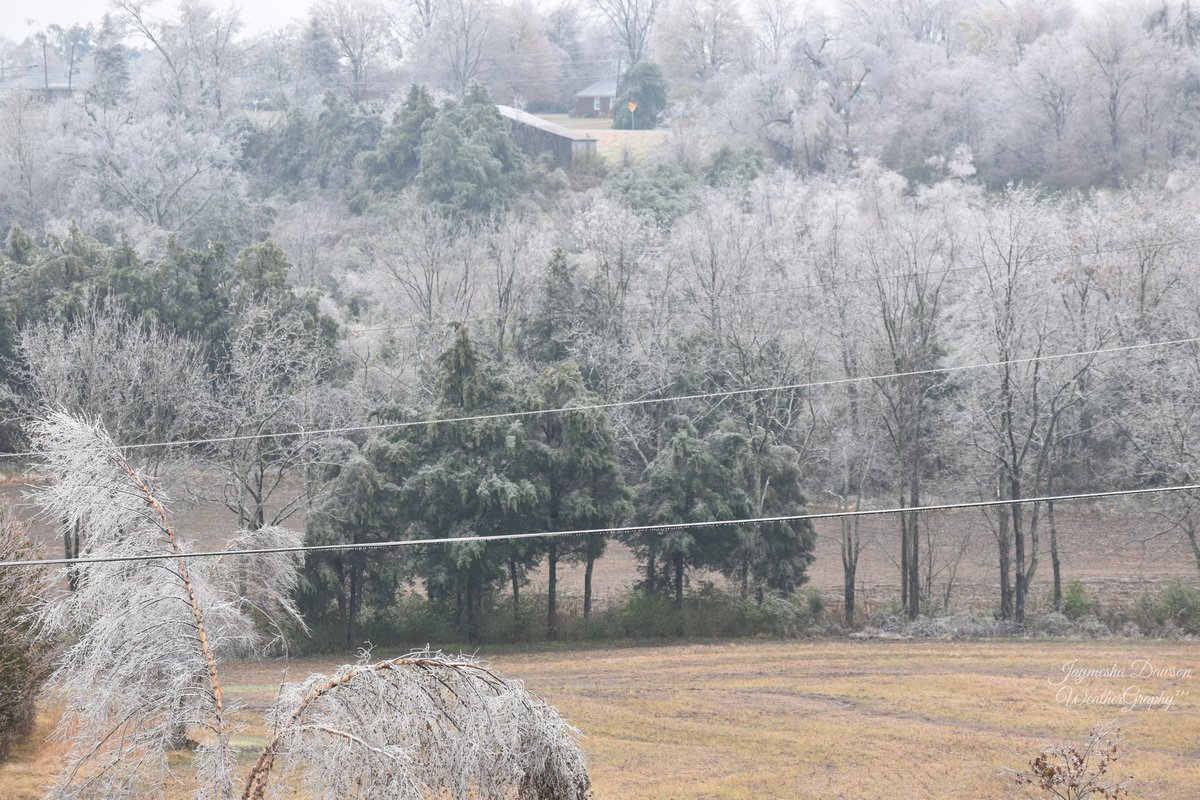
A white forest in Nelson County, KY...from the Nov. 14-15, 2018 freezing rain event (photo by Jaymesha Dawson)
For those who want to delve deeper into some of the tools we're getting used to, check out these weblinks:
* Ensemble Situational Awareness Tool, from the North American Ensemble Forecasting System (as well as the European Ensemble Prediction System)
* ECMWF Extreme Forecast Index
* Weather Prediction Center's Cluster Analysis, using American, Canadian, and European ensemble data
* High-Resolution Ensemble Forecast, shorter-term model data


 Weather Story
 Weather Map
 Local Radar