The Climate Prediction Center produces a number of tools to help diagnose the potential for excessive heat over the medium and long-range of the forecast (greater than 6 days out to seasonal time scales). The start to the month of September 2023 gives some good chances to look at a likely above-normal temperature scenario.
First and most familiar to most users is the 6-10 and 8-14 day outlooks. The image below is to the static one issued Thursday afternoon (8/31/23) for the period Sept. 6-10, 2023. (Link to the most updated version is here or by hovering over the 6-10 day tab on the main webpage). Note the area of "warm: colors (oranges and reds). These colors are NOT a guarantee that hot conditions will occur (100% chance)...rather it shows for KY and southern IN a range of 60-80% chances for above normal temperatures averaged over that 9/6-9/10 period (both high and low temperatures...combined as an average temperature).
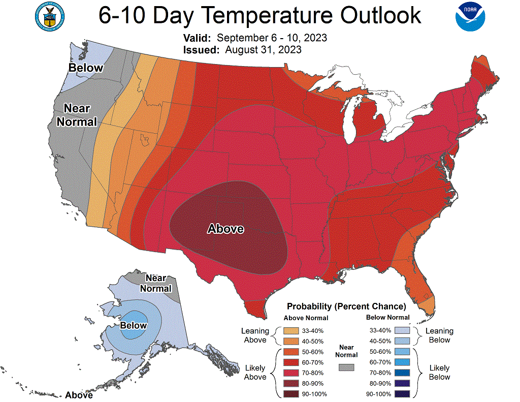
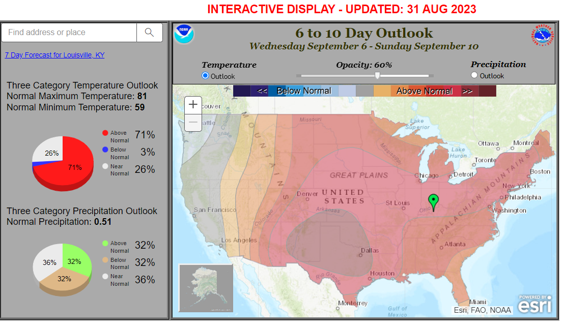
The interactive display for the 6-10 day outlook goes into more detail, letting you know what "normal" is for that time of year as well as the chances for near normal conditions and even below normal (again, the link to the most current version is here). Clicking on Louisville gives you a normal high of 81 and low of 59. There's a 71% chance of above normal temperatures, 26% chance for near normal, and 3% chance for below normal. So again, you can see the "most likely" outlook is for above normal temperatures.
Diving a little further into the details, the forecast for excessive heat during this time period is not as likely as what we had last week or with the heat event back in late July. CPC also produces outlooks for excessive heat, both above normal climatology values and above given threshold values. Heat Advisories are issued for 105-110 degree Heat Index (or prolonged periods of 100-105), whereas Excessive Heat Warnings are issued for 110 or above Heat Index (or prolonged periods of 105-110). The graphics below show what CPC is thinking for their outlook period.
.gif)
At first glance the above image seems daunting for above normal heat indices over the Ohio Valley. 90-100% chance of above normal heat index. The dashed contours however show what an above normal heat index is (with a contour of 90 degrees parallel to the Ohio/Kentucky border...and our forecast area in the 90-95 range. So the outlook gives a near certain (again 90-100%) chance for heat indices above this 90-95 degree range. What about the forecast we'd hit Heat Advisory criteria? You can look at threshold heat index forecasts as well.
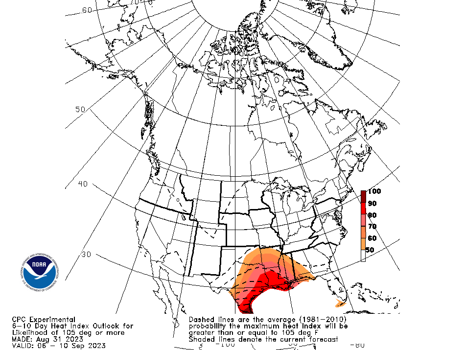
Based on this forecast, there is less than a 50% chance for excessing our local criteria for Heat Advisory conditions. Just as a reference, the dashed contour lines show the typical chance this time of year to reach Heat Advisory criteria (which puts us in the 0-5% range). The colored plots show the current forecast's chances (again <50%).
So this forecast indicates we likely will have warm temperatures to start September, but given lower dewpoints than what we had in late August and July, the heat indices likely just won't peak as high.
There are a lot of good outlook products on the CPC website, for the winter, there are forecasts for extreme cold and wind chills. Whenever NWS Louisville and CPC note a signal for extreme heat/cold/rainfall/etc., look for posts about it in our social media as well as top news stories and daily weather story graphics.


 Weather Story
 Weather Map
 Local Radar