Louisville, KY
Weather Forecast Office
Last week, Dan McKemy and Ryan Sharp, meteorologists at the National Weather Service in Louisville, were able to present some of their work to and learn from other operational meteorologists at the National Weather Association (NWA) Annual Meeting...this year held in Huntsville, AL. The convention brings together partners from broadcast meteorology, universities, government meteorologists, as well as private meteorological companies. The theme for this year's convention was "Pay it Forward". Several sessions focused on mentoring younger meteorologists as well as lessons we learned from the bigger weather events over the past couple of years...including Hurricanes Florence and Michael as well as the devastating EF4 tornado that went through southeast Alabama on March 3, 2019.
Ryan gave a presentation on a new way to visualize the plethora of data coming from the latest series of earth-observing satellites (GOES 16/17). Work on the national level has provided composite imagery of multiple channels from GOES, with those composites called RGB, based on the assignment of different images a red/green/blue color.

Lead Meteorologist Ryan Sharp giving a presentation at the NWA Conference in Huntsville.

An example RGB, in this case called the Day Cloud Phase Distinction, because of its ability to show forecasts the difference between water clouds (in the cyan color), clouds with both ice and liquid water (in green), and deeper/thinner ice clouds (yellow/pink). To create the composite, the Infrared (IR) channel on GOES is given a red color, the visible channel is colored green, and then the channel focusing on snow and ice is given a blue color.
Meteorologist Dan McKemy gave a poster presentation on how he used some new radar forecasting techniques to make decisions on whether to warn or not warn on some rotating storms over the Ohio Valley. Forecasters across the National Weather Service are finding more ways to study Dual Polarization radar data as we see more cases of storms since those data became available to forecasters roughly 5 years ago. With that study, more features are being identified that could help us distinguish between tornadic and non-tornadic storms.
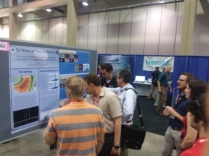
Meteorologist Dan McKemy presenting his case study to a crowd of meteorologists at the NWA in Huntsville.
Current Hazards
Hazardous Weather Outlook
Storm Prediction Center
Submit a Storm Report
Advisory/Warning Criteria
Radar
Fort Knox
Evansville
Fort Campbell
Nashville
Jackson
Wilmington
Latest Forecasts
El Nino and La Nina
Climate Prediction
Central U.S. Weather Stories
1-Stop Winter Forecast
Aviation
Spot Request
Air Quality
Fire Weather
Recreation Forecasts
1-Stop Drought
Event Ready
1-Stop Severe Forecast
Past Weather
Climate Graphs
1-Stop Climate
CoCoRaHS
Local Climate Pages
Tornado History
Past Derby/Oaks/Thunder Weather
Football Weather
Local Information
About the NWS
Forecast Discussion
Items of Interest
Spotter Training
Regional Weather Map
Decision Support Page
Text Products
Science and Technology
Outreach
LMK Warning Area
About Our Office
Station History
Hazardous Weather Outlook
Local Climate Page
Tornado Machine Plans
Weather Enterprise Resources
US Dept of Commerce
National Oceanic and Atmospheric Administration
National Weather Service
Louisville, KY
6201 Theiler Lane
Louisville, KY 40229-1476
502-969-8842
Comments? Questions? Please Contact Us.


 Weather Story
 Weather Map
 Local Radar