Overview
|
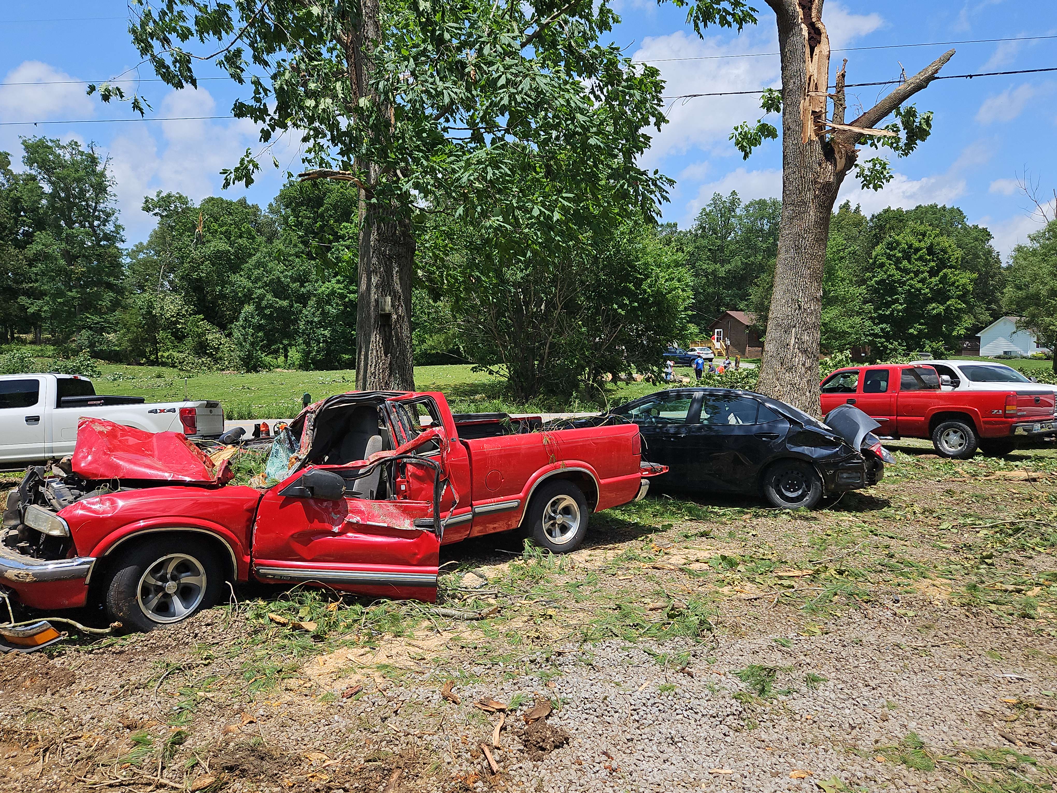
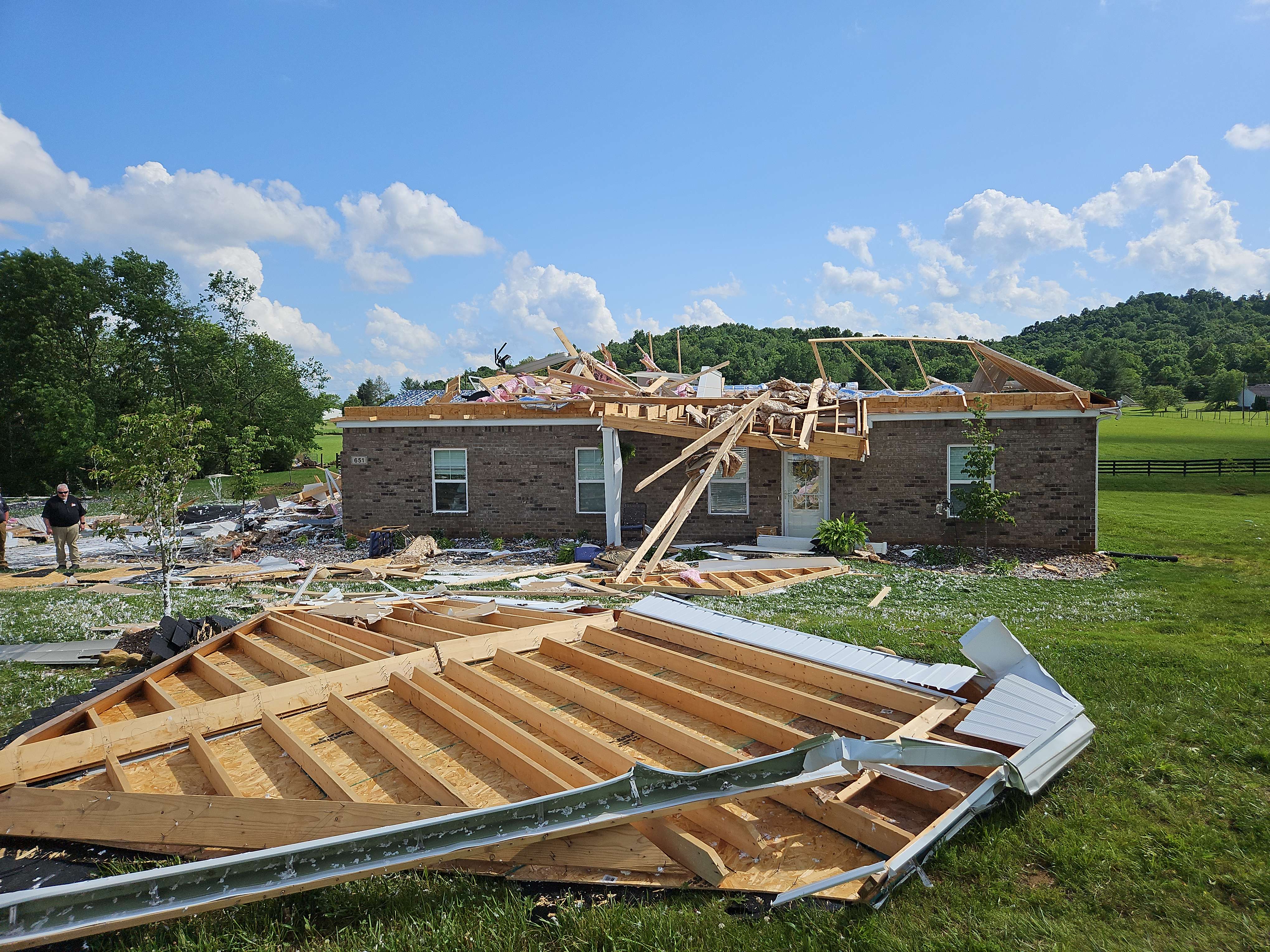
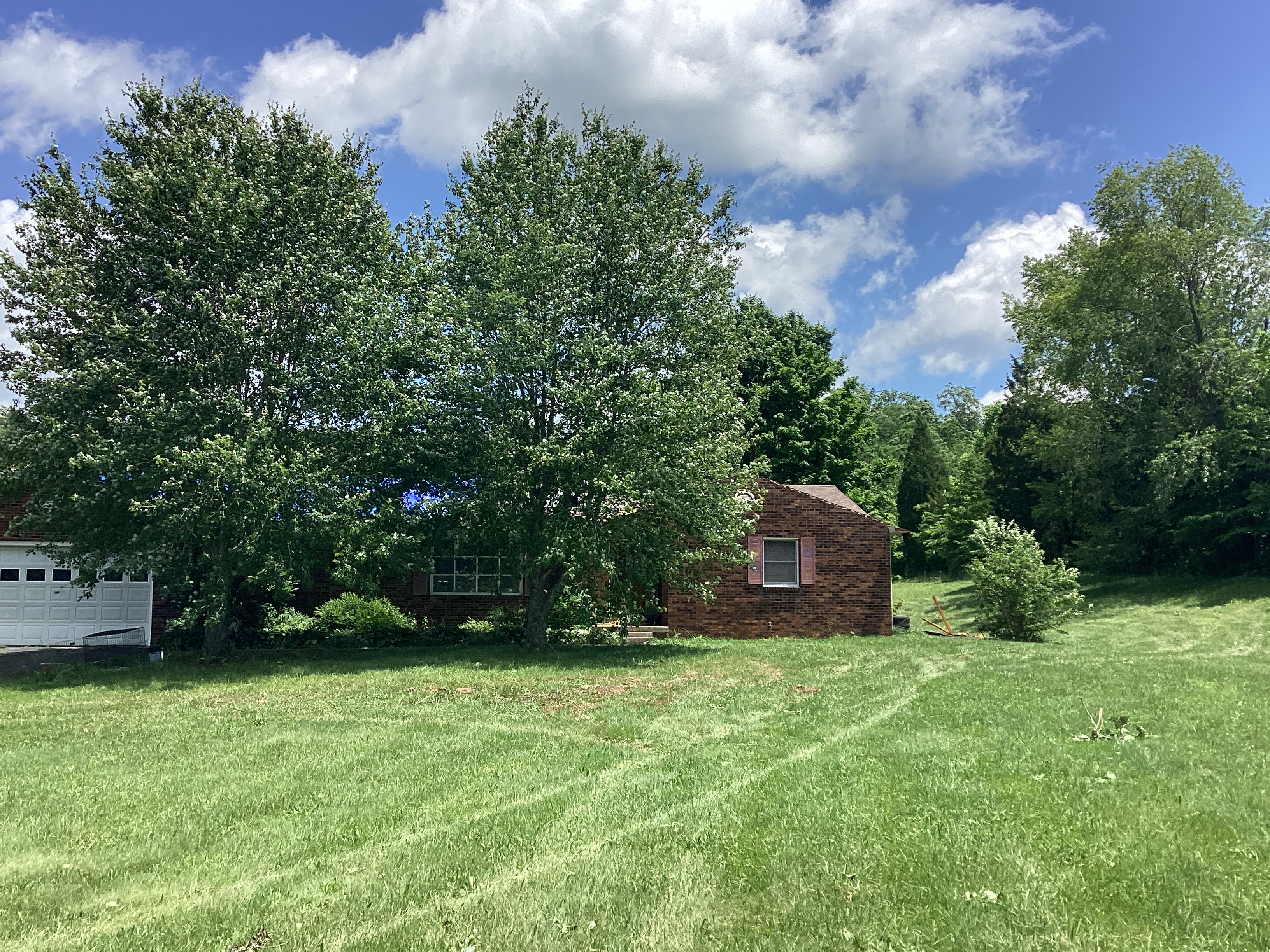
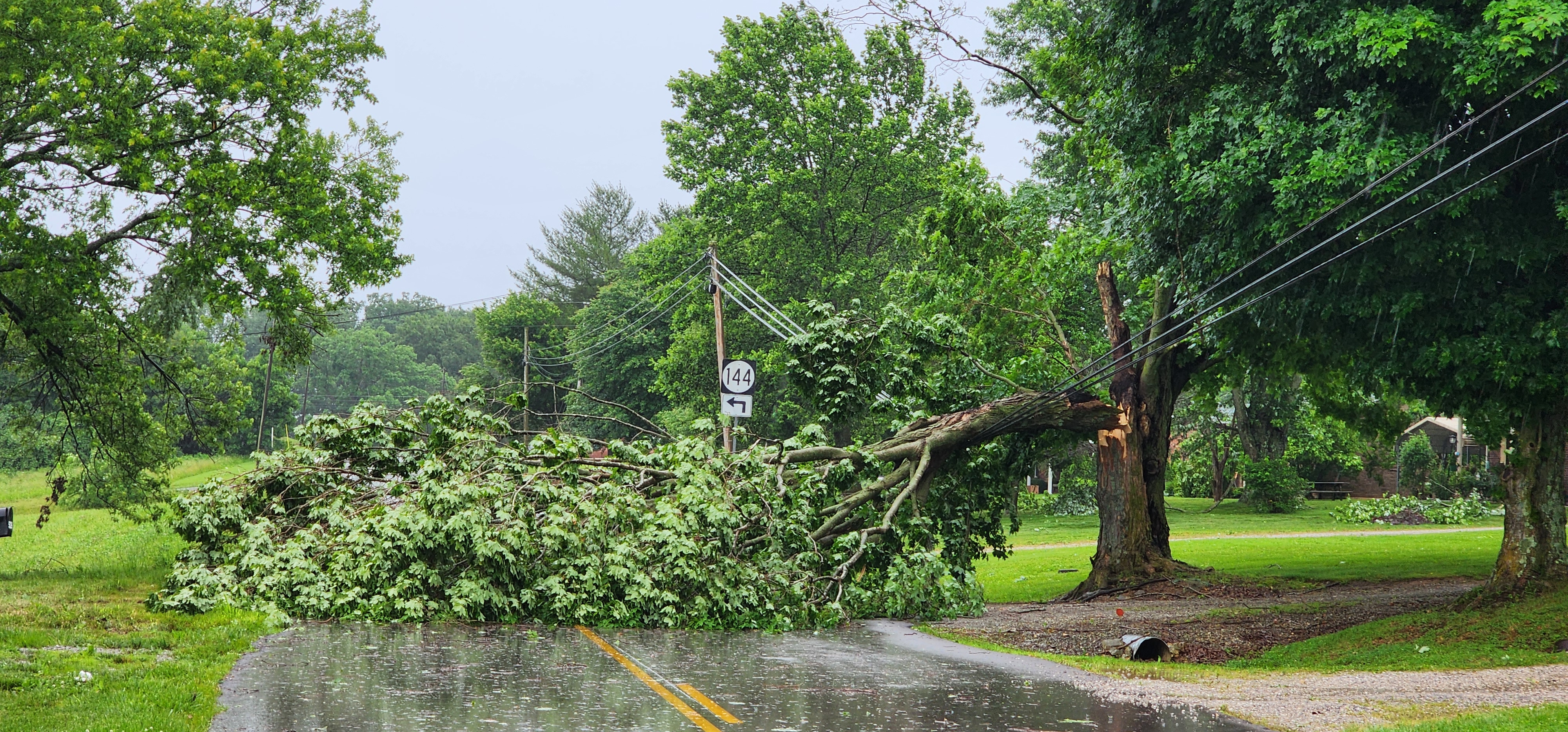
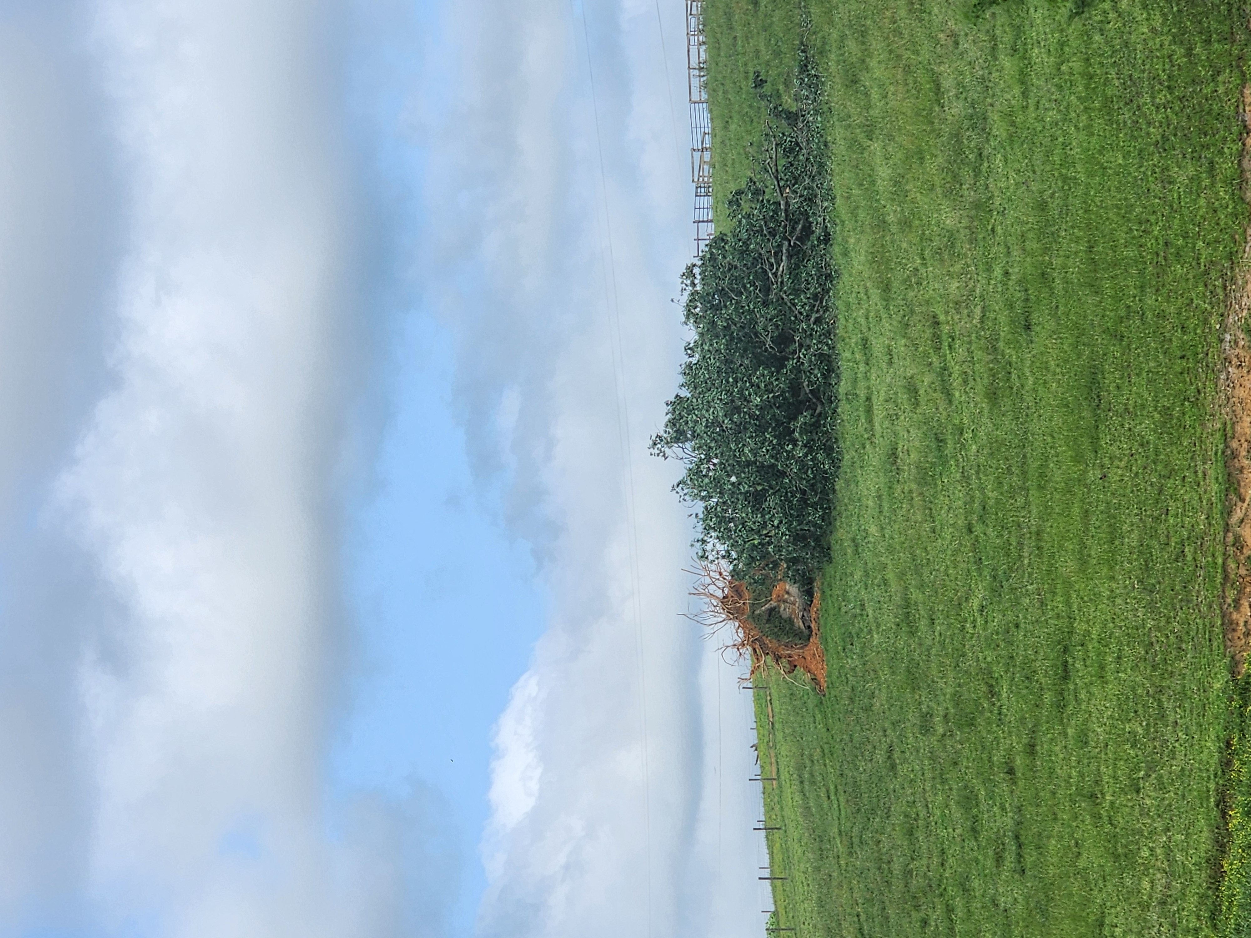
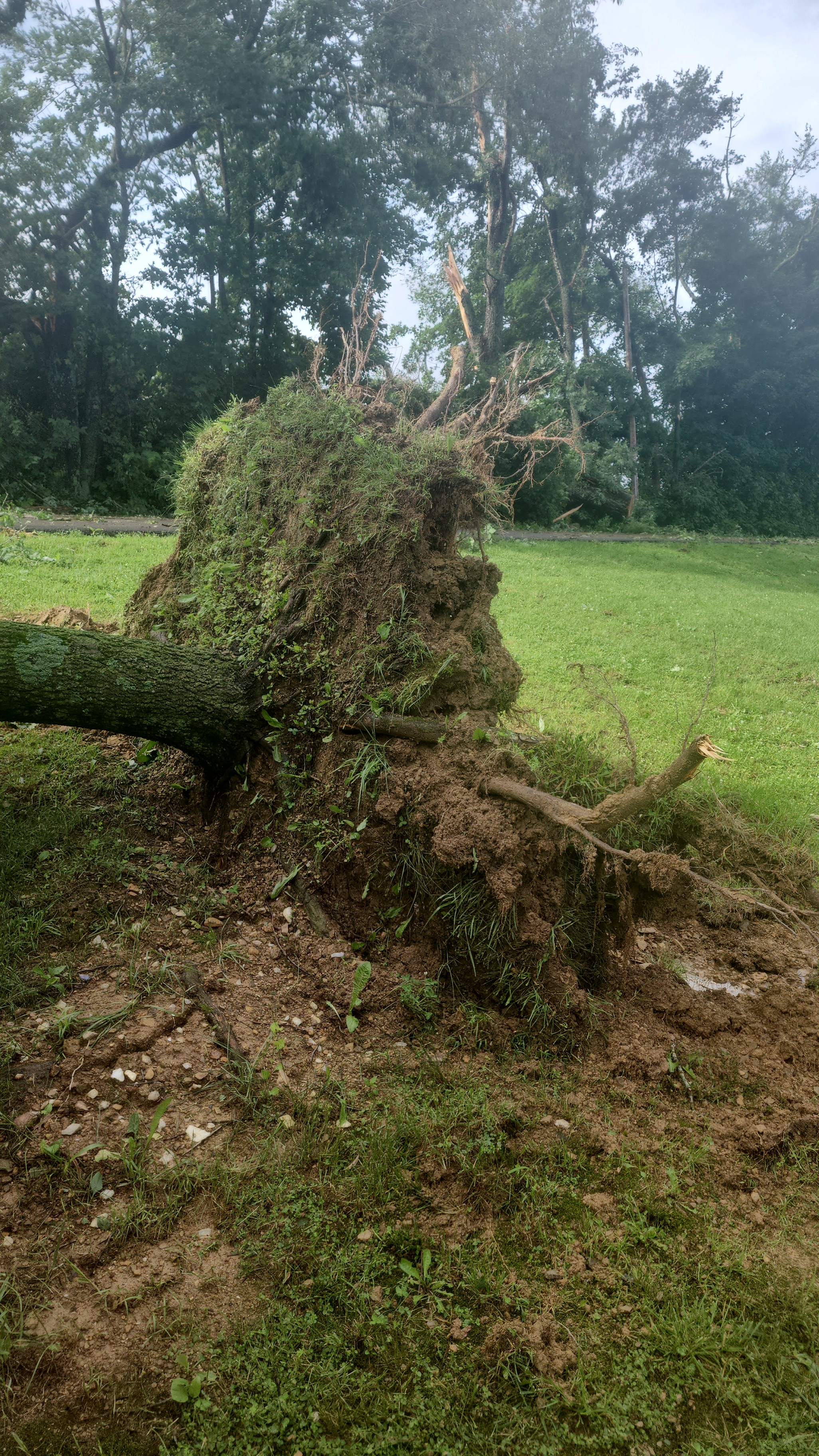
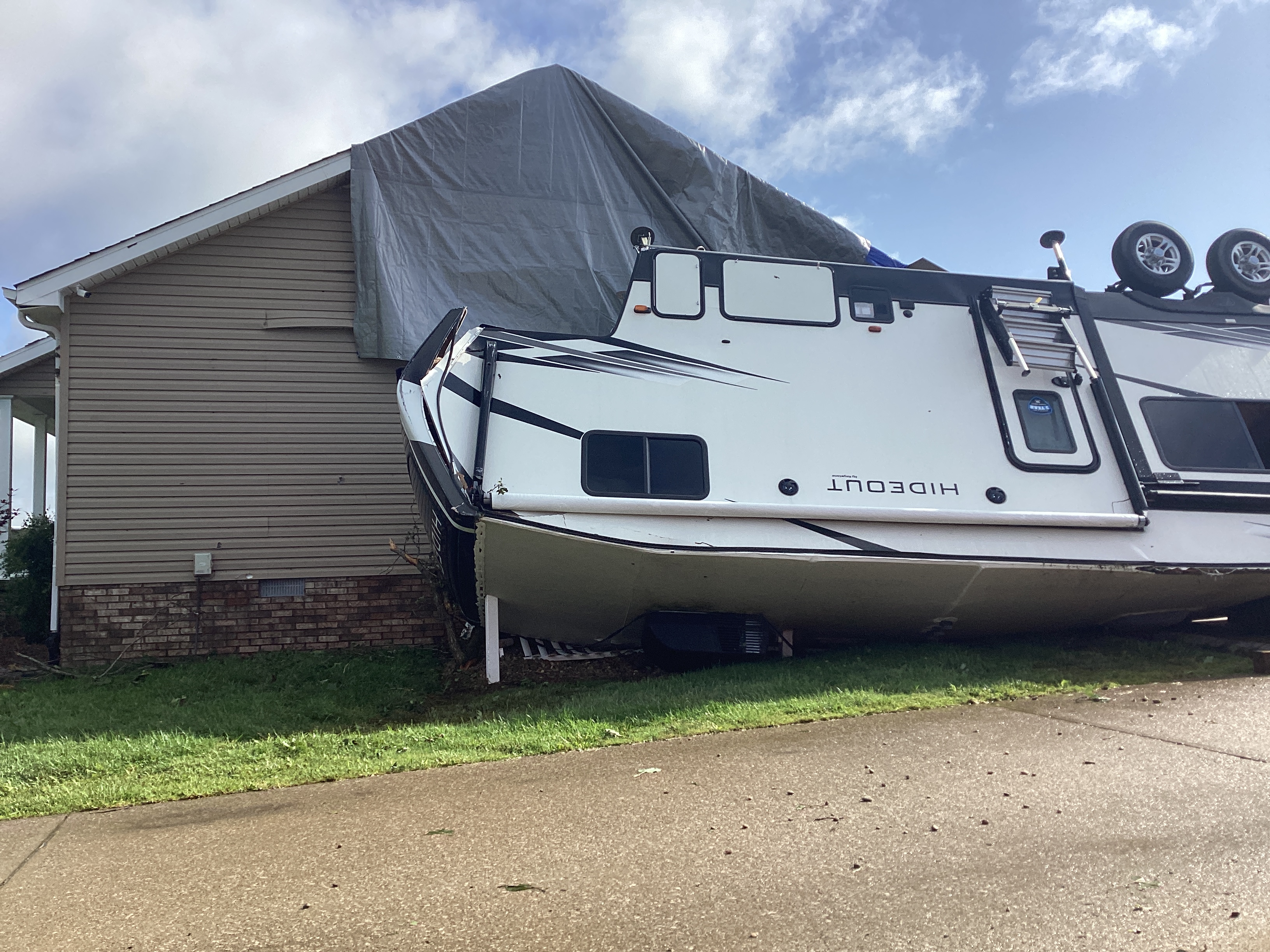
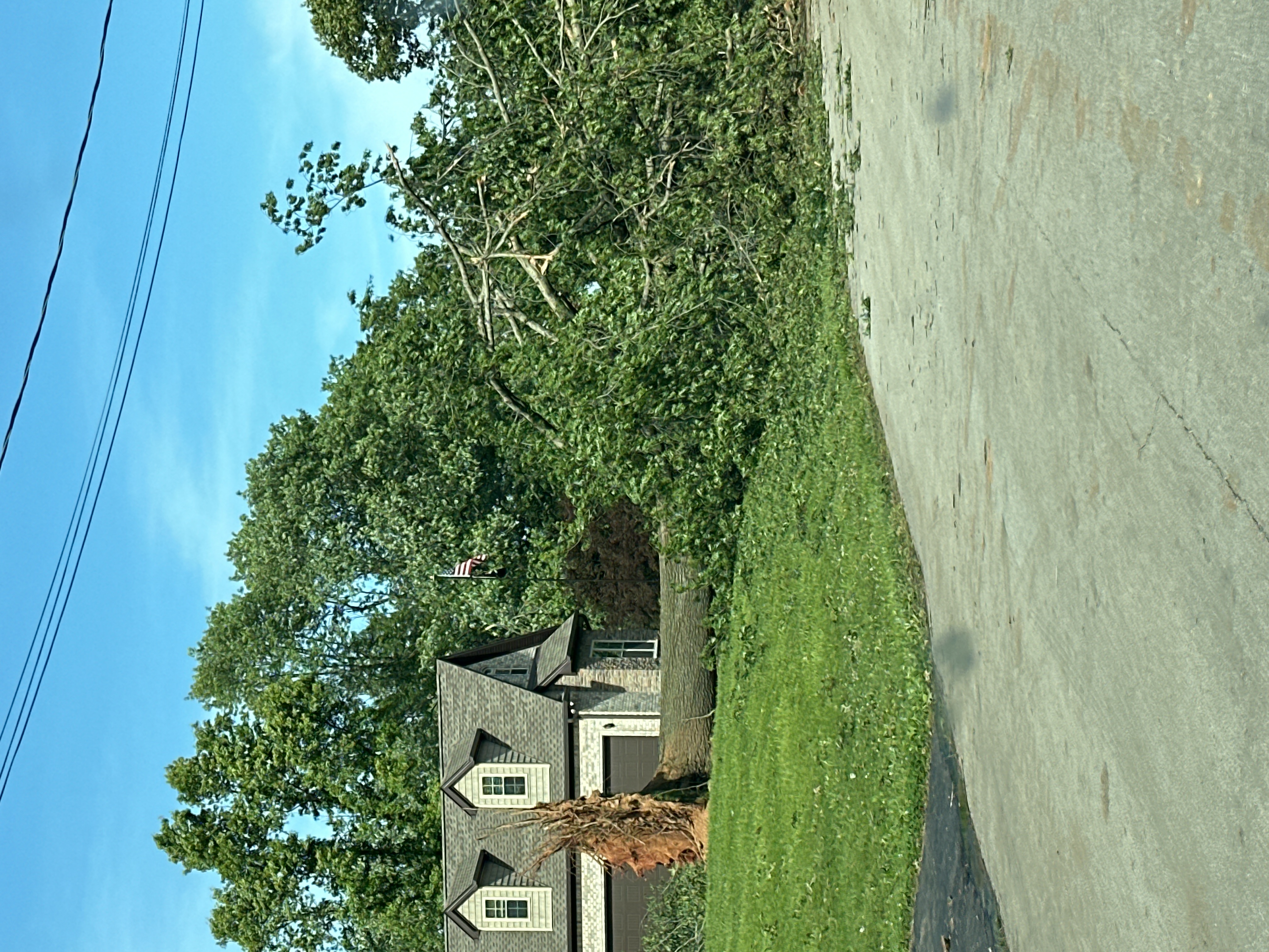
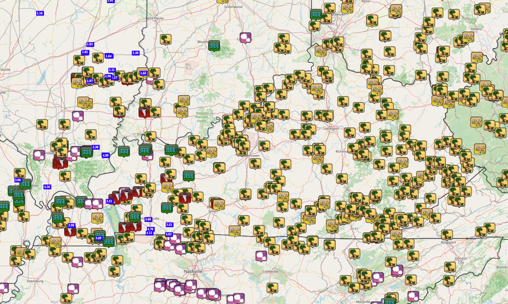
On May 26, 2024, multiple rounds of severe weather moved through the region. Round #1 brought extensive tree damage, two confirmed tornadoes, and very heavy rainfall which resulted in river flooding. Round #2 brought even more tree damage and another six tornadoes in central Kentucky.
|
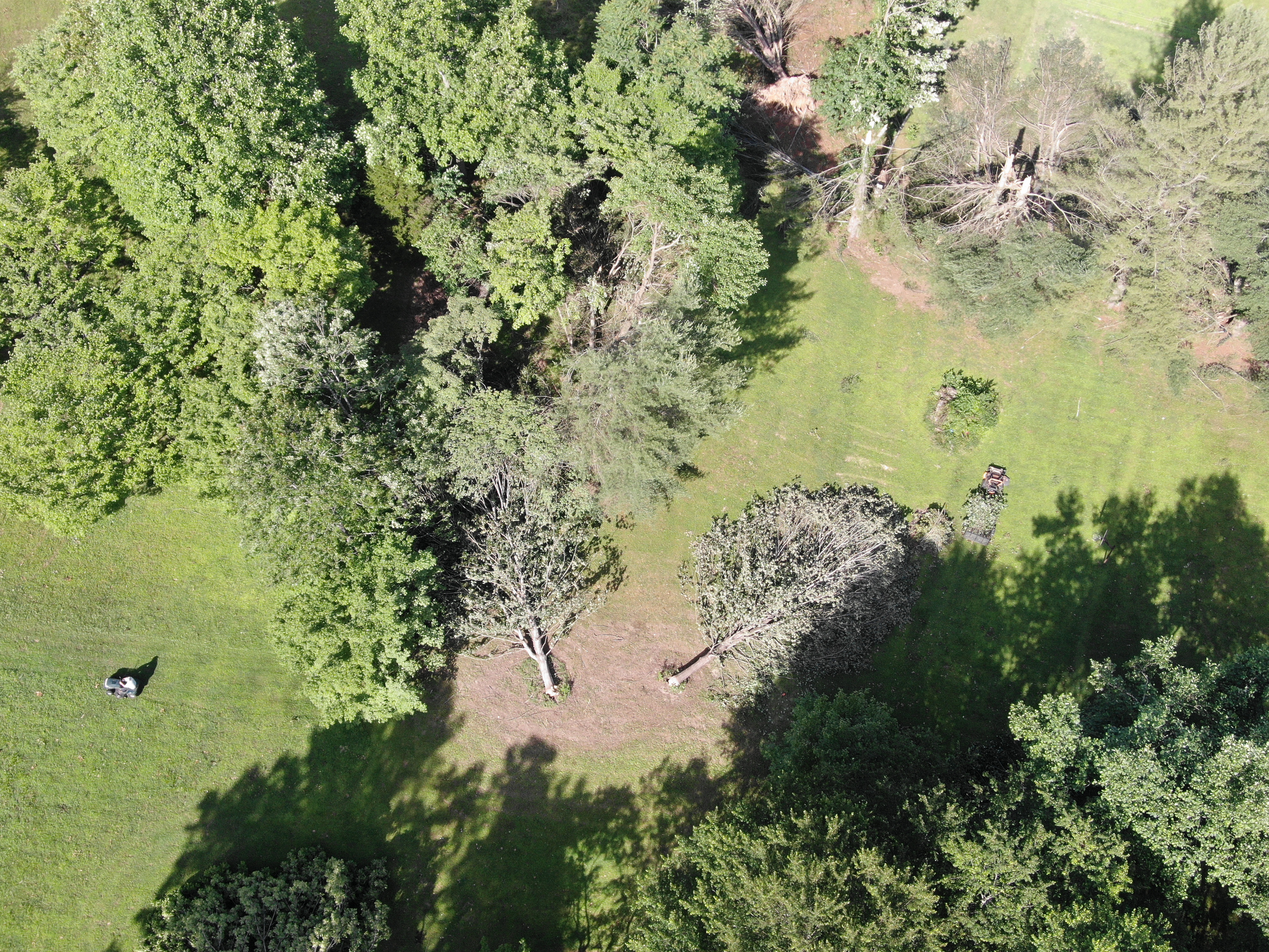
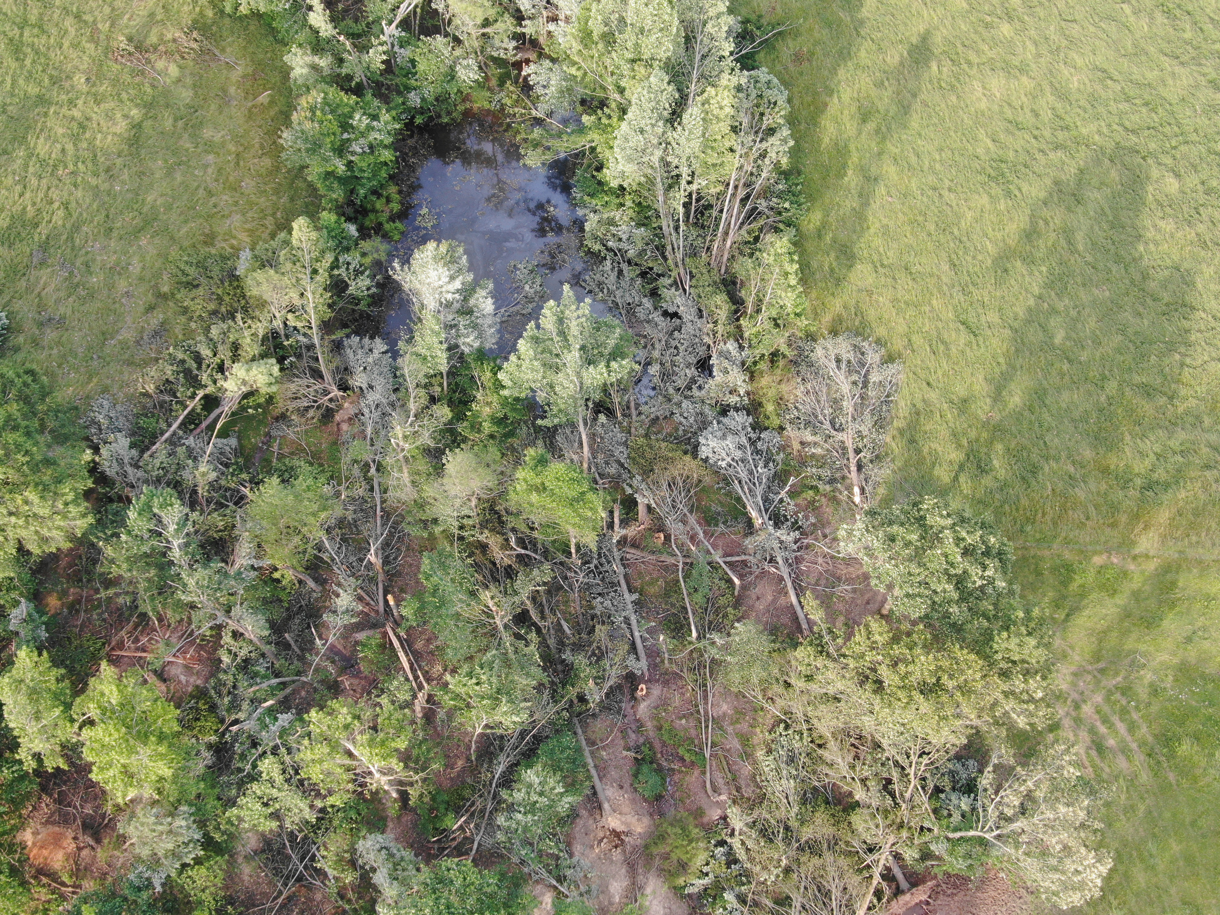
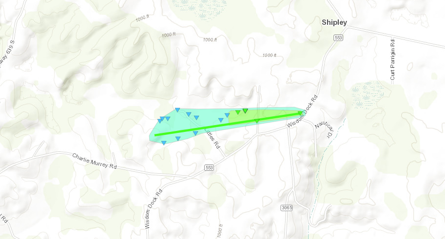
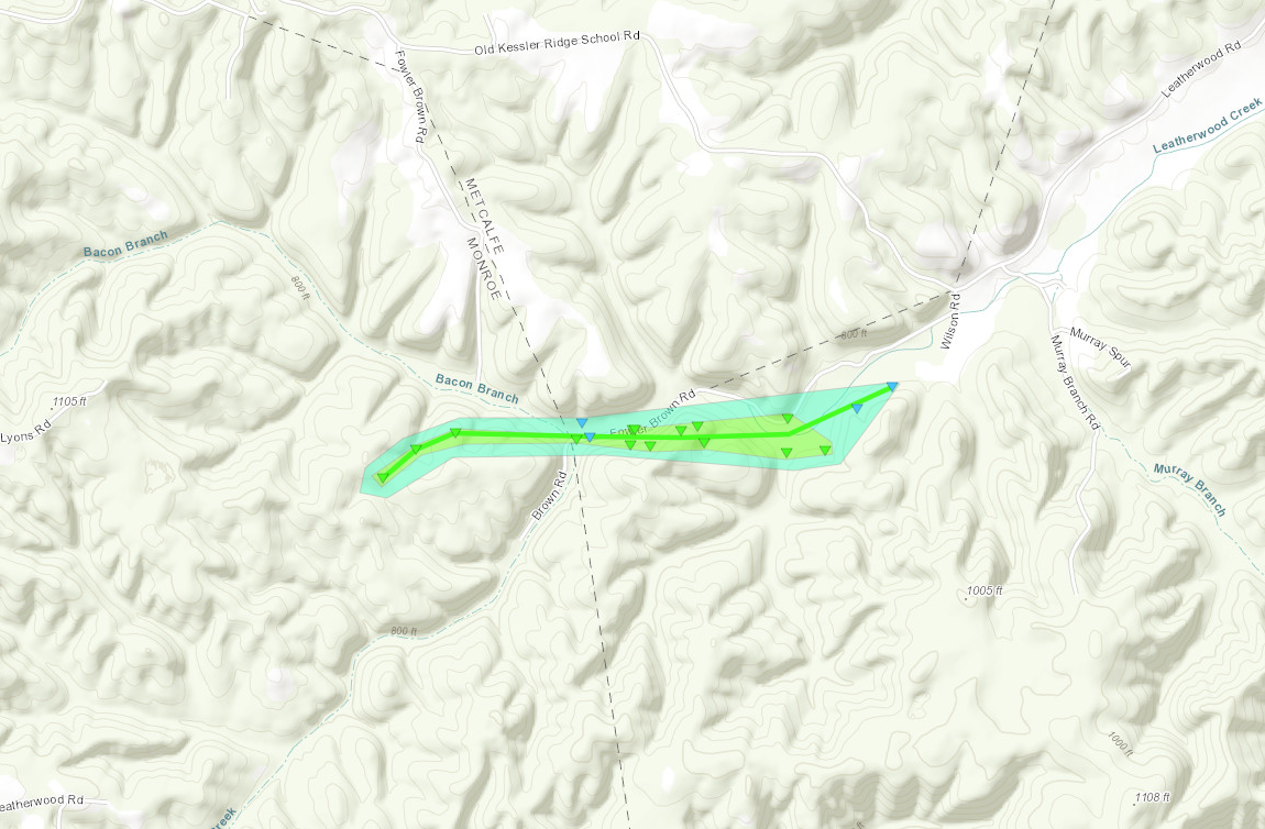
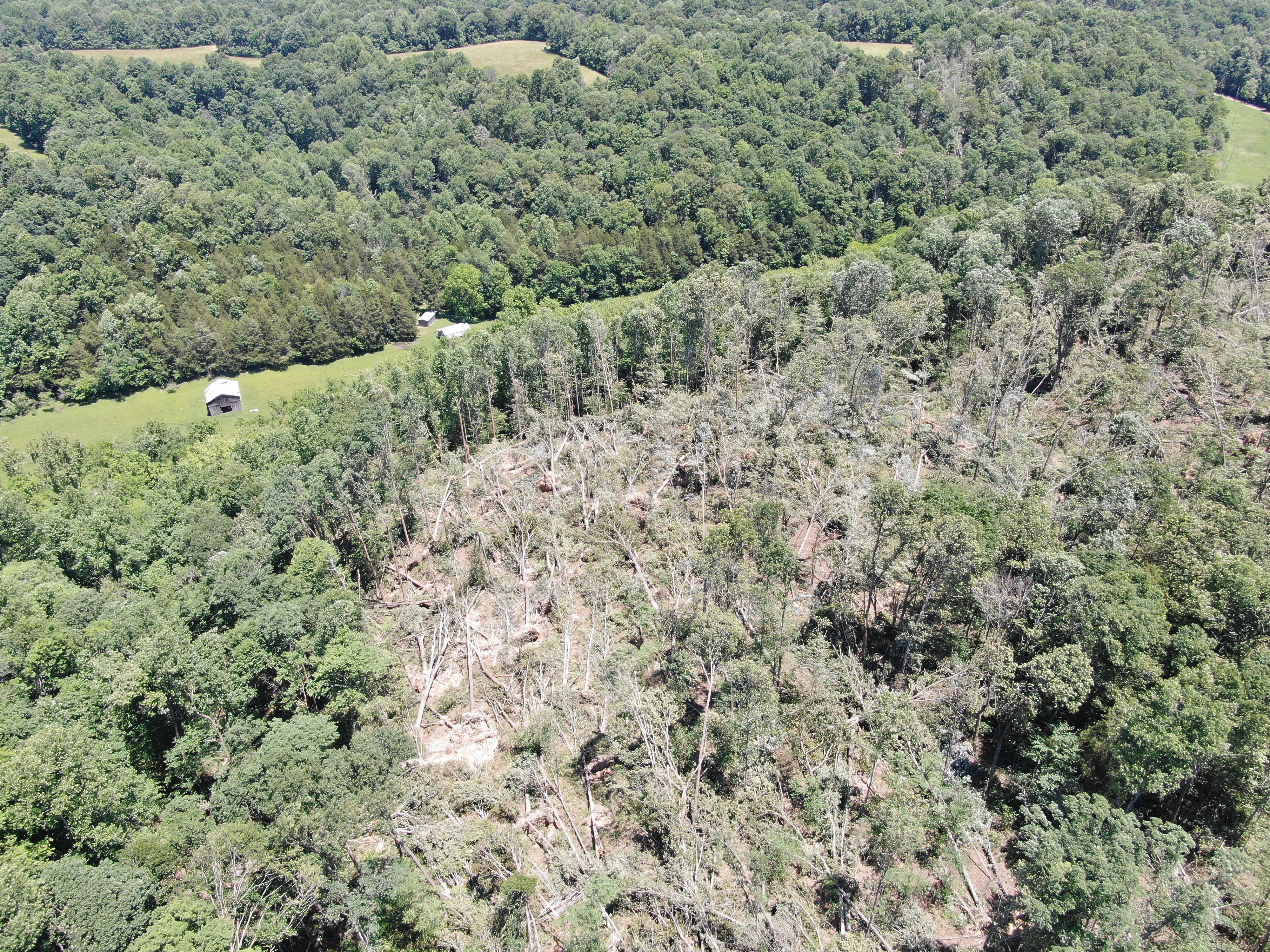
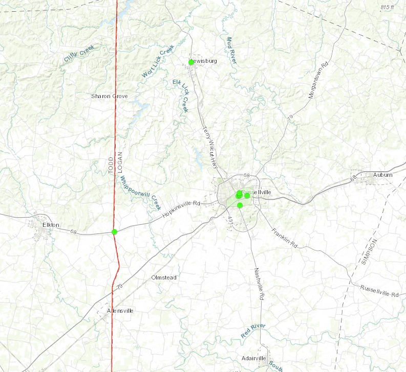
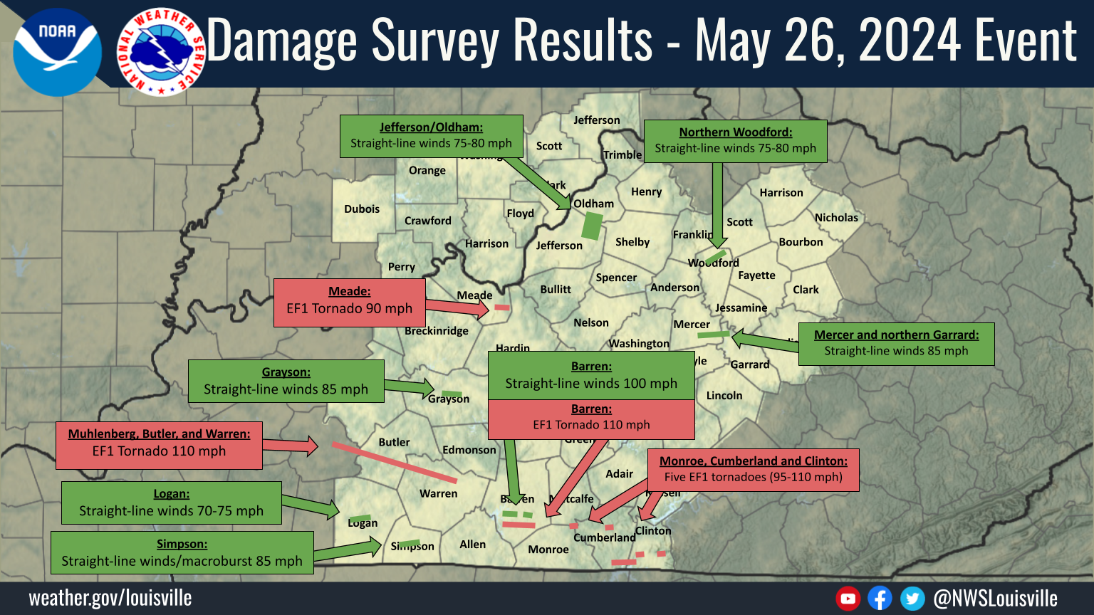 Damage Survey Map |
Tornadoes:
|
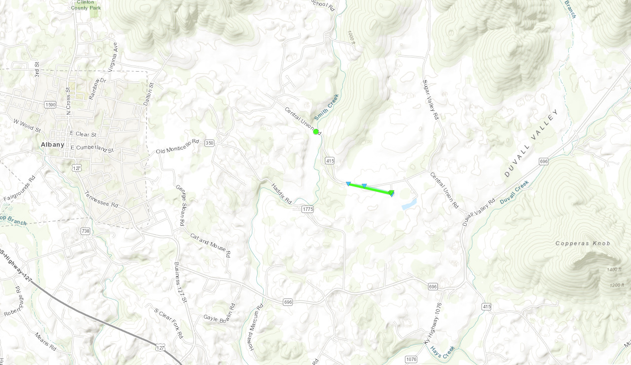
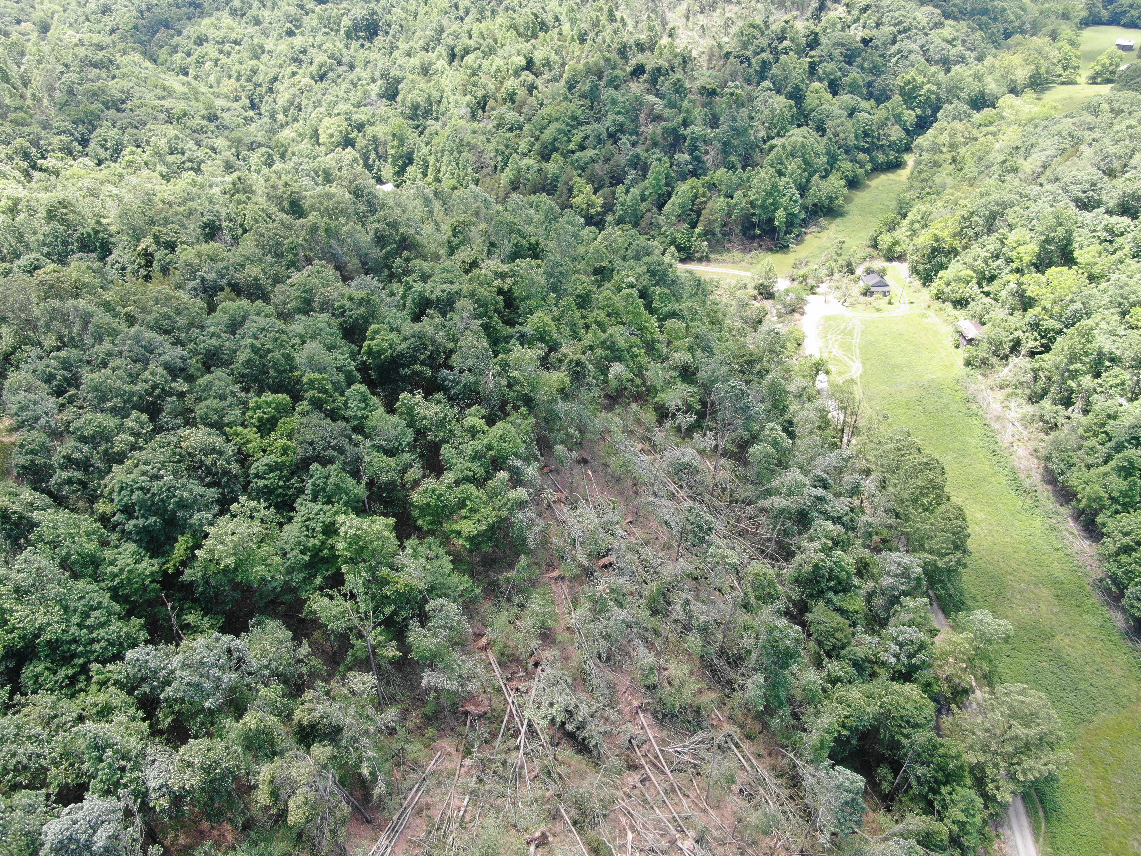
Tornado - 3 W Albany, KY
|
||||||||||||||||||||
|
Tornado - 3 E Albany, KY
|
||||||||||||||||
|
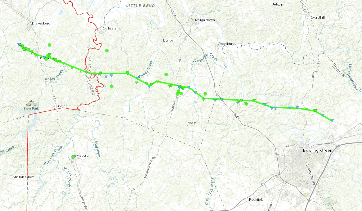
Tornado - Huntsville, KY to Girkin, KY
|
||||||||||||||||||||
|
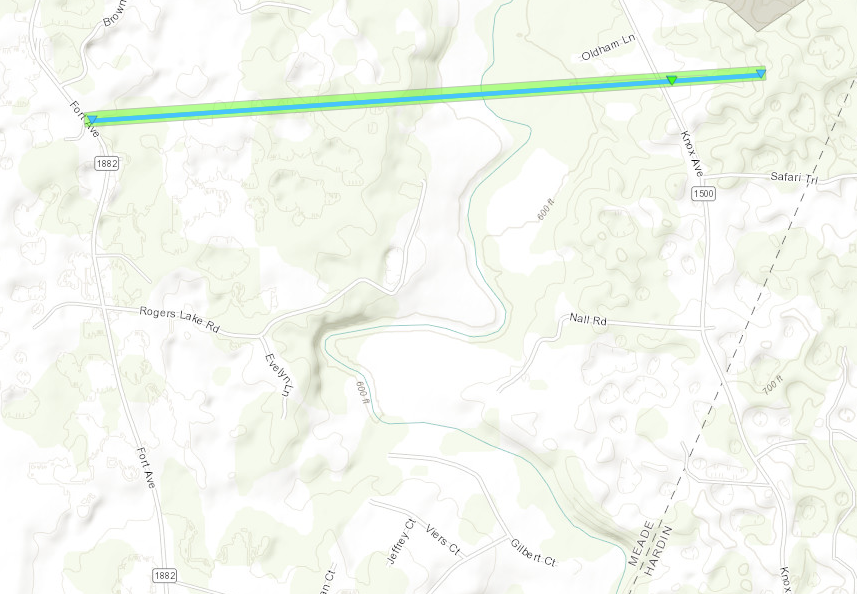
Tornado - Flaherty, KY
|
||||||||||||||||||||
|
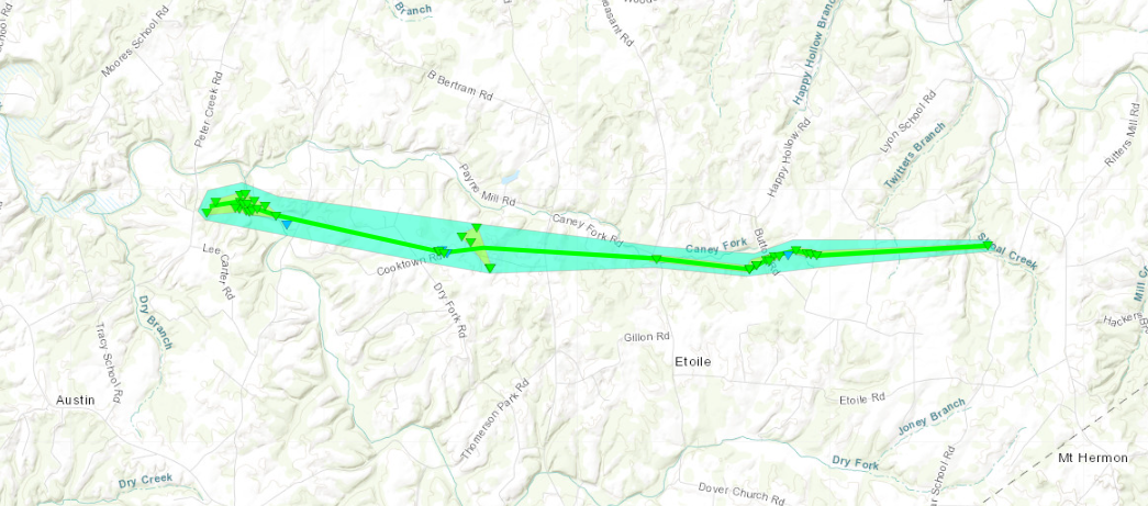
Tornado - 3 NE Austin to Etoile, KY
|
||||||||||||||||
|
Tornado - 5 WSW Marrowbone, KY
|
||||||||||||||||||||
|
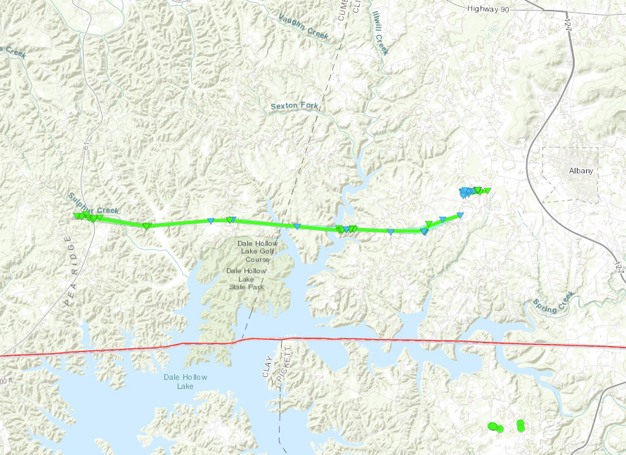
Tornado - North Side of Dale Hollow Lake
|
||||||||||||||||||||
|
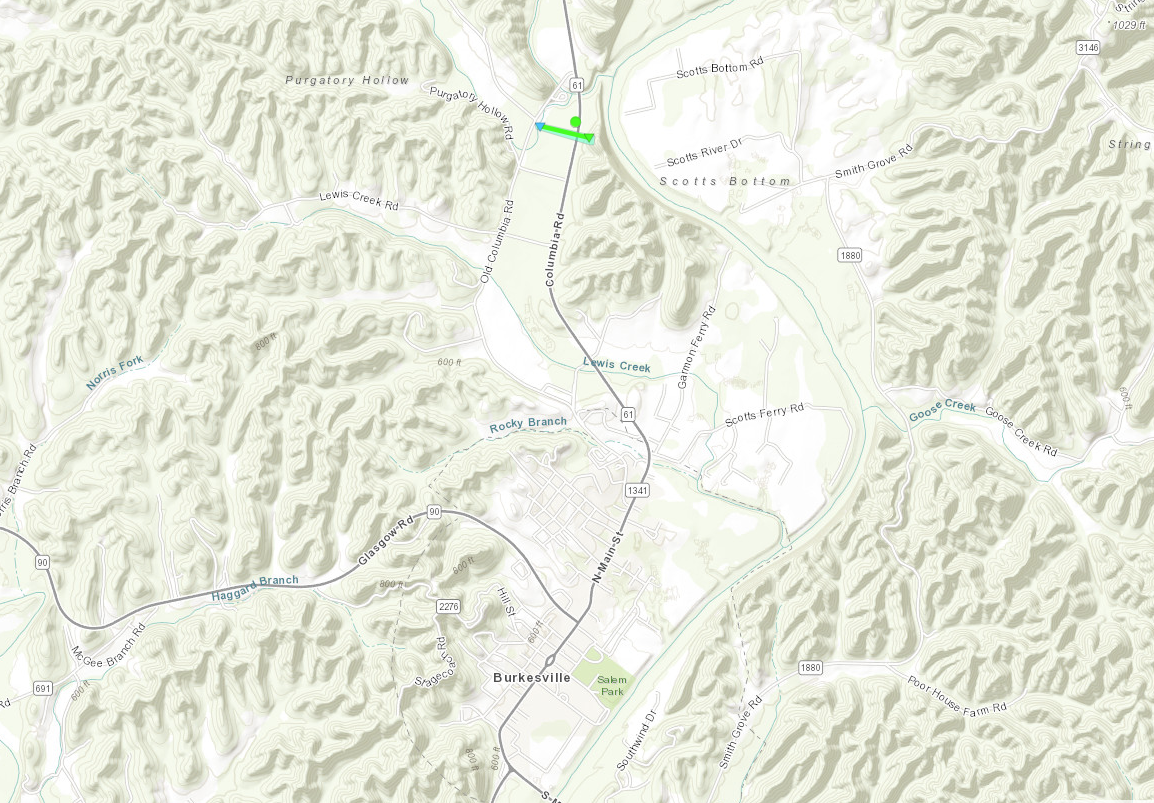
Tornado - 2 N Burkesville
|
||||||||||||||||
The Enhanced Fujita (EF) Scale classifies tornadoes into the following categories:
| EF0 Weak 65-85 mph |
EF1 Moderate 86-110 mph |
EF2 Significant 111-135 mph |
EF3 Severe 136-165 mph |
EF4 Extreme 166-200 mph |
EF5 Catastrophic 200+ mph |
 |
|||||
Wind:
|
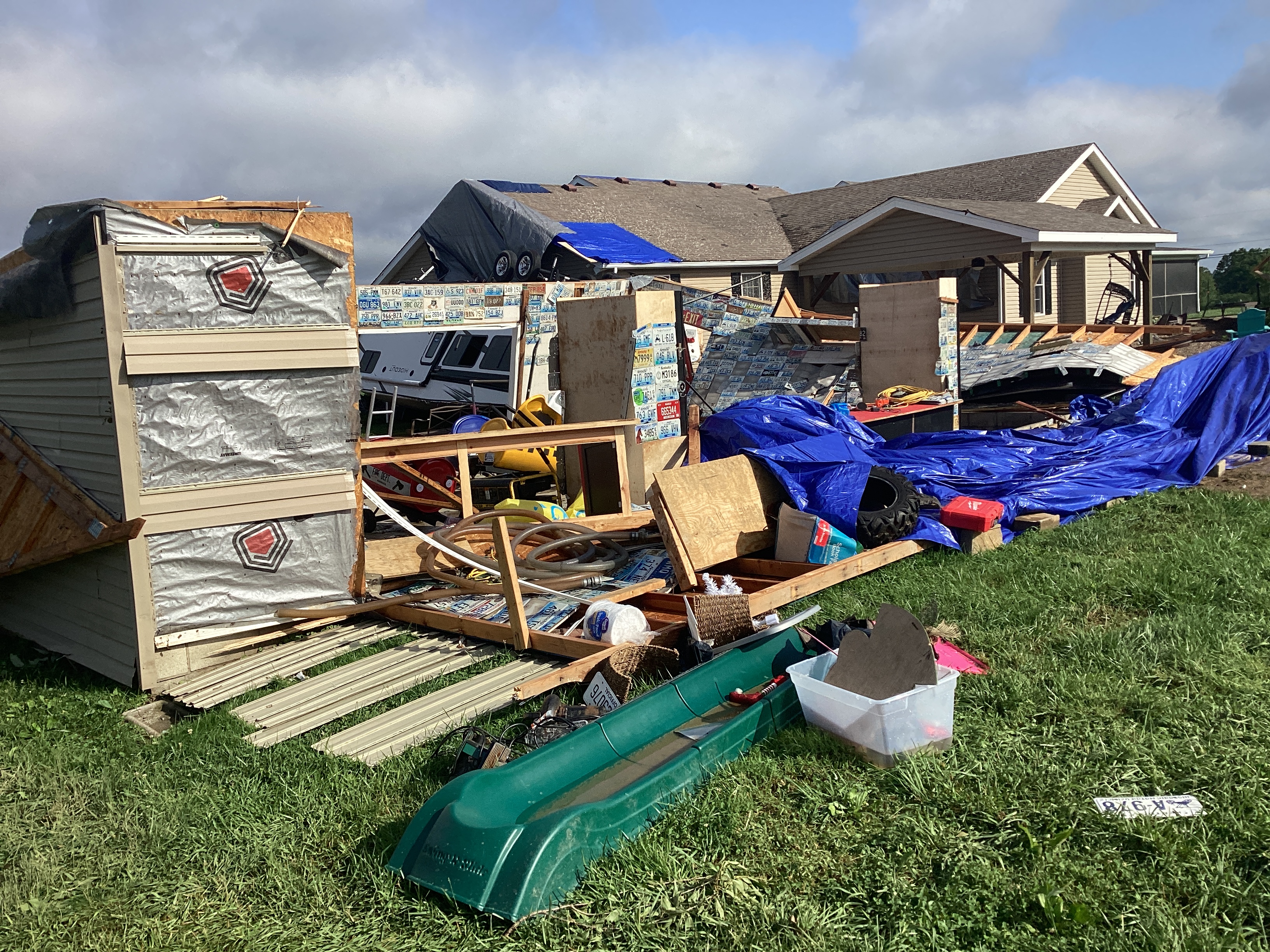
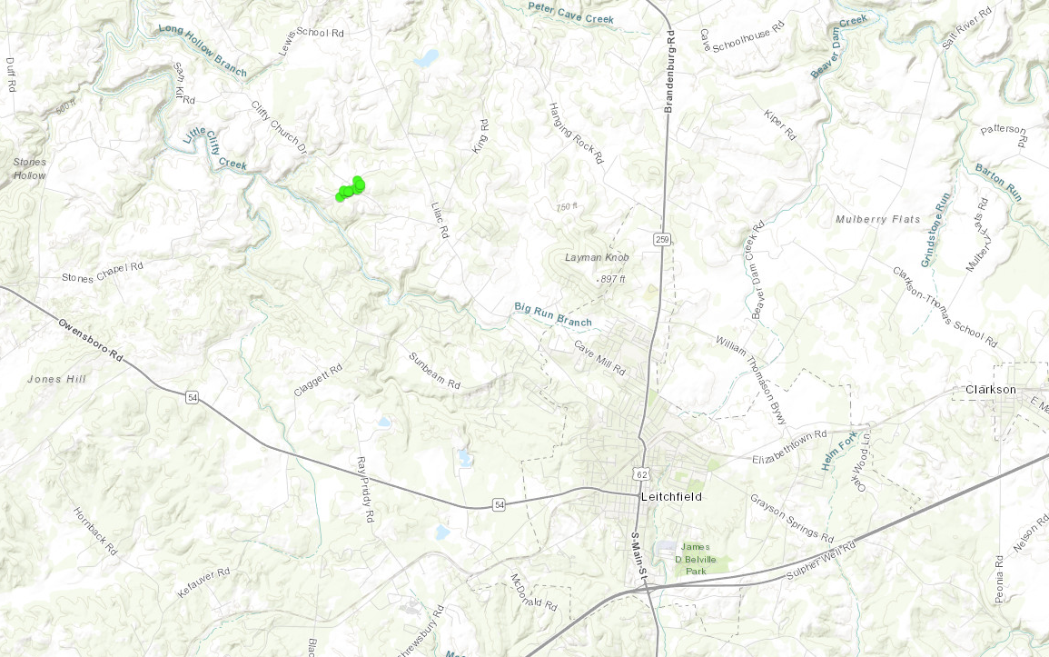
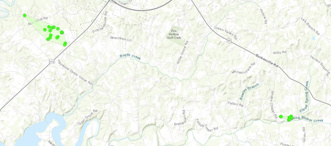
Straight Line Winds - North of Leitchfield, KY
|
||||||||||||||||
|
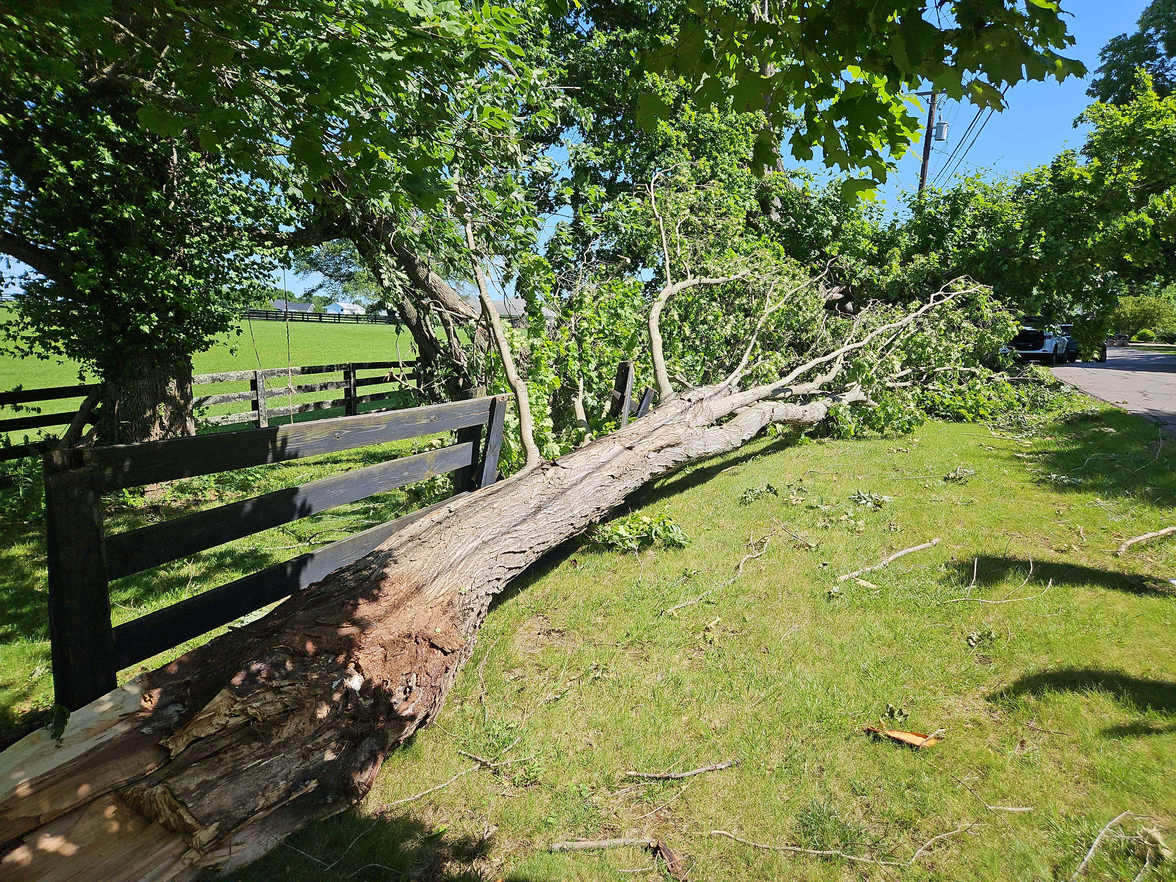
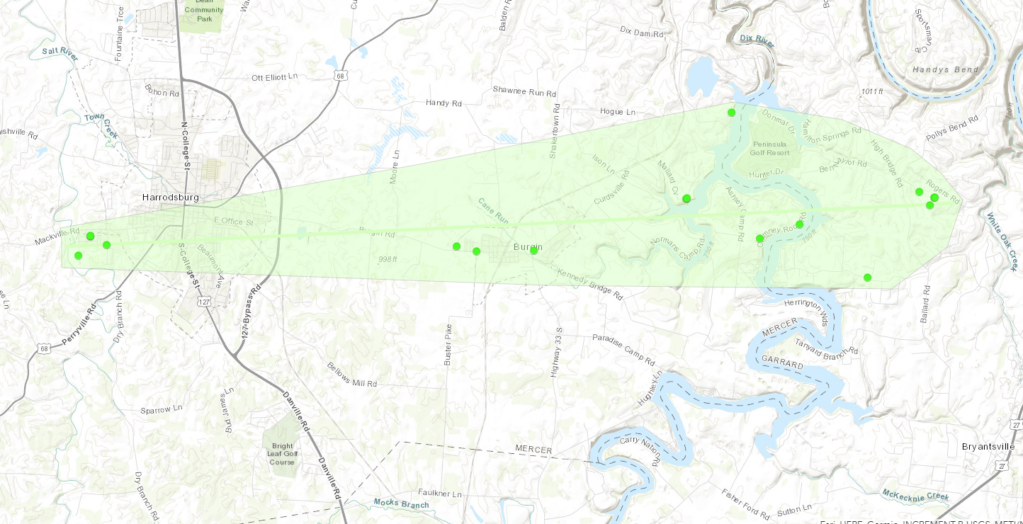
Straight Line Winds - Harrodsburg, Burgin, and northern Garrard County
|
||||||||||||||||
|
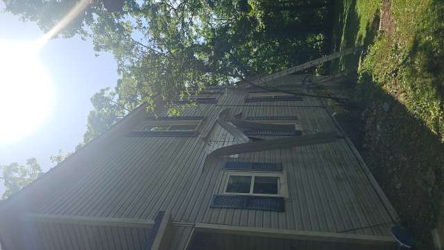
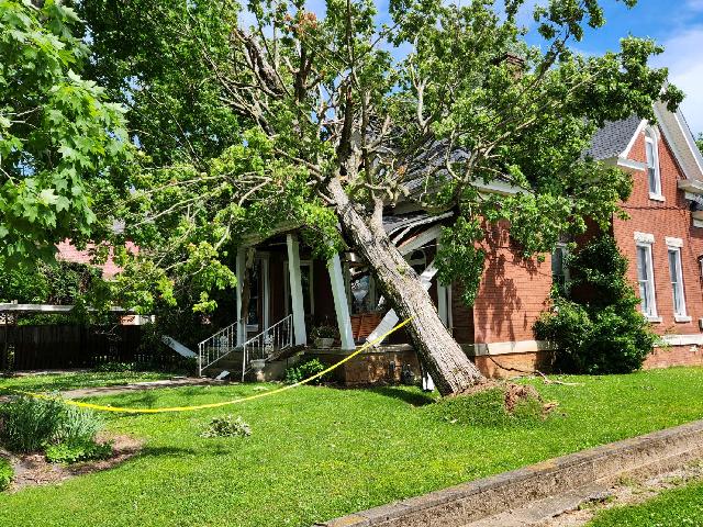
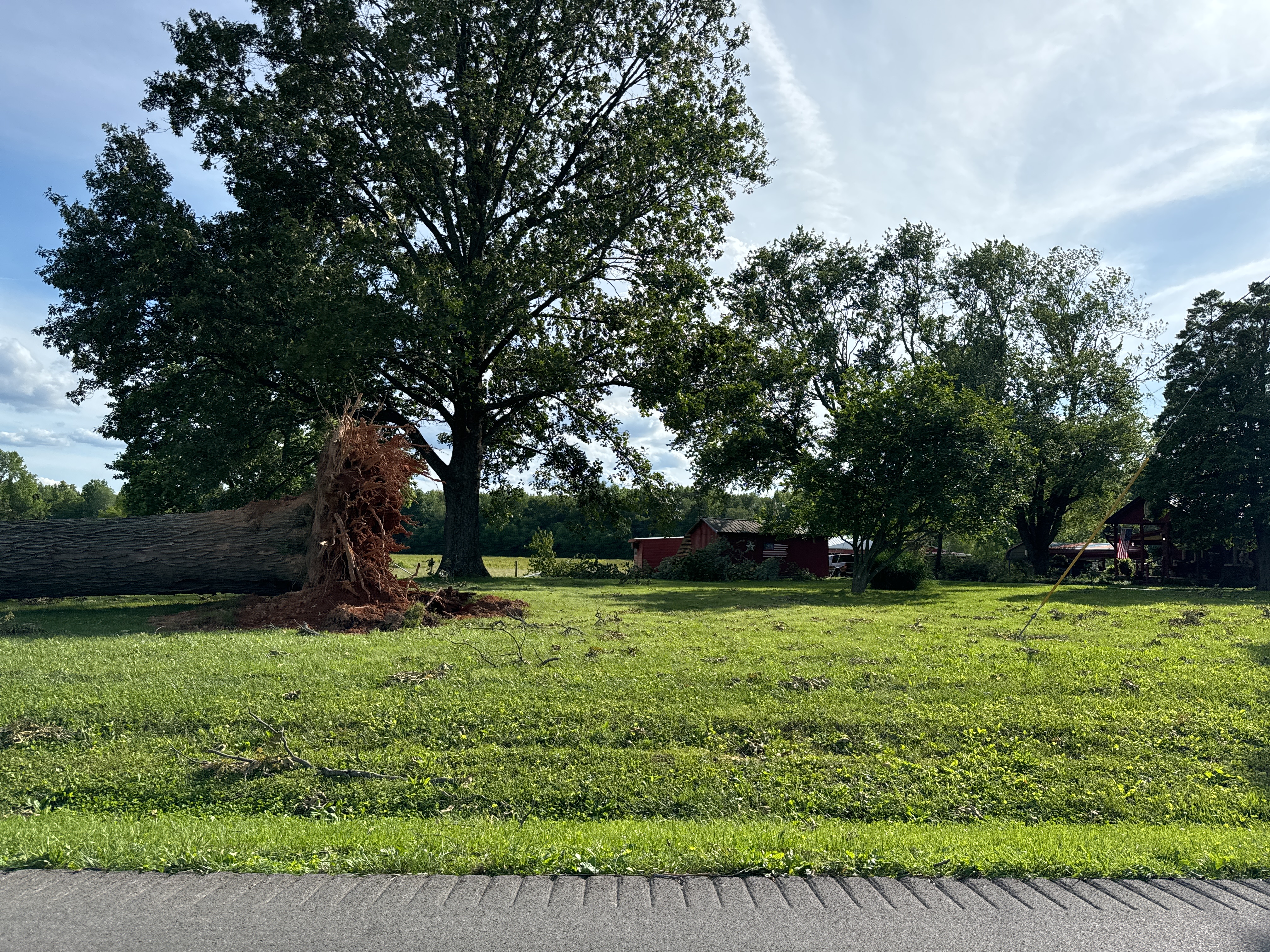
Straight Line Winds - Russellville, KY
|
||||||||||||||||
|
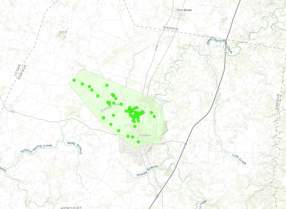
Straight Line Winds - Franklin, KY
|
||||||||||||||||
|
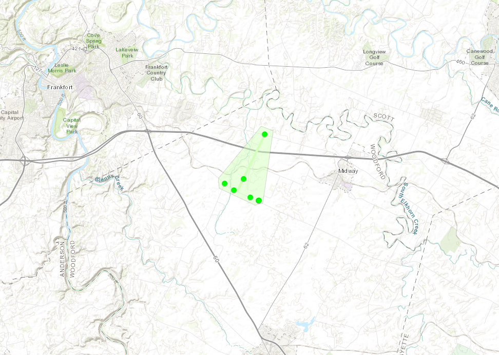
Straight Line Winds - W of Midway, KY
|
||||||||||||
|
Straight Line Winds - S of Glasgow, KY
|
||||||||||||
|
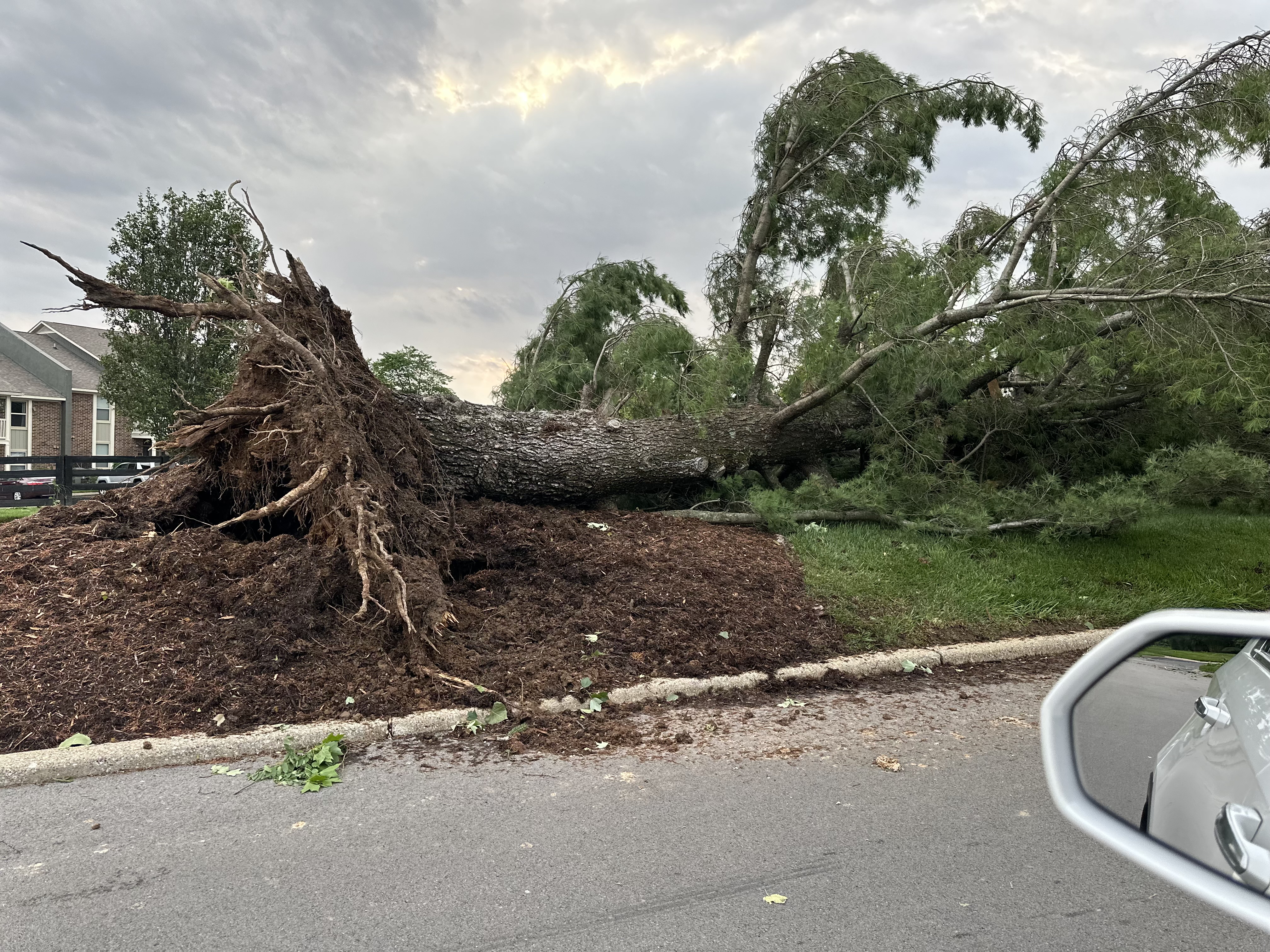
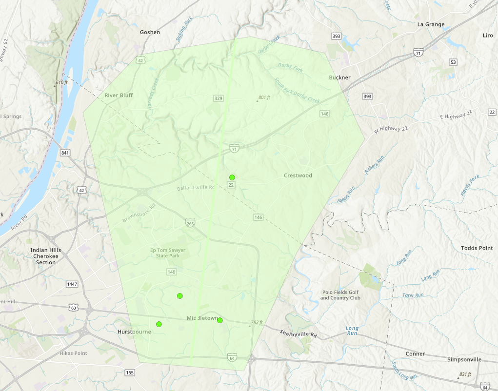
Straight Line Winds - Middletown, KY
|
||||||||||||||
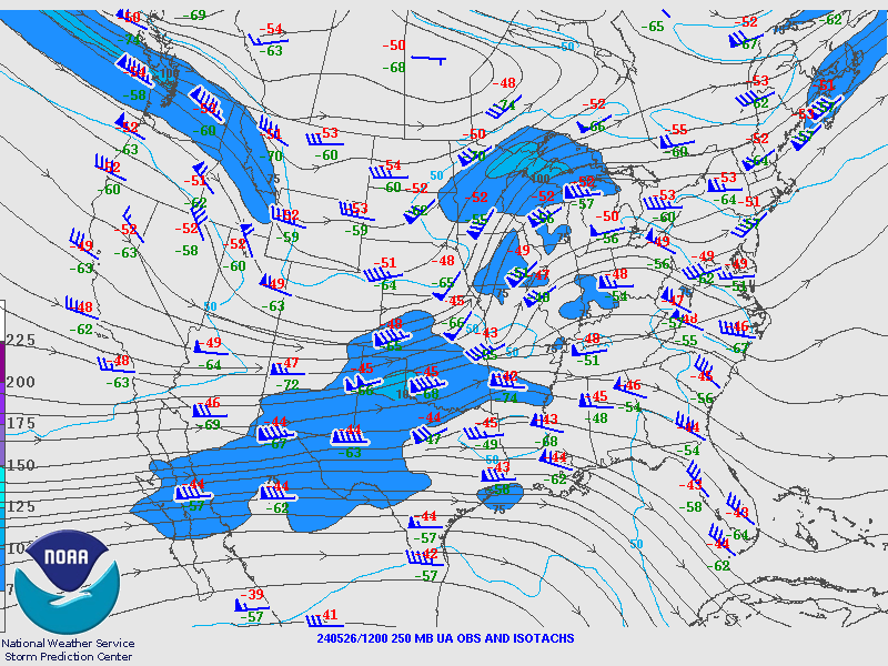
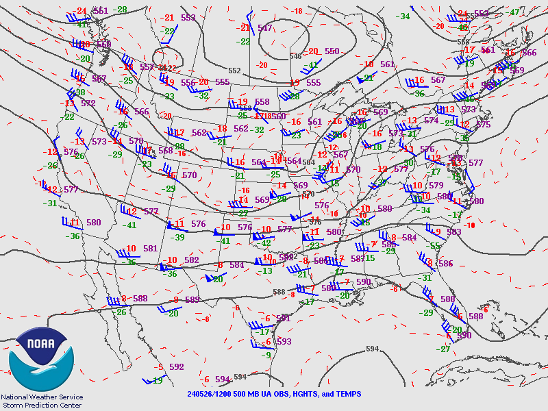
Environment:
Sunday Morning Environment
 |
 |
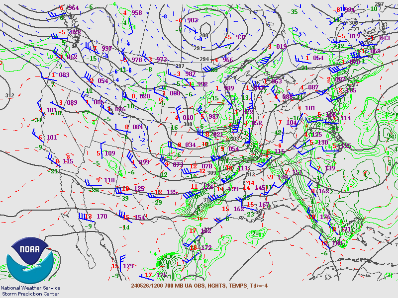 |
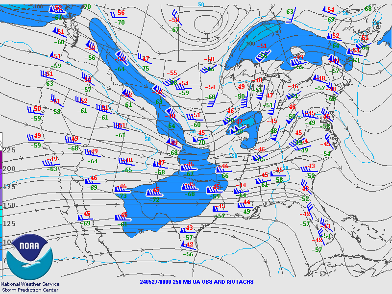
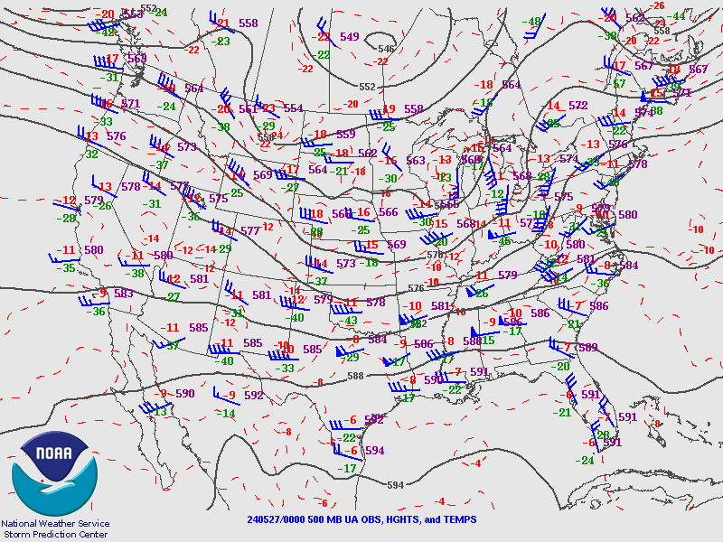
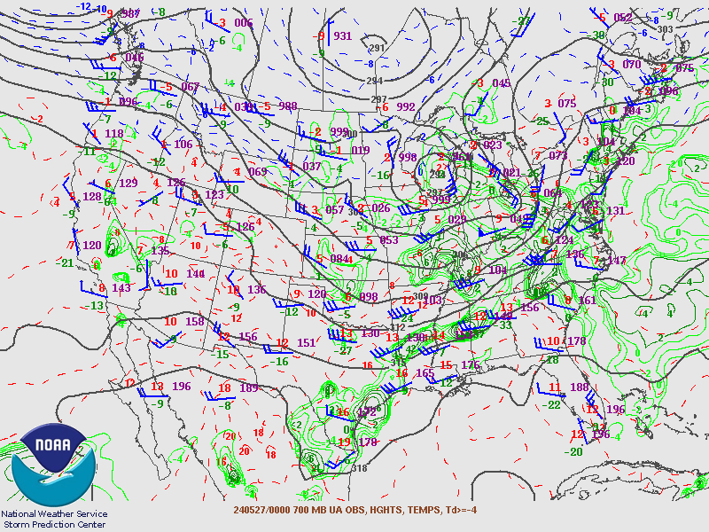
| 250 mb Analysis | 500 mb Analysis | 700 mb Analysis |
 |
 |
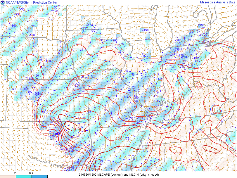 |
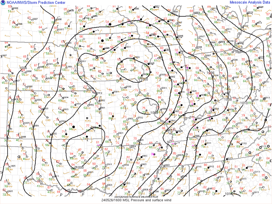
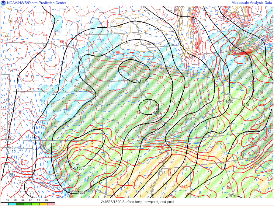
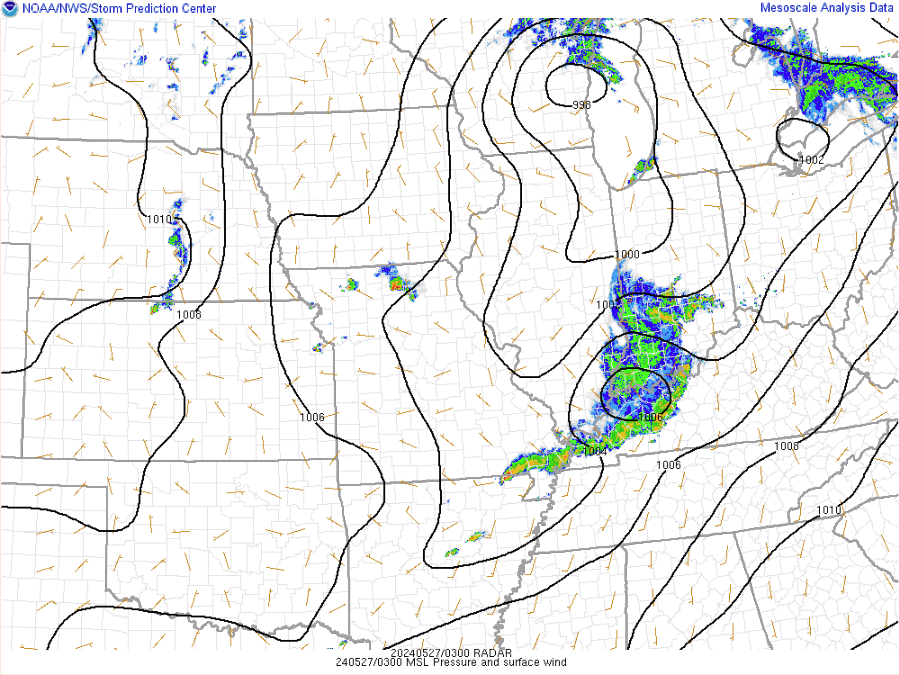
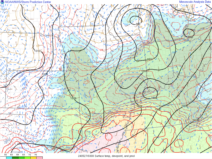
| Mean Sea Level Pressure | MSLP, Temperature, Dewpoint | ML CAPE, ML CIN |
 |
 |
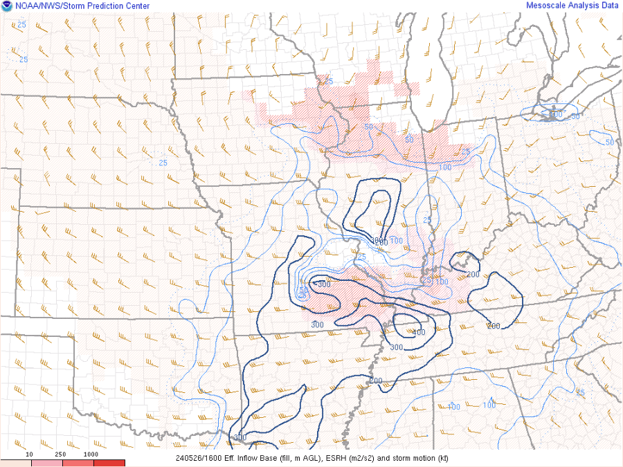 |
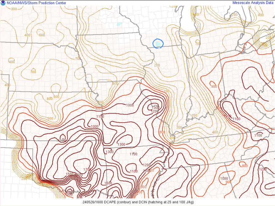
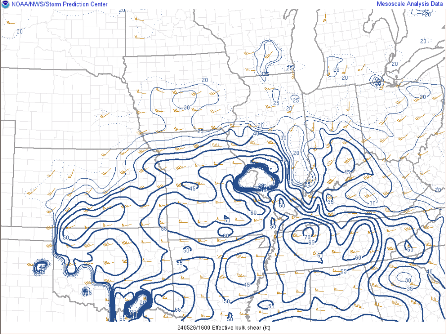
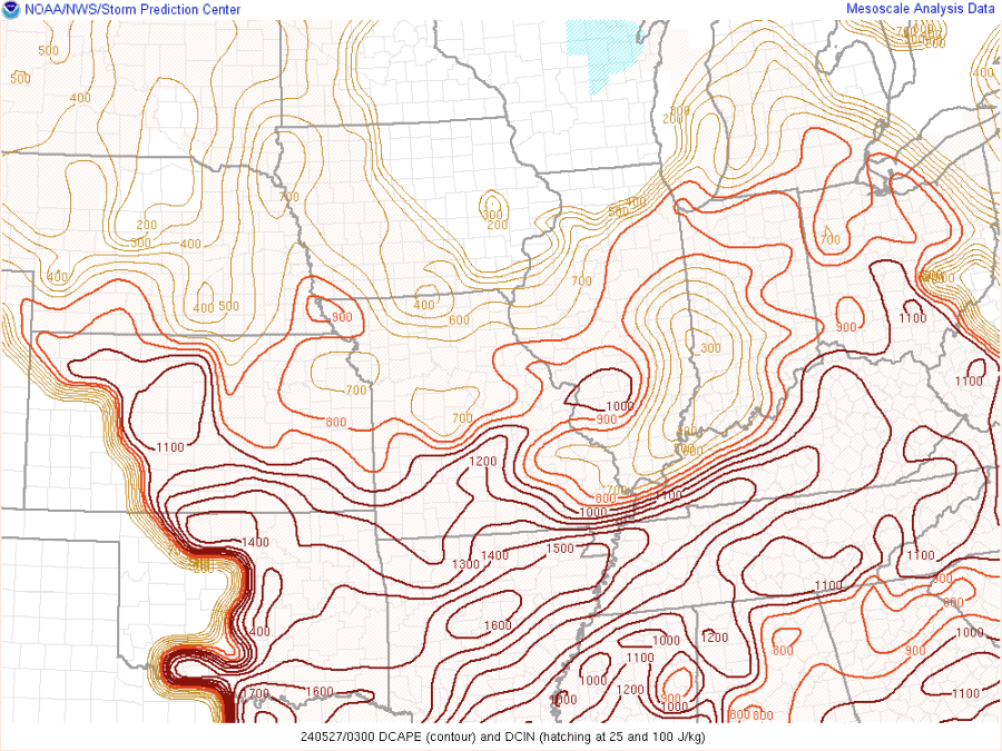
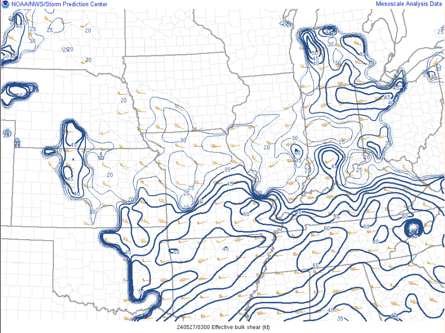
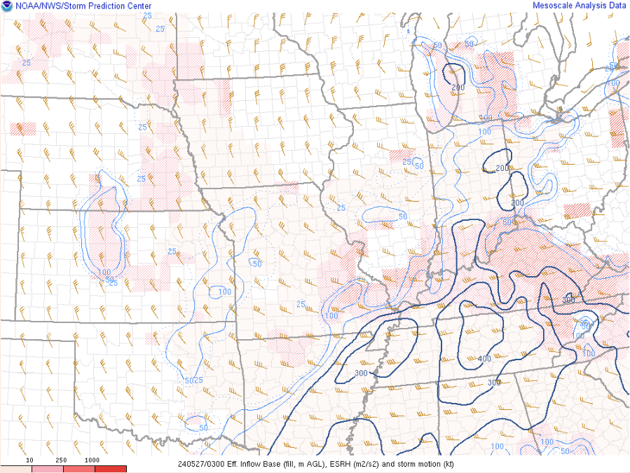
| Downdraft CAPE | Effective Bulk Wind Shear | Effective Storm Relative Helicity |
 |
 |
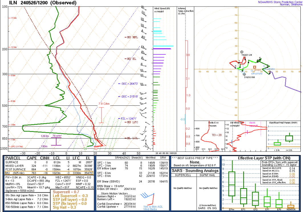 |
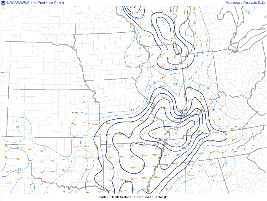
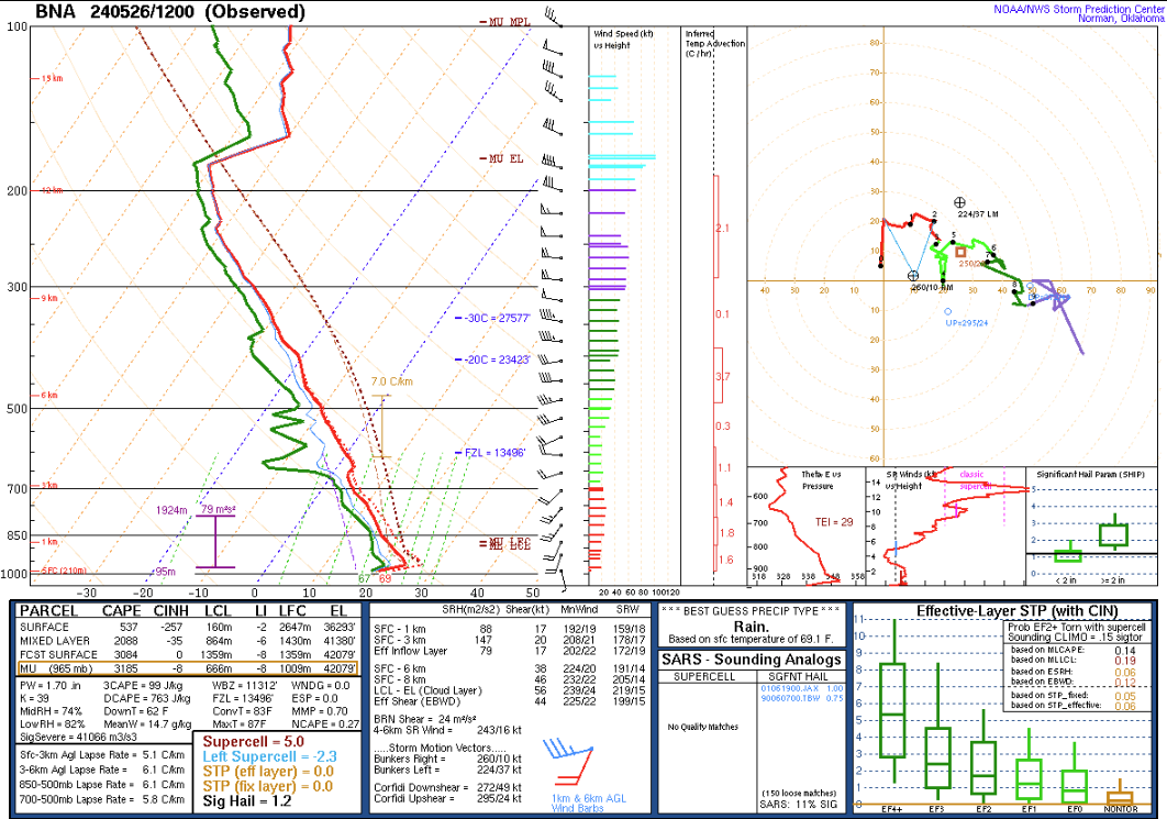
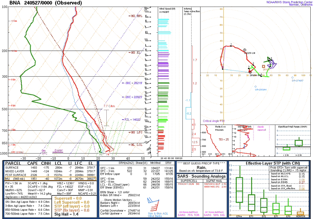
| 0-3 km Shear | 12z BNA Sounding | 12z ILN Sounding |
Sunday Evening Environment
 |
 |
 |
| 250 mb Analysis | 500 mb Analysis | 700 mb Analysis |
 |
 |
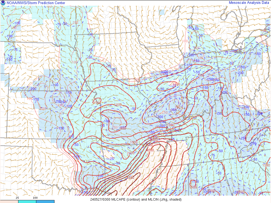 |
| Mean Sea Level Pressure, Radar | MSLP, Temperature, Dewpoint | ML CAPE, ML CIN |
 |
 |
 |
| Downdraft CAPE | Effective Bulk Wind Shear | Effective Storm Relative Helicity |
 |
 |
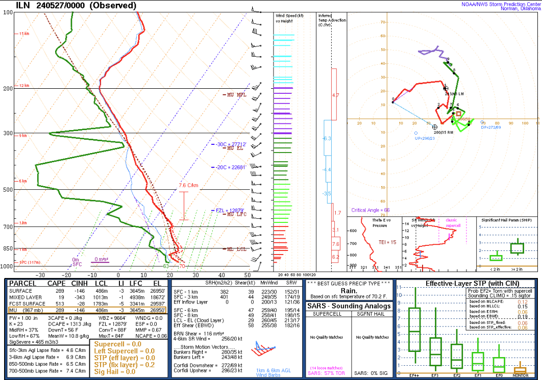 |
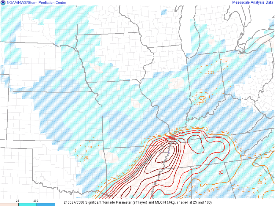
| Significant Tornado Parameter | BNA 00z Sounding | ILN 00z Sounding |


 Weather Story
 Weather Map
 Local Radar